Category:United Kingdom photographs taken on 2005-11-05
Countries of Europe: Belgium · Czech Republic · Finland · France‡ · Germany · Republic of Ireland · Italy · Netherlands‡ · Norway · Poland · Portugal‡ · Russia‡ · Spain‡ · Sweden · Switzerland · Turkey‡ · Ukraine · United Kingdom
‡: partly located in Europe
‡: partly located in Europe
| ← | 5 November 2005 | → | ||
| ← | November 2005 | → | ||

United Kingdom photographs taken on 5 November 2005.
Image files should be categorized here automatically using {{taken on}} template. Direct categorisation is also possible, if automatic is impossible.
Subcategories
This category has the following 2 subcategories, out of 2 total.
Media in category "United Kingdom photographs taken on 2005-11-05"
The following 200 files are in this category, out of 535 total.
(previous page) (next page)-
 A Field near Bradwell - geograph.org.uk - 75612.jpg 640 × 480; 146 KB
-
 A Forest Road - geograph.org.uk - 75188.jpg 640 × 480; 272 KB
-

-
 A Mill in Strath Rusdale - geograph.org.uk - 75174.jpg 640 × 480; 256 KB
-
 A prospect of Armathwaite Hall - geograph.org.uk - 505588.jpg 640 × 480; 72 KB
-
 A small wooded area - geograph.org.uk - 74620.jpg 640 × 480; 93 KB
-
 A View from the Struie Hill - geograph.org.uk - 74775.jpg 640 × 480; 81 KB
-
 A1290 road outside Sulgrave - geograph.org.uk - 74506.jpg 640 × 480; 118 KB
-
 A194(M) northbound from Peareth Hall Road.jpg 640 × 480; 75 KB
-
 Abandoned section of the A10 - geograph.org.uk - 74703.jpg 480 × 640; 76 KB
-
 Abbey St Bathans Kirk.jpg 640 × 480; 105 KB
-
 Acer (maple) at Dawyck - geograph.org.uk - 74643.jpg 640 × 480; 152 KB
-

-
 Albion Road - geograph.org.uk - 74427.jpg 640 × 480; 66 KB
-
 All Saints, Briston, Norfolk - East end - geograph.org.uk - 319713.jpg 478 × 640; 105 KB
-
 All Saints, Briston, Norfolk - geograph.org.uk - 319710.jpg 640 × 339; 91 KB
-
 All Saints, Briston, Norfolk - geograph.org.uk - 319711.jpg 640 × 480; 113 KB
-
 Allotments in Hauxton - geograph.org.uk - 74799.jpg 640 × 480; 102 KB
-
 Ancient Mound - geograph.org.uk - 74533.jpg 640 × 480; 127 KB
-
 Anonymous farm buildings - geograph.org.uk - 74691.jpg 640 × 480; 99 KB
-
 Approach to M11 Junction 11 - geograph.org.uk - 74702.jpg 640 × 480; 41 KB
-
-
 Arable land on Rectory Farm - geograph.org.uk - 74712.jpg 640 × 480; 61 KB
-
 Armathwaite Hall Hotel - geograph.org.uk - 505581.jpg 640 × 480; 65 KB
-
 Atwick - Farmland - geograph.org.uk - 74738.jpg 640 × 480; 133 KB
-
 Ayton Castle.jpg 640 × 350; 75 KB
-
 B1242 South of Atwick - geograph.org.uk - 74736.jpg 640 × 480; 135 KB
-
-
 Bairdsknowe Service Reservoir - geograph.org.uk - 74547.jpg 640 × 480; 104 KB
-
 Balfron Tower E14.jpg 4,048 × 3,040; 406 KB
-
 Banwellcastle.jpg 640 × 480; 88 KB
-
 Banwellcaves.jpg 640 × 480; 132 KB
-
 Barff House - geograph.org.uk - 75115.jpg 640 × 480; 181 KB
-
 Barn at Newsham Grange - geograph.org.uk - 91285.jpg 640 × 480; 47 KB
-
 Basingstoke Athletics - geograph.org.uk - 74646.jpg 640 × 480; 80 KB
-
 Bawdy Knowes - geograph.org.uk - 75258.jpg 640 × 480; 144 KB
-
 Beach at Double Gates - geograph.org.uk - 79772.jpg 640 × 480; 89 KB
-
 Beeches at 'Oaks of Kirkconnell' - geograph.org.uk - 75017.jpg 640 × 480; 189 KB
-
 Beeston Regis Church - geograph.org.uk - 507415.jpg 640 × 427; 80 KB
-
 Between the Fairways - geograph.org.uk - 75177.jpg 640 × 475; 115 KB
-
 Bishops Place, near Albourne - geograph.org.uk - 74558.jpg 640 × 479; 158 KB
-
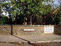
 Blackfell Primary School - geograph.org.uk - 74633.jpg 640 × 588; 84 KB
-
 Blackhill Cemetery South - geograph.org.uk - 74474.jpg 480 × 640; 80 KB
-
 Blenheim Palace Clocktower, Oxforshire, England - panoramio.jpg 1,704 × 2,272; 986 KB
-
 Blenheim Palace Fountains in the Garden, Oxforshire, England - panoramio.jpg 1,536 × 2,048; 1.04 MB
-
 Blenheim Palace Gardens, Oxforshire, England - panoramio.jpg 2,048 × 1,536; 853 KB
-
 Blenheim Palace Insignia, Oxforshire, England - panoramio.jpg 2,048 × 1,536; 1.09 MB
-
 Blenheim Palace Statue in the Gardens, Oxforshire, England - panoramio.jpg 1,536 × 2,048; 792 KB
-
 Blofield Church - geograph.org.uk - 1121334.jpg 640 × 480; 112 KB
-
 Blythe Bridge railway station 1.jpg 640 × 480; 106 KB
-
 All Saints, Bodham, Norfolk - geograph.org.uk - 319757.jpg 640 × 423; 116 KB
-
 All Saints, Bodham, Norfolk - Tower - geograph.org.uk - 319759.jpg 563 × 640; 106 KB
-
 Bonnyton Golf Club Clubhouse - geograph.org.uk - 74542.jpg 640 × 480; 104 KB
-
 Bonnyton Moor Farm - geograph.org.uk - 98040.jpg 640 × 480; 103 KB
-
 Bradwell Marina - geograph.org.uk - 74480.jpg 640 × 480; 53 KB
-
 Brick Kiln Clump, Nr Lymington, Hants - geograph.org.uk - 74347.jpg 600 × 450; 47 KB
-
 Bridge 137, Halls Lock - geograph.org.uk - 75243.jpg 640 × 480; 134 KB
-
 Bridge of Alford - geograph.org.uk - 85216.jpg 640 × 414; 122 KB
-
 Bridge over wet ground - geograph.org.uk - 75270.jpg 640 × 480; 116 KB
-
 Bridleway near Steep Down - geograph.org.uk - 797641.jpg 640 × 480; 68 KB
-
 Burnmouth Harbour - geograph.org.uk - 122319.jpg 640 × 480; 104 KB
-
 Byway to Rolston - geograph.org.uk - 74730.jpg 640 × 480; 143 KB
-
 Cairnsmore of Carsphairn - geograph.org.uk - 95458.jpg 640 × 367; 112 KB
-
 Car Park for St. Peter on the Wall - geograph.org.uk - 74492.jpg 640 × 480; 62 KB
-
 Caravan Park - geograph.org.uk - 75615.jpg 640 × 480; 132 KB
-
 Castle Acre Priory 01.jpg 640 × 480; 84 KB
-
 Castle Caereinion under a moody sky - geograph.org.uk - 343222.jpg 640 × 442; 56 KB
-
 Childs Wickham Village hall.jpg 640 × 480; 160 KB
-
 Churchill Clock Tower - geograph.org.uk - 74466.jpg 640 × 480; 95 KB
-
 Cloisters and tower, Norwich Cathedral - geograph.org.uk - 75935.jpg 427 × 640; 134 KB
-
 Cobbs Mill Bridge - geograph.org.uk - 74534.jpg 640 × 479; 273 KB
-
 Colliery Wheel - geograph.org.uk - 75156.jpg 640 × 475; 89 KB
-
 Concord - Washington Fire Station - geograph.org.uk - 74574.jpg 640 × 480; 83 KB
-

-

-
 Coombe Farm, near Sayers Common - geograph.org.uk - 74543.jpg 640 × 479; 186 KB
-
 Coppicing in Northaw - geograph.org.uk - 74777.jpg 427 × 640; 183 KB
-
 Corley church - geograph.org.uk - 103755.jpg 480 × 640; 179 KB
-
 Corn Exchange. - geograph.org.uk - 74920.jpg 640 × 447; 52 KB
-
 Corner of Garsdale Close, London N11 - geograph.org.uk - 74299.jpg 640 × 480; 119 KB
-
 Course of the River Eye near Coston - geograph.org.uk - 74511.jpg 640 × 480; 126 KB
-
 2005-11-05 - United Kingdom - England - London - Covent Garden - Pigeons 4887809685.jpg 2,485 × 1,731; 2.35 MB
-
 Craigengar, west ridge - geograph.org.uk - 75284.jpg 640 × 480; 133 KB
-
 Cresthaven - geograph.org.uk - 74425.jpg 640 × 480; 84 KB
-
 Crosswood Reservoir - geograph.org.uk - 75256.jpg 640 × 480; 122 KB
-
-
 Demolition in Simonstone - geograph.org.uk - 74359.jpg 640 × 480; 65 KB
-
 Didcot Services - geograph.org.uk - 77159.jpg 640 × 480; 73 KB
-
 Disused Boat - geograph.org.uk - 91322.jpg 640 × 480; 64 KB
-
 Disused quarry - geograph.org.uk - 75279.jpg 480 × 640; 135 KB
-

-
 Disused Wagonway - geograph.org.uk - 75128.jpg 640 × 475; 104 KB
-
 Doocot, Salters Road nr Pathhead - geograph.org.uk - 75220.jpg 480 × 640; 70 KB
-
 Drove road from Ford to Kintraw, Argyll.jpg 640 × 450; 86 KB
-

-
 Dry-stane dyke - geograph.org.uk - 75246.jpg 640 × 480; 84 KB
-
 East Coast Mainline - geograph.org.uk - 75148.jpg 640 × 475; 103 KB
-
 St. Andrew's Church, East Heslerton - geograph.org.uk - 74394.jpg 508 × 640; 102 KB
-
 Easter Gellet Farm. - geograph.org.uk - 74288.jpg 640 × 480; 94 KB
-
 Fala Kirk and bank to road - geograph.org.uk - 75221.jpg 640 × 480; 146 KB
-
 Farmland East of North End - geograph.org.uk - 74728.jpg 640 × 480; 125 KB
-
 Farmland near Garthorpe and Saxby - geograph.org.uk - 74462.jpg 640 × 427; 129 KB
-
 Farmland near Honeysuckle Farm - geograph.org.uk - 74747.jpg 640 × 480; 127 KB
-
 Farmland near Hornsea Mere - geograph.org.uk - 74744.jpg 640 × 480; 131 KB
-
 Farmland North of Atwick - geograph.org.uk - 74739.jpg 640 × 480; 136 KB
-
 Farmland North of Hornsea - geograph.org.uk - 74735.jpg 640 × 480; 129 KB
-
 Farmland SE of Great Hatfield - geograph.org.uk - 74729.jpg 640 × 480; 124 KB
-
 Farmland South of Burshill - geograph.org.uk - 75117.jpg 640 × 480; 87 KB
-
 Farmland SW of Burshill - geograph.org.uk - 75190.jpg 640 × 480; 200 KB
-
 Farmland West of Leven - geograph.org.uk - 74743.jpg 640 × 480; 110 KB
-
-
 Fields Behind The Grey House - geograph.org.uk - 90627.jpg 640 × 480; 59 KB
-
 Fields between Littleton and Crawley - geograph.org.uk - 74676.jpg 640 × 480; 50 KB
-
 Fields east of Crawley - geograph.org.uk - 74687.jpg 640 × 480; 107 KB
-
 Finsbury laboratory building 1.jpg 640 × 480; 161 KB
-
 Finsbury mwb hq 1.jpg 640 × 540; 207 KB
-
 Flooded Fields - geograph.org.uk - 75167.jpg 640 × 475; 93 KB
-
 Floors - geograph.org.uk - 74526.jpg 640 × 480; 77 KB
-
 Football Ground in Hutton Village - geograph.org.uk - 74424.jpg 640 × 480; 158 KB
-
 Footpath off the Downham Rd - geograph.org.uk - 74634.jpg 640 × 482; 138 KB
-
 Footpath over Railway - geograph.org.uk - 75150.jpg 640 × 475; 59 KB
-
 Footpath to Downham Rd - geograph.org.uk - 74622.jpg 640 × 482; 137 KB
-
 From the first floor gallery - geograph.org.uk - 505585.jpg 640 × 480; 93 KB
-
 Giant Chair, Victoria Road, Burgess Hill - geograph.org.uk - 74525.jpg 479 × 640; 159 KB
-
 Giant Humbugs ^ - geograph.org.uk - 75749.jpg 640 × 480; 175 KB
-
 Gilbert's Burn - geograph.org.uk - 74581.jpg 640 × 480; 110 KB
-
 Glaciated rock on Dun Dubh, Ford, Argyll - geograph.org.uk - 74417.jpg 640 × 467; 101 KB
-
 Goddards Green, showing Sportsman Pub.jpg 640 × 479; 179 KB
-
 Gorton Bothy above Water of Tulla - geograph.org.uk - 179308.jpg 640 × 437; 51 KB
-
 Government Offices - geograph.org.uk - 75165.jpg 640 × 475; 75 KB
-
 Grey Horse Inn - geograph.org.uk - 75158.jpg 640 × 475; 97 KB
-
 Halls Lock - geograph.org.uk - 75236.jpg 640 × 480; 57 KB
-

-
 Hardley School, Nr Fawley, Hants - geograph.org.uk - 74300.jpg 640 × 480; 90 KB
-
 Hauxton Mill - geograph.org.uk - 74709.jpg 480 × 640; 104 KB
-
 Heigholme Hall - geograph.org.uk - 75118.jpg 640 × 480; 88 KB
-
 High Weetslade - geograph.org.uk - 75140.jpg 640 × 475; 72 KB
-
 High Weetslade - geograph.org.uk - 75142.jpg 640 × 475; 84 KB
-
 Highland Cattle above Glen Turret - geograph.org.uk - 74675.jpg 640 × 480; 83 KB
-
 Hillside overlooking Loch Turret - geograph.org.uk - 74588.jpg 640 × 480; 65 KB
-
 Holding No 6 - geograph.org.uk - 589926.jpg 640 × 463; 65 KB
-
 Holiday Huts on the Banks of the Tees - geograph.org.uk - 91327.jpg 640 × 480; 94 KB
-
 Holy Trinity Church Burrington - geograph.org.uk - 74479.jpg 640 × 426; 100 KB
-

-
 Housing in Sulgrave, Washington, Tyne and Wear.jpg 640 × 480; 32 KB
-
 Hurstpierpoint College - geograph.org.uk - 74597.jpg 640 × 479; 143 KB
-
 Hutton Garden Centre - geograph.org.uk - 74428.jpg 640 × 480; 96 KB
-
 Iron Age earthworks, Wolstonbury Hill - geograph.org.uk - 74606.jpg 640 × 479; 148 KB
-
 Jackton Village - geograph.org.uk - 74556.jpg 640 × 480; 96 KB
-
 Lane south of Crawley - geograph.org.uk - 74693.jpg 640 × 480; 82 KB
-
 Level crossing at Little Shelford - geograph.org.uk - 74822.jpg 640 × 480; 66 KB
-
 Lings Covert, near Branston - geograph.org.uk - 74443.jpg 640 × 427; 144 KB
-
 Little Arram Farm - geograph.org.uk - 75112.jpg 640 × 480; 112 KB
-
 Little Atwick - geograph.org.uk - 75111.jpg 640 × 480; 59 KB
-
 Lochmaben town centre.jpg 640 × 478; 90 KB
-
 Lockey Park - geograph.org.uk - 75131.jpg 640 × 475; 90 KB
-
 London Colney, Bridge over the River Colne - geograph.org.uk - 74472.jpg 640 × 425; 117 KB
-
 Lower Farm, north of Littleton - geograph.org.uk - 74662.jpg 640 × 480; 82 KB
-
 Marshall Meadows Caravan Park - geograph.org.uk - 122290.jpg 640 × 480; 93 KB
-
 Mealowther from Craigengar - geograph.org.uk - 75287.jpg 640 × 480; 105 KB
-
 Mealowther summit - geograph.org.uk - 75276.jpg 640 × 480; 142 KB
-

-
 Middle Ellick Farm - geograph.org.uk - 74483.jpg 640 × 426; 167 KB
-
 Mill Lane and Downham Rd - geograph.org.uk - 74631.jpg 640 × 482; 114 KB
-
 Mill Loch, Lochmaben - geograph.org.uk - 100001.jpg 640 × 461; 227 KB
-
 MilltimberAir.jpg 640 × 480; 148 KB
-
 MotherwellRailwayStation.jpg 1,600 × 1,200; 726 KB
-
 Mountain hare - geograph.org.uk - 74582.jpg 640 × 480; 81 KB
-
 Muddleswood crossways - geograph.org.uk - 74561.jpg 640 × 479; 187 KB
-
 New Housing in Melton Park - geograph.org.uk - 75122.jpg 640 × 475; 145 KB
-
 Nissan Works - geograph.org.uk - 74580.jpg 640 × 480; 52 KB
-
 Nissan Works Goods Entrance - geograph.org.uk - 74589.jpg 640 × 480; 50 KB
-

-
 North East Aircraft Museum - geograph.org.uk - 74604.jpg 640 × 480; 54 KB
-
 North East Aircraft Museum, Tyne and Wear.jpg 640 × 480; 55 KB
-
 North Gosforth - Brackenside.jpg 640 × 475; 152 KB
-
 North Gosforth Chapel - geograph.org.uk - 75119.jpg 640 × 475; 178 KB
-
 North Tyneside Steam Railway - geograph.org.uk - 75100.jpg 640 × 496; 97 KB
-
 North West Ring Road Basingstoke - geograph.org.uk - 74663.jpg 640 × 480; 94 KB
-
 Northern Playing Fields - geograph.org.uk - 74501.jpg 640 × 455; 35 KB
-
 Not-a-white kirk, Whitekirk - geograph.org.uk - 75232.jpg 640 × 480; 117 KB
-
 Old railway carriage - geograph.org.uk - 75253.jpg 480 × 640; 145 KB
-
 Old sheepfold - geograph.org.uk - 75265.jpg 640 × 480; 136 KB
-
 Ornamental post on Carr Dyke - geograph.org.uk - 98541.jpg 426 × 640; 133 KB
-
 Pasture near Hornsea - geograph.org.uk - 74731.jpg 640 × 480; 127 KB
-
 Path on Craigengar - geograph.org.uk - 75293.jpg 640 × 480; 143 KB
-
 PEACOCKS - geograph.org.uk - 74840.jpg 640 × 480; 113 KB
-
 Phone Box, Ellemford - geograph.org.uk - 75260.jpg 480 × 640; 114 KB
-
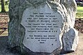 Pilgrims Memorial, Immingham - geograph.org.uk - 74866.jpg 640 × 427; 160 KB
-
 Preston Dene - geograph.org.uk - 75219.jpg 640 × 480; 104 KB
-
 Priors Marston - geograph.org.uk - 74325.jpg 640 × 480; 89 KB
-
 Priors Marston - St Leonards Church - geograph.org.uk - 74293.jpg 640 × 480; 111 KB
-
 Public Footpath to Church House - geograph.org.uk - 91318.jpg 640 × 480; 66 KB
-
 Railway Lines - geograph.org.uk - 75166.jpg 640 × 475; 109 KB
-
 Recreation Ground - geograph.org.uk - 75163.jpg 640 × 475; 73 KB
-

-
 Resting place, Church Lane, Albourne - geograph.org.uk - 74553.jpg 640 × 479; 265 KB
-
 Ribbonfield Farm - geograph.org.uk - 589957.jpg 640 × 366; 54 KB
-
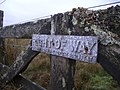 Right of Way - geograph.org.uk - 75263.jpg 640 × 480; 127 KB
-
 River Don near Alford.jpg 640 × 426; 170 KB


_northbound_from_Peareth_Hall_Road.jpg)


_at_Dawyck_-_geograph.org.uk_-_74643.jpg)


.jpg)


