Category:United Kingdom photographs taken on 2005-11-07
Countries of Europe: Finland · Germany · Italy · Netherlands‡ · Russia‡ · Spain‡ · Switzerland · Turkey‡ · United Kingdom
‡: partly located in Europe
‡: partly located in Europe
| ← | 7 November 2005 | → | ||
| ← | November 2005 | → | ||

United Kingdom photographs taken on 7 November 2005.
Image files should be categorized here automatically using {{taken on}} template. Direct categorisation is also possible, if automatic is impossible.
Subcategories
This category has only the following subcategory.
Media in category "United Kingdom photographs taken on 2005-11-07"
The following 200 files are in this category, out of 298 total.
(previous page) (next page)-
 "Planters" - geograph.org.uk - 75480.jpg 640 × 480; 83 KB
-
 "The Shaws" Girl Guide Camp, Cudham TN14 - geograph.org.uk - 75554.jpg 640 × 481; 113 KB
-
 A Bridge and Gate at Scotney Castle - geograph.org.uk - 75345.jpg 640 × 480; 79 KB
-
 A Field With Hops Farm in the Distance - geograph.org.uk - 75365.jpg 640 × 480; 46 KB
-
 A Fungus near a Footpath - geograph.org.uk - 75367.jpg 640 × 480; 75 KB
-
-
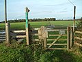
 A stile on the grounds of Scotney Castle - geograph.org.uk - 75344.jpg 640 × 480; 109 KB
-
 A very rural square - geograph.org.uk - 75514.jpg 640 × 427; 67 KB
-
 A Weir in Goudhurst - geograph.org.uk - 75360.jpg 640 × 480; 91 KB
-

-
 A563 outer ring road, Leicester - geograph.org.uk - 75356.jpg 640 × 427; 178 KB
-
 Acer leaves, Southernhay Green - geograph.org.uk - 1089614.jpg 640 × 424; 107 KB
-
 Across the fields.... - geograph.org.uk - 75923.jpg 640 × 481; 74 KB
-
 After the storm - geograph.org.uk - 1183787.jpg 640 × 480; 244 KB
-
 Aikman Avenue, New Parks, Leicester - geograph.org.uk - 75346.jpg 640 × 427; 107 KB
-
 All Saints Church, Monk Sherborne - geograph.org.uk - 75920.jpg 640 × 481; 50 KB
-

-

-
 Approaching Groby Road Roundabout - geograph.org.uk - 75359.jpg 640 × 427; 111 KB
-
 Autumn on the River - geograph.org.uk - 75461.jpg 640 × 480; 166 KB
-
 Avenham Park - geograph.org.uk - 75803.jpg 640 × 479; 181 KB
-
 Avon Valley Path - geograph.org.uk - 75312.jpg 640 × 481; 118 KB
-
 Avon Valley Path - geograph.org.uk - 75313.jpg 640 × 481; 89 KB
-
 Ballygowan Orange Hall - geograph.org.uk - 75486.jpg 640 × 480; 70 KB
-
 Banksy Love @ Big Ben - Flickr - Kris Krug.jpg 1,544 × 1,024; 844 KB
-
 Banoge Bridge - geograph.org.uk - 75446.jpg 640 × 480; 168 KB
-

-
 Barrack Cottages - geograph.org.uk - 75683.jpg 640 × 480; 128 KB
-
 Beaumont Leys Shopping Centre - geograph.org.uk - 75416.jpg 640 × 427; 127 KB
-
 Biddlestone Chapel - geograph.org.uk - 75289.jpg 640 × 480; 145 KB
-
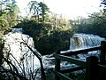 Bonnington Linn - geograph.org.uk - 75426.jpg 640 × 480; 123 KB
-
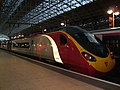 BritRail - panoramio.jpg 1,280 × 960; 466 KB
-
 Broomfield village sign - geograph.org.uk - 76189.jpg 480 × 640; 89 KB
-
 Burnham carnival - geograph.org.uk - 75884.jpg 640 × 480; 85 KB
-
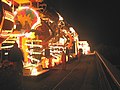
 Burnham carnival - geograph.org.uk - 75886.jpg 640 × 602; 146 KB
-
 Burnham carnival - geograph.org.uk - 75887.jpg 640 × 558; 121 KB
-
 Burnham carnival - geograph.org.uk - 75888.jpg 623 × 640; 160 KB
-
 Burnham carnival - geograph.org.uk - 75889.jpg 640 × 595; 141 KB
-

-
 Cardiff arcade.jpg 1,200 × 1,500; 1.38 MB
-
 Cardiff Market.JPG 2,592 × 1,944; 3.26 MB
-
-
 Chapel Farm - geograph.org.uk - 77126.jpg 640 × 480; 107 KB
-
 Charmwood Farm, Charmwood Lane BR6 - geograph.org.uk - 75556.jpg 640 × 481; 73 KB
-
 Chestnut coppice - geograph.org.uk - 75698.jpg 480 × 640; 160 KB
-
 Chestnut fencing - geograph.org.uk - 75694.jpg 640 × 480; 150 KB
-
 Chestnut Road, Glenfield, Leicester - geograph.org.uk - 75364.jpg 640 × 427; 81 KB
-
 Ancient lime tree - geograph.org.uk - 75721.jpg 640 × 480; 137 KB
-
 Chilston Park Hotel - geograph.org.uk - 75706.jpg 640 × 480; 88 KB
-
 Colesdale Farm, Northaw Road West - geograph.org.uk - 75209.jpg 640 × 480; 176 KB
-
 Compton End - geograph.org.uk - 159417.jpg 640 × 426; 101 KB
-
 Conwy Castle - geograph.org.uk - 1113912.jpg 600 × 450; 184 KB
-
 Copthorne sports fields - geograph.org.uk - 75510.jpg 640 × 427; 63 KB
-
 Corner Cupboard pub, Winchcombe, Cotswolds, England - panoramio - David Broad.jpg 2,048 × 1,536; 685 KB
-
 Corner Cupboard pub, Winchcombe, Cotswolds, England - panoramio.jpg 1,536 × 2,048; 976 KB
-
 Corra Castle - geograph.org.uk - 75418.jpg 480 × 640; 131 KB
-
 Country House - geograph.org.uk - 75336.jpg 640 × 480; 53 KB
-
 Countryside east of North Cudham Lane BR6 - geograph.org.uk - 75436.jpg 640 × 476; 100 KB
-
 Countryside Railway Bridge, Low Ackworth - geograph.org.uk - 75254.jpg 640 × 479; 140 KB
-

-
 County Hall, Glenfield, Leicester - geograph.org.uk - 75404.jpg 640 × 427; 117 KB
-
 Crook Hall, Durham - geograph.org.uk - 76063.jpg 640 × 384; 72 KB
-
 Cudham parish church, TN14 - geograph.org.uk - 75581.jpg 640 × 481; 109 KB
-
 Cumberland Infirmary Hospital.jpg 640 × 480; 94 KB
-
 Donaghcloney Elim Church - geograph.org.uk - 75437.jpg 640 × 480; 106 KB
-
 Donaghcloney Methodist Church - geograph.org.uk - 75405.jpg 640 × 480; 69 KB
-
 Donaghcloney Parish Church Waringstown - geograph.org.uk - 75473.jpg 640 × 480; 99 KB
-
 Donaghcloney War Memorial - geograph.org.uk - 75428.jpg 480 × 640; 65 KB
-
 Drainage ditch - geograph.org.uk - 75399.jpg 640 × 428; 76 KB
-
 Driveway from Finchcocks House - geograph.org.uk - 75357.jpg 640 × 480; 118 KB
-

-
 Embury Beacon - geograph.org.uk - 75525.jpg 640 × 480; 31 KB
-
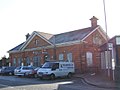
 End of Fareham railway station - geograph.org.uk - 75377.jpg 640 × 480; 115 KB
-
 Entrance to fencing yard on Water Lane - geograph.org.uk - 75692.jpg 640 × 480; 142 KB
-
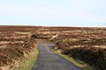
 Exford, Almsworthy Common - geograph.org.uk - 75801.jpg 640 × 427; 99 KB
-
 Exford, road by Alderman's Barrow - geograph.org.uk - 75802.jpg 640 × 427; 111 KB
-
 Exfordwhitehorse.jpg 640 × 427; 132 KB
-
 Exmoor, by Larkbarrow Gate - geograph.org.uk - 75795.jpg 640 × 427; 112 KB
-
 Exmoor, by Larkbarrow Gate - geograph.org.uk - 75797.jpg 640 × 427; 130 KB
-
 Farm on Horncastle Hill. - geograph.org.uk - 75249.jpg 640 × 480; 101 KB
-

-
 Farmland near Nostell Priory. - geograph.org.uk - 75244.jpg 640 × 480; 66 KB
-
 Field beside Esk Mill - geograph.org.uk - 234789.jpg 640 × 480; 62 KB
-
 Fly-tipping in King's Wood - geograph.org.uk - 77073.jpg 640 × 480; 157 KB
-
 Footpath to West Mill - geograph.org.uk - 75522.jpg 640 × 480; 42 KB
-
 Footpath, gedney Drove End - geograph.org.uk - 75351.jpg 640 × 421; 60 KB
-
 Forest Ridge, Keston Park, BR2 - geograph.org.uk - 75427.jpg 640 × 466; 128 KB
-
 Fruits of autumn - geograph.org.uk - 75675.jpg 640 × 480; 155 KB
-
 Grass track racing circuit - geograph.org.uk - 76521.jpg 640 × 480; 85 KB
-
 Green Lane Plantation. - geograph.org.uk - 75286.jpg 640 × 480; 92 KB
-
 Greenodd Sands - geograph.org.uk - 83646.jpg 640 × 480; 75 KB
-
 Gull Rock from Nabor Point - geograph.org.uk - 75526.jpg 640 × 480; 37 KB
-
 Hamlet of Holbeach Hurn - geograph.org.uk - 75442.jpg 640 × 428; 72 KB
-
 Harrods, Knightsbridge - geograph.org.uk - 988296.jpg 640 × 480; 56 KB
-
 Hartland Mill - geograph.org.uk - 76130.jpg 640 × 480; 47 KB
-
 Hazelwood Road, Cudham TN14 - geograph.org.uk - 75589.jpg 640 × 481; 75 KB
-
 Henaford from Upcott Cross - geograph.org.uk - 75501.jpg 640 × 480; 37 KB
-
 Home Farm, Sandway - geograph.org.uk - 77091.jpg 640 × 433; 77 KB
-
 Horley station.jpg 640 × 480; 49 KB
-
 Jockey's Wood, Knockholt TN14 - geograph.org.uk - 75648.jpg 640 × 481; 68 KB
-
 Kempsford Church - geograph.org.uk - 77109.jpg 427 × 640; 171 KB
-
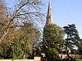 Keyston church - geograph.org.uk - 76735.jpg 640 × 480; 199 KB
-
 Kilndown Church and a Village House - geograph.org.uk - 75354.jpg 640 × 480; 105 KB
-
 King's Cross - geograph.org.uk - 75505.jpg 640 × 480; 28 KB
-

-
 Looking towards Cornwall - geograph.org.uk - 75499.jpg 640 × 480; 31 KB
-
 Luccombe, Lucott Cross - geograph.org.uk - 75807.jpg 640 × 427; 93 KB
-
 Luccombe, north from Black Mires - geograph.org.uk - 75805.jpg 640 × 427; 109 KB
-
 Lurgan Elim church - geograph.org.uk - 75465.jpg 640 × 480; 88 KB
-
 Lurgan Free Presbyterian Church - geograph.org.uk - 75468.jpg 640 × 480; 107 KB
-
 Lygon Arms, Broadway, Cotswolds, England - panoramio.jpg 2,048 × 1,536; 686 KB
-
 Mace Farm and Cottages, Mace Lane TN14 - geograph.org.uk - 75584.jpg 640 × 481; 73 KB
-
 Magheralin Catholic Church - geograph.org.uk - 75398.jpg 480 × 640; 83 KB
-
 Magheralin Parish Church - geograph.org.uk - 75389.jpg 480 × 640; 123 KB
-
 Mainland Britain's only turlough - geograph.org.uk - 75102.jpg 640 × 455; 104 KB
-
 Mansley Cliff - geograph.org.uk - 76097.jpg 640 × 480; 30 KB
-
 Marine drive - geograph.org.uk - 75885.jpg 611 × 640; 156 KB
-
 Maze Station Hotel - geograph.org.uk - 75369.jpg 640 × 480; 102 KB
-
 Milford Common and Swansford Hill - geograph.org.uk - 76101.jpg 640 × 480; 19 KB
-
 Moira Methodist Church - geograph.org.uk - 75371.jpg 640 × 480; 102 KB
-
 Moira Police Station - geograph.org.uk - 75378.jpg 640 × 480; 77 KB
-
 Nant Gwryd valley, Capel Curig, Conwy - geograph.org.uk - 84499.jpg 600 × 450; 330 KB
-
 New development, Kingswood - geograph.org.uk - 76182.jpg 640 × 480; 110 KB
-
 North of Capel Curig - geograph.org.uk - 84498.jpg 600 × 450; 274 KB
-
 Notton Lane. - geograph.org.uk - 75264.jpg 640 × 480; 140 KB
-
 Oasts at Tillman Gate Farm - geograph.org.uk - 77077.jpg 640 × 480; 103 KB
-
 Oasts near Bowley Farm - geograph.org.uk - 75707.jpg 640 × 487; 89 KB
-
-
 Old Hemlington Road - geograph.org.uk - 76157.jpg 640 × 480; 83 KB
-
 Old Pilchard Works, Newlyn - geograph.org.uk - 75202.jpg 640 × 507; 156 KB
-
 Old Post Cottage, Little London - geograph.org.uk - 75926.jpg 640 × 481; 67 KB
-
 The Pepperbox, Fairbourne Heath - geograph.org.uk - 75699.jpg 640 × 480; 91 KB
-
 Pheasant Pens, Compton End - geograph.org.uk - 159423.jpg 640 × 426; 123 KB
-
 Playing fields on edge of Gosport - geograph.org.uk - 75375.jpg 640 × 480; 113 KB
-
 Playing fields, Skewen. - geograph.org.uk - 75241.jpg 640 × 429; 102 KB
-
 Plough Inn, Little London - geograph.org.uk - 75927.jpg 640 × 481; 42 KB
-
 Porlock, approaching West Porlock - geograph.org.uk - 75790.jpg 640 × 427; 148 KB
-

-
 Porlock, Porlock Bay from Porlock Weir - geograph.org.uk - 75812.jpg 640 × 427; 111 KB
-
 Porlock, the toll road - geograph.org.uk - 75784.jpg 640 × 427; 197 KB
-
 Porlock, toll gate on toll road - geograph.org.uk - 75785.jpg 640 × 427; 138 KB
-
 Porth Trecastell - geograph.org.uk - 679839.jpg 640 × 480; 65 KB
-
 Preston Minster.jpg 426 × 640; 95 KB
-
 Puffball in King's Wood - geograph.org.uk - 77036.jpg 640 × 496; 132 KB
-
 Quaker School, Ackworth - geograph.org.uk - 75248.jpg 640 × 479; 111 KB
-
 Quarry Dalton in Furness - geograph.org.uk - 84136.jpg 640 × 480; 89 KB
-
-
 Railway bridge over Haw Park Lane. - geograph.org.uk - 75278.jpg 640 × 480; 105 KB
-

-
 Rapids^ - geograph.org.uk - 75455.jpg 640 × 480; 110 KB
-

-

-

-
 Robert Owen's House, New Lanark.jpg 640 × 480; 96 KB
-
 Ronald Duncan's Hut - geograph.org.uk - 75523.jpg 640 × 480; 40 KB
-
-
 Rushden St Mary's Church - geograph.org.uk - 76719.jpg 480 × 640; 87 KB
-
 Rushden St Mary's Church - geograph.org.uk - 76725.jpg 480 × 640; 107 KB
-
 Sapperton church - geograph.org.uk - 77098.jpg 640 × 427; 108 KB
-
 Sharlston, near Wakefield - geograph.org.uk - 75239.jpg 640 × 480; 60 KB
-
 Snag Farm, Cudham TN14 - geograph.org.uk - 75652.jpg 640 × 481; 75 KB
-

-
 South ridge of Fountains Fell - geograph.org.uk - 76325.jpg 640 × 480; 142 KB
-
-
 Southern slip road - Exeter - geograph.org.uk - 75217.jpg 640 × 480; 97 KB
-
 Spaldwick church - geograph.org.uk - 78380.jpg 460 × 640; 83 KB
-
 Speke's Mill Mouth from Swansford Hill - geograph.org.uk - 76104.jpg 640 × 480; 21 KB
-
 Speke's Mill Mouth waterfall - geograph.org.uk - 76118.jpg 640 × 480; 33 KB
-
 Spelmonden Hops Farm - geograph.org.uk - 75363.jpg 640 × 265; 30 KB
-
 Sports Ground - geograph.org.uk - 75322.jpg 640 × 480; 55 KB
-
 Sports Road, Glenfield, Leicester - geograph.org.uk - 75362.jpg 640 × 427; 88 KB
-
 Springfield Close, Potters Bar - geograph.org.uk - 75301.jpg 640 × 430; 69 KB
-
 St Catherine's Tor - geograph.org.uk - 76127.jpg 640 × 480; 24 KB
-

-
 St Margaret's Well - geograph.org.uk - 76188.jpg 640 × 480; 166 KB
-
 St Nectan's Church, Welcombe - geograph.org.uk - 75515.jpg 640 × 480; 32 KB
-
 St Nectan's Well, Welcombe - geograph.org.uk - 75518.jpg 480 × 640; 64 KB
-

-
 St. Patrick's Donaghcloney - geograph.org.uk - 75425.jpg 640 × 480; 91 KB
-
 Sunset on Breydon Water. Norfolk - geograph.org.uk - 274458.jpg 360 × 480; 26 KB
-
 Swamp on the River Len - geograph.org.uk - 75687.jpg 640 × 480; 187 KB
-

-
 The Chattri War Memorial - geograph.org.uk - 75650.jpg 640 × 453; 53 KB
-

-
 The old bridge at Kirkfieldbank - geograph.org.uk - 75504.jpg 640 × 480; 131 KB
-
 The Potted Garden - geograph.org.uk - 75666.jpg 640 × 480; 127 KB
-
 The Queen's College Arms, Pamber End - geograph.org.uk - 75928.jpg 640 × 481; 60 KB
-

-
 The Road to Little London - geograph.org.uk - 75925.jpg 640 × 481; 46 KB
-
 Tumulus on Hendon Moor - geograph.org.uk - 75497.jpg 640 × 480; 16 KB
-
 View from New Year's Lane, BR6 - geograph.org.uk - 75642.jpg 640 × 481; 101 KB
-
 View from North Cudham Lane TN14 - geograph.org.uk - 75608.jpg 640 × 481; 89 KB
-
 View North from Nabor Point - geograph.org.uk - 76076.jpg 640 × 480; 24 KB
-
 Walking along Cook's Walk, Glenfield (1) - geograph.org.uk - 788699.jpg 480 × 640; 105 KB
-
-
 Walking along Cook's Walk, Glenfield (3) - geograph.org.uk - 788704.jpg 640 × 427; 100 KB
-
 War Memorial at Horwich - geograph.org.uk - 75355.jpg 640 × 480; 179 KB
-
 Warehouse at Gedney Dyke - geograph.org.uk - 75431.jpg 640 × 428; 60 KB
-
 Waringstown Presbyterian Church - geograph.org.uk - 75477.jpg 640 × 480; 136 KB
-
 Waterfalls at Welcombe Mouth - geograph.org.uk - 75524.jpg 640 × 480; 43 KB


_-_geograph.org.uk_-_76094.jpg)


_-_geograph.org.uk_-_788699.jpg)
_-_geograph.org.uk_-_788701.jpg)
_-_geograph.org.uk_-_788704.jpg)


