Category:United Kingdom photographs taken on 2006-02-18
| ← | Saturday 18 February 2006 | → | ||
| ← | February 2006 | → | ||

United Kingdom photographs taken on 18 February 2006.
Image files should be categorized here automatically using {{taken on}} template. Direct categorisation is also possible, if automatic is impossible.
Subcategories
This category has the following 2 subcategories, out of 2 total.
Media in category "United Kingdom photographs taken on 2006-02-18"
The following 200 files are in this category, out of 855 total.
(previous page) (next page)-
 "King's Head", Horton - geograph.org.uk - 124343.jpg 640 × 480; 97 KB
-
 'Mole' Sculpture - geograph.org.uk - 124055.jpg 640 × 480; 158 KB
-
 'Wild Acres' holiday accommodation - geograph.org.uk - 125399.jpg 640 × 426; 149 KB
-
 6 Cygnets with Parent Swans - geograph.org.uk - 517823.jpg 600 × 450; 111 KB
-
 80 Miles per hour limit^ - geograph.org.uk - 610626.jpg 640 × 480; 88 KB
-
 A Sign of the times. - geograph.org.uk - 124603.jpg 640 × 543; 109 KB
-
 A tree near Caersws - geograph.org.uk - 231250.jpg 640 × 480; 77 KB
-
 A632 Matlock to Chesterfield road.jpg 640 × 481; 100 KB
-
 AA telephone box at Brancaster - geograph.org.uk - 123884.jpg 640 × 480; 175 KB
-
 Abandoned Lodge - geograph.org.uk - 123775.jpg 640 × 480; 164 KB
-

-
 Altataggart Bridge - geograph.org.uk - 124761.jpg 640 × 479; 146 KB
-
 Ammunition Store, Windsor Ride - geograph.org.uk - 126174.jpg 640 × 480; 86 KB
-
 Ampfield House - geograph.org.uk - 124222.jpg 640 × 480; 269 KB
-
 Andover - St Mary's Church - geograph.org.uk - 783753.jpg 419 × 640; 127 KB
-
 Andover - War Memorial - geograph.org.uk - 783747.jpg 640 × 419; 109 KB
-
 Angling Clubhouse by Loch Thom - panoramio.jpg 1,280 × 960; 485 KB
-
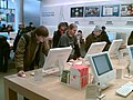 Apple Store, London (102078430).jpg 640 × 480; 89 KB
-
 Aqueduct Across Corrie Burn - geograph.org.uk - 126189.jpg 640 × 480; 140 KB
-
 Aqueduct Crossing Duchray Water - geograph.org.uk - 126996.jpg 640 × 480; 165 KB
-
 Aqueduct in Loch Ard Forest - geograph.org.uk - 126183.jpg 640 × 480; 172 KB
-
 Argyll Hotel Southend. - geograph.org.uk - 130495.jpg 640 × 480; 72 KB
-
 Army Training Area - geograph.org.uk - 124271.jpg 640 × 480; 35 KB
-
 Arran Summer Sunset 2 - panoramio.jpg 1,280 × 960; 438 KB
-
 Ashintully Castle - geograph.org.uk - 124112.jpg 640 × 480; 71 KB
-
 Ayton Banks Farm - geograph.org.uk - 124290.jpg 640 × 480; 53 KB
-
 B4569 Road between Caersws and Trefeglwys - geograph.org.uk - 200520.jpg 640 × 480; 108 KB
-

-
 Barn at Vong Farm, east of Pott Row - geograph.org.uk - 123909.jpg 640 × 480; 109 KB
-
 Christ Church, Barnston - geograph.org.uk - 124035.jpg 640 × 480; 163 KB
-
 Bebington Cemetery - geograph.org.uk - 123914.jpg 640 × 480; 150 KB
-
 Beech Wood, Hampstead Norreys - geograph.org.uk - 125478.jpg 640 × 480; 73 KB
-
 Beeley Moor. - geograph.org.uk - 125323.jpg 640 × 481; 121 KB
-
 Beely Moor. - geograph.org.uk - 126477.jpg 640 × 481; 113 KB
-
 Belfast, St Anne's cathedral.JPG 3,000 × 2,250; 4.85 MB
-
 Beltrim - geograph.org.uk - 124753.jpg 640 × 479; 126 KB
-
 Beltrim and Lenamore Townland - geograph.org.uk - 124712.jpg 640 × 269; 77 KB
-
 Beltrim National School - geograph.org.uk - 124777.jpg 640 × 479; 135 KB
-
 Beltrim Townland - geograph.org.uk - 124729.jpg 640 × 479; 161 KB
-
 Beltrim Townland - geograph.org.uk - 124741.jpg 640 × 479; 162 KB
-
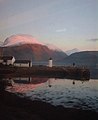 Ben Nevis - geograph.org.uk - 714420.jpg 521 × 640; 37 KB
-
 Berries (101232887).jpg 3,456 × 2,304; 2.24 MB
-
 Big rock by Llyn Gwynant - geograph.org.uk - 558612.jpg 640 × 427; 102 KB
-
 Birch Tree, Landmoth Wood - geograph.org.uk - 124286.jpg 480 × 640; 156 KB
-
 Birch Woodland, Landmoth Wood - geograph.org.uk - 124144.jpg 640 × 480; 113 KB
-
 St Edith's Church, Bishop Wilton.jpg 640 × 480; 83 KB
-
 Bishop Wilton - geograph.org.uk - 125959.jpg 640 × 480; 126 KB
-
 Bishop Wilton Wold - geograph.org.uk - 125387.jpg 640 × 480; 121 KB
-
 Bishop Wilton Wold - geograph.org.uk - 125975.jpg 640 × 480; 113 KB
-
 Bishopbridge - geograph.org.uk - 124140.jpg 640 × 427; 101 KB
-
 Blackpool Tram - geograph.org.uk - 1097472.jpg 640 × 480; 82 KB
-
 Blackwater Dam Outlet - geograph.org.uk - 1105494.jpg 640 × 480; 124 KB
-
 Boathouse on Loch Gainmheach - geograph.org.uk - 123978.jpg 640 × 480; 259 KB
-
 Boathouse on Loch Gainmheach - geograph.org.uk - 123982.jpg 640 × 480; 225 KB
-
 Bodaioch Hall, Trefeglwys - geograph.org.uk - 200506.jpg 640 × 480; 125 KB
-
 Bold Street tram stop Fleetwood - geograph.org.uk - 1194076.jpg 640 × 480; 56 KB
-
 Bracebridge Heath reservoir - geograph.org.uk - 123854.jpg 640 × 480; 56 KB
-
 Bradney Village - geograph.org.uk - 124718.jpg 640 × 426; 130 KB
-
 Bridge over Afon Cerist, near Caersws - geograph.org.uk - 200526.jpg 640 × 480; 110 KB
-
 Bridge over Colwyn Brook - geograph.org.uk - 124479.jpg 640 × 480; 185 KB
-
 Bridge Over Stream, Caersws - geograph.org.uk - 194764.jpg 640 × 480; 111 KB
-

-
 Brunerican Bay, Southend. - geograph.org.uk - 125046.jpg 640 × 480; 110 KB
-
 Burnfoot - geograph.org.uk - 137474.jpg 640 × 480; 137 KB
-
 Burnham Norton Friary Gatehouse - geograph.org.uk - 123867.jpg 640 × 480; 137 KB
-
 St. Clement's, Burnham Overy - geograph.org.uk - 123859.jpg 640 × 480; 73 KB
-
 Burton Royd Lane, near Kirkburton - geograph.org.uk - 124019.jpg 426 × 640; 155 KB
-
 Butterbottom Flagpole - geograph.org.uk - 125641.jpg 640 × 480; 88 KB
-
 Byrne Avenue Baths - geograph.org.uk - 123908.jpg 640 × 425; 94 KB
-
 Calf Edge Farm, Lothersdale - geograph.org.uk - 1253815.jpg 640 × 480; 32 KB
-
 Car Park at Paulton Hospital - geograph.org.uk - 126710.jpg 640 × 430; 95 KB
-
 Careful with that axe, Eugene. - geograph.org.uk - 125762.jpg 640 × 480; 122 KB
-
 Carnedd Farm - geograph.org.uk - 203399.jpg 640 × 480; 115 KB
-

-
 Carskey Bay shoreline. - geograph.org.uk - 124994.jpg 640 × 480; 90 KB
-

-
 Cattle Grid near Trefeglwys - geograph.org.uk - 124468.jpg 640 × 480; 150 KB
-
 Cefn Croes wind farm - geograph.org.uk - 582422.jpg 640 × 480; 56 KB
-
 Chalk Pit - geograph.org.uk - 125348.jpg 640 × 480; 120 KB
-
 Chaloners Road, York - geograph.org.uk - 124492.jpg 640 × 480; 103 KB
-
 Channel in Cartmel Sands at dusk - geograph.org.uk - 1026672.jpg 640 × 480; 45 KB
-
 Chicken Shack^ - geograph.org.uk - 125433.jpg 640 × 480; 121 KB
-
 Chinese Bridge - geograph.org.uk - 411354.jpg 640 × 425; 104 KB
-
 Church at Wharram Percy - geograph.org.uk - 165981.jpg 480 × 640; 89 KB
-
 Church End Lane - geograph.org.uk - 124088.jpg 640 × 480; 59 KB
-
 Clapton Village - geograph.org.uk - 126749.jpg 640 × 430; 134 KB
-
 Clermiston Road - geograph.org.uk - 124024.jpg 640 × 480; 136 KB
-
 Clock Tower and War Memorial - geograph.org.uk - 124102 CROP.jpg 327 × 435; 21 KB
-
 Clock Tower and War Memorial - geograph.org.uk - 124102.jpg 495 × 640; 53 KB
-
-
 Coast Guard lookout post at Black Head - geograph.org.uk - 125394.jpg 640 × 426; 109 KB
-
 Coastguard Station, Southend, Kintyre.jpg 640 × 480; 63 KB
-
 Cobleland Campsite in Winter - geograph.org.uk - 125735.jpg 640 × 480; 158 KB
-
 Cod Beck - geograph.org.uk - 124152.jpg 640 × 480; 100 KB
-
 Coinagehall Street, Helston - geograph.org.uk - 124236.jpg 640 × 416; 93 KB
-
 ColdeatonCuttingOnTheTissingtonTrail(JohnDarch)Feb2006.jpg 640 × 480; 165 KB
-
 Colne FC v Ramsbottom Utd - geograph.org.uk - 1703922.jpg 2,272 × 1,712; 1.04 MB
-
 Colne from the football pitches - geograph.org.uk - 1703935.jpg 2,272 × 1,712; 1.15 MB
-
 Coming down Rylagh Top - geograph.org.uk - 124669.jpg 640 × 479; 141 KB
-
 Communication Mast - geograph.org.uk - 125345.jpg 480 × 640; 118 KB
-
 Compton DVOR navigation beacon - geograph.org.uk - 125492.jpg 640 × 480; 61 KB
-
 Confluence on River Add - geograph.org.uk - 123963.jpg 480 × 640; 201 KB
-
 Corus Hotel, near Ampfield - geograph.org.uk - 124180.jpg 640 × 480; 327 KB
-
 Cottage in Chalk Street. - geograph.org.uk - 124101.jpg 640 × 480; 81 KB
-
 Course of Old Railway, Forestburn Gate - geograph.org.uk - 124426.jpg 640 × 480; 124 KB
-
 Cow and calf, Castles. - geograph.org.uk - 125689.jpg 640 × 428; 100 KB
-
 Cows in the Farmyard at Mellangoose - geograph.org.uk - 124163.jpg 427 × 640; 109 KB
-
 Crags Below The Storr - geograph.org.uk - 123988.jpg 640 × 480; 127 KB
-

-
 Crocknakeeferty Mountain - geograph.org.uk - 124640.jpg 640 × 329; 76 KB
-
 Cross Hill Lane, Hartshead, Yorkshire - geograph.org.uk - 125883.jpg 640 × 480; 195 KB
-
 Culham Cut - geograph.org.uk - 124748.jpg 640 × 480; 58 KB
-
 Cutting on Disused Railway Line - geograph.org.uk - 124430.jpg 640 × 480; 130 KB
-
 Daffodil Field - geograph.org.uk - 124042.jpg 640 × 427; 162 KB
-
 Detail of memorial plaque - geograph.org.uk - 127216.jpg 480 × 640; 87 KB
-

-

-
 DLR Westferry aerial view.jpg 2,048 × 3,072; 4.18 MB
-

-
 Downs Banks - geograph.org.uk - 1082481.jpg 640 × 480; 43 KB
-
 Drifts, Beinn Eunaich - geograph.org.uk - 125795.jpg 640 × 480; 61 KB
-
 Dry Stone Wall at Langbar - geograph.org.uk - 123855.jpg 640 × 480; 181 KB
-
 Dun Grianan - geograph.org.uk - 748493.jpg 640 × 471; 161 KB
-
 Dunaverty Bay , Southend. - geograph.org.uk - 125008.jpg 640 × 480; 109 KB
-
 Dunaverty Bay, Southend, Kintyre. - geograph.org.uk - 125004.jpg 640 × 480; 102 KB
-
 Dunaverty Golf Clubhouse, Southend. - geograph.org.uk - 125020.jpg 640 × 480; 67 KB
-
 Eas Eunaich - geograph.org.uk - 125638.jpg 640 × 480; 111 KB
-
 East of Fridaythorpe - geograph.org.uk - 125361.jpg 640 × 480; 133 KB
-
 East of Full Sutton - geograph.org.uk - 125998.jpg 640 × 480; 127 KB
-
 East of Market Weighton - geograph.org.uk - 126001.jpg 640 × 480; 86 KB
-
 East top of Beinn Eunaich - geograph.org.uk - 126243.jpg 640 × 480; 54 KB
-
 East top of Beinn Eunaich - geograph.org.uk - 126246.jpg 640 × 480; 40 KB
-
 Entrance to Carnedd farm - geograph.org.uk - 231239.jpg 640 × 480; 147 KB
-
 Entrance to Park Wood - geograph.org.uk - 859385.jpg 640 × 480; 237 KB
-
 Eyarth Hall - geograph.org.uk - 123788.jpg 640 × 479; 132 KB
-
 Eyarth Hall Lodge - geograph.org.uk - 123793.jpg 640 × 480; 126 KB
-
 Factory - geograph.org.uk - 124711.jpg 640 × 426; 109 KB
-
 Fall Lane, Hartshead, Yorkshire - geograph.org.uk - 125894.jpg 640 × 477; 107 KB
-
 Farm access bridge at Crook Wheel - geograph.org.uk - 1026684.jpg 640 × 480; 90 KB
-
 Farm Buildings at Trewythen - geograph.org.uk - 124472.jpg 640 × 480; 167 KB
-

-

-

-
 Farm Gate, Near Red House, Trefeglwys - geograph.org.uk - 200523.jpg 640 × 480; 118 KB
-
 Farm Gate, Pen-y-ffynyon Farm - geograph.org.uk - 200514.jpg 640 × 480; 112 KB
-
 Farm Machinery - geograph.org.uk - 124740.jpg 640 × 480; 94 KB
-
 Farmer at work, Hartshead, Yorkshire - geograph.org.uk - 125249.jpg 640 × 480; 121 KB
-
 Farmland along the A1079 - geograph.org.uk - 126002.jpg 640 × 480; 162 KB
-
 Farmland North of the A166 - geograph.org.uk - 125366.jpg 640 × 480; 142 KB
-
 Farmland South of Skirpenbeck - geograph.org.uk - 125996.jpg 640 × 480; 146 KB
-

-
 Fields at Kates Bridge - geograph.org.uk - 124796.jpg 640 × 427; 74 KB
-
 Fimber Field Farm - geograph.org.uk - 125364.jpg 640 × 480; 75 KB
-
 Finchairn River Cave - Resurgence - geograph.org.uk - 123946.jpg 640 × 480; 189 KB
-
 Finchairn River Cave - the "Earth Bridge" - geograph.org.uk - 123947.jpg 640 × 480; 201 KB
-
 Firgrove Farm Cottage, Yateley - geograph.org.uk - 126209.jpg 640 × 480; 79 KB
-

-
 Fleetwood - geograph.org.uk - 1194064.jpg 640 × 480; 72 KB
-
 Fleetwood tram terminus. - geograph.org.uk - 1194070.jpg 640 × 480; 66 KB
-
 Flogging A Dead Horse - geograph.org.uk - 127228.jpg 640 × 480; 117 KB
-
 Fly-fishing - geograph.org.uk - 124327.jpg 640 × 480; 72 KB
-
 Footbridge Over Cod Beck - geograph.org.uk - 124288.jpg 480 × 640; 106 KB
-
 Footpath across the main road - geograph.org.uk - 124091.jpg 640 × 427; 96 KB
-

-

-

-
 Footpath to Billesley - geograph.org.uk - 124364.jpg 640 × 480; 88 KB
-
 Footpath to Bishop Wilton - geograph.org.uk - 125457.jpg 640 × 480; 118 KB
-
 Footpath to Gipsy Hill Farm - geograph.org.uk - 124878.jpg 640 × 480; 87 KB
-
 Footpath to Iron Gate Farm - geograph.org.uk - 124362.jpg 640 × 480; 115 KB
-
 Footpath waypost - geograph.org.uk - 124142.jpg 480 × 640; 63 KB
-
 Ford Foundry extension - geograph.org.uk - 126780.jpg 640 × 480; 58 KB
-

-
 Free range pigs - geograph.org.uk - 124154.jpg 640 × 409; 101 KB
-
 Fridaythorpe, Duck Pond - geograph.org.uk - 125359.jpg 640 × 480; 90 KB
-
 Garroby Hill.jpg 640 × 480; 98 KB
-
 Garrowby Lodge - geograph.org.uk - 125982.jpg 640 × 480; 138 KB
-
 Gate and stile - geograph.org.uk - 124323.jpg 640 × 480; 123 KB
-
 Gates to St. Nicholas Tower Chapel - geograph.org.uk - 127205.jpg 640 × 480; 140 KB
-
 Gateway to Moor End Farm - geograph.org.uk - 123862.jpg 640 × 480; 110 KB
-

-
 Gleann Cia-Aig near footbridge - geograph.org.uk - 947130.jpg 500 × 375; 85 KB
-
 Gleiniant Methodist Chapel - geograph.org.uk - 203403.jpg 640 × 480; 148 KB
-
 Godolphin Street, Helston - geograph.org.uk - 124190.jpg 640 × 411; 87 KB
-
 Gortin Glens - geograph.org.uk - 124700.jpg 640 × 479; 136 KB
-
 Gortin RC Church - geograph.org.uk - 124793.jpg 479 × 640; 93 KB
-
 Gortin, County Tyrone - geograph.org.uk - 124771.jpg 640 × 254; 58 KB
-
 Gowthorpe Fields - geograph.org.uk - 125999.jpg 640 × 480; 125 KB
-
 Gowthorpe.jpg 640 × 480; 137 KB
-
 Grand Union Canal - geograph.org.uk - 126770.jpg 640 × 480; 109 KB
-
 Grand Union Canal diversion - geograph.org.uk - 126774.jpg 640 × 480; 89 KB
-
 Great Dodd summit - geograph.org.uk - 1081987.jpg 640 × 480; 90 KB
-
 Great Givendale - Ponds - geograph.org.uk - 125340.jpg 640 × 480; 119 KB
-
 Green Lane at Haselor - geograph.org.uk - 124899.jpg 640 × 480; 88 KB
-
 Grimthorpe Manor - geograph.org.uk - 125343.jpg 640 × 480; 138 KB
-
 Grimthorpe Wood - geograph.org.uk - 125408.jpg 640 × 480; 170 KB
-
 Gynn Square - geograph.org.uk - 1194035.jpg 640 × 480; 65 KB
-
 Hanger Hill Drive - geograph.org.uk - 124025.jpg 640 × 425; 80 KB
-
 Hare today... - geograph.org.uk - 124871.jpg 640 × 477; 99 KB
-


.jpg)


.jpg)


Feb2006.jpg)


