Category:United Kingdom photographs taken on 2006-07-12

Subcategories
This category has only the following subcategory.
L
Media in category "United Kingdom photographs taken on 2006-07-12"
The following 200 files are in this category, out of 556 total.
(previous page) (next page)-
 14th century gateway - geograph.org.uk - 201007.jpg 427 × 640; 101 KB
-
 A14 north of Ellington - geograph.org.uk - 201293.jpg 640 × 480; 68 KB
-

-
 Abbey of St Benet at Holm - geograph.org.uk - 270080.jpg 640 × 480; 138 KB
-

-

-
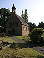
 All Saints' church - geograph.org.uk - 200950.jpg 640 × 427; 72 KB
-
 Almshouses at Ford - geograph.org.uk - 207048.jpg 640 × 480; 88 KB
-
 Alwington Church School - geograph.org.uk - 207050.jpg 640 × 480; 75 KB
-
 Alwington Church Tower - geograph.org.uk - 207029.jpg 480 × 640; 131 KB
-
 Alwington Methodist Church - geograph.org.uk - 207020.jpg 640 × 480; 91 KB
-
 Alwington Methodist Church - geograph.org.uk - 207021.jpg 640 × 480; 130 KB
-
 Alwington Parish Church - geograph.org.uk - 207031.jpg 640 × 480; 76 KB
-
 Alwington St Andrew's Churchyard - geograph.org.uk - 207032.jpg 640 × 480; 132 KB
-
 Aplin's Covert - geograph.org.uk - 201079.jpg 480 × 640; 114 KB
-
 Arsenal Panorama (188187883).jpg 1,600 × 220; 74 KB
-
 At Mains Farm crossroads. - geograph.org.uk - 203433.jpg 600 × 396; 82 KB
-
 Atlantic Village - geograph.org.uk - 212755.jpg 640 × 480; 79 KB
-
 Atlantic Village al fresco Food Court - geograph.org.uk - 210821.jpg 640 × 480; 89 KB
-
 Atlantis^ - geograph.org.uk - 210824.jpg 640 × 480; 103 KB
-
 Avenue House - geograph.org.uk - 200731.jpg 640 × 480; 89 KB
-
 Avoch Harbour - geograph.org.uk - 203428.jpg 600 × 399; 70 KB
-
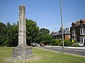
 Avoch War Memorial - geograph.org.uk - 203425.jpg 600 × 392; 71 KB
-
 Ballards Lane - geograph.org.uk - 200720.jpg 640 × 480; 91 KB
-
 Barnet, The Drive - geograph.org.uk - 201519.jpg 640 × 480; 81 KB
-
 Basford - Potato Field.jpg 640 × 426; 93 KB
-
 Battishorne Farm, Honiton - geograph.org.uk - 201154.jpg 640 × 480; 80 KB
-
-
 Beach Huts, Mundesley - geograph.org.uk - 205438.jpg 640 × 480; 124 KB
-
 Bear in the Air - geograph.org.uk - 204910.jpg 480 × 640; 184 KB
-
 Bethlehem Farm, Colwell - geograph.org.uk - 201126.jpg 480 × 640; 114 KB
-
 Bideford Cemetery - geograph.org.uk - 211167.jpg 640 × 480; 101 KB
-
 Black Lane, Mellor Moor - geograph.org.uk - 200884.jpg 640 × 480; 84 KB
-
 Blairdhu - geograph.org.uk - 201720.jpg 640 × 480; 84 KB
-
 Blakeney - geograph.org.uk - 204774.jpg 640 × 480; 95 KB
-
 Boat House at Mire Loch - geograph.org.uk - 647984.jpg 640 × 480; 70 KB
-
 Bodnant Hall - geograph.org.uk - 923991.jpg 640 × 480; 91 KB
-
 Boycombe - geograph.org.uk - 201149.jpg 640 × 480; 76 KB
-
 Bridge over Crescent Road - geograph.org.uk - 200762.jpg 640 × 480; 103 KB
-
 Bridge Street Fordingbridge Hampshire - geograph.org.uk - 201001.jpg 640 × 480; 136 KB
-
 Bridleway - geograph.org.uk - 200827.jpg 480 × 640; 187 KB
-
 Bridleway at Ashton Mill Farm - geograph.org.uk - 201138.jpg 640 × 480; 85 KB
-
 Brithdir - geograph.org.uk - 201381.jpg 640 × 480; 170 KB
-

-
 Building site, Alexandra Road, Penzance - geograph.org.uk - 201335.jpg 640 × 426; 222 KB
-

-
 Burley Moor - geograph.org.uk - 201262.jpg 640 × 480; 109 KB
-
 Bus shelter, Highfield - geograph.org.uk - 207793.jpg 640 × 480; 98 KB
-

-
 Calshot Beach and Beach Huts - geograph.org.uk - 327413.jpg 640 × 480; 110 KB
-

-
 Campsite at Stiffkey - geograph.org.uk - 208493.jpg 640 × 480; 123 KB
-
-
 Carved tree, West Park - geograph.org.uk - 603867.jpg 480 × 640; 116 KB
-
 Castle Howe monument Kendal - geograph.org.uk - 230101.jpg 640 × 479; 64 KB
-
 Cattle at Newton of Darnaway Farm. - geograph.org.uk - 200856.jpg 640 × 427; 80 KB
-

-

-
 Chorlton - Heath Farm.jpg 640 × 426; 74 KB
-

-
 Church of St. Michael, East Torrington - geograph.org.uk - 200739.jpg 640 × 472; 141 KB
-
 Church of St. Michael, East Torrington - geograph.org.uk - 200997.jpg 480 × 640; 106 KB
-
 Church Row St. Martins - geograph.org.uk - 200751.jpg 640 × 480; 102 KB
-
 Churchyard Cross - geograph.org.uk - 201006.jpg 427 × 640; 108 KB
-
 Cnoc a' Chrochaire - geograph.org.uk - 200930.jpg 640 × 480; 35 KB
-

-

-
 Control tower, Ludham Airfield - geograph.org.uk - 270164.jpg 640 × 480; 134 KB
-
 Conwy Castle over the Road Bridge - geograph.org.uk - 924002.jpg 640 × 480; 53 KB
-
 Corbet House, Wyndham Road, SE5 - geograph.org.uk - 200912.jpg 640 × 480; 113 KB
-
 Coul of Fairburn - geograph.org.uk - 201760.jpg 640 × 480; 63 KB
-
 Coverham church lychgate - geograph.org.uk - 345351.jpg 600 × 450; 83 KB
-
 Crendon House Westfield Road Long Crendon - geograph.org.uk - 201258.jpg 640 × 427; 150 KB
-
 Cross on Top of Mellor Moor - geograph.org.uk - 200894.jpg 640 × 480; 59 KB
-
 Cuthbert House - geograph.org.uk - 200632.jpg 640 × 480; 94 KB
-
 Cwm Pitch - geograph.org.uk - 206221.jpg 640 × 480; 76 KB
-
 Cwmorthin waterfall.JPG 1,600 × 2,400; 2.34 MB
-
 Dairy buildings at Hindford - geograph.org.uk - 201891.jpg 640 × 480; 98 KB
-
 Diageo - geograph.org.uk - 201047.jpg 640 × 480; 76 KB
-

-
 Disused Cottage at Glenurquhart Farm - geograph.org.uk - 204195.jpg 600 × 412; 343 KB
-

-
 Down to the Hill - geograph.org.uk - 202050.jpg 640 × 480; 130 KB
-
 Drumsmittal Lane - geograph.org.uk - 203516.jpg 600 × 443; 155 KB
-
 Dun Dornaigil broch - geograph.org.uk - 263968.jpg 640 × 480; 119 KB
-
 Duncton Mill - geograph.org.uk - 201282.jpg 640 × 480; 122 KB
-
 Dunfermline High Street - geograph.org.uk - 625191.jpg 480 × 640; 72 KB
-
 Dyke, Newmore - geograph.org.uk - 207799.jpg 480 × 640; 51 KB
-
 East Coast Mainline Railway Bridge - geograph.org.uk - 200638.jpg 640 × 480; 78 KB
-
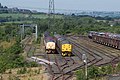
 East End Railway - geograph.org.uk - 202184.jpg 640 × 480; 136 KB
-
 Church of St. Michael, East Torrington - geograph.org.uk - 200992.jpg 477 × 640; 111 KB
-
 Eastham yew.jpg 640 × 480; 345 KB
-
 Elston Methodist church - geograph.org.uk - 200953.jpg 640 × 427; 74 KB
-

-
 Entry to Girsby Manor - geograph.org.uk - 201219.jpg 425 × 640; 117 KB
-
 EoM nr TYG.JPG 1,600 × 2,400; 1.36 MB
-

-
 Fairy Cross Bus Shelter - geograph.org.uk - 207023.jpg 640 × 480; 93 KB
-
 Fairy Cross Bus Shelter - geograph.org.uk - 207026.jpg 640 × 480; 132 KB
-

-
 Farway - geograph.org.uk - 201142.jpg 480 × 640; 134 KB
-
 Farway Castle - geograph.org.uk - 201150.jpg 640 × 480; 187 KB
-
 Dovecote at Felbrigg Hall - geograph.org.uk - 205436.jpg 480 × 640; 128 KB
-
 Felbrigg Hall - geograph.org.uk - 204921.jpg 640 × 480; 144 KB
-
 FelbriggHall(PhilipHalling)Jul2006.jpg 640 × 480; 131 KB
-
 Field at Colwell - geograph.org.uk - 201089.jpg 640 × 480; 110 KB
-

-
 Field in Kidderminster Foreign, Worcestershire, England.jpg 640 × 480; 77 KB
-
 Fields west of Duncton village - geograph.org.uk - 201285.jpg 640 × 480; 87 KB
-
 Flatford Mill - geograph.org.uk - 709325.jpg 640 × 434; 99 KB
-

-
 Flytip on Side of Road - geograph.org.uk - 310826.jpg 640 × 409; 126 KB
-
 Former Bridge - geograph.org.uk - 202180.jpg 640 × 480; 128 KB
-
 Fort George, coastline - geograph.org.uk - 1510621.jpg 640 × 427; 61 KB
-
 Fountain at Trafalgar Square WC2 - geograph.org.uk - 1281759.jpg 479 × 640; 106 KB
-
 FR Boston Lodge.JPG 1,884 × 1,404; 1,014 KB
-
 FR PHS EoM9.JPG 1,600 × 2,400; 1.35 MB
-
 FR Prince Tan-y-Bwlch.JPG 1,536 × 1,155; 1,000 KB
-
 Garve - geograph.org.uk - 207768.jpg 640 × 418; 79 KB
-
 Gateshead Interchange Sculpture - geograph.org.uk - 201211.jpg 640 × 480; 74 KB
-
 Gayton Manor, Gayton-le-Wold - geograph.org.uk - 200835.jpg 640 × 425; 128 KB
-
 Gayton Manor, Gayton-le-Wold - geograph.org.uk - 305352.jpg 640 × 470; 169 KB
-
-
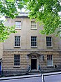 Georgianhousebristol.jpg 480 × 640; 83 KB
-
 Giant Hogweed, Beware^^^^^ - geograph.org.uk - 200862.jpg 640 × 427; 144 KB
-
 Glen Ochil Prison - geograph.org.uk - 201040.jpg 640 × 480; 73 KB
-
 Going underground - geograph.org.uk - 201230.jpg 480 × 640; 99 KB
-
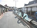
 Graffiti at Hopswood Aqueduct - geograph.org.uk - 201523.jpg 640 × 480; 82 KB
-
 Graves Saad Saadi Ali and Yusuf Dadoo.jpg 2,032 × 1,524; 1.01 MB
-

-

-
 Ha-Ha and Orangery, Felbrigg Hall - geograph.org.uk - 204924.jpg 640 × 480; 149 KB
-
 Hadley Highstone.jpg 640 × 480; 92 KB
-
 Hare and Hounds - geograph.org.uk - 829476.jpg 640 × 481; 93 KB
-
 Hare and Hounds, Putts Corner - geograph.org.uk - 201153.jpg 640 × 480; 95 KB
-
 Healey Mills Yard, near Wakefield - geograph.org.uk - 362291.jpg 640 × 426; 118 KB
-

-
 Hervey Close - geograph.org.uk - 200765.jpg 640 × 480; 117 KB
-
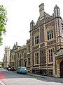
 Heslington Hall - geograph.org.uk - 980456.jpg 640 × 480; 119 KB
-
 High Street, Stockbridge - geograph.org.uk - 202951.jpg 640 × 427; 126 KB
-
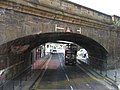 Hills Street Railway Bridge - geograph.org.uk - 200655.jpg 640 × 480; 77 KB
-

-
 Holkham Hall - geograph.org.uk - 206890.jpg 640 × 481; 118 KB
-
 Holy Trinity - geograph.org.uk - 200961.jpg 480 × 640; 95 KB
-
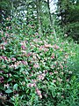 Honeysuckle, Balvaird Wood. - geograph.org.uk - 207805.jpg 480 × 640; 161 KB
-
 Horse trough at Smithfield - geograph.org.uk - 213154.jpg 640 × 480; 145 KB
-
 Hough Common.jpg 640 × 426; 109 KB
-
 Houses on Great George Street - geograph.org.uk - 200572.jpg 640 × 480; 81 KB
-
 Intersections - geograph.org.uk - 200629.jpg 640 × 480; 82 KB
-
 Island and Information - geograph.org.uk - 202075.jpg 640 × 480; 86 KB
-
 Junction on Drumsmittal lane. - geograph.org.uk - 204313.jpg 640 × 452; 349 KB
-
 Keeping cool - geograph.org.uk - 201011.jpg 640 × 427; 76 KB
-
 Kineton Hill - geograph.org.uk - 202057.jpg 640 × 480; 88 KB
-
 Kyle line - geograph.org.uk - 207777.jpg 640 × 480; 88 KB
-
 Leather Lane Market - geograph.org.uk - 213151.jpg 640 × 480; 139 KB
-
 Linne Wood - geograph.org.uk - 201717.jpg 640 × 480; 152 KB
-
 Llandrillo - geograph.org.uk - 201301.jpg 640 × 480; 157 KB
-
 Loading Bay at the Allen Smelt Mill Flues - geograph.org.uk - 201942.jpg 640 × 480; 135 KB
-
 Loch a' Choire Lèith - geograph.org.uk - 203484.jpg 640 × 480; 65 KB
-
 Loch an Dubh-charn - geograph.org.uk - 204059.jpg 640 × 480; 142 KB
-
 Long Lawford - geograph.org.uk - 200541.jpg 640 × 480; 132 KB
-
 Long Lawford - geograph.org.uk - 201097.jpg 640 × 480; 121 KB
-

-
 Looking towards Harpgates Plantation - geograph.org.uk - 201014.jpg 640 × 480; 100 KB
-
 Looking towards Redstone, Morayshire. - geograph.org.uk - 200851.jpg 640 × 427; 94 KB
-
 Looking up Park Street - geograph.org.uk - 200657.jpg 480 × 640; 88 KB
-
 Looking up the Canaird River - geograph.org.uk - 430044.jpg 640 × 480; 84 KB
-
 Lossit Bay - geograph.org.uk - 216158.jpg 640 × 480; 120 KB
-

-
 Ludford Magna Airfield - geograph.org.uk - 305340.jpg 640 × 426; 117 KB
-
 Luichart Dam - geograph.org.uk - 204056.jpg 640 × 480; 86 KB
-
 Luttrell's Tower in Stanswood Bay - geograph.org.uk - 326940.jpg 461 × 640; 92 KB
-
 Lychgate - geograph.org.uk - 201004.jpg 427 × 640; 103 KB
-
-
 Meig Dam - geograph.org.uk - 203438.jpg 640 × 480; 104 KB
-

-
 Metton Church - geograph.org.uk - 204913.jpg 640 × 480; 145 KB
-
 Milton Court - geograph.org.uk - 200820.jpg 640 × 428; 135 KB
-
 Minffordd - geograph.org.uk - 201390.jpg 640 × 480; 187 KB
-
 Minster Green - geograph.org.uk - 201613.jpg 640 × 427; 83 KB
-

-
 Muirside - geograph.org.uk - 201043.jpg 640 × 480; 83 KB
-
 Mundesley Maritime Museum - geograph.org.uk - 204932.jpg 640 × 480; 101 KB
-
 Narrowboat on Hopswood Aqueduct - geograph.org.uk - 201518.jpg 640 × 480; 58 KB
-
 Near Biscathorpe - geograph.org.uk - 303980.jpg 640 × 480; 140 KB
-
 Near the Start of the Tree Top Way - geograph.org.uk - 200858.jpg 640 × 512; 125 KB
-
 New Church Road, SE5 (2) - geograph.org.uk - 200880.jpg 640 × 480; 114 KB
-
 New Roundabout - geograph.org.uk - 201037.jpg 640 × 480; 76 KB
-
 Newbold-On-Avon - geograph.org.uk - 201083.jpg 640 × 480; 101 KB
-
 Newbold-On-Avon - geograph.org.uk - 201091.jpg 640 × 480; 134 KB
-
 Night shift - panoramio.jpg 2,592 × 1,944; 310 KB
-
 Tomb, Northleigh churchyard - geograph.org.uk - 201611.jpg 640 × 480; 118 KB
-
 Northleigh Farm - geograph.org.uk - 201140.jpg 640 × 480; 91 KB
-
 Northleigh from the northeast - geograph.org.uk - 201135.jpg 480 × 640; 117 KB
-
 Obelisk, Holkham Hall - geograph.org.uk - 206887.jpg 640 × 481; 63 KB
-
 Offwell Brook valley at West Colwell - geograph.org.uk - 201156.jpg 640 × 480; 94 KB
-
 Offwell Brook valley at West Colwell - geograph.org.uk - 201157.jpg 640 × 480; 81 KB
-
 Offwell Brook valley below Colwell - geograph.org.uk - 201105.jpg 640 × 480; 154 KB
-
 Offwell Woods - geograph.org.uk - 201074.jpg 480 × 640; 135 KB
-
 Ogof Badrig-Patrick's Cave - geograph.org.uk - 670403.jpg 640 × 426; 72 KB


Jul2006.jpg)


_-_geograph.org.uk_-_200880.jpg)


.jpg)