Category:United Kingdom photographs taken on 2006-07-15
Countries of Europe: Austria · Belgium · Croatia · Denmark · Estonia · Finland · France‡ · Germany · Greece · Hungary · Iceland · Republic of Ireland · Italy · Netherlands‡ · Norway · Poland · Portugal‡ · Romania · Russia‡ · Serbia · Slovakia · Spain‡ · Sweden · Switzerland · Turkey‡ · Ukraine · United Kingdom
Specific status: Isle of Man
‡: partly located in Europe
Specific status: Isle of Man
‡: partly located in Europe
| ← | 15 July 2006 | → | ||
| ← | July 2006 | → | ||

United Kingdom photographs taken on 15 July 2006.
Image files should be categorized here automatically using {{taken on}} template. Direct categorisation is also possible, if automatic is impossible.
Media in category "United Kingdom photographs taken on 2006-07-15"
The following 200 files are in this category, out of 982 total.
(previous page) (next page)-
 16 Rock Park - geograph.org.uk - 359596.jpg 640 × 480; 112 KB
-
 A Hot Country Lane - geograph.org.uk - 205205.jpg 640 × 427; 100 KB
-
 A Scottish Bluebell - geograph.org.uk - 202495.jpg 480 × 639; 97 KB
-

-
 A Walk to the River Alde, Suffolk - geograph.org.uk - 208973.jpg 640 × 360; 79 KB
-
 A342 - geograph.org.uk - 202754.jpg 640 × 480; 76 KB
-
 A342 - geograph.org.uk - 202762.jpg 640 × 480; 70 KB
-
 Abhainn Shira - geograph.org.uk - 204611.jpg 478 × 640; 148 KB
-
 Access to Canal from Main Road Bridge - geograph.org.uk - 210313.jpg 640 × 480; 99 KB
-
 Achnashellach railway station - geograph.org.uk - 203415.jpg 640 × 480; 158 KB
-
 AchnashellachRailwayStation.jpg 640 × 480; 172 KB
-
 Adensfield aka Goathland - geograph.org.uk - 1072959.jpg 640 × 480; 58 KB
-
 Alderwood - geograph.org.uk - 202461.jpg 640 × 480; 27 KB
-
 All Saints Church Wold Newton - geograph.org.uk - 203452.jpg 640 × 480; 124 KB
-
-
 Allotments, Roundhay, Leeds - geograph.org.uk - 202534.jpg 640 × 340; 80 KB
-

-
 Allt Coire nam Ban - geograph.org.uk - 204437.jpg 640 × 478; 126 KB
-
 Alltami Quarry - geograph.org.uk - 202355.jpg 640 × 480; 97 KB
-

-
 An Unusual Fingerpost - geograph.org.uk - 205634.jpg 640 × 427; 139 KB
-
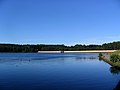
 Angerton Lake - geograph.org.uk - 401554.jpg 640 × 480; 99 KB
-
 Angle Tarn - geograph.org.uk - 217619.jpg 640 × 480; 81 KB
-
 Angle Tarn Path - geograph.org.uk - 204215.jpg 640 × 480; 84 KB
-
 Annandale Water picnic area - geograph.org.uk - 924613.jpg 640 × 480; 102 KB
-
 Annandale Water service station - geograph.org.uk - 924617.jpg 640 × 480; 103 KB
-
 Annandale Water services - geograph.org.uk - 924609.jpg 640 × 480; 126 KB
-
 Annandale Water, view of island - geograph.org.uk - 924623.jpg 640 × 480; 56 KB
-

-
 ARC - panoramio.jpg 3,072 × 2,304; 1.15 MB
-
 Attenborough Nature Centre - geograph.org.uk - 202833.jpg 640 × 480; 277 KB
-
 Attenborough Nature Reserve - geograph.org.uk - 202630.jpg 640 × 480; 278 KB
-
 Attenborough Nature Reserve - geograph.org.uk - 202642.jpg 480 × 640; 279 KB
-
 Attenborough Nature Reserve - geograph.org.uk - 202656.jpg 640 × 480; 281 KB
-
 Balloch Castle and park - geograph.org.uk - 207052.jpg 640 × 480; 54 KB
-
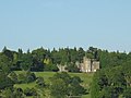 Balloch Castle. - geograph.org.uk - 207053.jpg 640 × 480; 66 KB
-
 Bare roots - geograph.org.uk - 204551.jpg 640 × 511; 112 KB
-
 Barmouth Town - geograph.org.uk - 259672.jpg 640 × 480; 128 KB
-
 Barricane Beach - geograph.org.uk - 207128.jpg 640 × 480; 96 KB
-
 The Old Police Station, High Street - geograph.org.uk - 202297.jpg 640 × 480; 120 KB
-
 Batley station p2.jpg 2,304 × 1,728; 626 KB
-
 Beach near Tonfanau Station - geograph.org.uk - 1298052.jpg 640 × 480; 74 KB
-
 Beach North of Seahouses - geograph.org.uk - 924187.jpg 640 × 342; 51 KB
-
 Bealach Fraoch - geograph.org.uk - 204672.jpg 640 × 478; 174 KB
-
 Bealach north of Beinn nan Aighenan - geograph.org.uk - 204693.jpg 640 × 478; 174 KB
-
 Beinn Liath Mhor - geograph.org.uk - 203426.jpg 640 × 480; 143 KB
-
 Beinn Liath Mhor - geograph.org.uk - 203439.jpg 640 × 480; 144 KB
-
 Beinn Liath Mhor - geograph.org.uk - 203442.jpg 640 × 480; 146 KB
-
 Beinn Liath Mhor - geograph.org.uk - 203487.jpg 640 × 480; 184 KB
-
 Beinn Liath Mhor - geograph.org.uk - 203490.jpg 640 × 480; 175 KB
-
 Beinn Liath Mhor - geograph.org.uk - 205068.jpg 640 × 480; 146 KB
-
 Beinn Liath Mhor - geograph.org.uk - 205095.jpg 640 × 480; 129 KB
-
 Beinn Liath Mhor - geograph.org.uk - 205109.jpg 640 × 480; 130 KB
-
 Beinn Liath Mhor - geograph.org.uk - 205121.jpg 640 × 480; 138 KB
-
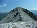 Beinn Liath Mhor - geograph.org.uk - 207790.jpg 640 × 480; 145 KB
-
 Beinn Liath Mhor - geograph.org.uk - 207792.jpg 640 × 480; 159 KB
-
 Beinn Liath Mhor - geograph.org.uk - 208429.jpg 640 × 480; 186 KB
-
 Beinn Liath Mhor - geograph.org.uk - 209391.jpg 640 × 480; 149 KB
-
 Beinn Liath Mhor summit - geograph.org.uk - 208425.jpg 640 × 480; 169 KB
-
 Beinn Liath Mhor summit - geograph.org.uk - 208427.jpg 640 × 480; 148 KB
-
 Below Loch Dochard - geograph.org.uk - 204048.jpg 640 × 478; 129 KB
-
 Black and White - geograph.org.uk - 202663.jpg 480 × 640; 298 KB
-
 Blaen-y-buarth farmhouse - geograph.org.uk - 204161.jpg 640 × 427; 121 KB
-
 Blue Plaque, Canal Gardens, Roundhay - geograph.org.uk - 202476.jpg 580 × 414; 56 KB
-
 Boat on shingle ridge, Blakeney Point - geograph.org.uk - 313758.jpg 640 × 480; 93 KB
-
 Boats on the Trent at Attenborough - geograph.org.uk - 202844.jpg 640 × 460; 286 KB
-
 Bodenham Chapel - geograph.org.uk - 202590.jpg 640 × 480; 72 KB
-
 Bog asphodel by Loch Garry - geograph.org.uk - 203890.jpg 480 × 640; 55 KB
-
 Border light - geograph.org.uk - 841869.jpg 640 × 481; 47 KB
-
 Boturich Castle, by Balloch. - geograph.org.uk - 207055.jpg 640 × 480; 92 KB
-
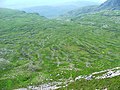
 Braeriach Plateau - geograph.org.uk - 229127.jpg 640 × 480; 102 KB
-
 Bridge HBS-31 - geograph.org.uk - 203501.jpg 640 × 480; 84 KB
-
 Bridge Over Kielder Burn - geograph.org.uk - 203820.jpg 640 × 480; 242 KB
-
 Bridge Over River Esk, Canonbie - geograph.org.uk - 203852.jpg 640 × 480; 186 KB
-
 Bridge over the Lancaster Canal - geograph.org.uk - 202428.jpg 600 × 450; 261 KB
-
 Bridge over the line at Wadhurst station - geograph.org.uk - 202701.jpg 640 × 480; 163 KB
-
 Bridleway to Chacombe - geograph.org.uk - 202583.jpg 640 × 480; 73 KB
-
 Brocas Farm, Hever Road, Kent - geograph.org.uk - 202347.jpg 640 × 480; 101 KB
-
 Broxham House, Kent - geograph.org.uk - 202362.jpg 640 × 480; 130 KB
-
 Bryn Llech Summit View - geograph.org.uk - 221619.jpg 640 × 427; 56 KB
-

-
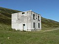
 Buildings at Deadwater - geograph.org.uk - 204598.jpg 640 × 480; 205 KB
-
 Bypassing Wadebridge - geograph.org.uk - 202425.jpg 640 × 489; 111 KB
-
 Byway skirting Great Yews wood - geograph.org.uk - 202966.jpg 640 × 427; 272 KB
-
 Cairn near Carreg y Big - geograph.org.uk - 223969.jpg 640 × 427; 138 KB
-
 Cairn on Beinn Liath Mhor - geograph.org.uk - 205073.jpg 640 × 480; 148 KB
-
 Cairnsgarroch cairn - geograph.org.uk - 204099.jpg 640 × 480; 98 KB
-
 Car Park at Kielder Water - geograph.org.uk - 204525.jpg 640 × 480; 163 KB
-
 Carlyon Farm - geograph.org.uk - 204517.jpg 640 × 427; 96 KB
-
 Carnavel track towards Carsphairn - geograph.org.uk - 204133.jpg 640 × 480; 94 KB
-
 Carreg Cennen seen from the southeast - geograph.org.uk - 211604.jpg 640 × 480; 102 KB
-
 Castell Dolbadarn - geograph.org.uk - 254298.jpg 640 × 480; 78 KB
-
 Cattle in the River - geograph.org.uk - 202965.jpg 640 × 446; 130 KB
-
 Cellardyke harbour - geograph.org.uk - 1143527.jpg 640 × 480; 117 KB
-
 Ceunant Ty'n y Ddol - geograph.org.uk - 203090.jpg 640 × 479; 68 KB
-
 Church Door - geograph.org.uk - 203457.jpg 480 × 640; 71 KB
-
 Church of St Mary and St Botolph - geograph.org.uk - 208930.jpg 480 × 640; 122 KB
-
 Church of St. Patrick, Patterdale - geograph.org.uk - 214274.jpg 640 × 480; 107 KB
-
 Clatteringshaws Dam - geograph.org.uk - 212427.jpg 640 × 480; 82 KB
-
 Clatteringshaws Loch - geograph.org.uk - 212422.jpg 640 × 480; 79 KB
-
 Cliffs of Meallan Ghobhar - geograph.org.uk - 202746.jpg 640 × 480; 105 KB
-
 Clogwyn yr Adar - geograph.org.uk - 203067.jpg 478 × 640; 104 KB
-
 Coastal defence - geograph.org.uk - 203908.jpg 640 × 475; 78 KB
-

-
 Coir' an Albannaich - geograph.org.uk - 204418.jpg 640 × 478; 186 KB
-
 Coire Lair - geograph.org.uk - 203479.jpg 640 × 480; 125 KB
-
 Contrails over the Lake District - geograph.org.uk - 203956.jpg 640 × 480; 28 KB
-
 Converted butty - geograph.org.uk - 202634.jpg 640 × 480; 82 KB
-
 Converted Mill - geograph.org.uk - 202518.jpg 640 × 427; 106 KB
-
 Coran of Portmark cairn - geograph.org.uk - 202677.jpg 640 × 480; 84 KB
-
 Coran of Portmark eastern slopes - geograph.org.uk - 204104.jpg 640 × 480; 82 KB
-
 Cottage near the village green, Parwich - geograph.org.uk - 376649.jpg 640 × 400; 127 KB
-
 Cottages at Youlgreave - geograph.org.uk - 709142.jpg 640 × 426; 81 KB
-
 Cottages in Port William - geograph.org.uk - 214171.jpg 640 × 480; 86 KB
-
 Cottingley station.jpg 2,304 × 1,728; 733 KB
-
 Creinch, small island on Loch Lomond. - geograph.org.uk - 206554.jpg 640 × 480; 63 KB
-
 Daldinia concentrica - geograph.org.uk - 202856.jpg 640 × 480; 314 KB
-
 Deer and the Douglas Water - geograph.org.uk - 202526.jpg 640 × 480; 97 KB
-
 Derelict Building near Treweens - geograph.org.uk - 205187.jpg 640 × 427; 137 KB
-
 Descending from Meall nan Eun - geograph.org.uk - 204708.jpg 640 × 488; 93 KB
-

-
 Dollywaggon Pike from Grisedale.jpg 640 × 480; 61 KB
-
 Down Barn farmhouse - geograph.org.uk - 203147.jpg 640 × 427; 123 KB
-
 Downhill to the Camel Estuary - geograph.org.uk - 204495.jpg 640 × 427; 132 KB
-
 Drumtroddan Farm - geograph.org.uk - 214129.jpg 640 × 480; 71 KB
-

-
 Dry Stone Walls near Hwylfa - geograph.org.uk - 222192.jpg 640 × 427; 84 KB
-
 Dunstall Water Bridge - geograph.org.uk - 209704.jpg 640 × 480; 106 KB
-
 Early Misty Morning at Bourock - geograph.org.uk - 412778.jpg 640 × 426; 73 KB
-
 Early morning stillness - geograph.org.uk - 823111.jpg 640 × 427; 32 KB
-
 East ridge of Beinn nan Aighenan - geograph.org.uk - 204067.jpg 640 × 478; 129 KB
-
 Eileen Donan Castle from Carr Brae.jpg 2,656 × 2,008; 2.89 MB
-
 Electric cows - geograph.org.uk - 202767.jpg 480 × 640; 75 KB
-
 En route to OV 0000 (2) - geograph.org.uk - 213640.jpg 640 × 426; 167 KB
-
 Entering Durgate village - geograph.org.uk - 202684.jpg 640 × 480; 141 KB
-

-
 F18 - RIAT 2006 (2464555873).jpg 1,024 × 683; 74 KB
-
 F18 Hornet - RIAT 2006 (2364894518).jpg 1,024 × 678; 671 KB
-
 F18 Hornet - RIAT 2006 (2371917064).jpg 1,024 × 683; 750 KB
-
 Falls of Dee, Braeriach - geograph.org.uk - 229042.jpg 640 × 480; 127 KB
-
 St Peter's Church Falstone - geograph.org.uk - 203723.jpg 640 × 480; 258 KB
-
 United Reformed Church, Falstone - geograph.org.uk - 203725.jpg 640 × 480; 207 KB
-
 Far Tongue Gill - geograph.org.uk - 203944.jpg 480 × 640; 139 KB
-
 Farm Land - geograph.org.uk - 586841.jpg 640 × 480; 67 KB
-
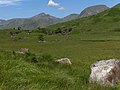
 Farmland at Dourie - geograph.org.uk - 214169.jpg 640 × 480; 81 KB
-
 Farmland at Monreith - geograph.org.uk - 214142.jpg 640 × 480; 68 KB
-
 Farmland at SE895700 - geograph.org.uk - 203395.jpg 640 × 480; 122 KB
-
 Farmland at TA107716 - geograph.org.uk - 203519.jpg 640 × 480; 117 KB
-
 Farmland near New Galloway - geograph.org.uk - 212414.jpg 640 × 480; 75 KB
-
 Fence, Wasdale Pike - geograph.org.uk - 202561.jpg 640 × 480; 94 KB
-
 Fewston Reservoir, Yorkshire - geograph.org.uk - 997834.jpg 640 × 480; 39 KB
-
 Ffridd Wen ruins - geograph.org.uk - 202727.jpg 640 × 427; 125 KB
-
 Field of Wheat - geograph.org.uk - 202437.jpg 640 × 427; 132 KB
-
 Field to the South of Warks Burn - geograph.org.uk - 203706.jpg 640 × 480; 166 KB
-
 Field, but not for long - geograph.org.uk - 212622.jpg 640 × 480; 64 KB
-
 Flood Barrier - geograph.org.uk - 361344.jpg 640 × 480; 99 KB
-
 Florist - geograph.org.uk - 313388.jpg 640 × 426; 108 KB
-
 Folly Lake - geograph.org.uk - 204735.jpg 640 × 480; 112 KB
-

-

-
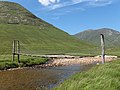 Footbridge, River Kinglass - geograph.org.uk - 204654.jpg 640 × 478; 135 KB
-
 Footpath - geograph.org.uk - 203483.jpg 640 × 480; 155 KB
-
 Footpath - geograph.org.uk - 210284.jpg 640 × 480; 188 KB
-
 Footpath above Achnashellach - geograph.org.uk - 203418.jpg 640 × 480; 162 KB
-
 Footpath above Cae-cwmpas - geograph.org.uk - 202716.jpg 640 × 427; 113 KB
-

-

-

-

-
 Footpath on the Field Edge - geograph.org.uk - 202427.jpg 640 × 427; 124 KB
-
 Footpath to Cropredy - geograph.org.uk - 202612.jpg 640 × 480; 56 KB
-
 Footpath to Newbiggin Crags - geograph.org.uk - 202421.jpg 600 × 450; 178 KB
-
 Ford crossing at Perterburn - geograph.org.uk - 1138371.jpg 480 × 640; 123 KB
-
 Foreshore at Seahouses - geograph.org.uk - 924171.jpg 640 × 480; 77 KB
-
 Forest road - geograph.org.uk - 202521.jpg 640 × 480; 97 KB
-
 Forest track - geograph.org.uk - 202555.jpg 640 × 480; 97 KB
-
 Former Chapel Enborne Row - geograph.org.uk - 1472364.jpg 640 × 511; 76 KB
-
 Former Electricity Power Station - geograph.org.uk - 276377.jpg 640 × 480; 115 KB
-
 Former station, Dalnaspidal - geograph.org.uk - 203642.jpg 640 × 491; 76 KB
-
 FrazeyFord.jpg 960 × 1,280; 364 KB
-
 Frog - geograph.org.uk - 204620.jpg 640 × 478; 170 KB
-
 Fuar Tholl - geograph.org.uk - 203474.jpg 640 × 480; 162 KB
-
 Fulham Broadway - geograph.org.uk - 313383.jpg 640 × 480; 104 KB
-
 Fulham Road SW6 - geograph.org.uk - 313380.jpg 640 × 426; 91 KB
-
 Garry tunnel entrance - geograph.org.uk - 203857.jpg 640 × 480; 51 KB
-
 Garry tunnel machinery - geograph.org.uk - 203864.jpg 640 × 480; 68 KB
-
 Gate and Stile near Bryn Llech - geograph.org.uk - 221623.jpg 640 × 427; 101 KB
-
 Gate near Blaen-y-buarth above Penmachno - geograph.org.uk - 222185.jpg 640 × 427; 124 KB
-
 Gate near Parc farm - geograph.org.uk - 202729.jpg 640 × 427; 124 KB
-
 Get set^ - geograph.org.uk - 202418.jpg 640 × 480; 144 KB
-
 Giant Marshmallows near Sychdyn - geograph.org.uk - 202386.jpg 640 × 480; 121 KB
-
 Glas Bheinn Mhor - geograph.org.uk - 203394.jpg 640 × 478; 150 KB
-
 Glas Bheinn Mhor - geograph.org.uk - 203396.jpg 640 × 478; 152 KB
-
 Goathland - geograph.org.uk - 1072962.jpg 640 × 480; 89 KB
-
 Goathland Station - geograph.org.uk - 1072970.jpg 480 × 640; 88 KB
-
 Goathland Station - geograph.org.uk - 1072973.jpg 640 × 480; 113 KB
-
 Goathland Station - geograph.org.uk - 1072980.jpg 640 × 480; 120 KB
-
 Gonvena Hill, Wadebridge - geograph.org.uk - 202931.jpg 640 × 427; 110 KB
-
 Grand Hotel Llandudno - geograph.org.uk - 477515.jpg 640 × 480; 60 KB
-
 Grand Hotel, Llandudno - geograph.org.uk - 477513.jpg 640 × 480; 85 KB


_-_geograph.org.uk_-_213640.jpg)


.jpg)
.jpg)
.jpg)


