Category:United Kingdom photographs taken on 2006-08-17
Countries of Europe: Austria · Azerbaijan‡ · Belgium · Bosnia and Herzegovina · Croatia · Czech Republic · Finland · France‡ · Germany · Greece · Hungary · Republic of Ireland · Italy · Latvia · Netherlands‡ · Norway · Poland · Portugal‡ · Romania · Russia‡ · Serbia · Slovakia · Spain‡ · Sweden · Switzerland · Turkey‡ · Ukraine · United Kingdom
Specific status: Gibraltar
‡: partly located in Europe
Specific status: Gibraltar
‡: partly located in Europe
| ← | 17 August 2006 | → | ||
| ← | August 2006 | → | ||

United Kingdom photographs taken on 17 August 2006.
Image files should be categorized here automatically using {{taken on}} template. Direct categorisation is also possible, if automatic is impossible.
Media in category "United Kingdom photographs taken on 2006-08-17"
The following 200 files are in this category, out of 413 total.
(previous page) (next page)-
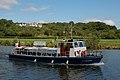 "The Lady Sandel" on the Bann (1) - geograph.org.uk - 220953.jpg 640 × 426; 142 KB
-
 "The Lady Sandel" on the Bann (2) - geograph.org.uk - 220961.jpg 640 × 426; 142 KB
-

-
 'Footpath' near Heckingham Church - geograph.org.uk - 223733.jpg 480 × 640; 120 KB
-
 2-1 at Ballynaloob - geograph.org.uk - 221046.jpg 640 × 426; 116 KB
-
 A 220 bus - Shepherd's Bush Road, W6 - geograph.org.uk - 892658.jpg 640 × 480; 89 KB
-
 A Juniper at Reading - geograph.org.uk - 854036.jpg 640 × 480; 57 KB
-
 Abbey Road, Old Buckenham - geograph.org.uk - 223625.jpg 640 × 480; 95 KB
-
 Abbey Road, Old Buckenham - geograph.org.uk - 223627.jpg 640 × 480; 116 KB
-
 Across the fields to Stonebroom - geograph.org.uk - 221553.jpg 640 × 480; 118 KB
-
 Air Cadet Sailplane - geograph.org.uk - 221200.jpg 640 × 432; 58 KB
-
 Ascending Cul Mor - geograph.org.uk - 1246298.jpg 640 × 480; 74 KB
-
 Attingham Park - geograph.org.uk - 370372.jpg 640 × 382; 77 KB
-
 Attingham Park - geograph.org.uk - 370374.jpg 640 × 346; 59 KB
-
 Auchmithie Harbour - geograph.org.uk - 222220.jpg 640 × 391; 248 KB
-
 Ballycraig Upper - geograph.org.uk - 222339.jpg 640 × 479; 69 KB
-
 Ballydraig Upper - geograph.org.uk - 222342.jpg 640 × 479; 63 KB
-
 Ballyforlea Picnic Area - geograph.org.uk - 222282.jpg 640 × 479; 51 KB
-
 Ballymagarry Road - geograph.org.uk - 222346.jpg 640 × 479; 46 KB
-
 Ballymenagh, Cookstown - geograph.org.uk - 222275.jpg 640 × 479; 53 KB
-
 Ballymenagh, County Tyrone - geograph.org.uk - 222277.jpg 640 × 479; 40 KB
-
 Ballyreagh - geograph.org.uk - 222453.jpg 640 × 479; 49 KB
-
 Ballywillan old church - geograph.org.uk - 222434.jpg 640 × 314; 34 KB
-
 Ballywillan Presbyterian church - geograph.org.uk - 222449.jpg 640 × 537; 40 KB
-
 Barns at North Farm - geograph.org.uk - 223557.jpg 640 × 480; 89 KB
-
 Barnsdale Hill - geograph.org.uk - 221556.jpg 640 × 480; 66 KB
-
 Beach near Horsey Corner - geograph.org.uk - 223015.jpg 480 × 640; 113 KB
-
 Beaver Grove Ruin - geograph.org.uk - 220865.jpg 640 × 427; 132 KB
-
 Beddgelert with Craig Wen behind. - geograph.org.uk - 273296.jpg 640 × 426; 252 KB
-
 Berberis Darwinii - geograph.org.uk - 222341.jpg 640 × 427; 234 KB
-
 Berryscaur farm - geograph.org.uk - 222860.jpg 640 × 480; 85 KB
-
 Black Head - geograph.org.uk - 227806.jpg 640 × 480; 127 KB
-
 Booking Hall, Oakworth Station - geograph.org.uk - 357212.jpg 640 × 480; 84 KB
-

-
 Brushfield Street, Spitalfields - geograph.org.uk - 221029.jpg 640 × 480; 98 KB
-
 Bryn Gwna Inn, Caeathro - geograph.org.uk - 230471.jpg 640 × 480; 92 KB
-
 Bushmills town centre.jpg 640 × 479; 63 KB
-
 Buster in the Bay - geograph.org.uk - 903025.jpg 640 × 480; 66 KB
-
 C A's Test Track - geograph.org.uk - 221157.jpg 640 × 426; 96 KB
-
 Cae Garw - geograph.org.uk - 220856.jpg 640 × 480; 76 KB
-
 Cairnglastenhope, Wark Forest - geograph.org.uk - 221097.jpg 640 × 480; 100 KB
-
 Capel Caeathro - geograph.org.uk - 230467.jpg 480 × 640; 99 KB
-

-
 Carsington Visitor Centre - geograph.org.uk - 1724894.jpg 640 × 293; 50 KB
-
 Cattle Grazing - geograph.org.uk - 220880.jpg 640 × 480; 53 KB
-
 Causeway Hotel - geograph.org.uk - 222393.jpg 640 × 455; 48 KB
-
 Causeway School Museum - geograph.org.uk - 222391.jpg 640 × 479; 45 KB
-
 Cefn Mably Inn - geograph.org.uk - 221444.jpg 640 × 480; 73 KB
-
 Chapel near Rhiw - geograph.org.uk - 220903.jpg 640 × 427; 68 KB
-
 Chartley Manor Farm - geograph.org.uk - 1442016.jpg 640 × 480; 103 KB
-
 Chichester - East Pallant - geograph.org.uk - 1173268.jpg 640 × 480; 62 KB
-
 Chichester - Pallant House Gallery - geograph.org.uk - 1173262.jpg 640 × 480; 103 KB
-
 Chichester - Pallant House Gallery - geograph.org.uk - 1173265.jpg 640 × 480; 102 KB
-

-
 Coldharbour Lane, SW9 (2) - geograph.org.uk - 220888.jpg 640 × 480; 113 KB
-
 Coldharbour Lane, SW9 - geograph.org.uk - 220882.jpg 640 × 480; 114 KB
-
 Coltrim Crossroads - geograph.org.uk - 222295.jpg 640 × 479; 46 KB
-

-

-
 Cottage at Trevance, near St Issey - geograph.org.uk - 221581.jpg 640 × 480; 116 KB
-
 Cottage by Gowka Burn Cleuch - geograph.org.uk - 221551.jpg 640 × 480; 74 KB
-
 Cottages in Rosenannon - geograph.org.uk - 221595.jpg 640 × 480; 131 KB
-
 Cottages on Earsham Street - geograph.org.uk - 223080.jpg 640 × 480; 81 KB
-
 Cottages, Coverack - geograph.org.uk - 227775.jpg 640 × 480; 95 KB
-
 Cransworth Common Farm, Rosenannon - geograph.org.uk - 221603.jpg 640 × 480; 107 KB
-
 Creag nan Calman - geograph.org.uk - 1246307.jpg 640 × 482; 66 KB
-
 Càm Bhealach path - geograph.org.uk - 222234.jpg 640 × 480; 132 KB
-
 Càm Bhealach path - geograph.org.uk - 222243.jpg 640 × 480; 134 KB
-
 Càm Bhealach path - geograph.org.uk - 222250.jpg 640 × 480; 191 KB
-
 Dallican Water - geograph.org.uk - 428812.jpg 640 × 492; 89 KB
-
 Desertmartin RC Church - geograph.org.uk - 222317.jpg 640 × 479; 56 KB
-
 Dredging the Barmouth - geograph.org.uk - 559455.jpg 640 × 427; 63 KB
-
 Dual Footpaths near Hafod Gau - geograph.org.uk - 221178.jpg 640 × 427; 71 KB
-
 Dunserverick Orange hall - geograph.org.uk - 222377.jpg 640 × 479; 44 KB
-
 Dylan Thomas Theatre, Swansea - geograph.org.uk - 220927.jpg 640 × 480; 116 KB
-
 Eastern end of the Lulworth range walk - geograph.org.uk - 221705.jpg 640 × 480; 180 KB
-
 Ellastone Telephone Exchange - geograph.org.uk - 221538.jpg 640 × 480; 117 KB
-
 End of the Road - geograph.org.uk - 220867.jpg 640 × 427; 75 KB
-
 Entrance to Dunrobin Castle - geograph.org.uk - 704697.jpg 480 × 640; 79 KB
-
 Fields by Watergate Farm, Rosenannon - geograph.org.uk - 221917.jpg 640 × 480; 111 KB
-
-

-
 Footpath to Easton Lodge - geograph.org.uk - 221193.jpg 640 × 426; 134 KB
-
 Forest track at Fenton Yet - geograph.org.uk - 222874.jpg 640 × 480; 74 KB
-
 Forest track Wark Forest - geograph.org.uk - 221101.jpg 640 × 480; 84 KB
-
 Forest Track, Wark Forest - geograph.org.uk - 221102.jpg 640 × 480; 73 KB
-
 Francis Colliery Headgear - geograph.org.uk - 305376.jpg 640 × 480; 71 KB
-
 Fred Daly, OBE - geograph.org.uk - 222444.jpg 640 × 479; 79 KB
-
 Giant wind turbine at Nigg yard - geograph.org.uk - 221125.jpg 640 × 480; 64 KB
-
 Giant's Causeway - geograph.org.uk - 222395.jpg 640 × 320; 31 KB
-
 Giant's Causeway - geograph.org.uk - 222399.jpg 640 × 223; 26 KB
-
 Giant's Causeway - geograph.org.uk - 222400.jpg 640 × 479; 84 KB
-
 Giant's Causeway bus - geograph.org.uk - 222406.jpg 640 × 479; 84 KB
-

-
 Great Goliath, Thurlton - geograph.org.uk - 223563.jpg 480 × 640; 51 KB
-
 Hales - geograph.org.uk - 223542.jpg 640 × 480; 131 KB
-
 Hellisay.jpg 640 × 442; 76 KB
-
 Helmsdale Harbour - geograph.org.uk - 704708.jpg 640 × 480; 61 KB
-
 Hewke - geograph.org.uk - 222779.jpg 640 × 480; 125 KB
-
 Holiday homes - geograph.org.uk - 222380.jpg 640 × 479; 81 KB
-
 Holiday homes - geograph.org.uk - 222382.jpg 640 × 479; 88 KB
-
 Hoping for Horses - geograph.org.uk - 221137.jpg 640 × 432; 77 KB
-
 Horsey Drainage Mill (National Trust) - geograph.org.uk - 222940.jpg 480 × 640; 85 KB
-
 Horsey Mere - geograph.org.uk - 222929.jpg 640 × 480; 80 KB
-

-
 Ice-creams at the Giant's Causeway - geograph.org.uk - 222408.jpg 640 × 479; 72 KB
-
 Kale field - geograph.org.uk - 222872.jpg 640 × 480; 88 KB
-
 Kielder water uk - panoramio.jpg 2,048 × 1,536; 705 KB
-
 Kincraig Point - geograph.org.uk - 222139.jpg 640 × 480; 112 KB
-
 Ladywell Sawmill - geograph.org.uk - 222359.jpg 640 × 427; 220 KB
-
 Ladywell Sawmill - geograph.org.uk - 222361.jpg 640 × 329; 197 KB
-
 Lane to Bishopscleuch - geograph.org.uk - 222778.jpg 640 × 480; 90 KB
-
 Large Blue House - geograph.org.uk - 220936.jpg 640 × 427; 70 KB
-
 Lighthouse at Lowestoft Denes - geograph.org.uk - 223524.jpg 640 × 480; 134 KB
-
 Llanbeblig - geograph.org.uk - 230512.jpg 640 × 480; 63 KB
-
 Lletty, Caeathro - geograph.org.uk - 220872.jpg 640 × 480; 110 KB
-
 Loch Lomond - geograph.org.uk - 224816.jpg 640 × 480; 93 KB
-
 Loch Lomond - geograph.org.uk - 224817.jpg 640 × 480; 101 KB
-
 Loch Shin - geograph.org.uk - 704700.jpg 640 × 480; 34 KB
-
 Lochmill - geograph.org.uk - 222248.jpg 640 × 427; 268 KB
-
 Looking down Stryd Y Castell - geograph.org.uk - 273286.jpg 426 × 640; 285 KB
-
 Looking over Dryfe Water - geograph.org.uk - 222856.jpg 640 × 480; 80 KB
-
 Looking towards Hewke Hill - geograph.org.uk - 222780.jpg 640 × 480; 82 KB
-
 Looking towards Nether Boreland Hill - geograph.org.uk - 222865.jpg 640 × 480; 83 KB
-
 Looking up the River Yare - geograph.org.uk - 223589.jpg 480 × 640; 68 KB
-
 Looking up the River Yare - geograph.org.uk - 223698.jpg 640 × 480; 84 KB
-
 Lookout Station, Bass Point - geograph.org.uk - 227154.jpg 480 × 640; 83 KB
-
 Lower Rivington Reservoir.JPG 1,504 × 1,000; 227 KB
-
 Lowestoft Denes - geograph.org.uk - 223527.jpg 640 × 480; 100 KB
-
 Maghera Church - geograph.org.uk - 222328.jpg 640 × 479; 70 KB
-
 Maghera Presbyterian Church - geograph.org.uk - 222322.jpg 307 × 480; 21 KB
-
 Main Street, Auchmithie - geograph.org.uk - 222216.jpg 640 × 382; 207 KB
-
 Maize near Trenance - geograph.org.uk - 221880.jpg 640 × 480; 115 KB
-
 Mansion on Bangor Road - geograph.org.uk - 230456.jpg 640 × 480; 76 KB
-
 Maritime Quarter, Swansea - geograph.org.uk - 220934.jpg 403 × 600; 130 KB
-
 Maritime Quarter, Swansea - geograph.org.uk - 220987.jpg 640 × 480; 125 KB
-
 McBride's Bar - geograph.org.uk - 222376.jpg 640 × 479; 64 KB
-
 Meall na Teanga , Munro No 275 - geograph.org.uk - 222214.jpg 640 × 480; 120 KB
-
 Middleport Pottery - geograph.org.uk - 293758.jpg 640 × 427; 139 KB
-

-
 Modern Council Housing in Bro Seiont - geograph.org.uk - 230524.jpg 640 × 480; 54 KB
-
 Moneymore Presbyterian Church - geograph.org.uk - 222315.jpg 640 × 479; 65 KB
-
 Montbretia (Crocosmia), Rosenannon Downs - geograph.org.uk - 222008.jpg 479 × 640; 164 KB
-

-
 Mumbles Pier - geograph.org.uk - 220989.jpg 640 × 480; 65 KB
-
 Mumbles Pier - geograph.org.uk - 220992.jpg 640 × 480; 115 KB
-
 Municipal electricity - geograph.org.uk - 223938.jpg 640 × 480; 103 KB
-
 Mupe Bay - geograph.org.uk - 222050.jpg 640 × 480; 124 KB
-
 Near High House Farm - geograph.org.uk - 223543.jpg 640 × 480; 111 KB
-
 Norton Subcourse Mill.jpg 480 × 640; 126 KB
-
 Old Spitalfields Market - geograph.org.uk - 221040.jpg 640 × 480; 156 KB
-
 Old Spitalfields Market - geograph.org.uk - 221045.jpg 640 × 480; 107 KB
-

-
 On the way down - geograph.org.uk - 1246290.jpg 640 × 480; 55 KB
-

-

-
 Path to Little Easton - geograph.org.uk - 221189.jpg 640 × 426; 95 KB
-
 Paxton Pits Nature Reserve - geograph.org.uk - 222065.jpg 640 × 469; 72 KB
-
 Plas Brereton - geograph.org.uk - 220852.jpg 640 × 480; 110 KB
-
 Plas Ty Coch - geograph.org.uk - 220897.jpg 640 × 480; 116 KB
-
 Pont y Garreg Newydd near Pandy Tudur - geograph.org.uk - 220859.jpg 640 × 427; 108 KB
-

-

-
 Post Box and Footpath at Rhyd Loew - geograph.org.uk - 221179.jpg 640 × 427; 139 KB
-
 Post van, Trenance, near St Issey - geograph.org.uk - 221866.jpg 640 × 480; 146 KB
-
 Produce stall with honesty box, Trevance - geograph.org.uk - 221887.jpg 480 × 640; 142 KB
-
 Pumping station, Wadebridge - geograph.org.uk - 221905.jpg 640 × 480; 119 KB
-
 Pylons - geograph.org.uk - 222272.jpg 427 × 640; 211 KB
-
-
 Range walk on West Creech Hill - geograph.org.uk - 221658.jpg 640 × 480; 158 KB
-
 Red Phone box and letter box, Rosenannon - geograph.org.uk - 221592.jpg 640 × 480; 102 KB
-
 Reedham Ferry (north).jpg 480 × 640; 105 KB
-
 Rhodes Cottage - geograph.org.uk - 223878.jpg 640 × 480; 117 KB
-
 River Bann at Hutchinson's Quay - geograph.org.uk - 220928.jpg 640 × 426; 139 KB
-
 River Yeo - geograph.org.uk - 220969.jpg 640 × 480; 51 KB
-
 River Yeo - geograph.org.uk - 220970.jpg 640 × 480; 41 KB
-
 River Yeo - geograph.org.uk - 220975.jpg 480 × 640; 57 KB
-
 Road Junction near Gwytherin - geograph.org.uk - 220860.jpg 640 × 427; 75 KB
-

-
 Robber's Cleugh - geograph.org.uk - 220982.jpg 640 × 480; 140 KB
-
 Rose Bay Willow Herb, Rosenannon Downs - geograph.org.uk - 222006.jpg 640 × 479; 172 KB
-
 Rosenannon Downs with unfenced road - geograph.org.uk - 221925.jpg 640 × 480; 78 KB
-

-
 Rosenannon Methodist Church, Cornwall (geograph 221909).jpg 640 × 480; 82 KB
-
 Saint John the Baptist - geograph.org.uk - 224660.jpg 640 × 480; 108 KB
-
 Sandstone Cottages - geograph.org.uk - 222231.jpg 640 × 270; 138 KB
-
 Scree slopes to SW of Meall na Teanga - geograph.org.uk - 222221.jpg 640 × 480; 134 KB
-
 Scree slopes to the N of Meall na Teanga - geograph.org.uk - 222227.jpg 640 × 480; 144 KB
-
 Seals at Loch Fleet - geograph.org.uk - 704691.jpg 640 × 480; 55 KB
-
 Sheep at Flower's Barrow, Isle of Purbeck - geograph.org.uk - 222032.jpg 640 × 480; 150 KB
-
 Shipbourne Primary School - geograph.org.uk - 226942.jpg 640 × 480; 115 KB
-
 Shrewsbury Market Hall - geograph.org.uk - 370453.jpg 639 × 560; 78 KB
-
 Shrewsbury St. Alkmund - geograph.org.uk - 351087.jpg 639 × 626; 72 KB
-

-
 Sign for the Quay Inn, Wareham - geograph.org.uk - 635591.jpg 427 × 640; 56 KB
-
 Silage and Woodland - geograph.org.uk - 222867.jpg 640 × 480; 84 KB
-
 Clock tower at Silchester House - geograph.org.uk - 399125.jpg 640 × 480; 67 KB
-
 Silchester House - geograph.org.uk - 399117.jpg 640 × 480; 58 KB
-
 Snugbury's Ice-Cream Farm - geograph.org.uk - 220957.jpg 640 × 420; 278 KB
-
 Sound of Gighay - geograph.org.uk - 648155.jpg 640 × 429; 88 KB
_-_geograph.org.uk_-_220953.jpg)
_-_geograph.org.uk_-_220961.jpg)


_-_geograph.org.uk_-_223020.jpg)


_-_geograph.org.uk_-_220888.jpg)


_with_heather,_Rosenannon_Downs_-_geograph.org.uk_-_222005.jpg)


_-_geograph.org.uk_-_222940.jpg)


,_Rosenannon_Downs_-_geograph.org.uk_-_222008.jpg)


.jpg)


,_Winnards_Perch_-_geograph.org.uk_-_221660.jpg)


.jpg)


