Category:United Kingdom photographs taken on 2006-08-20
Countries of Europe: Austria · Belgium · Croatia · Denmark · Finland · France‡ · Georgia‡ · Germany · Greece · Hungary · Republic of Ireland · Italy · Latvia · Netherlands‡ · Norway · Poland · Portugal‡ · Romania · Russia‡ · Spain‡ · Sweden · Switzerland · Turkey‡ · Ukraine · United Kingdom
Specific status: Isle of Man
‡: partly located in Europe
Specific status: Isle of Man
‡: partly located in Europe
| ← | 20 August 2006 | → | ||
| ← | August 2006 | → | ||

United Kingdom photographs taken on 20 August 2006.
Image files should be categorized here automatically using {{taken on}} template. Direct categorisation is also possible, if automatic is impossible.
Media in category "United Kingdom photographs taken on 2006-08-20"
The following 200 files are in this category, out of 704 total.
(previous page) (next page)-
 "The Long Corridor" - geograph.org.uk - 225250.jpg 640 × 480; 110 KB
-
 1873 Pump House and Clock Tower - geograph.org.uk - 222469.jpg 407 × 640; 147 KB
-
 A Diminished Warland Reservoir. - geograph.org.uk - 224811.jpg 640 × 480; 70 KB
-
 A head in Linenhall Street, Belfast - geograph.org.uk - 272972.jpg 640 × 426; 121 KB
-
 A pair of dry troughs - geograph.org.uk - 231750.jpg 640 × 480; 143 KB
-
-
 A Surfeit Of Umlauts - geograph.org.uk - 248815.jpg 640 × 480; 100 KB
-
 A View From Struie Hill - geograph.org.uk - 248384.jpg 640 × 481; 97 KB
-
 A55 Expressway near Northop - geograph.org.uk - 222703.jpg 640 × 480; 76 KB
-
 A90 at Finavon - geograph.org.uk - 222528.jpg 640 × 420; 232 KB
-
 Abandoned car, Miterdale - geograph.org.uk - 228581.jpg 640 × 480; 294 KB
-
 Abandoned Gravel and Sand Pits - geograph.org.uk - 222570.jpg 640 × 495; 151 KB
-
 Across fields to Pimperne - geograph.org.uk - 223669.jpg 640 × 480; 65 KB
-
-
 Airdrie Academy - geograph.org.uk - 222492.jpg 640 × 456; 89 KB
-
 Airdrie to Bathgate Cycle Path - geograph.org.uk - 222531.jpg 640 × 480; 171 KB
-
 Airdrie War Memorial - geograph.org.uk - 222475.jpg 640 × 480; 99 KB
-

-
 Alfreton House.jpg 640 × 473; 312 KB
-
 Algeily Burn - geograph.org.uk - 222622.jpg 480 × 640; 104 KB
-

-
 Altvraigy Burn - geograph.org.uk - 222617.jpg 640 × 480; 89 KB
-
 Ants and Eggs - geograph.org.uk - 726733.jpg 640 × 480; 191 KB
-
 Approaching Seaforth Island - geograph.org.uk - 653630.jpg 640 × 480; 72 KB
-

-
 Araboy - geograph.org.uk - 236670.jpg 640 × 427; 41 KB
-
 Ardcastle Quay - geograph.org.uk - 223614.jpg 640 × 480; 94 KB
-
 Arran Drive, Airdrie - geograph.org.uk - 222485.jpg 640 × 480; 143 KB
-
 Church of St George, Arreton - geograph.org.uk - 225759.jpg 640 × 480; 101 KB
-
 Ashmore Village scene - geograph.org.uk - 223665.jpg 640 × 480; 91 KB
-
 Attractive and informative Devon roadsign - geograph.org.uk - 226485.jpg 640 × 480; 113 KB
-
 Bada na Bresoch - geograph.org.uk - 222665.jpg 640 × 480; 96 KB
-
 Bakehurst Estate Park - geograph.org.uk - 222999.jpg 640 × 431; 29 KB
-
 Balloch - geograph.org.uk - 223363.jpg 640 × 480; 63 KB
-
 Ballycopeland Mill - geograph.org.uk - 224066.jpg 640 × 480; 45 KB
-
 Bank Top , Ettersgill - geograph.org.uk - 222389.jpg 640 × 479; 121 KB
-
 Bannut Tree - geograph.org.uk - 222737.jpg 639 × 481; 55 KB
-
 Barcombe, dismantled railway line - geograph.org.uk - 223449.jpg 640 × 480; 128 KB
-
 Barclays Bank - geograph.org.uk - 222386.jpg 640 × 506; 108 KB
-
 George's Gent's Hairdressing - geograph.org.uk - 281959.jpg 480 × 640; 136 KB
-
 Hasina Indian Take Away - geograph.org.uk - 227697.jpg 380 × 640; 88 KB
-
 The Red Lion Hotel - geograph.org.uk - 222484.jpg 640 × 477; 110 KB
-
 Packhorse Bridge over the Bar Brook - geograph.org.uk - 222375.jpg 480 × 640; 82 KB
-
 Battle Abbey Gatehouse - geograph.org.uk - 1276086.jpg 480 × 640; 82 KB
-
 Battle School - geograph.org.uk - 1276093.jpg 640 × 480; 77 KB
-
 Bawhelps - geograph.org.uk - 222695.jpg 640 × 480; 75 KB
-
 Bawhelps - geograph.org.uk - 222698.jpg 640 × 480; 72 KB
-
 Ben Nevis from Corpach sea lock. - geograph.org.uk - 256874.jpg 640 × 480; 54 KB
-
 Ben Nevis path from the Glen road. - geograph.org.uk - 233970.jpg 640 × 480; 106 KB
-
 Benbane Head - geograph.org.uk - 232365.jpg 640 × 427; 52 KB
-
 Benton Metro Station - geograph.org.uk - 222804.jpg 640 × 475; 87 KB
-
 Big Wood, Thetford Forest - geograph.org.uk - 222653.jpg 640 × 480; 121 KB
-
 Birch Rigg , Ettersgill - geograph.org.uk - 222378.jpg 640 × 344; 40 KB
-
 Black Knight Landing - geograph.org.uk - 223482.jpg 640 × 483; 100 KB
-
 Blasting Shelters at Utley Edge. - geograph.org.uk - 224809.jpg 640 × 480; 96 KB
-
 Chapel of St Giles, Blaston - geograph.org.uk - 222584.jpg 640 × 480; 75 KB
-
 Boats at The Kench, Hayling Island - geograph.org.uk - 499009.jpg 640 × 427; 65 KB
-
 Boats moored on Loch Duich - geograph.org.uk - 223458.jpg 640 × 480; 55 KB
-
 Bouldery woodland - geograph.org.uk - 223348.jpg 640 × 480; 133 KB
-
 Bowlees - geograph.org.uk - 222963.jpg 640 × 479; 106 KB
-
 Bridge at the end of the Road - geograph.org.uk - 222118.jpg 640 × 427; 109 KB
-
 Bridge near Llangaffo - geograph.org.uk - 222643.jpg 600 × 450; 143 KB
-
 Bridge over Lead Brook near Oakenholt - geograph.org.uk - 222595.jpg 640 × 480; 151 KB
-
 Bridge to Easter Bleaton - geograph.org.uk - 227205.jpg 640 × 480; 111 KB
-
 Bridleway on Stoke Hill - geograph.org.uk - 223819.jpg 640 × 480; 142 KB
-
 Bridleway on Stoke Hill - geograph.org.uk - 223830.jpg 480 × 640; 127 KB
-
 Brighton, Gardner Arts Centre - geograph.org.uk - 225923.jpg 640 × 480; 84 KB
-

-

-
 Brwynog Uchaf Ruins - geograph.org.uk - 222157.jpg 640 × 427; 100 KB
-
 Bryn Deva Primary School - geograph.org.uk - 222576.jpg 640 × 480; 122 KB
-
 Burncleuch farm - geograph.org.uk - 224337.jpg 640 × 480; 85 KB
-
 Burned Out Farmhouse - geograph.org.uk - 236686.jpg 640 × 427; 86 KB
-
 Burnt-out Car at Kilgarth Landfill Site - geograph.org.uk - 222441.jpg 640 × 480; 126 KB
-
 Camas a' Bhuailidh - geograph.org.uk - 227825.jpg 640 × 384; 48 KB
-
 Camas an Lochain - geograph.org.uk - 243658.jpg 640 × 384; 60 KB
-
 Campsite in Delamont Country Park - geograph.org.uk - 224181.jpg 640 × 480; 80 KB
-
 Car Boot at Y Traeth - geograph.org.uk - 259678.jpg 640 × 480; 113 KB
-
 Carbisdale Castle - geograph.org.uk - 225253.jpg 640 × 480; 107 KB
-
 Carn an Fhidhleir - geograph.org.uk - 223358.jpg 640 × 480; 75 KB
-
 Carr Bridge - geograph.org.uk - 248592.jpg 640 × 480; 107 KB
-
 Cassindilly Farm - geograph.org.uk - 223793.jpg 640 × 480; 123 KB
-
 Castle Hill, Hallaton - geograph.org.uk - 222685.jpg 640 × 480; 62 KB
-
 Cattle Grid near Garthmyn - geograph.org.uk - 222125.jpg 640 × 427; 109 KB
-

-
 Chartwell - geograph.org.uk - 1275993.jpg 640 × 480; 82 KB
-
 Clach an Nuill Dhuirch - geograph.org.uk - 227818.jpg 640 × 384; 35 KB
-
 Clach Leim - geograph.org.uk - 243625.jpg 640 × 384; 62 KB
-
 Clandeboye cemetery , Bangor - geograph.org.uk - 222104.jpg 640 × 426; 172 KB
-
 Clattercut Lane junction - geograph.org.uk - 222715.jpg 640 × 480; 70 KB
-
 Cliffs Overlooking Leckilroy Cove - geograph.org.uk - 232311.jpg 640 × 427; 64 KB
-
 Closed pub at Dunhampton.jpg 640 × 480; 44 KB
-
 Cob Clough Culvert, Ripponden, Barkisland - geograph.org.uk - 224631.jpg 640 × 480; 150 KB
-
 Cooksbridge, The Malthouse - geograph.org.uk - 223494.jpg 640 × 395; 98 KB
-
 Corpach Sea lock. - geograph.org.uk - 256872.jpg 640 × 480; 89 KB
-
 Cows near Netter's Hall, Attwaters Lane - geograph.org.uk - 332759.jpg 640 × 480; 161 KB
-
 Crandart - geograph.org.uk - 223176.jpg 640 × 480; 98 KB
-
 Cranwich Church - geograph.org.uk - 222644.jpg 480 × 640; 125 KB
-
 Crimple Beck - geograph.org.uk - 222211.jpg 479 × 640; 169 KB
-
 Crown Inn, Mundford - geograph.org.uk - 222636.jpg 640 × 480; 88 KB
-
 Dahlia at Varfell - geograph.org.uk - 222197.jpg 640 × 480; 112 KB
-
 Danescombe Valley - geograph.org.uk - 1062169.jpg 480 × 640; 63 KB
-

-
 Dead tree Nevis Glen. - geograph.org.uk - 234010.jpg 640 × 480; 158 KB
-
 Dema Glass Chimneys - geograph.org.uk - 222048.jpg 640 × 480; 94 KB
-
 Dema Glass Chimneys - geograph.org.uk - 222049.jpg 640 × 480; 61 KB
-
 Dema Glass Chimneys - geograph.org.uk - 222051.jpg 640 × 480; 57 KB
-
 Dema Glass Chimneys - geograph.org.uk - 222052.jpg 640 × 480; 62 KB
-
 Dema Glass Chimneys - geograph.org.uk - 222054.jpg 640 × 480; 71 KB
-
 Dema Glass Chimneys Demolished - geograph.org.uk - 222015.jpg 640 × 426; 38 KB
-
 Descent from Swinhope Head - geograph.org.uk - 222559.jpg 640 × 380; 84 KB
-

-

-
 Disused chapel near Bod Hyfryd - geograph.org.uk - 222140.jpg 640 × 427; 129 KB
-
 Disused footbridge over a disused railway - geograph.org.uk - 222751.jpg 600 × 450; 144 KB
-
 Disused Quarry at Utley Edge. - geograph.org.uk - 224807.jpg 640 × 480; 78 KB
-
 Disused railway from Haggs Bridge - geograph.org.uk - 222303.jpg 479 × 640; 157 KB
-
 Dornoch Firth - geograph.org.uk - 248386.jpg 640 × 480; 97 KB
-

-
 Drainage channel near Shotwick - geograph.org.uk - 222466.jpg 640 × 480; 163 KB
-
 Drive to Upper House Farm, Stoke Bliss - geograph.org.uk - 223742.jpg 640 × 480; 147 KB
-
 Driveway to Hursley Farm, Stoke Bliss - geograph.org.uk - 223593.jpg 640 × 480; 125 KB
-
 Drumderg - geograph.org.uk - 227231.jpg 640 × 480; 75 KB
-
 Dry Burn near Foul Bog - geograph.org.uk - 224276.jpg 640 × 480; 82 KB
-
 Dukesfield Smelt Mill - geograph.org.uk - 955958.jpg 640 × 480; 163 KB
-
 Former St John's church - geograph.org.uk - 222542.jpg 640 × 480; 81 KB
-
 East Hayling Light Railway - geograph.org.uk - 1722992.jpg 2,496 × 1,664; 1.91 MB
-
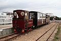 East Hayling Light Railway at Eastoke - geograph.org.uk - 499023.jpg 640 × 427; 94 KB
-
 East Manywells Farm, Cullingworth - geograph.org.uk - 224413.jpg 640 × 480; 76 KB
-
 Egerton House, Flint Mountain - geograph.org.uk - 222675.jpg 640 × 480; 104 KB
-
 Elland Road Bridge, Ripponden. - geograph.org.uk - 224639.jpg 474 × 640; 125 KB
-
 Elland Road, Ripponden, Soyland - geograph.org.uk - 224606.jpg 640 × 418; 116 KB
-

-
 Entrance to old station, Hallaton - geograph.org.uk - 222677.jpg 640 × 480; 86 KB
-
 Eroded peat - geograph.org.uk - 222709.jpg 640 × 480; 74 KB
-
 Farm and buildings at Fox Hill - geograph.org.uk - 222618.jpg 640 × 480; 143 KB
-
 Farm and Farmland near Clogher South - geograph.org.uk - 232384.jpg 640 × 427; 51 KB
-
 Farm machinery - geograph.org.uk - 222739.jpg 600 × 450; 92 KB
-
 Farm track at SO638652 - geograph.org.uk - 223730.jpg 640 × 480; 132 KB
-
 Farmland known as Southlands - geograph.org.uk - 222615.jpg 640 × 480; 144 KB
-
 Farmland near Dalgleish - geograph.org.uk - 224267.jpg 640 × 480; 79 KB
-
 Fence Corner, strathcanaird - geograph.org.uk - 227654.jpg 640 × 384; 47 KB
-
 Field Gate - geograph.org.uk - 222593.jpg 640 × 480; 110 KB
-

-
 Finavon Doocot - geograph.org.uk - 222537.jpg 640 × 494; 297 KB
-
 Fingland farm - geograph.org.uk - 224331.jpg 640 × 480; 82 KB
-
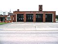 Fire Station, Y Fflint - geograph.org.uk - 222651.jpg 640 × 480; 68 KB
-
 First 52596 R416VPU (220021230).jpg 1,280 × 960; 163 KB
-

-
 Flint High School - geograph.org.uk - 222663.jpg 640 × 480; 96 KB
-

-
 Footpath sign at Rew Cross - geograph.org.uk - 226486.jpg 640 × 480; 104 KB
-
 Footpath, Bersham Woods - geograph.org.uk - 1281870.jpg 640 × 427; 93 KB
-
 Ford across the Lyvennet - King's Meaburn - geograph.org.uk - 222183.jpg 600 × 450; 311 KB
-
 Ford over the Lyvennet - geograph.org.uk - 222175.jpg 600 × 450; 321 KB
-
 Foreshore of Loch Fyne at Ardcastle - geograph.org.uk - 223612.jpg 640 × 480; 97 KB
-

-
 Foulbog and Bloodhope Burn - geograph.org.uk - 224322.jpg 640 × 480; 89 KB
-
 Frog - geograph.org.uk - 228091.jpg 640 × 480; 143 KB
-
 Frogmore - geograph.org.uk - 226398.jpg 640 × 480; 96 KB
-
 Fulwith Mill Farm - geograph.org.uk - 222204.jpg 640 × 479; 93 KB
-

-
 Gap Stile and Footpath sign. - geograph.org.uk - 222179.jpg 600 × 450; 244 KB
-

-
 Giant's Causeway - geograph.org.uk - 254740.jpg 640 × 427; 99 KB
-
 Glen Cally - geograph.org.uk - 222621.jpg 640 × 480; 81 KB
-
 Glen Golly - geograph.org.uk - 248808.jpg 640 × 480; 51 KB
-
 Glen Isla - geograph.org.uk - 223186.jpg 640 × 480; 62 KB
-
 Glen Nevis looking east. - geograph.org.uk - 233990.jpg 640 × 480; 113 KB
-
 Glen Nevis looking southeast. - geograph.org.uk - 233965.jpg 640 × 480; 76 KB
-
 Glen Nevis. - geograph.org.uk - 233976.jpg 640 × 480; 38 KB
-
 Glen Nevis. - geograph.org.uk - 233980.jpg 640 × 480; 52 KB
-
 Glendearg farm - geograph.org.uk - 224330.jpg 640 × 480; 80 KB
-
 Glendevon Youth Hostel - geograph.org.uk - 248208.jpg 640 × 480; 103 KB
-
 Glenfoot Cattery, Glen Devon - geograph.org.uk - 248207.jpg 640 × 480; 107 KB
-
 Gorge, Water of Nevis. - geograph.org.uk - 234018.jpg 640 × 480; 153 KB
-
 Granite stile - geograph.org.uk - 254314.jpg 610 × 640; 159 KB
-
 Grassy footpath across the Mendips - geograph.org.uk - 222710.jpg 600 × 450; 90 KB
-

-
 Greenways Turf near Shotwick - geograph.org.uk - 222489.jpg 640 × 480; 81 KB
-
 Grinllwm View - geograph.org.uk - 222176.jpg 640 × 427; 47 KB
-

-
 Hall at Howburn - geograph.org.uk - 222405.jpg 640 × 480; 151 KB
-
 Hanley Child Church.jpg 640 × 480; 123 KB
-
 Harland Way - geograph.org.uk - 222347.jpg 479 × 640; 149 KB
-
 Harland Way - near Spofforth - geograph.org.uk - 222338.jpg 479 × 640; 149 KB
-
 Harland Way Junction - geograph.org.uk - 222356.jpg 640 × 479; 126 KB
-
 Harvest Bales - geograph.org.uk - 222596.jpg 640 × 480; 149 KB
-
 Hassocks Infant School - geograph.org.uk - 225337.jpg 640 × 480; 85 KB
-
 Hay barn - geograph.org.uk - 222736.jpg 600 × 450; 86 KB
-
 Heading up Mosedale - geograph.org.uk - 967278.jpg 640 × 445; 103 KB
-
 Heath Green - geograph.org.uk - 222507.jpg 640 × 469; 179 KB
-
 High Farm, near Allexton - geograph.org.uk - 222530.jpg 640 × 480; 76 KB
-
 Holwick Scars - geograph.org.uk - 223072.jpg 640 × 269; 65 KB
-
-
 Hungry horses - geograph.org.uk - 222673.jpg 600 × 450; 73 KB
-

-
 Inner Huntly - geograph.org.uk - 224143.jpg 640 × 480; 69 KB
-
 Inveraray near harbour - geograph.org.uk - 1468747.jpg 640 × 480; 90 KB
-
 Josephs Amazing Camels - geograph.org.uk - 223474.jpg 640 × 480; 121 KB


.jpg)


