Category:United Kingdom photographs taken on 2006-09-24
| ← | Sunday 24 September 2006 | → | ||
| ← | September 2006 | → | ||

United Kingdom photographs taken on 24 September 2006.
Image files should be categorized here automatically using {{taken on}} template. Direct categorisation is also possible, if automatic is impossible.
Media in category "United Kingdom photographs taken on 2006-09-24"
The following 200 files are in this category, out of 858 total.
(previous page) (next page)-
 'Floral Clock' gardens - geograph.org.uk - 249178.jpg 640 × 480; 124 KB
-
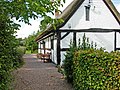
 1st Woodcutts Scout Hut - geograph.org.uk - 246864.jpg 640 × 480; 77 KB
-
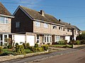
 8 Eaton Gardens - geograph.org.uk - 246968.jpg 479 × 640; 165 KB
-
 A good time for the gulls^ - geograph.org.uk - 248280 (cropped).jpg 638 × 239; 57 KB
-
 A good time for the gulls^ - geograph.org.uk - 248280.jpg 640 × 480; 67 KB
-
 A nasty bend in the road - geograph.org.uk - 246732.jpg 640 × 480; 86 KB
-
 A View to Hamsterley forest - geograph.org.uk - 246977.jpg 640 × 480; 95 KB
-
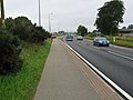
 A418 Roundabout, Aylesbury - geograph.org.uk - 248140.jpg 640 × 480; 95 KB
-
 A6 at Barmoor Clough - geograph.org.uk - 252327.jpg 640 × 458; 37 KB
-
 A6015 - geograph.org.uk - 250214.jpg 640 × 432; 41 KB
-
 A82 north of Urquart Bay. - geograph.org.uk - 250768.jpg 640 × 480; 84 KB
-
 A82 south of Inverness near Brachla. - geograph.org.uk - 250765.jpg 640 × 480; 109 KB
-
 A96 to Inverness near Seafield. - geograph.org.uk - 250758.jpg 640 × 480; 77 KB
-
 AA callbox at Brachla. - geograph.org.uk - 250766.jpg 640 × 480; 127 KB
-
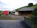 Aberfwr Farm, Abertridwr - geograph.org.uk - 248443.jpg 640 × 480; 94 KB
-
 Above Aldbourne - geograph.org.uk - 248528.jpg 640 × 480; 108 KB
-

-
 Aero Tow from Ridgewell - geograph.org.uk - 270662.jpg 640 × 426; 51 KB
-
 Aire Farmhouse - geograph.org.uk - 261997.jpg 640 × 480; 55 KB
-

-
 Aldbourne - geograph.org.uk - 248500.jpg 640 × 480; 121 KB
-
 Aldbourne - geograph.org.uk - 248505.jpg 640 × 480; 117 KB
-
 Alfa Romeo GTV IMG 8260 - Flickr - tonylanciabeta.jpg 1,600 × 1,066; 294 KB
-
 Alfa Romeo GTV IMG 8261 - Flickr - tonylanciabeta.jpg 1,600 × 1,066; 283 KB
-
 Ammonites at Dinton Castle - geograph.org.uk - 247434.jpg 640 × 427; 106 KB
-
-
 Apartments at the Stewponey - geograph.org.uk - 246945.jpg 500 × 385; 140 KB
-
 Ash and byway, Upper Upham - geograph.org.uk - 248650.jpg 480 × 640; 138 KB
-
 Autumnal growth by Ord More woods - geograph.org.uk - 249144.jpg 640 × 480; 171 KB
-
 Bantock House - geograph.org.uk - 247046.jpg 640 × 480; 265 KB
-
 Bard of Tournaig Memorial Cairn - geograph.org.uk - 246937.jpg 640 × 480; 106 KB
-
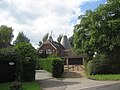
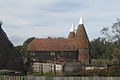
 Barham Oast, Alders Road, Capel, Kent - geograph.org.uk - 576711.jpg 640 × 480; 62 KB
-
 Barn, Upper Upham - geograph.org.uk - 248643.jpg 640 × 480; 124 KB
-
 Lloyds TSB - geograph.org.uk - 246559.jpg 640 × 633; 160 KB
-
 Bean Hill, Longborough - geograph.org.uk - 246778.jpg 639 × 479; 64 KB
-
 Beeches beside the Ridgeway - geograph.org.uk - 248662.jpg 640 × 480; 211 KB
-
 Beningbrough Hall1.jpg 640 × 480; 91 KB
-
 Berkeley Castle 01.jpg 640 × 480; 132 KB
-
 Blackpool tower looking up - geograph.org.uk - 721823.jpg 480 × 640; 66 KB
-

-
 Blakenhall - Gonsley Cottages.jpg 640 × 462; 147 KB
-
 Blue Boys Oast, Kippings Cross, Kent - geograph.org.uk - 337665.jpg 640 × 480; 141 KB
-
 Bourton-on-the-Hill - geograph.org.uk - 246898.jpg 640 × 480; 52 KB
-
 Bridge of Canny - geograph.org.uk - 249170.jpg 640 × 480; 81 KB
-
 Bridge over the River Lyne - geograph.org.uk - 248980.jpg 640 × 480; 106 KB
-

-

-
 Broom pods - geograph.org.uk - 249146.jpg 640 × 480; 142 KB
-
 Bumble bee, Nymans Gardens - geograph.org.uk - 247272.jpg 640 × 480; 78 KB
-
 Burgh Head Forest - Deer Seat - geograph.org.uk - 1302122.jpg 479 × 640; 108 KB
-
 Burnfoot Farm - geograph.org.uk - 248279.jpg 640 × 480; 91 KB
-
 Burnham light 358566 32000eba.jpg 640 × 480; 40 KB
-
 St John's Church - geograph.org.uk - 247989.jpg 480 × 640; 89 KB
-
 St John's Church and graveyard - geograph.org.uk - 247991.jpg 640 × 480; 107 KB
-
 Byway below Upper Upham - geograph.org.uk - 248600.jpg 640 × 480; 173 KB
-
 Byway, Aldbourne - geograph.org.uk - 248538.jpg 640 × 480; 149 KB
-
 Byway, Snap - geograph.org.uk - 248594.jpg 480 × 640; 247 KB
-
 Cannon Street Station - geograph.org.uk - 246885.jpg 640 × 480; 117 KB
-

-
 Capel Grange Oast, Badsell Road, Five Oak Green, Kent (geograph 337645, high-res).jpg 2,816 × 2,112; 571 KB
-
-
 Caravan Park at Low Moor Head Farm - geograph.org.uk - 248401.jpg 640 × 480; 88 KB
-

-
 Cattle grid on the B1266 at Ellerby Moor - geograph.org.uk - 247139.jpg 640 × 480; 138 KB
-
 Cattle near Mains of Corgyle - geograph.org.uk - 247007.jpg 640 × 480; 71 KB
-
 Cattle pens near Wide Open Dikes - geograph.org.uk - 248513.jpg 640 × 480; 86 KB
-
 Cattle. Upper Upham - geograph.org.uk - 248639.jpg 640 × 480; 120 KB
-
 Chalkland valley, west of Seaton - geograph.org.uk - 248230.jpg 640 × 427; 81 KB
-
 Cheldon Bridge - geograph.org.uk - 249711.jpg 640 × 480; 174 KB
-

-
 Chinese junk on River Ness. - geograph.org.uk - 250755.jpg 640 × 480; 87 KB
-
 Church at Blackford - geograph.org.uk - 248376.jpg 640 × 480; 68 KB
-

-
 Church of St Barnabas, Snowshill - geograph.org.uk - 246922.jpg 640 × 480; 61 KB
-
 Churchyard and cottages, Snowshill - geograph.org.uk - 246925.jpg 640 × 480; 74 KB
-
 Circular reservoir near Chigwell Row - geograph.org.uk - 250864.jpg 640 × 479; 73 KB
-

-
 Cliff top, Flamborough Head. - geograph.org.uk - 247753.jpg 640 × 416; 121 KB
-
 Clover in a field at Wembworthy Down - geograph.org.uk - 249721.jpg 480 × 640; 178 KB
-
 Coach and Horses, Longborough - geograph.org.uk - 246854.jpg 640 × 480; 63 KB
-
 Coal Chauldrons and pit wheel sculpture at Burnhope.jpg 640 × 480; 67 KB
-
 Cobley Farm, Worlington - geograph.org.uk - 249698.jpg 640 × 480; 119 KB
-

-
 Copse, Upper Upham - geograph.org.uk - 248614.jpg 640 × 480; 94 KB
-
 Cottage and lane, Dinton - geograph.org.uk - 247506.jpg 640 × 480; 100 KB
-
 Cottage near Tween-Moor Cross - geograph.org.uk - 249819.jpg 640 × 480; 121 KB
-
 Cottages at Newtown of Rockcliffe - geograph.org.uk - 248300.jpg 640 × 480; 67 KB
-
 Cottages at Walton - geograph.org.uk - 247087.jpg 640 × 480; 95 KB
-
 Cottages on Westlington Lane - geograph.org.uk - 247507.jpg 640 × 480; 75 KB
-
 Country road near Floristonrigg - geograph.org.uk - 248277.jpg 640 × 480; 93 KB
-
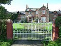
 Country Seat^ - geograph.org.uk - 246919.jpg 640 × 426; 142 KB
-
 Country track to Dunain Park Hotel. - geograph.org.uk - 250749.jpg 640 × 480; 91 KB
-
 County lane at Fitches Grange - geograph.org.uk - 246771.jpg 640 × 480; 123 KB
-

-
 Cow Lane Canal Bridge, Knottingley - geograph.org.uk - 246712.jpg 640 × 480; 135 KB
-
 Cowley gasometer (gas-holder) - geograph.org.uk - 248150.jpg 637 × 479; 116 KB
-
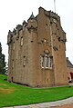
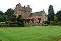 Crathes Castle1.JPG 2,896 × 1,944; 1.83 MB
-
 Crathes Castle2.jpg 2,896 × 1,944; 1.2 MB
-
 Crathes Castle3.jpg 1,944 × 2,896; 1.21 MB
-
 Crown Hotel, Aldbourne - geograph.org.uk - 248405.jpg 640 × 480; 69 KB
-
 Darnford road - geograph.org.uk - 249236.jpg 640 × 346; 45 KB
-
 De Smet Rosedowns Factory - geograph.org.uk - 246903.jpg 480 × 640; 100 KB
-
 Deer fence, stile and two gates - geograph.org.uk - 247632.jpg 640 × 481; 93 KB
-
 Deer in Whitcliff Park - geograph.org.uk - 247530.jpg 640 × 480; 150 KB
-
 Den Lane, near junction with Mill Lane - geograph.org.uk - 249679.jpg 640 × 467; 139 KB
-
 Dinton Castle - geograph.org.uk - 247425.jpg 640 × 480; 155 KB
-
 Dinton Castle ruins - from the inside - geograph.org.uk - 247429.jpg 640 × 480; 155 KB
-
 Dinton Hall - geograph.org.uk - 247494.jpg 640 × 480; 95 KB
-
 Directions to Culloden. - geograph.org.uk - 250756.jpg 640 × 480; 82 KB
-

-

-
 Downland, Upper Upham - geograph.org.uk - 248620.jpg 640 × 480; 113 KB
-
 Dr Williams School 247302.jpg 230 × 170; 10 KB
-
 Drain - Dike Leading From Friar Dike - geograph.org.uk - 387157.jpg 640 × 480; 141 KB
-

-
 Driveway to Hallees, Easton - geograph.org.uk - 248631.jpg 640 × 480; 88 KB
-
 Driveway to Sezincote House - geograph.org.uk - 246892.jpg 640 × 480; 88 KB
-
-
 Dunain Park Hotel roadside entrance. - geograph.org.uk - 250748.jpg 640 × 480; 124 KB
-
 East Hardwick War Memorial - geograph.org.uk - 246772.jpg 640 × 480; 99 KB
-
 Edinburgh Waverley Station concourse - geograph.org.uk - 261407.jpg 640 × 480; 129 KB
-
 Eglwysilan - Church of St Ilan - geograph.org.uk - 247766.jpg 640 × 480; 138 KB
-
 Elm Drive, Garsington - geograph.org.uk - 247988.jpg 640 × 480; 109 KB
-
 End Farm - geograph.org.uk - 246993.jpg 640 × 480; 74 KB
-
 Entering Eglwysilan Common - geograph.org.uk - 247779.jpg 640 × 480; 107 KB
-
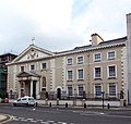
 Entrance - Charterhouse Hospital - geograph.org.uk - 247169.jpg 581 × 640; 148 KB
-
 Entrance Finchale College - geograph.org.uk - 246612.jpg 640 × 480; 80 KB
-
 Entrance to Nymans Gardens, Handcross - geograph.org.uk - 247258.jpg 497 × 640; 107 KB
-
 Farm buildings at Great Burridge - geograph.org.uk - 249703.jpg 640 × 480; 141 KB
-

-
 Farmland - geograph.org.uk - 247257.jpg 640 × 480; 84 KB
-
 Farmland above Aldbourne - geograph.org.uk - 248813.jpg 640 × 478; 146 KB
-
 Farmland above Aldbourne - geograph.org.uk - 248828.jpg 640 × 478; 128 KB
-
 Farmland below Hilldrop - geograph.org.uk - 248853.jpg 640 × 478; 121 KB
-
 Farmland looking towards Brychyni - geograph.org.uk - 247269.jpg 640 × 480; 72 KB
-
 Farmland near Aldbourne - geograph.org.uk - 248822.jpg 640 × 478; 110 KB
-
 Farmland near Cefn Pencoed - geograph.org.uk - 247260.jpg 640 × 480; 79 KB
-
 Farmland, Aldbourne - geograph.org.uk - 248533.jpg 640 × 480; 107 KB
-
 Farmland, Aldbourne - geograph.org.uk - 248541.jpg 640 × 480; 138 KB
-
 Farmland, Aldbourne - geograph.org.uk - 248548.jpg 640 × 480; 136 KB
-
 Farmland, Hilldrop - geograph.org.uk - 248876.jpg 640 × 478; 89 KB
-
 Farmland, Liddington Warren - geograph.org.uk - 248705.jpg 640 × 478; 122 KB
-
 Farmland, Upham - geograph.org.uk - 248655.jpg 640 × 480; 127 KB
-
 Farmland, Upper Upham - geograph.org.uk - 248648.jpg 640 × 480; 140 KB
-
 Feeding trough, Scuggate - geograph.org.uk - 248969.jpg 640 × 480; 87 KB
-
 Fell House, Boltonfellend - geograph.org.uk - 248978.jpg 640 × 480; 59 KB
-
 Ferry Meadows Railway Station 2 - geograph.org.uk - 259483.jpg 640 × 434; 147 KB
-
 Fiat 500 IMG 8307 - Flickr - tonylanciabeta.jpg 1,600 × 1,066; 345 KB
-
 Fiat 500 IMG 8308 - Flickr - tonylanciabeta.jpg 1,600 × 1,066; 290 KB
-
 Field beside the B3042 - geograph.org.uk - 249701.jpg 640 × 480; 130 KB
-

-

-
 Five Oak Green village sign - geograph.org.uk - 336369.jpg 480 × 640; 77 KB
-
 Forest track and cycle route - geograph.org.uk - 246878.jpg 640 × 427; 82 KB
-
 Former chapel at Blakenhall - geograph.org.uk - 249653.jpg 558 × 640; 174 KB
-
 Former Rail Line - Low Marishes - geograph.org.uk - 387133.jpg 640 × 480; 131 KB
-
 Fosseway Farm caravan site - geograph.org.uk - 246904.jpg 640 × 480; 46 KB
-
 Four Locks Canal Bridge - geograph.org.uk - 246969.jpg 640 × 480; 223 KB
-
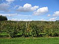 Fruit growing at Cudd Farm - geograph.org.uk - 246858.jpg 640 × 480; 76 KB
-
 Fulham House , Nr Whitley - geograph.org.uk - 246764.jpg 640 × 480; 79 KB
-
 Gallops at Higher Eastington - geograph.org.uk - 249818.jpg 640 × 480; 128 KB
-
 Garden given over to poultry - geograph.org.uk - 248975.jpg 640 × 480; 101 KB
-
 Gardens of Creebridge House Hotel - geograph.org.uk - 892319.jpg 640 × 427; 105 KB
-

-
 Gibraltar, Bucks - geograph.org.uk - 247406.jpg 640 × 480; 117 KB
-
 Gift Shop, Nymans Gardens, Handcross - geograph.org.uk - 247261.jpg 640 × 433; 92 KB
-
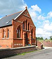
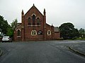
 Gipping Chapel - geograph.org.uk - 247693.jpg 640 × 480; 126 KB
-
 Gipping Chapel - geograph.org.uk - 247696.jpg 640 × 480; 144 KB
-

-

-
 Green Farm, Scuggate - geograph.org.uk - 248967.jpg 640 × 480; 85 KB
-
 Greenhouses with no glass^ - geograph.org.uk - 247057.jpg 570 × 395; 227 KB
-
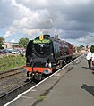
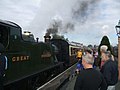 GWR Loco on the SVR - geograph.org.uk - 247549.jpg 500 × 375; 129 KB
-
 New Mill - geograph.org.uk - 355648.jpg 500 × 375; 171 KB
-
 St James - geograph.org.uk - 246837.jpg 640 × 480; 150 KB
-
 Harding's Leigh - geograph.org.uk - 249717.jpg 640 × 480; 134 KB
-
 Hay bales at Great Burridge - geograph.org.uk - 249699.jpg 640 × 480; 113 KB
-
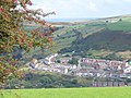 Head of the Valley, Senghenydd - geograph.org.uk - 248431.jpg 640 × 480; 138 KB
-

-
 Helsby Hill 2.jpg 640 × 480; 148 KB
-
 The old Wesleyan Chapel, Hethersgill - geograph.org.uk - 248977.jpg 640 × 480; 74 KB
-
 High Clear Plantation - geograph.org.uk - 248567.jpg 640 × 480; 146 KB
-
 High Clear Plantation - geograph.org.uk - 248586.jpg 640 × 480; 111 KB
-
 Hilton Park Hotel - geograph.org.uk - 273055.jpg 639 × 448; 167 KB
-

-

-
 Horsechestnut Tree at Whitcliff Park - geograph.org.uk - 247462.jpg 640 × 480; 111 KB
-

-

-
 Into the distance - geograph.org.uk - 246884.jpg 480 × 640; 77 KB
-
 Inverewe Gardens Restaurant - geograph.org.uk - 246931.jpg 640 × 480; 119 KB
-
 Inverewe House - geograph.org.uk - 246958.jpg 640 × 480; 117 KB
-
 Izaak Walton's Cottage - geograph.org.uk - 247064.jpg 640 × 480; 131 KB
-
 Kettering Carnegie Library (253258612).jpg 640 × 480; 72 KB
-
 Kimblesworth Church - geograph.org.uk - 246647.jpg 640 × 480; 71 KB
-
 Kingsdon (Colyton) Station - geograph.org.uk - 248223.jpg 640 × 480; 143 KB
-
 St Charles Borromeo Church Hull.jpg 640 × 609; 119 KB
-
-

-


.jpg)


.jpg)


_-_geograph.org.uk_-_248150.jpg)


.jpg)

_Station_-_geograph.org.uk_-_248223.jpg)


.jpg)
_Showbus_2006.jpg)