Category:United Kingdom photographs taken on 2006-10-24
Countries of Europe: Austria · Bulgaria · Croatia · Denmark · France‡ · Iceland · Republic of Ireland · Italy · Netherlands‡ · Norway · Poland · Romania · Russia‡ · Serbia · Slovakia · Spain‡ · Switzerland · Turkey‡ · Ukraine · United Kingdom
‡: partly located in Europe
‡: partly located in Europe
| ← | 24 October 2006 | → | ||
| ← | October 2006 | → | ||

United Kingdom photographs taken on 24 October 2006.
Image files should be categorized here automatically using {{taken on}} template. Direct categorisation is also possible, if automatic is impossible.
Media in category "United Kingdom photographs taken on 2006-10-24"
The following 200 files are in this category, out of 659 total.
(previous page) (next page)-
 2 World Wars - 1 Village - geograph.org.uk - 266520.jpg 640 × 429; 116 KB
-
 A Scarecrows View at Skidby.jpg 640 × 480; 74 KB
-

-
 Agricola Bridge, Catterick - geograph.org.uk - 276655.jpg 640 × 480; 104 KB
-
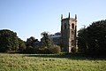 All Saints' church, Croft - geograph.org.uk - 266399.jpg 640 × 427; 59 KB
-
 All Saints, Horsey, Norfolk - North aisle - geograph.org.uk - 321595.jpg 640 × 459; 122 KB
-
 All Saints, Horsey, Norfolk - Sanctuary - geograph.org.uk - 321594.jpg 473 × 640; 134 KB
-

-

-
 All Saints, Lessingham, Norfolk - geograph.org.uk - 321531.jpg 640 × 480; 129 KB
-
 All Saints, Lessingham, Norfolk - geograph.org.uk - 321534.jpg 476 × 640; 115 KB
-

-
 Alpacas - geograph.org.uk - 266679.jpg 640 × 244; 43 KB
-
 Amey Road Sign - geograph.org.uk - 714905.jpg 640 × 479; 85 KB
-
 Angel Hotel, Ashton under Lyne - geograph.org.uk - 570741.jpg 640 × 444; 146 KB
-
 Arkengarthdale - geograph.org.uk - 266337.jpg 640 × 385; 80 KB
-
 Autumnal woodland - geograph.org.uk - 267566.jpg 640 × 480; 208 KB
-
 B4553 Cricklade Road - geograph.org.uk - 266422.jpg 640 × 480; 108 KB
-
 Back Street - geograph.org.uk - 266682.jpg 640 × 480; 89 KB
-
 Ballinderry old school - geograph.org.uk - 267327.jpg 640 × 479; 55 KB
-
 Ballydonnell Townland - geograph.org.uk - 267325.jpg 640 × 479; 58 KB
-
 Ballylifford RC Church - geograph.org.uk - 267328.jpg 640 × 414; 43 KB
-
 Ballymenagh, Cookstown - geograph.org.uk - 267233.jpg 640 × 479; 53 KB
-
 Ballymultrea - geograph.org.uk - 267298.jpg 640 × 444; 51 KB
-
 Ballymultrea Townland - geograph.org.uk - 267295.jpg 640 × 479; 65 KB
-
 Ballymultrea Townland - geograph.org.uk - 267305.jpg 640 × 479; 60 KB
-
 Ballyneil Townland - geograph.org.uk - 267309.jpg 640 × 479; 62 KB
-
 Ballyneill Beg Townland - geograph.org.uk - 267312.jpg 640 × 479; 59 KB
-
 Ballyneill Beg Townland - geograph.org.uk - 267315.jpg 640 × 479; 70 KB
-
 Ballyneill Beg Townland - geograph.org.uk - 267319.jpg 640 × 479; 75 KB
-
 Ballyronan - geograph.org.uk - 267286.jpg 640 × 479; 83 KB
-
 Ballyronan - geograph.org.uk - 267289.jpg 640 × 479; 87 KB
-
 Ballyronan - geograph.org.uk - 267308.jpg 640 × 479; 49 KB
-
 Barn, Belle Vue Farm, Herston - geograph.org.uk - 268643.jpg 640 × 480; 148 KB
-
 Barrow beside A361 - geograph.org.uk - 266664.jpg 640 × 479; 71 KB
-
 Birchy Barton Hill, Heavitree - geograph.org.uk - 268049.jpg 482 × 640; 120 KB
-
 Birkby Nab Wood (south) - geograph.org.uk - 266275.jpg 640 × 385; 100 KB
-
 Bolton-on-Swale.jpg 640 × 480; 109 KB
-
 Bonny Braes - geograph.org.uk - 714899.jpg 640 × 479; 73 KB
-
 Bonny Braes House - geograph.org.uk - 714898.jpg 640 × 479; 123 KB
-
 Bonny Braes House - geograph.org.uk - 714918.jpg 640 × 479; 61 KB
-
 Booze - geograph.org.uk - 266473.jpg 640 × 383; 79 KB
-
 Boundary Fence - geograph.org.uk - 696846.jpg 640 × 479; 74 KB
-
 Bourn windmill.jpg 640 × 461; 140 KB
-

-
 Bremhill, Swindon to Stroud railway - geograph.org.uk - 266499.jpg 640 × 480; 135 KB
-
 Brixham harbour at night - geograph.org.uk - 1420640.jpg 640 × 426; 60 KB
-
 Broadsands beach, water and concrete - geograph.org.uk - 375996.jpg 480 × 640; 169 KB
-
 Bunker entrance hatch - geograph.org.uk - 269634.jpg 640 × 480; 77 KB
-
 Bus Stand, Fort William - geograph.org.uk - 2335819.jpg 3,072 × 2,304; 2.96 MB
-
 Bus Stop, Fort William - geograph.org.uk - 2335808.jpg 3,072 × 2,304; 2.93 MB
-
 Cairnryan Picnic Area - geograph.org.uk - 714891.jpg 640 × 479; 91 KB
-
 Caldecote Church Now a private house - geograph.org.uk - 314398.jpg 640 × 428; 141 KB
-
 Canalside apartments - geograph.org.uk - 266098.jpg 640 × 480; 130 KB
-
 Cardiff Castle and grounds - geograph.org.uk - 327329.jpg 640 × 480; 192 KB
-
 Cattle above Ringstead - geograph.org.uk - 266597.jpg 640 × 480; 96 KB
-
 Cattle, Stock Lane - geograph.org.uk - 267543.jpg 640 × 478; 129 KB
-
 Cattle, Stock Lane - geograph.org.uk - 267547.jpg 640 × 478; 161 KB
-
 Chapman's Pool - geograph.org.uk - 268604.jpg 640 × 480; 125 KB
-
 Church House - geograph.org.uk - 266963.jpg 640 × 480; 110 KB
-

-
 Clifton Inn, Exeter - geograph.org.uk - 267629.jpg 640 × 482; 100 KB
-
 Clissold Park London - panoramio (cropped).jpg 406 × 541; 131 KB
-
 Clissold Park London - panoramio.jpg 1,280 × 960; 361 KB
-
 Closing Tide in Church Cove - geograph.org.uk - 895995.jpg 640 × 480; 72 KB
-
 Coastal view east from White Nothe - geograph.org.uk - 266446.jpg 640 × 480; 90 KB
-
 Coastline, Ardnave Point, Islay - geograph.org.uk - 273790.jpg 467 × 640; 125 KB
-
 Codrington Street, Exeter - geograph.org.uk - 267617.jpg 640 × 482; 71 KB
-
 Cold War Bunker - geograph.org.uk - 269630.jpg 640 × 480; 68 KB
-
 Colleton Crescent, Exeter - geograph.org.uk - 267071.jpg 640 × 482; 122 KB
-
 Colleton Crescent, Exeter - geograph.org.uk - 267077.jpg 482 × 640; 113 KB
-
 Colleton Villa, Exeter - geograph.org.uk - 267037.jpg 640 × 482; 87 KB
-
 All Saints Church Connington - geograph.org.uk - 311065.jpg 640 × 428; 152 KB
-
 The interior of All Saints Connington - geograph.org.uk - 311067.jpg 640 × 429; 61 KB
-
-
 Converted Pumphouse on Wiston Estate - geograph.org.uk - 267148.jpg 640 × 480; 128 KB
-
 Cottages at Ballyneill - geograph.org.uk - 267311.jpg 640 × 278; 34 KB
-

-
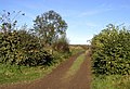
 Country Lane - geograph.org.uk - 266253.jpg 640 × 480; 132 KB
-
 Cricklade - St. Sampson's Church - geograph.org.uk - 268619.jpg 640 × 480; 109 KB
-
 Cricklade, Dismantled railway line - geograph.org.uk - 266397.jpg 640 × 480; 131 KB
-
 Cricklade, High Street - geograph.org.uk - 268609.jpg 640 × 480; 118 KB
-
 Croft - geograph.org.uk - 266243.jpg 427 × 640; 91 KB
-
 Crow's Bridge - geograph.org.uk - 266960.jpg 640 × 427; 59 KB
-
-
 Cusworth Hall Museum, Doncaster - geograph.org.uk - 760130.jpg 640 × 480; 82 KB
-
 Dairy herd above Ringstead - geograph.org.uk - 266918.jpg 640 × 480; 78 KB
-
 Disused lobster farm, Ardnave, Islay - geograph.org.uk - 273828.jpg 640 × 480; 87 KB
-
 Disused Railway - geograph.org.uk - 266480.jpg 640 × 457; 231 KB
-
 Don't wave your rod around^ - geograph.org.uk - 266623.jpg 640 × 480; 67 KB
-
 Drive to Ladybank House - geograph.org.uk - 276694.jpg 640 × 480; 123 KB
-
 Druidstone Beach - geograph.org.uk - 831713.jpg 640 × 480; 56 KB
-
 Ducks on Lough Neagh - geograph.org.uk - 267285.jpg 640 × 479; 48 KB
-
 East and West Piers, Whitby - geograph.org.uk - 1019107.jpg 3,295 × 2,196; 2.1 MB
-

-

-
 Electricity Pylons - geograph.org.uk - 266674.jpg 640 × 480; 64 KB
-
 Enormous fungi - geograph.org.uk - 266629.jpg 640 × 480; 111 KB
-
 Entrance to Lower Chancton Farm - geograph.org.uk - 266607.jpg 640 × 480; 66 KB
-
 Entrance to Mutton's Farm - geograph.org.uk - 266615.jpg 640 × 480; 113 KB
-
 Entrance to Pig Lane - geograph.org.uk - 266670.jpg 640 × 478; 76 KB
-
 Entrance to the British Alpaca Stud - geograph.org.uk - 266675.jpg 640 × 480; 76 KB
-
 Exeter city wall near the cathedral - geograph.org.uk - 266554.jpg 482 × 640; 167 KB
-

-
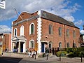
 George's Meeting House, Exeter - geograph.org.uk - 267120.jpg 640 × 482; 103 KB
-
 George's Meeting House, Exeter - geograph.org.uk - 267126.jpg 640 × 482; 106 KB
-

-
 Eyam Information Centre - geograph.org.uk - 1605624.jpg 640 × 480; 116 KB
-
-
 Falcon Barn - geograph.org.uk - 266595.jpg 640 × 480; 109 KB
-
 Farm Track - geograph.org.uk - 266251.jpg 640 × 432; 135 KB
-
 Farm track north of Harepath Farm - geograph.org.uk - 266672.jpg 640 × 473; 63 KB
-
 Farmland - geograph.org.uk - 266271.jpg 640 × 339; 65 KB
-
 Farmland - geograph.org.uk - 266631.jpg 640 × 380; 106 KB
-
 Farmland between Baydon and Wanborough - geograph.org.uk - 267483.jpg 640 × 478; 107 KB
-
 Farmland east of Whilton - geograph.org.uk - 266124.jpg 640 × 480; 78 KB
-
 Farmland near Thurlaston - geograph.org.uk - 266568.jpg 640 × 427; 102 KB
-
 Farmland, Aldbourne - geograph.org.uk - 267509.jpg 640 × 478; 122 KB
-
 Farmland, Ardnave, Islay - geograph.org.uk - 273741.jpg 640 × 493; 94 KB
-
 Farmland, Ardnave, Islay - geograph.org.uk - 273767.jpg 640 × 479; 113 KB
-
 Farmland, Ogbourne St George - geograph.org.uk - 267401.jpg 640 × 480; 103 KB
-
 Field southeast of Spital Bushes - geograph.org.uk - 266557.jpg 640 × 480; 163 KB
-
 Field southwest of Brockley Warren - geograph.org.uk - 267576.jpg 640 × 480; 123 KB
-
 Fields between Railway and A168 - geograph.org.uk - 266694.jpg 640 × 480; 61 KB
-
 Firsby Clough - geograph.org.uk - 267043.jpg 640 × 427; 38 KB
-
 Fishing platform at Throxenby Mere - geograph.org.uk - 266387.jpg 640 × 480; 110 KB
-
 St Helen Folksworth - geograph.org.uk - 309528.jpg 640 × 428; 123 KB
-
 Foot of North Rake Hush - geograph.org.uk - 334950.jpg 640 × 383; 103 KB
-
 Footpath across Stoborough Heath - geograph.org.uk - 268244.jpg 640 × 480; 137 KB
-
 Footpath near Ladybank House - geograph.org.uk - 276698.jpg 640 × 480; 125 KB
-
 Footpath to Dick Hill - geograph.org.uk - 266279.jpg 640 × 440; 116 KB
-
 Fort William Bus station - geograph.org.uk - 2336052.jpg 1,600 × 1,200; 357 KB
-
 Foston, North Yorkshire.jpg 640 × 480; 98 KB
-
 Friar's Walk, Exeter - geograph.org.uk - 267098.jpg 640 × 482; 91 KB
-
 Frodsham Bridge - geograph.org.uk - 747529.jpg 640 × 480; 159 KB
-
 Galphay Lane - geograph.org.uk - 266281.jpg 640 × 480; 110 KB
-
 Gardens in Autumn at Allerton Towers - geograph.org.uk - 303704.jpg 640 × 480; 117 KB
-
 Garras Primary School - geograph.org.uk - 277905.jpg 600 × 450; 58 KB
-
 Gas Terminals, Barrow-in-Furness - geograph.org.uk - 267132.jpg 640 × 468; 79 KB
-
 Gate Bridge - geograph.org.uk - 266261.jpg 640 × 480; 145 KB
-
 Gate Bridge Road - geograph.org.uk - 266263.jpg 640 × 480; 143 KB
-
 Gated track leads towards Spital Bushes - geograph.org.uk - 267557.jpg 640 × 480; 123 KB
-
 Grass triangle at Throxenby Mere - geograph.org.uk - 266383.jpg 640 × 480; 129 KB
-
 Green Waste on the Old Shaston Drove - geograph.org.uk - 310887.jpg 640 × 406; 143 KB
-
 Hacks Lane, Crawley - geograph.org.uk - 266555.jpg 640 × 480; 148 KB
-
 St Mary Haddon Church - geograph.org.uk - 309533.jpg 640 × 428; 136 KB
-
 Haunn - Cottages - geograph.org.uk - 270314.jpg 640 × 480; 100 KB
-
 Hayes Knoll, Dismantled railway line - geograph.org.uk - 266427.jpg 640 × 480; 126 KB
-

-
 Heavitree Hospital - geograph.org.uk - 267641.jpg 640 × 482; 117 KB
-
 Heavitree Hospital - geograph.org.uk - 267645.jpg 640 × 361; 61 KB
-
 Heavitree Pleasure Ground - geograph.org.uk - 267693.jpg 640 × 482; 108 KB
-
 Heavitree Pleasure Ground - geograph.org.uk - 268019.jpg 640 × 482; 136 KB
-

-
 High Bray, above Sherracombe Ford - geograph.org.uk - 266449.jpg 640 × 427; 190 KB
-
 High Bray, logging at Sherracombe - geograph.org.uk - 266457.jpg 640 × 427; 254 KB
-
 High Bray, near Sherracombe Ford - geograph.org.uk - 266454.jpg 640 × 427; 231 KB
-
 High Bray, Sherracombe Lane - geograph.org.uk - 266460.jpg 640 × 427; 314 KB
-
 High Bray, towards Sherracombe Ford - geograph.org.uk - 266450.jpg 640 × 427; 186 KB
-
 Holworth House and Ringstead - geograph.org.uk - 266717.jpg 640 × 480; 96 KB
-
 Holy Trinity, Ingham, Norfolk - geograph.org.uk - 321501.jpg 640 × 450; 106 KB
-
 Holy Trinity, Ingham, Norfolk - geograph.org.uk - 321503.jpg 519 × 640; 125 KB
-
 Hook Station - geograph - 266589.jpg 640 × 464; 90 KB
-
 Horley Fire Station - geograph.org.uk - 268156.jpg 640 × 480; 185 KB
-
 Horses at Druidstone - geograph.org.uk - 831709.jpg 640 × 480; 66 KB
-
 Horses, Burney Farm - geograph.org.uk - 267555.jpg 640 × 478; 131 KB
-
 Houns-tout cliff - geograph.org.uk - 268317.jpg 640 × 480; 108 KB
-
 Houns-tout cliff - geograph.org.uk - 268607.jpg 640 × 480; 103 KB
-
 Housel Bay Hotel - geograph.org.uk - 350236.jpg 640 × 480; 147 KB
-
-
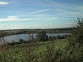
 Inlet at Lough Neagh - geograph.org.uk - 267287.jpg 640 × 273; 25 KB
-
 Inlet at Lough Neagh - geograph.org.uk - 267326.jpg 640 × 282; 42 KB
-
 Irchester Village Library - geograph.org.uk - 266904.jpg 640 × 473; 89 KB
-

-
 Just Neptune, Exeter - geograph.org.uk - 266546.jpg 482 × 640; 70 KB
-
 Kilcronagh, Cookstown - geograph.org.uk - 266776.jpg 640 × 479; 59 KB
-
 Kilfinichan Bay - geograph.org.uk - 364167.jpg 640 × 426; 65 KB
-
 King's Arms, Langton Matravers - geograph.org.uk - 268653.jpg 640 × 480; 130 KB
-
 Knockavaddy Townland - geograph.org.uk - 266772.jpg 640 × 302; 40 KB
-
 Laight Moor - geograph.org.uk - 696833.jpg 640 × 479; 85 KB
-
 Laird's Hill - geograph.org.uk - 696865.jpg 640 × 479; 118 KB
-
 Lands End (281548276).jpg 3,456 × 2,304; 3.49 MB
-
 Landslip, St Aldhelm's Head - geograph.org.uk - 268612.jpg 640 × 480; 138 KB
-
 Lane to Bowbeer Farm - geograph.org.uk - 269635.jpg 640 × 480; 70 KB
-
 Lane to Drascombe Barton - geograph.org.uk - 269622.jpg 640 × 480; 68 KB
-
 Lane to West Underdown - geograph.org.uk - 269625.jpg 640 × 480; 87 KB
-
 Langthwaite - geograph.org.uk - 266377.jpg 640 × 383; 86 KB
-
 Lawton's Hope. Westhope - geograph.org.uk - 267011.jpg 640 × 427; 138 KB
-
 Leek Branch, Caldon Canal - geograph.org.uk - 317564.jpg 640 × 480; 154 KB
-
 Level Crossing, Hademore - geograph.org.uk - 266192.jpg 640 × 480; 87 KB
-
 Little Laight House - geograph.org.uk - 714879.jpg 640 × 479; 61 KB
-
 Livery Stables at Tollard Park - geograph.org.uk - 266123.jpg 640 × 480; 109 KB
-

-
 Lucky Lane, Exeter - geograph.org.uk - 267095.jpg 640 × 482; 89 KB
-
 Lydiard Millicent, All Saints Church - geograph.org.uk - 268632.jpg 640 × 480; 113 KB
-
 M56 Viaduct Runcorn and Frodsham - geograph.org.uk - 747527.jpg 640 × 426; 126 KB
-
 Manchester ship canal - geograph.org.uk - 747525.jpg 640 × 458; 45 KB
-
 Matlock - Chapels on Bank Road.jpg 2,048 × 1,536; 702 KB
-
 Mawgan Church - geograph.org.uk - 277072.jpg 600 × 480; 56 KB
-
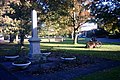
 Mawgan War Memorial - geograph.org.uk - 277902.jpg 600 × 450; 53 KB


_-_geograph.org.uk_-_266275.jpg)


.jpg)


.jpg)


