Category:United Kingdom photographs taken on 2006-10-05
| ← | Thursday 5 October 2006 | → | ||
| ← | October 2006 | → | ||

United Kingdom photographs taken on 5 October 2006.
Image files should be categorized here automatically using {{taken on}} template. Direct categorisation is also possible, if automatic is impossible.
Subcategories
This category has only the following subcategory.
Media in category "United Kingdom photographs taken on 2006-10-05"
The following 126 files are in this category, out of 126 total.
-
 A happy well fed tick - geograph.org.uk - 257665.jpg 640 × 480; 50 KB
-
 Badachro River - geograph.org.uk - 254257.jpg 640 × 480; 173 KB
-
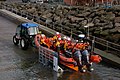 Bangor's new lifeboat - geograph.org.uk - 254239.jpg 640 × 426; 162 KB
-
 Barton Garage - geograph.org.uk - 254421.jpg 640 × 538; 114 KB
-
 Butts Road - geograph.org.uk - 254432.jpg 640 × 480; 94 KB
-
 The Old Hopper Cycle Factory - geograph.org.uk - 254424.jpg 640 × 480; 87 KB
-
 Beach at Port O' Warren Bay - geograph.org.uk - 261953.jpg 640 × 419; 88 KB
-

-
 Boxted Hall, Suffolk - geograph.org.uk - 816668.jpg 640 × 480; 102 KB
-
 Brant Broughton Church - geograph.org.uk - 1371864.jpg 640 × 480; 116 KB
-
 Cottages opposite the lane to Cockles - geograph.org.uk - 367853.jpg 640 × 441; 94 KB
-
 Cottages opposite White Lodge Gate - geograph.org.uk - 367905.jpg 640 × 428; 84 KB
-
 Cows and Trees - geograph.org.uk - 254495.jpg 640 × 480; 76 KB
-
 Creels on Dry Island - geograph.org.uk - 254252.jpg 640 × 480; 107 KB
-

-
 Cul Beag, Stac Pollaidh and Cul Mor - geograph.org.uk - 907968.jpg 640 × 426; 52 KB
-

-
 Disused quarry in Tollohill Wood - geograph.org.uk - 254289.jpg 640 × 480; 171 KB
-
 Disused quarry in Tollohill Wood. - geograph.org.uk - 254290.jpg 640 × 480; 156 KB
-
 Driveway to Rectory Farm - geograph.org.uk - 256583.jpg 640 × 480; 128 KB
-

-
 St Mary's Church, East Stoke - geograph.org.uk - 367862.jpg 428 × 640; 96 KB
-
 Farley Hill - geograph.org.uk - 254482.jpg 640 × 480; 120 KB
-
 Footpath and Holly - geograph.org.uk - 254506.jpg 640 × 480; 133 KB
-
 Footpath and Panda - geograph.org.uk - 254486.jpg 640 × 480; 158 KB
-
 Hulma Water - geograph.org.uk - 434756.jpg 640 × 363; 36 KB
-
 Inchkeith (Fife) - geograph.org.uk - 387774.jpg 640 × 342; 37 KB
-

-

-
 Kingsbarns Links Golf Course. - geograph.org.uk - 254127.jpg 640 × 480; 75 KB
-
 Lincoln, Greestone Stairs - geograph.org.uk - 1738432.jpg 772 × 1,024; 962 KB
-
 Littlemore Cottage, Cockles - geograph.org.uk - 365087.jpg 640 × 494; 97 KB
-
 Loch of Flatpunds - geograph.org.uk - 434274.jpg 640 × 386; 46 KB
-
 Loch of Flatpunds - geograph.org.uk - 434738.jpg 640 × 430; 37 KB
-
 McFly gig Nottingham 2006 MMB 01.jpg 1,600 × 1,200; 308 KB
-
 McFly gig Nottingham 2006 MMB 02.jpg 1,600 × 1,200; 585 KB
-
 McFly gig Nottingham 2006 MMB 02c.jpg 944 × 909; 175 KB
-
 McFly gig Nottingham 2006 MMB 03.jpg 1,600 × 1,200; 223 KB
-
 McFly gig Nottingham 2006 MMB 04.jpg 1,600 × 1,200; 591 KB
-
 Millennium Garden at Lamorna.jpg 640 × 480; 110 KB
-
 Monument in Tollohill wood - geograph.org.uk - 254132.jpg 480 × 640; 88 KB
-
 Moving Cows - geograph.org.uk - 254517.jpg 640 × 480; 101 KB
-
 Norwich Station - geograph.org.uk - 760082.jpg 480 × 640; 111 KB
-
 Norwich Station - geograph.org.uk - 760113.jpg 640 × 480; 102 KB
-
 Path to Wirksworth - geograph.org.uk - 254492.jpg 640 × 480; 75 KB
-
 Plane sailing - geograph.org.uk - 485842.jpg 640 × 293; 30 KB
-
 Road Junction to the east of Denton - geograph.org.uk - 254237.jpg 640 × 393; 103 KB
-
 Ruined settlement at Rigg - geograph.org.uk - 1273077.jpg 640 × 480; 59 KB
-

-
 Sheep Pens at Largiebaan. - geograph.org.uk - 254779.jpg 640 × 480; 91 KB
-

-

-
 Stonepit House, Denton, Northants - geograph.org.uk - 254245.jpg 640 × 416; 123 KB
-
 Tax Farm - geograph.org.uk - 254479.jpg 640 × 427; 87 KB
-

-
 The George public house in Roade - geograph.org.uk - 256567.jpg 640 × 480; 146 KB
-
 The Kintyre Way S of Cnoc Moy. - geograph.org.uk - 254800.jpg 640 × 480; 66 KB
-

-
 The view from the Tollohill monument - geograph.org.uk - 254160.jpg 640 × 480; 110 KB
-
 Track to Alton Manor - geograph.org.uk - 254510.jpg 640 × 480; 119 KB
-
 Trolligarts Water - geograph.org.uk - 434256.jpg 640 × 303; 40 KB
-
 Uninhabited cottage at Cockles - geograph.org.uk - 366172.jpg 499 × 611; 201 KB
-

-
 Aird from Dry Island - geograph.org.uk - 254249.jpg 640 × 480; 144 KB
-
 Allt A'Chapuill. - geograph.org.uk - 254805.jpg 640 × 480; 64 KB
-
 Amod Farm, Glen Breackerie. - geograph.org.uk - 254637.jpg 640 × 480; 49 KB
-

-
 Amod Hill. - geograph.org.uk - 254828.jpg 640 × 480; 84 KB
-
 Amod. - geograph.org.uk - 254832.jpg 640 × 480; 63 KB
-
 B3070 Army Ranges Warning at Cockles - geograph.org.uk - 367921.jpg 640 × 422; 104 KB
-

-
 Barn at Cockles - geograph.org.uk - 367112.jpg 640 × 428; 107 KB
-
 Barn at Largiebaan. - geograph.org.uk - 254778.jpg 640 × 480; 73 KB
-
 Black Sheep with White Tail. - geograph.org.uk - 254777.jpg 640 × 480; 60 KB
-
 Bridge over the Badachro River - geograph.org.uk - 254262.jpg 640 × 480; 142 KB
-
 Cnoc Moy and Forestry. - geograph.org.uk - 254782.jpg 640 × 480; 62 KB
-
 Enclosure. - geograph.org.uk - 254787.jpg 640 × 480; 54 KB
-
 Entering North Yorkshire - geograph.org.uk - 254033.jpg 640 × 406; 35 KB
-
 Fakenham town sign - geograph.org.uk - 254295.jpg 395 × 640; 98 KB
-
 Farm building at Glenahanty. - geograph.org.uk - 254766.jpg 640 × 480; 73 KB
-
 Farmhouse at Gartnacopaig. - geograph.org.uk - 254768.jpg 640 × 480; 60 KB
-
 Farmhouse at Glenahanty. - geograph.org.uk - 254763.jpg 640 × 480; 60 KB
-
-
 Forestry and Moorland S of Cnoc Moy. - geograph.org.uk - 254798.jpg 640 × 480; 70 KB
-
 Forestry Clearance on Corr nan Long. - geograph.org.uk - 254833.jpg 640 × 480; 60 KB
-
 Forestry on Amod Hill. - geograph.org.uk - 254826.jpg 640 × 480; 89 KB
-
 Forestry on Cnoc Moy. - geograph.org.uk - 254783.jpg 640 × 480; 60 KB
-
 Forestry on Remuil Hill. - geograph.org.uk - 254808.jpg 640 × 480; 80 KB
-
 Gartnacopaig. - geograph.org.uk - 254770.jpg 640 × 480; 75 KB
-
 Glenahanty. - geograph.org.uk - 254761.jpg 640 × 480; 44 KB
-
 Glenahanty. - geograph.org.uk - 254762.jpg 640 × 480; 73 KB
-
 Glenahanty. - geograph.org.uk - 254767.jpg 640 × 480; 94 KB
-
 High Glenadale. - geograph.org.uk - 254823.jpg 640 × 480; 86 KB
-
 Horses at Amod. - geograph.org.uk - 254837.jpg 640 × 480; 60 KB
-
 Interior of Farmhouse at Glenahanty. - geograph.org.uk - 254765.jpg 640 × 480; 74 KB
-
 Isolated House, Denton Road, Northants - geograph.org.uk - 254236.jpg 640 × 393; 145 KB
-
-
 Land Rover by the Loch Mor Track - geograph.org.uk - 254393.jpg 640 × 480; 52 KB
-
 Largiebaan. - geograph.org.uk - 254772.jpg 640 × 480; 60 KB
-
 Low Glenadale from Amod Hill. - geograph.org.uk - 254634.jpg 640 × 480; 55 KB
-
 Low Glenadale. - geograph.org.uk - 254831.jpg 640 × 480; 68 KB
-

-
 New forest road. - geograph.org.uk - 254640.jpg 640 × 480; 65 KB
-
 New Forestry Road. - geograph.org.uk - 254757.jpg 640 × 480; 72 KB
-
 On Top of Remuil Hill. - geograph.org.uk - 254816.jpg 640 × 480; 71 KB
-
 Oyster farming on Loch Gruinart - geograph.org.uk - 254647.jpg 640 × 480; 92 KB
-
 Panorama at the summit of Glas Bheinn - geograph.org.uk - 546789.jpg 640 × 141; 132 KB
-
 Rock feature S of Cnoc Moy. - geograph.org.uk - 254789.jpg 640 × 480; 59 KB
-
 South of Cnoc Moy. - geograph.org.uk - 254786.jpg 640 × 480; 60 KB
-
 Station Farm, Horton - geograph.org.uk - 254230.jpg 640 × 379; 105 KB
-
 The A171 over Gerrick Moor - geograph.org.uk - 254032.jpg 640 × 351; 39 KB
-

-

-
 The Kintyre Way at Largiebaan. - geograph.org.uk - 254780.jpg 640 × 480; 68 KB
-

-
 The Kintyre Way on Amod Hill. - geograph.org.uk - 254825.jpg 640 × 480; 90 KB
-
 The Kintyre Way on Remuill Hill. - geograph.org.uk - 254820.jpg 640 × 480; 48 KB
-
 The Kintyre Way S of Cnoc Moy. - geograph.org.uk - 254792.jpg 640 × 480; 78 KB
-
 The Kintyre Way S of Cnoc Moy. - geograph.org.uk - 254799.jpg 640 × 480; 71 KB
-

-
 The Road to Glenahanty. - geograph.org.uk - 254754.jpg 640 × 480; 93 KB
-
 The Road to Glenahanty. - geograph.org.uk - 254759.jpg 640 × 480; 71 KB
-
 The view from Remuil Hill. - geograph.org.uk - 254814.jpg 640 × 480; 63 KB
-
 Whinfell Forest - geograph.org.uk - 347542.jpg 640 × 480; 137 KB
-
 Whinfell Forest clearing - geograph.org.uk - 347555.jpg 640 × 480; 143 KB
-
 Working horses, Amod Farm. - geograph.org.uk - 254639.jpg 640 × 480; 67 KB


_-_geograph.org.uk_-_387774.jpg)


