Category:United Kingdom photographs taken on 2006-10-06
Countries of Europe: Austria · Belarus · Belgium · Czech Republic · Denmark · Finland · France‡ · Germany · Greece · Hungary · Republic of Ireland · Italy · Portugal‡ · Russia‡ · Slovakia · Spain‡ · Sweden · Switzerland · Turkey‡ · Ukraine · United Kingdom
‡: partly located in Europe
‡: partly located in Europe
| ← | 6 October 2006 | → | ||
| ← | October 2006 | → | ||

United Kingdom photographs taken on 6 October 2006.
Image files should be categorized here automatically using {{taken on}} template. Direct categorisation is also possible, if automatic is impossible.
Media in category "United Kingdom photographs taken on 2006-10-06"
The following 200 files are in this category, out of 260 total.
(previous page) (next page)-
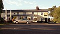 'Dog and Gun' inn - geograph.org.uk - 255651.jpg 640 × 365; 55 KB
-
 1930s Bungalow at Dinas Dinlle - geograph.org.uk - 254411.jpg 640 × 480; 72 KB
-

-

-
 A534 junction with Clay Lane - geograph.org.uk - 254390.jpg 640 × 480; 71 KB
-
 Afon Elan near Elan Village - geograph.org.uk - 412920.jpg 640 × 638; 167 KB
-

-

-
 Animals grazing by the wood on Manor Farm - geograph.org.uk - 256607.jpg 640 × 480; 128 KB
-
 Approaching Little Horwood village - geograph.org.uk - 256916.jpg 640 × 480; 118 KB
-
 Avenue of Trees Leading To Linley Hall - geograph.org.uk - 255649.jpg 640 × 480; 101 KB
-
 Barn and farmbuildings north of Puxley - geograph.org.uk - 256888.jpg 640 × 480; 140 KB
-

-
 "Amy Howson" - geograph.org.uk - 254428.jpg 480 × 640; 101 KB
-
 Beach at Low Tide - geograph.org.uk - 254602.jpg 640 × 480; 43 KB
-
 Beach Farm, Linley - geograph.org.uk - 256127.jpg 640 × 480; 93 KB
-
 Beechnut Avenue, Pontefract - geograph.org.uk - 254364.jpg 640 × 480; 129 KB
-
 Beltie Road - geograph.org.uk - 254692.jpg 640 × 480; 64 KB
-
 Blixes Farm - geograph.org.uk - 255618.jpg 640 × 480; 94 KB
-
 Bog oaks, Woodwalton Fen, Cambs - geograph.org.uk - 257736.jpg 640 × 480; 287 KB
-
 Brambles Nursery near Singleborough - geograph.org.uk - 256909.jpg 640 × 480; 130 KB
-
 Bridge over to New Fryston - geograph.org.uk - 254583.jpg 640 × 443; 35 KB
-
 Bridleway near Low Gate - geograph.org.uk - 296975.jpg 480 × 640; 138 KB
-
 Burn on moorland near Whiteyards - geograph.org.uk - 254707.jpg 640 × 480; 95 KB
-
 Cairn Hill moorland - geograph.org.uk - 254705.jpg 640 × 480; 87 KB
-
 Campbeltown Loch sunrise. - geograph.org.uk - 371809.jpg 640 × 480; 25 KB
-
 Camustianavaig - geograph.org.uk - 254391.jpg 640 × 480; 43 KB
-
 Castle Street - geograph.org.uk - 257597.jpg 640 × 480; 63 KB
-
 Castle Street and the Old Road - geograph.org.uk - 257411.jpg 640 × 480; 57 KB
-

-
 Cemetery Through Trees - geograph.org.uk - 254531.jpg 640 × 480; 106 KB
-
 Church Street and St Mary's - geograph.org.uk - 257744.jpg 640 × 480; 65 KB
-
 Coed Bedo - geograph.org.uk - 338315.jpg 640 × 261; 117 KB
-
 Country lane near Deanshanger - geograph.org.uk - 256893.jpg 640 × 480; 136 KB
-
 Country lane west of Holywell Farm - geograph.org.uk - 256905.jpg 640 × 480; 145 KB
-
 Dead Trees and Hide - geograph.org.uk - 254543.jpg 640 × 480; 99 KB
-
 Doric column pillar box - geograph.org.uk - 257366.jpg 480 × 640; 64 KB
-
 Doric column pillar box - geograph.org.uk - 257390.jpg 480 × 640; 72 KB
-

-

-

-
 Entering Thornton village - geograph.org.uk - 256902.jpg 640 × 480; 121 KB
-

-
 Entrance to Potterspury House - geograph.org.uk - 256696.jpg 640 × 480; 132 KB
-

-
 Farm buildings at Sunnyhill - geograph.org.uk - 256911.jpg 640 × 480; 124 KB
-
 Field margin on outskirts of Deanshanger - geograph.org.uk - 256895.jpg 640 × 480; 126 KB
-
 Gass Water - geograph.org.uk - 254696.jpg 640 × 480; 111 KB
-
 Godwick deserted village - geograph.org.uk - 367893.jpg 600 × 450; 50 KB
-
 Godwick deserted village.jpg 600 × 450; 51 KB
-
 Greymare Stone - geograph.org.uk - 254771.jpg 640 × 480; 89 KB
-
 Headstone in Sweetheart Abbey - geograph.org.uk - 392217.jpg 640 × 480; 140 KB
-
 Hospital of St Anne, Appleby - geograph.org.uk - 259640.jpg 640 × 480; 106 KB
-
 Kincardine Bridge - geograph.org.uk - 274137.jpg 640 × 424; 50 KB
-
 Kincardine Bridge - geograph.org.uk - 274897.jpg 640 × 424; 29 KB
-
 Kincardine on Forth - geograph.org.uk - 274396.jpg 640 × 424; 47 KB
-
 Kynance Cliffs - geograph.org.uk - 256436.jpg 640 × 480; 79 KB
-
 Landor House - geograph.org.uk - 257735.jpg 640 × 480; 69 KB
-
 Lane that leads to Blue Barns - geograph.org.uk - 255641.jpg 640 × 480; 99 KB
-

-
 Linley Hall - geograph.org.uk - 255877.jpg 640 × 480; 72 KB
-
 Llyn Caer Euni - geograph.org.uk - 339174.jpg 640 × 426; 150 KB
-

-
 Ludlow at Night - Flickr - Michelle Jones UK.jpg 1,000 × 800; 486 KB
-
 Main Runway of Caernarfon Airport - geograph.org.uk - 254561.jpg 640 × 372; 29 KB
-
 Market Street, Birkenhead - geograph.org.uk - 254459.jpg 640 × 480; 61 KB
-
 Mid Beltie road junction - geograph.org.uk - 254669.jpg 640 × 480; 46 KB
-
 Mill Hill Avenue, Pontefract - geograph.org.uk - 254366.jpg 640 × 480; 84 KB
-
-
 Mullion Cove Hotel - geograph.org.uk - 256314.jpg 640 × 480; 62 KB
-
-

-
 Neil Oliver at Windsor Quay (cropped).jpg 230 × 306; 132 KB
-
 Neil oliver windsor quay.jpg 791 × 522; 523 KB
-
 Nether Mains - geograph.org.uk - 254663.jpg 640 × 441; 45 KB
-
 New Deer, Main Street.jpg 640 × 480; 81 KB
-
 New Street - geograph.org.uk - 257400.jpg 640 × 480; 59 KB
-
 Norbury Primary School - geograph.org.uk - 255844.jpg 640 × 480; 49 KB
-
 Northern slopes of Wardlaw Hill - geograph.org.uk - 254712.jpg 640 × 480; 86 KB
-
 Nursery School - geograph.org.uk - 254699.jpg 640 × 480; 56 KB
-
 Ovis aries (deceased) - geograph.org.uk - 668707.jpg 500 × 375; 198 KB
-
 Parkhill Industrial Estate - geograph.org.uk - 259648.jpg 640 × 480; 55 KB
-
 Pier Hotel - geograph.org.uk - 760117.jpg 480 × 640; 113 KB
-
 Pit Winding Wheel - geograph.org.uk - 254315.jpg 640 × 480; 155 KB
-
 Plaque on the Eastgate - geograph.org.uk - 257371.jpg 639 × 480; 71 KB
-
 Plaque on The Guild Cottages - geograph.org.uk - 257748.jpg 639 × 478; 51 KB
-
 Playground and Monument - geograph.org.uk - 254591.jpg 640 × 480; 34 KB
-

-
 Proscribe Burn - geograph.org.uk - 254710.jpg 640 × 480; 100 KB
-
 Queen's Parade, Bangor (1) - geograph.org.uk - 257247.jpg 640 × 426; 127 KB
-
-
 Railway Bridge at Glenyards - geograph.org.uk - 254392.jpg 640 × 480; 113 KB
-
 Rainbow over Harby - geograph.org.uk - 255100.jpg 640 × 427; 54 KB
-
 Red Star Inn, Kirkton of Skene - geograph.org.uk - 259663.jpg 640 × 584; 65 KB
-
 Rethatching a cottage in Yardley Gobion - geograph.org.uk - 256622.jpg 640 × 480; 118 KB
-
 Road junction near Tyrellcote Farm - geograph.org.uk - 256904.jpg 640 × 480; 111 KB
-

-
 Road to Make Me Rich - geograph.org.uk - 261161.jpg 640 × 480; 86 KB
-

-
 Roundabout on the A421 near Great Horwood - geograph.org.uk - 256908.jpg 640 × 480; 145 KB
-
 Rowantree Burn below Wardlaw Hill - geograph.org.uk - 254714.jpg 640 × 480; 100 KB
-
 Sanderson House - geograph.org.uk - 254297.jpg 640 × 480; 65 KB
-
 Skew Bridge Approach - geograph.org.uk - 254575.jpg 640 × 408; 31 KB
-

-

-
 St Oswalds Church, Grasmere - geograph.org.uk - 667651.jpg 640 × 480; 157 KB
-
 Standing Stone below Coed Bedo - geograph.org.uk - 342232.jpg 640 × 426; 214 KB
-
-

-

-
 The A40 through West Wycombe Village - geograph.org.uk - 254719.jpg 640 × 482; 132 KB
-
 The A422 north of Thornton - geograph.org.uk - 256899.jpg 640 × 480; 147 KB
-
 The A5 - A422 roundabout at Old Stratford - geograph.org.uk - 256589.jpg 640 × 480; 145 KB
-
 The Athenaeum - geograph.org.uk - 257556.jpg 640 × 480; 73 KB
-
 The Beehive Public House at Deanshangar - geograph.org.uk - 256896.jpg 640 × 480; 139 KB
-
 The Cenotaph, Whitehall, London - geograph.org.uk - 306892.jpg 500 × 640; 149 KB
-
 The Control Tower, Caernarfon Airport - geograph.org.uk - 254546.jpg 640 × 455; 53 KB
-
 The Crypt at Worcester Cathedral - geograph.org.uk - 1005022.jpg 640 × 424; 49 KB
-
 The edge of East Ashalls Copse - geograph.org.uk - 256891.jpg 640 × 480; 126 KB
-
 The Fishguard to Rosslare ferry - geograph.org.uk - 310260.jpg 640 × 480; 73 KB
-
 The Great Ouse River near Thornton - geograph.org.uk - 256901.jpg 640 × 480; 114 KB
-
 The Guild Cottages - geograph.org.uk - 257747.jpg 640 × 480; 46 KB
-
 The Horseshoe Inn, Bridges - geograph.org.uk - 255852.jpg 640 × 480; 112 KB
-
 The pond with ducks at Wood End, Nash - geograph.org.uk - 256907.jpg 640 × 480; 114 KB
-

-
 The quay at Fishguard ferryport - geograph.org.uk - 310263.jpg 640 × 480; 87 KB
-
 The Quire at Worcester Cathedral - geograph.org.uk - 1005007.jpg 640 × 424; 97 KB
-
 The Ragleth Inn, Little Stretton - geograph.org.uk - 255655.jpg 640 × 480; 115 KB
-
 The run down Tyrebagger - geograph.org.uk - 259653.jpg 640 × 401; 44 KB
-
 The South Sands - geograph.org.uk - 254598.jpg 640 × 480; 50 KB
-
-
-
 Thornbrough Farmhouse - geograph.org.uk - 254734.jpg 640 × 457; 71 KB
-
 Thornbrough Lime Kilns - geograph.org.uk - 254955.jpg 640 × 480; 99 KB
-
 Thornbrough Road Ends - geograph.org.uk - 254738.jpg 640 × 457; 65 KB
-
 Thornton Hall - geograph.org.uk - 256903.jpg 640 × 480; 128 KB
-
 Tiny House At Birtley - geograph.org.uk - 256386.jpg 640 × 480; 103 KB
-
 Topiary in Torphins cemetery - geograph.org.uk - 254679.jpg 480 × 640; 65 KB
-
 Torphins cemetery - geograph.org.uk - 254680.jpg 480 × 640; 72 KB
-
 Track and derelict mine building - geograph.org.uk - 254698.jpg 640 × 480; 96 KB
-
 Track to old Barytes mine workings - geograph.org.uk - 254700.jpg 640 × 480; 88 KB
-
-
 Tyrebagger sculptures - geograph.org.uk - 259655.jpg 640 × 428; 81 KB
-
 Vine covered houses, Curry Rivel - geograph.org.uk - 1577472.jpg 640 × 480; 137 KB
-
 Warwick crossroads - geograph.org.uk - 257586.jpg 640 × 480; 61 KB
-
 Warwick Shire Hall and County Court building.jpg 640 × 480; 56 KB
-
 The Eastgate - geograph.org.uk - 257362.jpg 480 × 640; 63 KB
-
 The Westgate - geograph.org.uk - 257380.jpg 480 × 640; 66 KB
-

-
 West Lodge with stone dovecote - geograph.org.uk - 259664.jpg 640 × 447; 45 KB
-
 Wheldon Road - geograph.org.uk - 254572.jpg 640 × 466; 43 KB
-
 Whitstable - geograph.org.uk - 435309.jpg 640 × 427; 55 KB
-
 Whitstable Harbour - geograph.org.uk - 435306.jpg 640 × 427; 51 KB
-
 Woodland by Back Newton Lane - geograph.org.uk - 254301.jpg 640 × 348; 23 KB
-
 Woodside Ferry Terminal, Birkenhead - geograph.org.uk - 254477.jpg 640 × 480; 42 KB
-
 Worcester Cathedral - North entrance - geograph.org.uk - 1005041.jpg 640 × 424; 93 KB
-
 Wreaths Tower - geograph.org.uk - 392334.jpg 640 × 480; 116 KB
-
 A Wind Deformed Tree - geograph.org.uk - 254549.jpg 640 × 324; 44 KB
-
 Abermenai Point from Belan Beach - geograph.org.uk - 254580.jpg 640 × 480; 34 KB
-
 Airport Road - geograph.org.uk - 254451.jpg 640 × 480; 59 KB
-
 Binns Lane, Southowram - geograph.org.uk - 255724.jpg 640 × 476; 159 KB
-
 Bird in Hand Pub - geograph.org.uk - 254625.jpg 640 × 399; 36 KB
-
 Blythe Farm - geograph.org.uk - 254552.jpg 640 × 340; 56 KB
-
 Boundary Bridleway - geograph.org.uk - 254526.jpg 640 × 480; 87 KB
-
 Brocksbushes Farmhouse - geograph.org.uk - 254732.jpg 640 × 457; 50 KB
-
 Bryn Teg - A New House - geograph.org.uk - 254554.jpg 640 × 376; 50 KB
-
 Buchan landscape from Culsh Monument - geograph.org.uk - 254661.jpg 640 × 480; 56 KB
-

-
 Car Park at Morfa Dinlle - geograph.org.uk - 254566.jpg 640 × 480; 51 KB
-
 Carrick Academy, Maybole - geograph.org.uk - 254334.jpg 640 × 480; 108 KB
-
 Cattle Grid Near Squilver - geograph.org.uk - 256935.jpg 640 × 480; 81 KB
-
 Cold Hill Farm - geograph.org.uk - 256125.jpg 640 × 480; 75 KB
-
 Criffel - geograph.org.uk - 392745.jpg 640 × 480; 111 KB
-
 Crossroads At Soudley - geograph.org.uk - 256387.jpg 640 × 480; 99 KB
-
 Culsh monument, New Deer - geograph.org.uk - 254660.jpg 640 × 480; 45 KB
-
 Cultezeoun Farm - geograph.org.uk - 254330.jpg 640 × 480; 118 KB
-
 Darlow's Farm, Woodwalton Fen, Cambs - geograph.org.uk - 257814.jpg 640 × 480; 354 KB
-
 Detail on signpost - geograph.org.uk - 257574.jpg 480 × 640; 85 KB
-
 Drake Head Lane - geograph.org.uk - 254535.jpg 640 × 480; 124 KB
-
 Driving through the flood - geograph.org.uk - 257188.jpg 477 × 640; 127 KB
-
 Dryhill Farm - geograph.org.uk - 256360.jpg 640 × 480; 97 KB
-

-
 Entrance to Friends Meeting House - geograph.org.uk - 257403.jpg 480 × 640; 71 KB
-
 Entrance to New Deer showground - geograph.org.uk - 254672.jpg 640 × 480; 73 KB
-
 Entry to Concraig House - geograph.org.uk - 259660.jpg 640 × 461; 53 KB
-
 Farm at Ridge - geograph.org.uk - 256126.jpg 640 × 480; 74 KB
-
 Field Near Acton Scott - geograph.org.uk - 256353.jpg 640 × 480; 83 KB
-
 Flooded road, Bredgar - geograph.org.uk - 257183.jpg 480 × 640; 122 KB
-
 Gairloch - geograph.org.uk - 259665.jpg 640 × 442; 57 KB
-
 Godwick Barn - geograph.org.uk - 367889.jpg 600 × 450; 53 KB
-

-
 Hatton Farm - geograph.org.uk - 256368.jpg 640 × 480; 79 KB
-

-
 Hill Top Road - geograph.org.uk - 254528.jpg 640 × 480; 89 KB
-

-
 Houses on the clifftop - geograph.org.uk - 256312.jpg 640 × 480; 75 KB
-
 Innes Burial Ground - geograph.org.uk - 254685.jpg 640 × 480; 44 KB
-
 Innes Burial Ground - geograph.org.uk - 254688.jpg 480 × 640; 134 KB
-
 Junction at Great Leighs, Essex - geograph.org.uk - 255645.jpg 640 × 480; 75 KB
-
 Junction with A63 - geograph.org.uk - 254615.jpg 640 × 358; 37 KB


_-_geograph.org.uk_-_254308.jpg)


.jpg)


_-_geograph.org.uk_-_668707.jpg)


_-_geograph.org.uk_-_257247.jpg)


