Category:United Kingdom photographs taken on 2006-12-06
Countries of Europe: Czech Republic · Estonia · Germany · Greece · Italy · Netherlands‡ · Poland · Serbia · Spain‡ · United Kingdom
‡: partly located in Europe
‡: partly located in Europe
| ← | 6 December 2006 | → | ||
| ← | December 2006 | → | ||

United Kingdom photographs taken on 6 December 2006.
Image files should be categorized here automatically using {{taken on}} template. Direct categorisation is also possible, if automatic is impossible.
Subcategories
This category has the following 2 subcategories, out of 2 total.
Media in category "United Kingdom photographs taken on 2006-12-06"
The following 200 files are in this category, out of 271 total.
(previous page) (next page)-
 A Rickle o' Stanes - geograph.org.uk - 290295.jpg 640 × 266; 171 KB
-
 Afon Berwyn - geograph.org.uk - 290629.jpg 640 × 480; 189 KB
-
 All Saint's Church Longstanton.jpg 517 × 640; 137 KB
-
 An important landmark - geograph.org.uk - 290997.jpg 640 × 480; 172 KB
-
 Arty G, Market Street, Omagh - geograph.org.uk - 290674.jpg 640 × 518; 69 KB
-
 Barnyards - geograph.org.uk - 290284.jpg 640 × 340; 215 KB
-
 Barnyards - geograph.org.uk - 290288.jpg 640 × 244; 143 KB
-
 Belmont Park and Jesmond Road, Exeter - geograph.org.uk - 292025.jpg 640 × 480; 126 KB
-
 Blackboy Road, Exeter - geograph.org.uk - 292140.jpg 640 × 480; 69 KB
-
 Blackwall Farmhouse. - geograph.org.uk - 290257.jpg 640 × 480; 125 KB
-
 Blackwall House - geograph.org.uk - 290294.jpg 640 × 480; 119 KB
-
 Blackwall House Entrance. - geograph.org.uk - 290292.jpg 640 × 480; 123 KB
-
 Boggy Field - geograph.org.uk - 290251.jpg 640 × 480; 124 KB
-
 Boulders at White Crags - geograph.org.uk - 290457.jpg 640 × 480; 70 KB
-
 Bowness House Farm - geograph.org.uk - 291912.jpg 640 × 426; 122 KB
-
 Brent Scar and Attermire Scar - geograph.org.uk - 290628.jpg 640 × 378; 97 KB
-
 Bridge and waterfall at Nantymaen - geograph.org.uk - 290999.jpg 640 × 480; 194 KB
-
 Bridge at Nantymaen - geograph.org.uk - 290939.jpg 640 × 480; 222 KB
-
 Bridleway, Wark Forest - geograph.org.uk - 290552.jpg 640 × 480; 70 KB
-
 Bull sculpture, Ipswich - geograph.org.uk - 290381.jpg 640 × 427; 65 KB
-
 Bwlch Esgair Gelli - geograph.org.uk - 290924.jpg 640 × 480; 173 KB
-
 Bwlch Esgair Gelli - geograph.org.uk - 290960.jpg 640 × 480; 131 KB
-
 Cattle near Whitrigg, Kirkbride - geograph.org.uk - 291910.jpg 640 × 426; 125 KB
-
 Cave below Warrendale Knotts - geograph.org.uk - 290632.jpg 480 × 640; 193 KB
-
 Cheviot Hillside - geograph.org.uk - 290424.jpg 640 × 480; 98 KB
-
 Church - geograph.org.uk - 308334.jpg 640 × 426; 58 KB
-
 Church Road Willesden NW10 - geograph.org.uk - 308459.jpg 640 × 427; 62 KB
-
 Cobbled Road Willesden NW10 - geograph.org.uk - 308440.jpg 640 × 480; 83 KB
-
 Collared Earth Star Geastrum triplex - geograph.org.uk - 1132333.jpg 640 × 480; 127 KB
-
 Colyton, Higher Watchcombe - geograph.org.uk - 290342.jpg 640 × 427; 152 KB
-
 Craig Pantshiri - geograph.org.uk - 290616.jpg 640 × 480; 227 KB
-
 Dalby Forest Drive - geograph.org.uk - 290413.jpg 640 × 480; 111 KB
-
-
 Defence of the Realm^ - geograph.org.uk - 290633.jpg 640 × 480; 132 KB
-
 Derelict Barn - geograph.org.uk - 290253.jpg 640 × 480; 120 KB
-
 Door - geograph.org.uk - 291914.jpg 426 × 640; 78 KB
-

-
 Eaton Place, Heavitree Road, Exeter - geograph.org.uk - 292004.jpg 640 × 480; 69 KB
-
 Elf Hillock - geograph.org.uk - 290271.jpg 640 × 391; 211 KB
-
 Essex Road NW10 - geograph.org.uk - 308330.jpg 640 × 480; 88 KB
-
 European Christmas Market - geograph.org.uk - 293206.jpg 640 × 480; 90 KB
-
 Fallen Trees - geograph.org.uk - 290301.jpg 640 × 427; 316 KB
-
 Farm Buildings at Goatend - geograph.org.uk - 307439.jpg 640 × 427; 140 KB
-
 Feith Wood - geograph.org.uk - 290274.jpg 640 × 301; 156 KB
-
 Feith Wood - geograph.org.uk - 290276.jpg 534 × 640; 384 KB
-

-
 Fields at Nether Rusko - geograph.org.uk - 307432.jpg 640 × 427; 136 KB
-
 Fire Tower crossroads in Dalby Forest - geograph.org.uk - 290428.jpg 640 × 480; 113 KB
-
 Fleet Valley near Low Barlay - geograph.org.uk - 307453.jpg 640 × 427; 139 KB
-
-
 Forest Floor - geograph.org.uk - 290303.jpg 640 × 427; 321 KB
-
 Forest Operation - geograph.org.uk - 290282.jpg 427 × 640; 311 KB
-
 Forest Road - geograph.org.uk - 290280.jpg 640 × 427; 250 KB
-

-
 Forestry track at Shoulder of Mutton - geograph.org.uk - 290463.jpg 640 × 480; 112 KB
-
-
 Forestry track to Esgair Fawr - geograph.org.uk - 290631.jpg 640 × 480; 193 KB
-

-
 Garage door, Jesmond Road, Exeter - geograph.org.uk - 292028.jpg 640 × 480; 118 KB
-
 Garbity - geograph.org.uk - 290260.jpg 640 × 427; 282 KB
-
 Garbity - geograph.org.uk - 290305.jpg 640 × 427; 267 KB
-
 Garbity - geograph.org.uk - 290307.jpg 640 × 427; 286 KB
-
 Garbity - geograph.org.uk - 290309.jpg 640 × 427; 312 KB
-
 Gittisham, Combe House Hotel - geograph.org.uk - 290353.jpg 640 × 427; 216 KB
-
 Globe Inn, Exeter - geograph.org.uk - 292011.jpg 480 × 640; 83 KB
-
 Harvest Time - geograph.org.uk - 290311.jpg 640 × 427; 300 KB
-
 Harvesting - geograph.org.uk - 290336.jpg 640 × 427; 279 KB
-
 Haws - geograph.org.uk - 290321.jpg 427 × 640; 313 KB
-
 Hedgerow - geograph.org.uk - 290323.jpg 640 × 427; 296 KB
-
 Home Farm at Ireton Wood - geograph.org.uk - 290265.jpg 640 × 480; 117 KB
-
 House on Blackboy Road, Exeter - geograph.org.uk - 292138.jpg 480 × 640; 96 KB
-
 Houses in Clifton Hill, Exeter - geograph.org.uk - 292151.jpg 480 × 640; 93 KB
-
 Houses on Clifton Hill, Exeter - geograph.org.uk - 292163.jpg 640 × 480; 94 KB
-
 Hulme View - geograph.org.uk - 329934.jpg 640 × 508; 96 KB
-
 Huts in Belmont Park, Exeter - geograph.org.uk - 292020.jpg 640 × 480; 144 KB
-
 Inverness Crematorium - geograph.org.uk - 327119.jpg 640 × 245; 27 KB
-
 Ireton Wood Chapel. - geograph.org.uk - 290268.jpg 640 × 480; 118 KB
-
 Irfon - geograph.org.uk - 290993.jpg 640 × 480; 135 KB
-
 Sundial - geograph.org.uk - 290302.jpg 640 × 480; 123 KB
-
 Lane to Troed-y-rhiw and Pant-glas - geograph.org.uk - 290602.jpg 640 × 480; 208 KB
-
 Lanercost from Boothby bank - geograph.org.uk - 1005280.jpg 640 × 450; 81 KB
-
 Lintpots - geograph.org.uk - 290267.jpg 640 × 305; 164 KB
-
 Lintpots - geograph.org.uk - 290269.jpg 640 × 335; 180 KB
-
 Lintpots - geograph.org.uk - 290272.jpg 640 × 376; 194 KB
-
 Loch Leven and Pap of Glencoe - geograph.org.uk - 615393.jpg 640 × 480; 39 KB
-
 Locked gate into Dalby Forest south side - geograph.org.uk - 290468.jpg 640 × 480; 115 KB
-
 Log transporter in Wark Forest - geograph.org.uk - 290543.jpg 640 × 480; 108 KB
-
 Mains of Orton - geograph.org.uk - 290332.jpg 640 × 490; 276 KB
-
 Mains of Orton - geograph.org.uk - 290341.jpg 640 × 265; 149 KB
-
 Manor House, Deighton - geograph.org.uk - 290973.jpg 640 × 480; 71 KB
-
 Marchnant - geograph.org.uk - 290249.jpg 640 × 480; 195 KB
-
 Mayo Road NW10 - geograph.org.uk - 308339.jpg 640 × 426; 62 KB
-
 Milepost in Wilton village - geograph.org.uk - 290488.jpg 480 × 640; 236 KB
-
 Mill Hill Farm, Deighton - geograph.org.uk - 290242.jpg 640 × 480; 78 KB
-
 Moorland fencing - geograph.org.uk - 290475.jpg 640 × 480; 76 KB
-
 Mountain bike racing circuit - geograph.org.uk - 290466.jpg 640 × 480; 139 KB
-

-
 Mountain bike trail in Dalby Forest - geograph.org.uk - 290450.jpg 640 × 480; 92 KB
-
 Mountain road through Cwmberwyn - geograph.org.uk - 290619.jpg 640 × 480; 235 KB
-
 Mud - geograph.org.uk - 290290.jpg 640 × 384; 262 KB
-
 Nant y Maen Waterfall - geograph.org.uk - 290927.jpg 640 × 480; 182 KB
-

-
 Neasden Lane - geograph.org.uk - 309270.jpg 640 × 480; 76 KB
-
 New Wolsey Theatre, Ipswich - geograph.org.uk - 290379.jpg 640 × 427; 55 KB
-
 Old Tiverton Road , Exeter - geograph.org.uk - 292179.jpg 640 × 480; 75 KB
-
 One up, two down - geograph.org.uk - 290531.jpg 640 × 427; 88 KB
-
 Orton - geograph.org.uk - 290328.jpg 640 × 324; 186 KB
-
 Orton Doocot - geograph.org.uk - 290313.jpg 585 × 640; 363 KB
-
 Orton House - geograph.org.uk - 290315.jpg 640 × 390; 221 KB
-
 Orton House - geograph.org.uk - 290317.jpg 640 × 352; 196 KB
-
 Palace Theatre at Night - geograph.org.uk - 291274.jpg 480 × 640; 131 KB
-
 Passing place in the lane in Cwmberwyn - geograph.org.uk - 290607.jpg 480 × 640; 293 KB
-
 Peel Fell.jpg 640 × 480; 78 KB
-
 Pennine Way above the Warks Burn - geograph.org.uk - 290553.jpg 640 × 480; 50 KB
-
 Pigeon-close-up-on-head.jpg 1,800 × 1,200; 1.48 MB
-
 Pond near Watergate Sike, Wark Forest - geograph.org.uk - 290549.jpg 640 × 480; 97 KB
-
 Pond on Feith Burn - geograph.org.uk - 290279.jpg 427 × 640; 243 KB
-
 Pont Glan Marchnant - geograph.org.uk - 290255.jpg 640 × 480; 160 KB
-
 Portland Street, Exeter - geograph.org.uk - 292015.jpg 640 × 480; 84 KB
-

-
 Pulcree - geograph.org.uk - 307444.jpg 640 × 427; 126 KB
-
 RabbiJonathanSacks.jpg 1,280 × 853; 113 KB
-
 Rakestones Farm - geograph.org.uk - 290250.jpg 640 × 480; 122 KB
-
 Receding Tide - geograph.org.uk - 290356.jpg 640 × 466; 112 KB
-
 Rede Wood, Henley - geograph.org.uk - 290363.jpg 640 × 427; 126 KB
-
 Rede Wood, Henley - geograph.org.uk - 290378.jpg 640 × 427; 72 KB
-

-
 River Spey - geograph.org.uk - 290326.jpg 640 × 427; 246 KB
-
 Saltney Ferry Electricity Pylon - geograph.org.uk - 290676.jpg 640 × 480; 131 KB
-
 Settle Station - geograph.org.uk - 290612.jpg 640 × 457; 131 KB
-
 Settle Station waiting room - geograph.org.uk - 290618.jpg 640 × 480; 92 KB
-
 Sheep on the slopes of Craig y Fintan - geograph.org.uk - 290610.jpg 640 × 480; 245 KB
-
 Sheepfolds near Esgair Gelli - geograph.org.uk - 291415.jpg 640 × 498; 82 KB
-
 Shute, at Easy Bridge - geograph.org.uk - 290339.jpg 640 × 427; 163 KB
-
 Shute, Roman road - geograph.org.uk - 290335.jpg 640 × 427; 270 KB
-
 Shute, stone gateposts - geograph.org.uk - 290334.jpg 640 × 427; 192 KB
-
 Shute, track to Pennyhayes with tree - geograph.org.uk - 290338.jpg 640 × 427; 270 KB
-
 Shy kitten - geograph.org.uk - 435837.jpg 640 × 510; 132 KB
-
 South Holderness Technology College.jpg 640 × 442; 70 KB
-
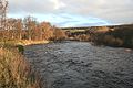
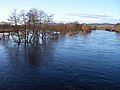 Spey in flood from Broomhill Bridge - geograph.org.uk - 338658.jpg 640 × 480; 131 KB
-
 St Mary Elms Cottage, Ipswich - geograph.org.uk - 290359.jpg 640 × 427; 76 KB
-
 St Peter's Church, Claydon - geograph.org.uk - 290383.jpg 640 × 427; 94 KB
-

-
 St Peter, Arkley, Herts - East end - geograph.org.uk - 379888.jpg 479 × 640; 90 KB
-
 St Peter, Arkley, Herts - Font - geograph.org.uk - 379886.jpg 433 × 640; 80 KB
-
 St Peter, Arkley, Herts - geograph.org.uk - 379879.jpg 640 × 402; 93 KB
-
 St Peter, Arkley, Herts - Organ - geograph.org.uk - 379885.jpg 481 × 640; 80 KB
-
 St Peter, Arkley, Herts - West end - geograph.org.uk - 379890.jpg 480 × 640; 87 KB
-
 St.Marys Church, Willesden NW10 - geograph.org.uk - 297131.jpg 480 × 640; 139 KB
-
 Stainforth Scar - geograph.org.uk - 290635.jpg 640 × 393; 80 KB
-
 Sundial Cottage, Biggin (290270 01abc1d5-by-John-Poyser).jpg 640 × 480; 123 KB
-
 Sundial House. - geograph.org.uk - 290273.jpg 640 × 480; 118 KB
-
 Sunnyside Farm - geograph.org.uk - 290245.jpg 640 × 480; 72 KB
-
 The Cross Keys, Henley - geograph.org.uk - 290530.jpg 640 × 427; 53 KB
-
 The Dingle. - geograph.org.uk - 294646.jpg 640 × 480; 124 KB
-
 The Disused Mill. - geograph.org.uk - 290281.jpg 640 × 480; 125 KB
-
-
 The new footbridge. - geograph.org.uk - 290283.jpg 480 × 640; 119 KB
-
 The Promised Land. - geograph.org.uk - 290275.jpg 640 × 480; 128 KB
-
 The Queens Head Hedon.jpg 446 × 640; 84 KB
-
 The Wheel of Manchester - geograph.org.uk - 293207.jpg 480 × 640; 138 KB
-
 Town Farm, Deighton - geograph.org.uk - 290247.jpg 640 × 480; 85 KB
-
 Track above Sand Dale in Dalby Forest - geograph.org.uk - 290458.jpg 640 × 480; 113 KB
-
 Track along Hawldale Rigg in Dalby Forest - geograph.org.uk - 290447.jpg 640 × 480; 101 KB
-

-
 Track at Red Dike in Dalby Forest - geograph.org.uk - 290435.jpg 640 × 480; 130 KB
-
 Track junction in Dalby Forest - geograph.org.uk - 290444.jpg 640 × 480; 114 KB
-
-
 Track junction to Jingleby Thorn Farm - geograph.org.uk - 290434.jpg 640 × 480; 139 KB
-
 Triangulation pillar n Dalby Forest - geograph.org.uk - 290433.jpg 640 × 480; 106 KB
-

-
 Valley Farm - geograph.org.uk - 290970.jpg 640 × 480; 46 KB
-
 View towards Dinas - geograph.org.uk - 290733.jpg 640 × 480; 92 KB
-
-
 Vue Cinema, Summerland Gate, Exeter - geograph.org.uk - 292000.jpg 640 × 548; 88 KB
-
 Warning notice on mountain bike trail - geograph.org.uk - 290454.jpg 480 × 640; 122 KB
-
 Waterfall at Nant-ystalwyn - geograph.org.uk - 290967.jpg 480 × 640; 255 KB
-
 Watergate Farm, near Wark - geograph.org.uk - 290550.jpg 640 × 480; 51 KB
-
 Waterloo Road - geograph.org.uk - 290863.jpg 640 × 480; 105 KB
-
 Widworthy, by Homebush Cross - geograph.org.uk - 290355.jpg 427 × 640; 307 KB
-
 Widworthy, Homebush Cross - geograph.org.uk - 290344.jpg 640 × 427; 266 KB
-
 Widworthy, lane to recycling centre - geograph.org.uk - 290346.jpg 640 × 427; 253 KB
-
 Widworthy, near Widworthy Hill - geograph.org.uk - 290351.jpg 640 × 427; 264 KB
-
 Widworthy, Widworthy Barton - geograph.org.uk - 290348.jpg 640 × 427; 247 KB
-

-
 A narrow squeeze^ - geograph.org.uk - 290991.jpg 480 × 640; 280 KB
-
 Above the Tywi - geograph.org.uk - 290964.jpg 640 × 480; 138 KB
-
 Afon Tywi - geograph.org.uk - 290978.jpg 640 × 480; 200 KB
-
 Bales and barn - geograph.org.uk - 290626.jpg 640 × 480; 88 KB
-
 Bell's Cottage, Banks - geograph.org.uk - 802358.jpg 640 × 480; 71 KB
-
 Bleak moorland - geograph.org.uk - 290455.jpg 640 × 480; 94 KB
-
 Bollard on the Dingle Footbridge - geograph.org.uk - 290213.jpg 480 × 640; 84 KB
-
 Bridleway to Berghersh House - geograph.org.uk - 290527.jpg 640 × 427; 74 KB
-
 Cheviot Hill countryside - geograph.org.uk - 290451.jpg 640 × 480; 96 KB
-
 Cheviot Hills moorland - geograph.org.uk - 290479.jpg 640 × 480; 76 KB
-
 Craig y Fintan - geograph.org.uk - 290609.jpg 480 × 640; 268 KB
-
 Cwm Nant Y Gerwyn - geograph.org.uk - 290966.jpg 640 × 480; 139 KB
-
 Cwmberwyn - geograph.org.uk - 290613.jpg 640 × 480; 161 KB
-
 Cwmberwyn - geograph.org.uk - 290627.jpg 640 × 480; 169 KB
-
 Cwmberwyn and Craig Clogan - geograph.org.uk - 290624.jpg 480 × 640; 216 KB


_above_the_Warks_Burn_-_geograph.org.uk_-_290554.jpg)


.jpg)


