Category:United Kingdom photographs taken on 2006-12-07
Countries of Europe: Austria · Czech Republic · France‡ · Georgia‡ · Germany · Greece · Italy · Netherlands‡ · Poland · Portugal‡ · Russia‡ · Slovakia · Spain‡ · Sweden · United Kingdom
‡: partly located in Europe
‡: partly located in Europe
| ← | 7 December 2006 | → | ||
| ← | December 2006 | → | ||

United Kingdom photographs taken on 7 December 2006.
Image files should be categorized here automatically using {{taken on}} template. Direct categorisation is also possible, if automatic is impossible.
Subcategories
This category has only the following subcategory.
Media in category "United Kingdom photographs taken on 2006-12-07"
The following 57 files are in this category, out of 57 total.
-
 Allotment Gardens, Withernsea - geograph.org.uk - 290680.jpg 640 × 451; 99 KB
-
 Ashbourne Airfield - geograph.org.uk - 316675.jpg 640 × 480; 119 KB
-
 Ballasting the track at the Maze Station - geograph.org.uk - 334822.jpg 640 × 426; 148 KB
-
 Christmas Shopping - geograph.org.uk - 290734.jpg 480 × 640; 88 KB
-
 Christmas Shopping - geograph.org.uk - 290737.jpg 480 × 640; 109 KB
-
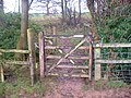
 Church footpath - geograph.org.uk - 291236.jpg 640 × 480; 122 KB
-
 Cranes, Salford Quays - geograph.org.uk - 293210.jpg 480 × 640; 84 KB
-
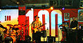 Edgar Broughton Band at the 100 Club 1.jpg 1,024 × 533; 179 KB
-
 Felpham Beach - geograph.org.uk - 1010740.jpg 640 × 480; 150 KB
-
 Fly Swatting - geograph.org.uk - 290764.jpg 640 × 480; 81 KB
-
 Former Council Offices - geograph.org.uk - 290732.jpg 480 × 640; 113 KB
-

-
 Glarryford level crossing - geograph.org.uk - 290723.jpg 640 × 426; 129 KB
-
 Estate Agents Ipswich - geograph.org.uk - 290769.jpg 640 × 480; 116 KB
-
 Building Society - geograph.org.uk - 290766.jpg 480 × 640; 92 KB
-
 Lowry Outlet Mall - geograph.org.uk - 293208.jpg 640 × 480; 79 KB
-
 M and S Ipswich - geograph.org.uk - 290763.jpg 480 × 640; 69 KB
-
 Mind the gap - geograph.org.uk - 290686.jpg 480 × 640; 81 KB
-
 Norwich Union - geograph.org.uk - 290731.jpg 640 × 480; 68 KB
-
 Nunsclough brook footbridge. - geograph.org.uk - 291291.jpg 640 × 480; 118 KB
-
 Offices, Salford Quays - geograph.org.uk - 293209.jpg 640 × 480; 111 KB
-
 Portrush lifeboat station - geograph.org.uk - 290715.jpg 640 × 426; 136 KB
-
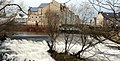 River Colne Weir - geograph.org.uk - 497089.jpg 640 × 323; 126 KB
-
 Shore Cottage - geograph.org.uk - 417303.jpg 640 × 480; 136 KB
-
 St Peter's Church, Broughton - geograph.org.uk - 290915.jpg 640 × 488; 35 KB
-
 Sunderland Stadium of Light at night - geograph.org.uk - 301015.jpg 640 × 480; 88 KB
-
 The Antrim-Ballymena road - geograph.org.uk - 290729.jpg 640 × 426; 86 KB
-
 The bla hole at Portstewart - geograph.org.uk - 290711.jpg 640 × 426; 160 KB
-
 The Glazert Burn - geograph.org.uk - 290727.jpg 480 × 640; 80 KB
-
 The Killagan Water at Glarryford - geograph.org.uk - 290720.jpg 640 × 426; 120 KB
-
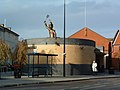
 Transporter Bridge Control Building - geograph.org.uk - 292868.jpg 480 × 640; 75 KB
-
 Tree hit by lightning - geograph.org.uk - 291295.jpg 480 × 640; 118 KB
-
 Union Road Bridge, New Mills - geograph.org.uk - 387535.jpg 640 × 427; 163 KB
-
 Violet Court, Wythenshawe before demoltion - panoramio.jpg 2,048 × 1,536; 700 KB
-
 W.H.Smiths Ipswich - geograph.org.uk - 290739.jpg 480 × 640; 105 KB
-
 Waxholme Road, Owthorne - geograph.org.uk - 290682.jpg 640 × 440; 107 KB
-
 Wetherden village - geograph.org.uk - 290708.jpg 640 × 427; 65 KB
-
 Winter hedgerow fruits - geograph.org.uk - 309348.jpg 640 × 480; 511 KB
-
 Wythenshawe Bus Station, 7 Dcmber 2006.jpg 2,048 × 1,536; 563 KB
-
 Below Taylor's Hill - geograph.org.uk - 290688.jpg 640 × 425; 111 KB
-
 Brook below Compton Grove - geograph.org.uk - 290709.jpg 640 × 480; 80 KB
-
 Field near Compton Hill Barn - geograph.org.uk - 290701.jpg 640 × 480; 100 KB
-
 Footpath across waterlogged field - geograph.org.uk - 290713.jpg 640 × 480; 74 KB
-
 Footpath to Maypole Green - geograph.org.uk - 290712.jpg 640 × 427; 84 KB
-
 Footpath to Shelland - geograph.org.uk - 290710.jpg 640 × 427; 73 KB
-
 Green Farm. - geograph.org.uk - 291287.jpg 640 × 480; 114 KB
-
 Hawthorns and power lines - geograph.org.uk - 290696.jpg 640 × 480; 82 KB
-

-

-
 Land Drainage System at Higher Ferry - geograph.org.uk - 301547.jpg 640 × 480; 180 KB
-
 Land Drainage System at Higher Ferry - geograph.org.uk - 301564.jpg 640 × 480; 178 KB
-
 Land Drainage System at Higher Ferry - geograph.org.uk - 301578.jpg 480 × 640; 202 KB
-
 Near Compton Grove - geograph.org.uk - 290699.jpg 640 × 480; 140 KB
-
 New Thropefield Farm - geograph.org.uk - 293458.jpg 640 × 480; 90 KB
-
 On Withington Hill - geograph.org.uk - 290691.jpg 640 × 491; 91 KB
-
 Thatched Garage - geograph.org.uk - 291255.jpg 640 × 480; 116 KB
-


