Category:United Kingdom photographs taken on 2007-01-28
Countries of Europe: Austria · Belarus · Belgium · Finland · France‡ · Germany · Greece · Hungary · Italy · Latvia · Netherlands‡ · Norway · Poland · Portugal‡ · Romania · Russia‡ · Slovakia · Spain‡ · Sweden · Switzerland · Turkey‡ · Ukraine · United Kingdom
Specific status: Gibraltar
‡: partly located in Europe
Specific status: Gibraltar
‡: partly located in Europe
| ← | 28 January 2007 | → | ||
| ← | January 2007 | → | ||

United Kingdom photographs taken on 28 January 2007.
Image files should be categorized here automatically using {{taken on}} template. Direct categorisation is also possible, if automatic is impossible.
Subcategories
This category has the following 12 subcategories, out of 12 total.
B
D
K
N
S
W
Media in category "United Kingdom photographs taken on 2007-01-28"
The following 200 files are in this category, out of 489 total.
(previous page) (next page)-
 47847 on 5Z58 York-Derby ECS (2792757382).jpg 1,600 × 1,200; 668 KB
-
 47847 on 5Z58 York-Derby ECS (2792835488).jpg 1,600 × 1,200; 653 KB
-

-
 Ashtead Common Depot and Ashtead Station - geograph.org.uk - 323393.jpg 640 × 480; 118 KB
-

-
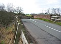
 Baildon Bridge, Baildon - Shipley - geograph.org.uk - 334389.jpg 640 × 480; 108 KB
-
 Barnett Wood Lane, Ashtead - geograph.org.uk - 323369.jpg 640 × 480; 110 KB
-
 Barnett Wood Lane, Ashtead - geograph.org.uk - 323378.jpg 640 × 480; 103 KB
-
 Barnstone Cement Works - geograph.org.uk - 324002.jpg 640 × 418; 75 KB
-
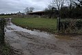
 Behind the flood bank - geograph.org.uk - 323836.jpg 640 × 427; 72 KB
-

-
 Black Lion Inn - geograph.org.uk - 323149.jpg 640 × 479; 105 KB
-
 Boats and Mudbanks, Stone Creek - geograph.org.uk - 759672.jpg 640 × 417; 194 KB
-
 Bog and bing - geograph.org.uk - 325288.jpg 480 × 640; 74 KB
-
 Church at Bowmanstead - geograph.org.uk - 323048.jpg 635 × 640; 87 KB
-
 Bradley Brook, the end of the road - geograph.org.uk - 323803.jpg 640 × 494; 123 KB
-
 Bridge - geograph.org.uk - 323052.jpg 640 × 480; 140 KB
-
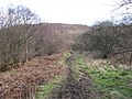
 Bridleway - geograph.org.uk - 324339.jpg 640 × 427; 89 KB
-

-
-
 Brook by the Welsh Marches footpath - geograph.org.uk - 323821.jpg 480 × 640; 145 KB
-
 Brook near Bradley Brook - geograph.org.uk - 323347.jpg 480 × 640; 176 KB
-
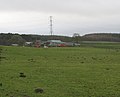
 Buncefield Oil Storage Depot - geograph.org.uk - 334054.jpg 640 × 473; 120 KB
-

-
 Burn of Care towards Castle Campbell - geograph.org.uk - 323398.jpg 640 × 480; 151 KB
-
 Car breakers at Stanley Crook - geograph.org.uk - 323148.jpg 640 × 480; 75 KB
-
 Channel Farm Cottages - geograph.org.uk - 323860.jpg 478 × 640; 102 KB
-
 Chapel, Lewes Road - geograph.org.uk - 323157.jpg 479 × 640; 128 KB
-

-

-
 Churchyard of St Mary's Church - geograph.org.uk - 323603.jpg 640 × 480; 150 KB
-
 Clee Liberty - geograph.org.uk - 323037.jpg 600 × 400; 112 KB
-
 Cliffs from Berwickshire Coastal path - geograph.org.uk - 323939.jpg 640 × 480; 132 KB
-
 Clifftops at Marshall Meadows Point - geograph.org.uk - 324241.jpg 640 × 480; 130 KB
-
 Coastline by Kinkell - geograph.org.uk - 323084.jpg 640 × 399; 55 KB
-
 Coastline North of Marshall Meadows - geograph.org.uk - 323188.jpg 640 × 480; 110 KB
-
 Collegiate Church of St. Mary - geograph.org.uk - 344480.jpg 640 × 480; 128 KB
-
 Commemorating Crux Easton Farms - geograph.org.uk - 323125.jpg 640 × 480; 130 KB
-
 Powers spiritual and temporal - geograph.org.uk - 323622.jpg 640 × 480; 55 KB
-
 Our Lady of Walsingham, Corby - geograph.org.uk - 323565.jpg 640 × 480; 59 KB
-
 Cottage in Rodmarton - geograph.org.uk - 323234.jpg 640 × 426; 108 KB
-
 Cottages in Long Street - geograph.org.uk - 324612.jpg 640 × 443; 96 KB
-
 Cottages on Ashtead Common - geograph.org.uk - 323420.jpg 640 × 480; 104 KB
-
 Craddocks Lane, Ashtead - geograph.org.uk - 323382.jpg 640 × 480; 111 KB
-
 Cross Street on a quiet morning - geograph.org.uk - 337705.jpg 640 × 473; 80 KB
-
 Cycle and foot path, A6116 - geograph.org.uk - 323670.jpg 640 × 480; 67 KB
-

-
 Debris at Baildon Bridge, Shipley - geograph.org.uk - 334378.jpg 640 × 470; 94 KB
-
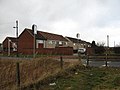
 Derby Moor School.jpg 640 × 428; 93 KB
-
 Disused railway bridge, Bawbrook - geograph.org.uk - 323483.jpg 640 × 465; 146 KB
-
 Driveway to Shenstone Court - geograph.org.uk - 323442.jpg 600 × 450; 255 KB
-
 Drop box at Spillar's Place, Omagh - geograph.org.uk - 323945.jpg 640 × 295; 35 KB
-
 East Growths, Patrington Haven - geograph.org.uk - 323850.jpg 640 × 479; 108 KB
-
 East of Patrington - geograph.org.uk - 323847.jpg 478 × 640; 93 KB
-
 Eastend Farm, Patrington - geograph.org.uk - 323844.jpg 640 × 534; 104 KB
-

-
 Eastfield, Patrington - geograph.org.uk - 323845.jpg 640 × 479; 107 KB
-
 Edge of Shotts - geograph.org.uk - 325829.jpg 640 × 480; 62 KB
-
 Electricity Pylon - geograph.org.uk - 323154.jpg 480 × 640; 125 KB
-
 Emer Bog boardwalk - geograph.org.uk - 1072892.jpg 400 × 600; 178 KB
-
 Entrance to farm building, Rodmarton - geograph.org.uk - 323996.jpg 640 × 426; 109 KB
-
 Epphaven Cove at High Tide - geograph.org.uk - 339824.jpg 640 × 427; 95 KB
-
 Eroded peat drain hole, South Grain - geograph.org.uk - 324337.jpg 640 × 480; 107 KB
-
 Essebourne Manor Hotel - geograph.org.uk - 323002.jpg 640 × 480; 172 KB
-
 Estate Entrance Arch - geograph.org.uk - 323019.jpg 480 × 640; 134 KB
-
 Extreme Fly-tipping - geograph.org.uk - 323421.jpg 640 × 428; 126 KB
-
 Farm Cottages - geograph.org.uk - 324613.jpg 640 × 427; 86 KB
-

-
 Farmland east of Burnaston - geograph.org.uk - 323330.jpg 640 × 428; 115 KB
-
 Farmland north of Findern - geograph.org.uk - 323343.jpg 640 × 428; 106 KB
-
 Farmland north of Findern - geograph.org.uk - 323352.jpg 640 × 428; 105 KB
-
 Feeding Time at the Whooper Pond - geograph.org.uk - 326014.jpg 640 × 421; 105 KB
-
 Fence along Forest Edge - geograph.org.uk - 323475.jpg 640 × 480; 118 KB
-
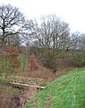 Footbridge and disused railway embankment - geograph.org.uk - 323810.jpg 506 × 640; 204 KB
-
 Forder Creek - geograph.org.uk - 331179.jpg 640 × 426; 247 KB
-
 Forder Viaduct - geograph.org.uk - 331168.jpg 640 × 427; 170 KB
-
 Forest Farm Entrance - geograph.org.uk - 324621.jpg 640 × 458; 125 KB
-
 Gated track off Woodgate. - geograph.org.uk - 323575.jpg 640 × 480; 316 KB
-
 Gateway Farm - geograph.org.uk - 1160415.jpg 640 × 480; 59 KB
-
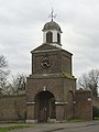 Gateway-Clocktower at Purfleet - geograph.org.uk - 323278.jpg 480 × 640; 73 KB
-
 George Inn - geograph.org.uk - 335099.jpg 640 × 481; 102 KB
-
 Great Oakley Hall.jpg 640 × 426; 208 KB
-
 Green Lane, Ashtead - geograph.org.uk - 323365.jpg 640 × 480; 113 KB
-
 Grizedale Beck - geograph.org.uk - 323380.jpg 640 × 480; 132 KB
-
 Hareshaw Moss - geograph.org.uk - 327198.jpg 640 × 480; 65 KB
-
 Hartwell Road, Long Street - geograph.org.uk - 324356.jpg 640 × 409; 96 KB
-
 Haverfield Lodge, Welwick - geograph.org.uk - 323848.jpg 640 × 444; 85 KB
-

-
 Hazleton Manor, Rodmarton - geograph.org.uk - 324000.jpg 640 × 426; 101 KB
-
 Heatherhead plantation - geograph.org.uk - 327195.jpg 640 × 480; 82 KB
-
 Holmside Hall - geograph.org.uk - 324508.jpg 640 × 480; 107 KB
-
 Home Truths On the A264 - geograph.org.uk - 323317.jpg 640 × 426; 102 KB
-
 James Watt College - geograph.org.uk - 323632.jpg 640 × 480; 184 KB
-
 Jubilee memorial, Waterhouses - geograph.org.uk - 323231.jpg 480 × 640; 77 KB
-

-

-

-
 Kings Head, High Street - geograph.org.uk - 323359.jpg 640 × 479; 102 KB
-
 Landing Stages, Stone Creek - geograph.org.uk - 759680.jpg 640 × 438; 162 KB
-
 Lane to Cock Road Farm - geograph.org.uk - 322780.jpg 430 × 640; 125 KB
-
 Leat at Brimhill - geograph.org.uk - 324493.jpg 480 × 640; 94 KB
-
 Linhouse Water - geograph.org.uk - 325101.jpg 640 × 480; 115 KB
-
 Links Road, Ashtead - geograph.org.uk - 323431.jpg 640 × 480; 120 KB
-
 Lizzie Brice's roundabout - geograph.org.uk - 325159.jpg 640 × 480; 59 KB
-

-
 Llyn Cwm Corsiog - geograph.org.uk - 338066.jpg 640 × 480; 73 KB
-
 Lodge to Shenstone Court - geograph.org.uk - 322921.jpg 600 × 450; 211 KB
-
 Looking N along Brambling Road. - geograph.org.uk - 323068.jpg 640 × 480; 231 KB
-

-
 Looking up Burn Crook - geograph.org.uk - 323429.jpg 640 × 480; 99 KB
-

-

-
 Lych Gate, East Hoathly Church - geograph.org.uk - 323342.jpg 479 × 640; 146 KB
-
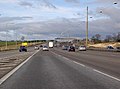 M1 at Junction 7, on a quiet day - geograph.org.uk - 336589.jpg 640 × 473; 68 KB
-
 M20 Bridge over Brands Hatch Road - geograph.org.uk - 323331.jpg 640 × 428; 103 KB
-
 Maiden's Rock - geograph.org.uk - 322872.jpg 463 × 640; 85 KB
-
 Marshall Meadows - geograph.org.uk - 323962.jpg 640 × 480; 55 KB
-
 Merse View - geograph.org.uk - 326020.jpg 640 × 430; 100 KB
-
 Mersey bridges - geograph.org.uk - 323990.jpg 640 × 483; 73 KB
-
 Modern Art^ - geograph.org.uk - 323618.jpg 480 × 640; 105 KB
-
 Muddy track in Gorsley Wood. - geograph.org.uk - 323542.jpg 640 × 480; 203 KB
-
 Muldron - geograph.org.uk - 325541.jpg 640 × 515; 60 KB
-
 Murieston Water - geograph.org.uk - 325137.jpg 640 × 480; 147 KB
-
 New entrance to Thickbroom Farm - geograph.org.uk - 323367.jpg 600 × 450; 227 KB
-
 New flood bank at Paull Holme Strays - geograph.org.uk - 323833.jpg 640 × 427; 74 KB
-
 New foot and bridleway bridge over A38 - geograph.org.uk - 323333.jpg 600 × 450; 181 KB
-
 New Houses near the Fountain Inn, Hythe - geograph.org.uk - 381109.jpg 640 × 480; 100 KB
-
 Oakbank Bing - geograph.org.uk - 325103.jpg 640 × 480; 119 KB
-
 Old entrance to Thickbroom Farm - geograph.org.uk - 323353.jpg 400 × 533; 236 KB
-
 Orienteering, Calder Wood - geograph.org.uk - 325153.jpg 640 × 480; 123 KB
-
 Oystercatchers on the Tee - geograph.org.uk - 324224.jpg 640 × 480; 99 KB
-
 Pastures Avenue, Littleover - geograph.org.uk - 323631.jpg 640 × 428; 107 KB
-
 Paull Holme Strays - geograph.org.uk - 323828.jpg 640 × 427; 84 KB
-
 Paull lighthouse - geograph.org.uk - 323838.jpg 480 × 640; 78 KB
-

-
 Peffermill Court, Edinburgh, Scotland.jpg 1,280 × 1,024; 76 KB
-
 Pheasant Shooting Range among coppices - geograph.org.uk - 328523.jpg 640 × 430; 105 KB
-
 Phone box, Bon Accord Crescent - geograph.org.uk - 327189.jpg 640 × 480; 70 KB
-
 Phone box, Forncett St Mary - geograph.org.uk - 323474.jpg 640 × 426; 136 KB
-
 Pigs living by the common - geograph.org.uk - 323207.jpg 640 × 430; 110 KB
-
 Pill Box at Aston Down - geograph.org.uk - 323428.jpg 640 × 426; 138 KB
-

-
 Pole Gutter Cottage - geograph.org.uk - 323059.jpg 400 × 600; 115 KB
-
 Porth Cynfor - geograph.org.uk - 330451.jpg 640 × 426; 89 KB
-
 Porth Padrig from the headland - geograph.org.uk - 330527.jpg 427 × 640; 156 KB
-
 Post Office, High Street - geograph.org.uk - 323348.jpg 479 × 640; 136 KB
-

-
 Privet Copse and Woodhay Poor - geograph.org.uk - 323057.jpg 640 × 480; 111 KB
-
 Prospect - Trust - geograph.org.uk - 323692.jpg 640 × 480; 180 KB
-
 Pump House, Rodmarton - geograph.org.uk - 323257.jpg 426 × 640; 103 KB
-
 Pumping station on Covet Lane. - geograph.org.uk - 323376.jpg 640 × 480; 172 KB
-
 Puzzle, Carron Crag - geograph.org.uk - 323279.jpg 480 × 640; 104 KB
-
 Railway Bridge, near Hapton - geograph.org.uk - 323402.jpg 640 × 426; 147 KB
-
 Railway Bridge-Road Junction near Coton - geograph.org.uk - 324164.jpg 640 × 444; 151 KB
-
 Railway lines - geograph.org.uk - 339798.jpg 640 × 480; 109 KB
-
 Railway Viaduct over M25 - geograph.org.uk - 334301.jpg 640 × 473; 56 KB
-
 Rainbow over Cairn Aosda - geograph.org.uk - 327501.jpg 640 × 481; 57 KB
-
 Ride, Wee Eldrick - geograph.org.uk - 325534.jpg 640 × 480; 86 KB
-
 Road closed - geograph.org.uk - 325717.jpg 640 × 480; 49 KB
-
 Road through Charlton Marshall - geograph.org.uk - 322782.jpg 640 × 430; 133 KB
-
 Road to Highland Court Farm. - geograph.org.uk - 323113.jpg 640 × 480; 188 KB
-
 Rock and Spindle - geograph.org.uk - 322949.jpg 424 × 640; 62 KB
-
 Rock and Spindle - geograph.org.uk - 322958.jpg 640 × 424; 51 KB
-
 Water Tower - geograph.org.uk - 323498.jpg 640 × 480; 105 KB
-
 Rodmarton church - geograph.org.uk - 323221.jpg 426 × 640; 88 KB
-
 Romach boathouse. - geograph.org.uk - 323297.jpg 640 × 426; 129 KB
-

-
 Roman Road to Shapwick - geograph.org.uk - 322756.jpg 430 × 640; 84 KB
-

-
 Shooters Positions in the Pasture - geograph.org.uk - 323032.jpg 640 × 480; 113 KB
-
 South Field, Patrington - geograph.org.uk - 323849.jpg 640 × 478; 79 KB
-
 Springhill - geograph.org.uk - 325830.jpg 640 × 405; 47 KB
-
 St Barnabas Church, Danesmoor - geograph.org.uk - 322852.jpg 640 × 480; 104 KB
-
 St Michael's - geograph.org.uk - 323580.jpg 640 × 426; 207 KB
-
 St Michael's Church - geograph.org.uk - 323574.jpg 640 × 426; 197 KB
-
 St Nicholas church, Cherington - geograph.org.uk - 323322.jpg 640 × 426; 116 KB
-
 St Stephen's Church, Saltash - geograph.org.uk - 331185.jpg 640 × 426; 166 KB
-
 Steel Structure Of Pylon - geograph.org.uk - 323175.jpg 640 × 480; 130 KB
-
 Steps, Oakbank Bing - geograph.org.uk - 325094.jpg 480 × 640; 133 KB
-
 Stone Creek, Holderness - geograph.org.uk - 759665.jpg 640 × 404; 146 KB
-
-
 Thatched Cottages - geograph.org.uk - 324285.jpg 640 × 453; 114 KB
-
 The Bell, Kemsing - geograph.org.uk - 323097.jpg 640 × 428; 104 KB
-

-
 The Glenaidan Centre - geograph.org.uk - 487985.jpg 350 × 174; 49 KB
-

-
 The Lees, near Bradley Brook - geograph.org.uk - 323776.jpg 640 × 480; 141 KB
-

-

-
 The Watts Arms in Hanslope - geograph.org.uk - 324617.jpg 640 × 459; 89 KB
-
 The Wheatsheaf , St. Helen Auckland - geograph.org.uk - 323238.jpg 640 × 451; 76 KB
-
 The Whooper Pond - geograph.org.uk - 326009.jpg 640 × 474; 102 KB
-
 Thorpe Hill, Welwick - geograph.org.uk - 323846.jpg 640 × 479; 52 KB
-
 Toronto - geograph.org.uk - 323184.jpg 640 × 446; 77 KB
-
 Tower Field, Caerlaverock - geograph.org.uk - 326031.jpg 640 × 465; 88 KB
-

-
 Track around Launceston Wood - geograph.org.uk - 323169.jpg 430 × 640; 106 KB
-
 Track off Bakeacre Lane - geograph.org.uk - 323364.jpg 640 × 428; 109 KB
-
 Track through Fermyn Woods - geograph.org.uk - 324310.jpg 640 × 480; 79 KB
-
 Track to Cock Road Farm - geograph.org.uk - 322763.jpg 640 × 430; 166 KB
.jpg)
.jpg)


