Category:United Kingdom photographs taken on 2007-04-14
Countries of Europe: Austria · Belgium · Bulgaria · Czech Republic · Denmark · Finland · France‡ · Germany · Greece · Hungary · Italy · Latvia · Monaco · Netherlands‡ · Norway · Poland · Portugal‡ · Romania · Russia‡ · Slovakia · Spain‡ · Sweden · Switzerland · Turkey‡ · Ukraine · United Kingdom
‡: partly located in Europe
‡: partly located in Europe
| ← | 14 April 2007 | → | ||
| ← | April 2007 | → | ||

United Kingdom photographs taken on 14 April 2007.
Image files should be categorized here automatically using {{taken on}} template. Direct categorisation is also possible, if automatic is impossible.
Subcategories
This category has the following 5 subcategories, out of 5 total.
L
S
W
Media in category "United Kingdom photographs taken on 2007-04-14"
The following 200 files are in this category, out of 1,243 total.
(previous page) (next page)-
 "Family outing", Solihull - geograph.org.uk - 403875.jpg 640 × 283; 52 KB
-
 "The Village", Brancepeth - geograph.org.uk - 401705.jpg 640 × 480; 82 KB
-
 'High Light' Thorngumbald Clough - geograph.org.uk - 400571.jpg 480 × 640; 93 KB
-
 'High Light' Thorngumbald Clough - geograph.org.uk - 400577.jpg 475 × 640; 94 KB
-
 'High Light' Thorngumbald Clough - geograph.org.uk - 400588.jpg 480 × 640; 140 KB
-
 'Low Light' Thorngumbald Clough - geograph.org.uk - 400564.jpg 480 × 640; 85 KB
-
 'Low Light' Thorngumbald Clough - geograph.org.uk - 400595.jpg 480 × 640; 92 KB
-
 'S' for Sugar - geograph.org.uk - 401353.jpg 640 × 480; 114 KB
-
 102 to Brent Cross - geograph.org.uk - 401249.jpg 640 × 480; 124 KB
-
 12-14 Claremont - geograph.org.uk - 400670.jpg 640 × 544; 333 KB
-
 13-15 Claremont - geograph.org.uk - 400673.jpg 640 × 429; 237 KB
-
 194 Grafton Street Little Horton - geograph.org.uk - 400607.jpg 429 × 640; 249 KB
-
 332009 at Royal Oak.JPG 1,905 × 1,065; 1.42 MB
-
 360204 at Royal Oak.JPG 2,857 × 1,700; 3.37 MB
-
 Adelante at Royal Oak 14-4-07.JPG 2,815 × 1,467; 2.96 MB
-
 21 Paradise Fold - geograph.org.uk - 400688.jpg 640 × 429; 271 KB
-
 34, Chat Hill Road - geograph.org.uk - 401248.jpg 640 × 429; 238 KB
-
 4, Claremont - geograph.org.uk - 400664.jpg 640 × 421; 245 KB
-
-
 49, Elizabeth Street, Little Horton - geograph.org.uk - 400610.jpg 640 × 479; 254 KB
-
 56 to 50 Melbourne Place, Little Horton - geograph.org.uk - 400661.jpg 640 × 429; 228 KB
-
 64, Little Horton Lane - geograph.org.uk - 400632.jpg 640 × 461; 238 KB
-

-
 72, Little Horton Lane - geograph.org.uk - 400625.jpg 640 × 499; 324 KB
-
 9-11 Claremont - geograph.org.uk - 400677.jpg 640 × 404; 223 KB
-
 A 849 - geograph.org.uk - 401372.jpg 640 × 480; 78 KB
-
 A 849 - geograph.org.uk - 401381.jpg 640 × 480; 73 KB
-
 A 99 Please^ - geograph.org.uk - 401264.jpg 640 × 469; 156 KB
-
 A clearing deep in the forest - geograph.org.uk - 405956.jpg 640 × 480; 158 KB
-
 A fence and rough grazing - geograph.org.uk - 400444.jpg 635 × 440; 97 KB
-
 A Great Holland Pond - geograph.org.uk - 402174.jpg 640 × 426; 124 KB
-
 A house below Coed Craig Forris - geograph.org.uk - 403448.jpg 640 × 480; 154 KB
-

-
 A peaceful oasis - geograph.org.uk - 400861.jpg 640 × 480; 86 KB
-

-
 A38 between Burton and Derby - geograph.org.uk - 403009.jpg 640 × 480; 136 KB
-
 A380 bridge over the Teign - geograph.org.uk - 409895.jpg 640 × 480; 178 KB
-
 Abandoned cars at Bryn Melyn - geograph.org.uk - 401303.jpg 640 × 480; 155 KB
-
 About to depart from Sydenham station - geograph.org.uk - 400289.jpg 640 × 426; 129 KB
-
 Above Old Lance Cliff, Robin Hood's Bay - geograph.org.uk - 762249.jpg 640 × 407; 198 KB
-
 Above Prison Band - geograph.org.uk - 401358.jpg 640 × 480; 97 KB
-
 ABP Buoy Quay, Albert Dock, Hull - geograph.org.uk - 400657.jpg 640 × 389; 107 KB
-
 Abutment of former railway bridge - geograph.org.uk - 400700.jpg 429 × 640; 216 KB
-
 Abutment of former railway bridge - geograph.org.uk - 400705.jpg 640 × 476; 261 KB
-
 Access cutting to Bwlch Gwyn Quarry - geograph.org.uk - 405565.jpg 480 × 640; 162 KB
-
 Access to Bear's Den - geograph.org.uk - 400946.jpg 640 × 480; 68 KB
-
 Access track on Langhope Height - geograph.org.uk - 400801.jpg 640 × 480; 90 KB
-

-
 Aerial walkway, Stover Country Park - geograph.org.uk - 409018.jpg 480 × 640; 341 KB
-
 Afon Fechan - geograph.org.uk - 401286.jpg 640 × 480; 143 KB
-
 Afon Fechan Ford - geograph.org.uk - 401277.jpg 640 × 480; 153 KB
-
 Afon Groes - geograph.org.uk - 401773.jpg 640 × 480; 147 KB
-

-
 Afon Twrch - geograph.org.uk - 401547.jpg 640 × 480; 150 KB
-
 Aglais io - geograph.org.uk - 488074.jpg 640 × 416; 256 KB
-
 Alexandra Terrace, Teignmouth - geograph.org.uk - 408318.jpg 640 × 480; 101 KB
-
-
 Allt Ghillecaluim - geograph.org.uk - 401363.jpg 640 × 480; 115 KB
-

-
 Alms Houses, Warwick - geograph.org.uk - 403858.jpg 640 × 480; 61 KB
-
 Along The River Humber - geograph.org.uk - 400548.jpg 640 × 480; 132 KB
-
 Along The River Humber - geograph.org.uk - 400599.jpg 640 × 476; 112 KB
-

-
 Amberley Castle - geograph.org.uk - 826457.jpg 426 × 640; 64 KB
-
 Amhainn Barr Chailleach - geograph.org.uk - 401396.jpg 640 × 480; 116 KB
-

-
 Ancient yew, St. Mary, Astbury.jpg 1,600 × 1,200; 432 KB
-
 Angel Wings, near Clovelly - geograph.org.uk - 467508.jpg 640 × 426; 158 KB
-
 Anstruther war memorial - geograph.org.uk - 400672.jpg 640 × 424; 120 KB
-
 Anstruther Wester - geograph.org.uk - 400647.jpg 640 × 424; 87 KB
-
 Apeton Manor Farm - geograph.org.uk - 401263.jpg 600 × 450; 232 KB
-
 Approaching Gorstain from the north - geograph.org.uk - 401141.jpg 640 × 480; 83 KB
-
 Approaching Sydenham station - geograph.org.uk - 400295.jpg 640 × 426; 139 KB
-
-
 Arnfield Clough - geograph.org.uk - 400833.jpg 640 × 480; 114 KB
-
 Arnfield Clough and Moorland - geograph.org.uk - 400883.jpg 640 × 480; 104 KB
-
 Arnfield Moor - geograph.org.uk - 400815.jpg 640 × 471; 104 KB
-
 Ashford to Canterbury railway line - geograph.org.uk - 402249.jpg 640 × 480; 77 KB
-
 Ashmore Brook - geograph.org.uk - 424338.jpg 640 × 480; 93 KB
-
 Ashtree Court - geograph.org.uk - 412927.jpg 640 × 480; 62 KB
-
 Assura Pharmacy, Pasture Lane. - geograph.org.uk - 400756.jpg 640 × 351; 171 KB
-

-

-
 Back Fold, off Low Lane - geograph.org.uk - 400884.jpg 640 × 429; 255 KB
-
 Back Street at side of Ivy House - geograph.org.uk - 400641.jpg 429 × 640; 218 KB
-
 Badachro River - geograph.org.uk - 401320.jpg 640 × 480; 104 KB
-
 Bala Lake in the smoke. - geograph.org.uk - 404138.jpg 640 × 480; 55 KB
-
 Balvenie Distillery - geograph.org.uk - 401338.jpg 640 × 480; 104 KB
-
 Balvenie Street, Dufftown - geograph.org.uk - 401347.jpg 640 × 480; 91 KB
-
 Bar Censa, Solihull - geograph.org.uk - 403884.jpg 640 × 527; 91 KB
-
 Barn - geograph.org.uk - 402243.jpg 640 × 480; 120 KB
-
 Barn - geograph.org.uk - 406935.jpg 640 × 480; 122 KB
-
 Barn near Water Houses - geograph.org.uk - 401066.jpg 640 × 480; 118 KB
-
 Beamsley Hospital, Beamsley - geograph.org.uk - 402200.jpg 640 × 475; 123 KB
-
 Beamsley Lane, Beamsley - geograph.org.uk - 402040.jpg 640 × 475; 119 KB
-
 Beamsley Mill, Beamsley - geograph.org.uk - 402165.jpg 640 × 474; 87 KB
-
 Beaulieu Heath, New Forest - geograph.org.uk - 407141.jpg 640 × 480; 80 KB
-
 Beer Festival at Tuckers Maltings - geograph.org.uk - 403054.jpg 427 × 640; 128 KB
-
 Beer Festival at Tuckers Maltings - geograph.org.uk - 403060.jpg 640 × 426; 89 KB
-
 Beinn a' Chreachain - Flickr - Graham Grinner Lewis.jpg 2,048 × 1,536; 653 KB
-
 Berners Wood - geograph.org.uk - 400576.jpg 428 × 640; 498 KB
-
 Berry Brow - Gold Hill - geograph.org.uk - 633116.jpg 640 × 480; 66 KB
-
 Beverley Wood, north of Great Smeaton - geograph.org.uk - 400480.jpg 640 × 480; 154 KB
-
 Birk Fell Hawse - geograph.org.uk - 402103.jpg 640 × 480; 88 KB
-
 Bitton Park Bowls Club, Teignmouth - geograph.org.uk - 408370.jpg 640 × 480; 70 KB
-
 Black guillemots, Bangor harbour (4) - geograph.org.uk - 400314.jpg 640 × 426; 111 KB
-
 Blackchurch Rock, Mouthmill Beach - geograph.org.uk - 420638.jpg 426 × 640; 123 KB
-
 Blackthorn blossoms - geograph.org.uk - 409887.jpg 640 × 480; 342 KB
-
 Bluebells in Berners Wood - geograph.org.uk - 401433.jpg 428 × 640; 484 KB
-
 Bluebells in Lower Brienton woods - geograph.org.uk - 454349.jpg 640 × 480; 152 KB
-
 Bourton Heath - geograph.org.uk - 401917.jpg 640 × 480; 130 KB
-
 Bourton Heath - geograph.org.uk - 403719.jpg 640 × 480; 94 KB
-
 Bourton-On-Dunsmore - geograph.org.uk - 400821.jpg 640 × 480; 110 KB
-
 Bourton-On-Dunsmore - geograph.org.uk - 400839.jpg 640 × 480; 138 KB
-
 Bowling Green at Clayton Victoria Park - geograph.org.uk - 400822.jpg 640 × 429; 245 KB
-
 Bracken mulch - geograph.org.uk - 410829.jpg 640 × 480; 54 KB
-
 St Brandon's Church, Brancepeth.jpg 640 × 480; 64 KB
-
 Brancepeth Castle.jpg 640 × 480; 66 KB
-

-
-
 Brick barns at Apeton Manor Farm - geograph.org.uk - 401266.jpg 600 × 450; 254 KB
-
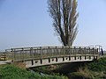
 Bridge - geograph.org.uk - 400988.jpg 640 × 480; 132 KB
-
-
 Bridge over The Stell - geograph.org.uk - 400552.jpg 640 × 480; 105 KB
-
 Bridges at Radcot - geograph.org.uk - 401223.jpg 640 × 480; 96 KB
-
 Bridle path at Clynmelyn - geograph.org.uk - 1240024.jpg 640 × 480; 165 KB
-
 Broomy Hill Water Tower - geograph.org.uk - 454415.jpg 640 × 480; 141 KB
-
 Bull Hill Farm, New Forest - geograph.org.uk - 408081.jpg 640 × 480; 87 KB
-
 Bullrushes , Stover Lake - geograph.org.uk - 409027.jpg 480 × 640; 256 KB
-
 Burghley House Grounds - geograph.org.uk - 661482.jpg 640 × 428; 54 KB
-
 Burghley House Grounds - geograph.org.uk - 661487.jpg 640 × 429; 64 KB
-
 Burghley House Grounds - geograph.org.uk - 661489.jpg 640 × 429; 66 KB
-
 Burray Northfield Coast.jpg 640 × 434; 157 KB
-

-
 Byway or bridleway^ - geograph.org.uk - 401123.jpg 640 × 428; 468 KB
-
 Caerfanell river - geograph.org.uk - 401229.jpg 640 × 480; 99 KB
-
 Cairn ,Wet Side Edge - geograph.org.uk - 401346.jpg 640 × 480; 101 KB
-
 Cairn on south tip of Cwar y Gigfran - geograph.org.uk - 401230.jpg 640 × 480; 92 KB
-
 Cairn, Wetherlam Edge - geograph.org.uk - 402083.jpg 640 × 480; 89 KB
-
 Castleford Flour Mill - geograph.org.uk - 401470.jpg 640 × 181; 32 KB
-
 Castlehill Farm Kingsley - geograph.org.uk - 407708.jpg 640 × 480; 131 KB
-
 Cata Sand Dunes and Beach - geograph.org.uk - 1070193.jpg 480 × 640; 41 KB
-
 Cattle Grid - geograph.org.uk - 401760.jpg 640 × 480; 116 KB
-
 Cefn Coch - geograph.org.uk - 401444.jpg 640 × 480; 123 KB
-
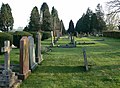 Cemetery in Countesthorpe near Leicester - geograph.org.uk - 401137.jpg 640 × 469; 122 KB
-
 Chalk pit - geograph.org.uk - 403654.jpg 640 × 480; 141 KB
-
 Charnock Richard - geograph.org.uk - 403888.jpg 640 × 287; 34 KB
-

-
 Chilham Castle from Soleshill Road - geograph.org.uk - 403663.jpg 640 × 480; 97 KB
-
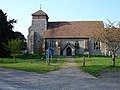 Church of St Peter, Molash - geograph.org.uk - 401184.jpg 640 × 480; 109 KB
-
 Cleat Hill Farm, Longdon Green - geograph.org.uk - 400381.jpg 640 × 480; 108 KB
-
 Cley Windmill.jpg 480 × 640; 62 KB
-
 Cliffs below Galantry Gower - geograph.org.uk - 420648.jpg 640 × 426; 123 KB
-
 Clitheroe Market - geograph.org.uk - 402445.jpg 640 × 480; 226 KB
-
 Clovelly church - geograph.org.uk - 407424.jpg 640 × 426; 134 KB
-
 Clovelly Harbour - geograph.org.uk - 420676.jpg 426 × 640; 124 KB
-
 Cockfosters Tube Depot - geograph.org.uk - 401590.jpg 640 × 480; 88 KB
-
 Cockfosters Tube Depot sidings - geograph.org.uk - 401600.jpg 640 × 480; 90 KB
-
 Coed Tyn y Fedw - geograph.org.uk - 401432.jpg 640 × 480; 154 KB
-
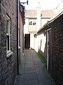 Coffee Yard - 2007-04-14.jpg 1,944 × 2,592; 2.01 MB
-
 Coirc Bheinn - the summit - geograph.org.uk - 402220.jpg 638 × 423; 78 KB
-
 Conisbrough Castle - geograph.org.uk - 406769.jpg 640 × 480; 66 KB
-
 Coot on nest, Stover Lake - geograph.org.uk - 409023.jpg 640 × 480; 316 KB
-
 Coot swimming in Stover lake - geograph.org.uk - 409025.jpg 640 × 480; 275 KB
-
 Cornice above Coire Loch Kander - geograph.org.uk - 403120.jpg 640 × 480; 101 KB
-
 Cottage Garden - geograph.org.uk - 411247.jpg 640 × 427; 290 KB
-
 Cottage ruins, Rhiwddolion - geograph.org.uk - 404469.jpg 640 × 480; 201 KB
-
 Cottages at Pilley Bailey, New Forest - geograph.org.uk - 401063.jpg 640 × 480; 106 KB
-
 Countesthorpe near Leicester - geograph.org.uk - 401134.jpg 640 × 560; 83 KB
-
 Country Road, west of Great Smeaton - geograph.org.uk - 400489.jpg 640 × 480; 56 KB
-
 Courtenay Avenue - geograph.org.uk - 401262.jpg 480 × 640; 187 KB
-
 Craignure Pier - geograph.org.uk - 403367.jpg 640 × 480; 82 KB
-
 Craignure.jpg 640 × 480; 61 KB
-
 Craoibh 435555.jpg 640 × 480; 106 KB
-

-
 Crocodile in the park - panoramio.jpg 1,600 × 1,200; 666 KB
-
 Crop Field - geograph.org.uk - 401099.jpg 640 × 480; 112 KB
-
 Cross In Hand Lane, Ashmore Brook - geograph.org.uk - 422489.jpg 640 × 480; 78 KB
-
 Crow Mills Bridge, South Wigston - geograph.org.uk - 401114.jpg 640 × 467; 110 KB
-
 Curving Furrows - geograph.org.uk - 400631.jpg 640 × 428; 293 KB
-
 Cwar y Gigfran - geograph.org.uk - 402185.jpg 640 × 480; 88 KB
-
 Cycle bridge near Nagden - geograph.org.uk - 400972.jpg 640 × 480; 62 KB
-
 Cycle track, Nagden Marshes - geograph.org.uk - 400984.jpg 640 × 480; 59 KB
-
 Daffodil plantation - geograph.org.uk - 400893.jpg 640 × 480; 92 KB
-

-

-
 Deansway - geograph.org.uk - 401242.jpg 640 × 480; 125 KB
-
 Deansway - geograph.org.uk - 401245.jpg 640 × 480; 170 KB
-
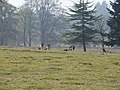 Deer at Deer Park - geograph.org.uk - 400494.jpg 640 × 480; 120 KB
-
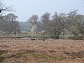 Deer Park - geograph.org.uk - 400493.jpg 640 × 480; 117 KB
-
 Deftones live brixton academy 2007.jpg 800 × 600; 111 KB
-
 Denne Manor Lane, Shottenden - geograph.org.uk - 403729.jpg 640 × 482; 88 KB
-
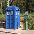 Derbyshire Police Box at Crich.jpg 1,024 × 1,024; 434 KB
-
 Desirable property^ - geograph.org.uk - 401182.jpg 640 × 480; 129 KB
-

-
 Dewsbury Road - geograph.org.uk - 401287.jpg 640 × 480; 93 KB
-
 Dismantled railway track bed - geograph.org.uk - 400526.jpg 425 × 640; 124 KB
-
 Draycote - geograph.org.uk - 400796.jpg 480 × 640; 166 KB
-
 Dreel viaduct - geograph.org.uk - 400616.jpg 454 × 640; 112 KB
-
 Dried peat hag on ridge to Beinn Sgiath - geograph.org.uk - 401126.jpg 640 × 426; 103 KB


_-_geograph.org.uk_-_400314.jpg)


.jpg)


