Category:United Kingdom photographs taken on 2007-04-10
Countries of Europe: Armenia‡ · Austria · Bosnia and Herzegovina · Finland · France‡ · Germany · Greece · Hungary · Republic of Ireland · Italy · Lithuania · Netherlands‡ · Norway · Poland · Portugal‡ · Romania · Russia‡ · Serbia · Spain‡ · Sweden · Switzerland · Turkey‡ · Ukraine · United Kingdom · Vatican City
‡: partly located in Europe
‡: partly located in Europe
| ← | 10 April 2007 | → | ||
| ← | April 2007 | → | ||

United Kingdom photographs taken on 10 April 2007.
Image files should be categorized here automatically using {{taken on}} template. Direct categorisation is also possible, if automatic is impossible.
Subcategories
This category has only the following subcategory.
S
Media in category "United Kingdom photographs taken on 2007-04-10"
The following 200 files are in this category, out of 587 total.
(previous page) (next page)-
 170206 at Marks Tey.jpg 3,648 × 2,736; 4.47 MB
-
 A ruined steading - geograph.org.uk - 396565.jpg 640 × 480; 52 KB
-
 A40 Brecon Bypass - geograph.org.uk - 396940.jpg 640 × 480; 135 KB
-
 Afon Tarell footbridges - geograph.org.uk - 396946.jpg 640 × 480; 220 KB
-
 Aglais io - geograph.org.uk - 396093.jpg 640 × 426; 112 KB
-
 Allt Mòr - geograph.org.uk - 456994.jpg 480 × 640; 108 KB
-
 Anstruther High Street - geograph.org.uk - 397458.jpg 640 × 371; 84 KB
-
 Anstruther Museum - geograph.org.uk - 397474.jpg 640 × 434; 91 KB
-
 Approaching Portaferry - geograph.org.uk - 640973.jpg 640 × 480; 69 KB
-
 Approaching the Bailey Bridge - geograph.org.uk - 400960.jpg 640 × 480; 64 KB
-
 Approaching the new footbridge - geograph.org.uk - 403183.jpg 640 × 480; 102 KB
-
 Ardchiavaig - geograph.org.uk - 456971.jpg 640 × 446; 58 KB
-
 Arrival at Strangford - geograph.org.uk - 640933.jpg 640 × 602; 61 KB
-
 Arrival on Iona - geograph.org.uk - 455645.jpg 640 × 480; 47 KB
-
 Back Street in Upper Largo - geograph.org.uk - 403381.jpg 640 × 480; 83 KB
-
 Bailey bridge over the River Ribble - geograph.org.uk - 397923.jpg 640 × 480; 72 KB
-
 Barmouth Parish Church - geograph.org.uk - 404490.jpg 640 × 480; 92 KB
-
 Barn - geograph.org.uk - 506666.jpg 452 × 640; 468 KB
-
 Beach and Sound - geograph.org.uk - 456702.jpg 640 × 480; 51 KB
-
 Beach, Baile Mòr - geograph.org.uk - 456722.jpg 640 × 480; 91 KB
-
 Beaconhill Plantation - geograph.org.uk - 397734.jpg 640 × 481; 69 KB
-
 Beccles station buildings - geograph.org.uk - 970010.jpg 640 × 480; 76 KB
-
 Beccles station buildings - geograph.org.uk - 970017.jpg 640 × 480; 67 KB
-
 Beckton DLR Station - geograph.org.uk - 401883.jpg 640 × 460; 143 KB
-
 Beckton, Garnet Walk, E6 - geograph.org.uk - 397529.jpg 640 × 480; 110 KB
-
 Beckton, Premier Travel Inn, E6 - geograph.org.uk - 397581.jpg 640 × 480; 86 KB
-
 Beech trees - geograph.org.uk - 396588.jpg 640 × 480; 67 KB
-
 Beestons Bus Sudbury -5.jpg 3,648 × 2,736; 3.91 MB
-
 Bend in the Old Railway Line - geograph.org.uk - 403478.jpg 640 × 480; 109 KB
-
 Blackbird on an aerial, Swindon - geograph.org.uk - 395870.jpg 640 × 480; 56 KB
-
 Boundary fence - geograph.org.uk - 396504.jpg 640 × 480; 63 KB
-
 Bowood House - panoramio.jpg 2,560 × 1,920; 1.88 MB
-
 Braco Hotel and Main Street - geograph.org.uk - 401020.jpg 640 × 480; 117 KB
-
 Bretby Business Park main entrance - geograph.org.uk - 398773.jpg 640 × 481; 78 KB
-
 Bretby Hall.jpg 640 × 467; 103 KB
-
 Bretby Nursing Home - Bretby park - geograph.org.uk - 398102.jpg 640 × 481; 104 KB
-
 Brinkworth Brook - geograph.org.uk - 395911.jpg 480 × 640; 132 KB
-
 Brinkworth Brook - geograph.org.uk - 395914.jpg 640 × 463; 85 KB
-
 Brizlincote Hall Farm - geograph.org.uk - 396791.jpg 640 × 472; 132 KB
-
 Brow Gill Beck joining Cam Beck - geograph.org.uk - 398348.jpg 640 × 359; 91 KB
-
 Burnage - Stagecoach 17699 (MW52UJF) rear.jpg 2,048 × 1,536; 861 KB
-
 Burnage - Stagecoach 17699 (MW52UJF).jpg 2,048 × 1,536; 861 KB
-
 Calder and Hebble Navigation - geograph.org.uk - 481591.jpg 640 × 480; 106 KB
-
 Cam Beck - geograph.org.uk - 398313.jpg 640 × 480; 80 KB
-
 Cam Beck, with fallen tree - geograph.org.uk - 398345.jpg 640 × 511; 162 KB
-
 Cardington village hall - geograph.org.uk - 774419.jpg 640 × 427; 88 KB
-
 Cars for restoration ^ - geograph.org.uk - 397236.jpg 640 × 480; 122 KB
-
 Castleman Trail, Crow, Ringwood - geograph.org.uk - 395963.jpg 640 × 480; 146 KB
-

-

-

-
 Chapel - geograph.org.uk - 396603.jpg 640 × 480; 71 KB
-
 Chesterstone Farm - geograph.org.uk - 403417.jpg 640 × 480; 91 KB
-
 Childe of Hale, Hale - geograph.org.uk - 396755.jpg 600 × 442; 93 KB
-
 Claerwen Farm House - geograph.org.uk - 1720264.jpg 1,600 × 1,067; 384 KB
-

-
 Close-Up of a Clee Hill Radar - geograph.org.uk - 453792.jpg 640 × 480; 128 KB
-
 Cnoc na Coinnich - geograph.org.uk - 457000.jpg 640 × 480; 90 KB
-
 Coed -y-foel-uchaf - geograph.org.uk - 396279.jpg 640 × 480; 79 KB
-

-
 Common Farm from Winshill - geograph.org.uk - 396890.jpg 640 × 481; 112 KB
-
 Coseley Railway Station.jpg 640 × 480; 143 KB
-
 Cottage at crematorium access road - geograph.org.uk - 398767.jpg 640 × 481; 84 KB
-
 Cruachan Mìn - geograph.org.uk - 457890.jpg 640 × 480; 89 KB
-
 Cruachan Mìn - geograph.org.uk - 457901.jpg 640 × 480; 51 KB
-
 Cruachan Mìn - geograph.org.uk - 457908.jpg 640 × 480; 100 KB
-
 Current footpath and unused trackway - geograph.org.uk - 397611.jpg 640 × 481; 84 KB
-
 Cwmystwyth Road - geograph.org.uk - 1720271.jpg 1,600 × 1,067; 204 KB
-
 Cycle path near Holy Island Causeway - geograph.org.uk - 409162.jpg 640 × 426; 141 KB
-
 Dawlish Warren , Beach - geograph.org.uk - 1156651.jpg 640 × 480; 63 KB
-
 Dawlish Warren , Beach and Coastline - geograph.org.uk - 1156635.jpg 640 × 480; 62 KB
-
 Dawlish Warren , Beach Road - geograph.org.uk - 1156616.jpg 640 × 480; 56 KB
-
 Dawlish Warren , Coastline - geograph.org.uk - 1156625.jpg 640 × 480; 47 KB
-
 Dawlish Warren , Green Space - geograph.org.uk - 1156699.jpg 640 × 480; 82 KB
-
 Dawlish Warren , Sand Dunes - geograph.org.uk - 1156643.jpg 640 × 480; 96 KB
-
 Dawlish Warren , Sand Sculpture - geograph.org.uk - 1156761.jpg 640 × 480; 73 KB
-
 Dawlish Warren , Sandy Beach - geograph.org.uk - 1156682.jpg 640 × 480; 72 KB
-
 Devil's Bridge Road - geograph.org.uk - 1720278.jpg 1,600 × 1,067; 361 KB
-

-
 Dover - Calais - panoramio.jpg 1,200 × 1,600; 167 KB
-
 Dreel Burn - geograph.org.uk - 396488.jpg 640 × 633; 139 KB
-
 Eider Ducks - geograph.org.uk - 400931.jpg 640 × 517; 101 KB
-
 Eilean a Chuilinn in Loch Sunart - geograph.org.uk - 412639.jpg 640 × 480; 153 KB
-
 Emirates Stadium, Highbury and its surrounds from the air.jpg 640 × 458; 140 KB
-
 Empire Road - an unusual road-s - geograph.org.uk - 396885.jpg 640 × 481; 73 KB
-

-

-
 Entering the housing estate - geograph.org.uk - 396685.jpg 640 × 481; 82 KB
-
-

-
 Ettington Park Manor - panoramio.jpg 2,272 × 1,704; 1.93 MB
-
 Exeter , Exeter Bus Station - geograph.org.uk - 1156769.jpg 640 × 480; 67 KB
-
 Faith, Hope and Charity - geograph.org.uk - 427183.jpg 480 × 640; 117 KB
-
 Farm at Easter Greenwells - geograph.org.uk - 396670.jpg 640 × 480; 66 KB
-
 Farm road to Abbot's Close - geograph.org.uk - 396015.jpg 640 × 480; 90 KB
-
 Farm road to Ingman Lodge - geograph.org.uk - 397229.jpg 640 × 480; 77 KB
-
 Farm track from Nether Lodge - geograph.org.uk - 403150.jpg 640 × 480; 51 KB
-
 Farm Track leading to Largo Law - geograph.org.uk - 403425.jpg 640 × 480; 113 KB
-

-
 Farnley Cemetery - Tong Road - geograph.org.uk - 396083.jpg 634 × 444; 96 KB
-

-
 Fields at Selside - geograph.org.uk - 398270.jpg 640 × 480; 61 KB
-

-
 Fields below Ingman Lodge - geograph.org.uk - 397879.jpg 640 × 480; 144 KB
-
 Fields, Iona - geograph.org.uk - 455659.jpg 640 × 480; 74 KB
-
 Fishing Boat, Johnshaven Road End - geograph.org.uk - 401785.jpg 640 × 480; 135 KB
-
 Fishing near Orchill - geograph.org.uk - 401048.jpg 640 × 480; 161 KB
-
 Font Green, Selside - geograph.org.uk - 398260.jpg 640 × 480; 74 KB
-
 Foot bridge over the river Meig - geograph.org.uk - 395952.jpg 512 × 384; 117 KB
-

-
 Footbridge over the A24 - geograph.org.uk - 396638.jpg 640 × 487; 55 KB
-
 Footpath Through the Gorse - geograph.org.uk - 403432.jpg 640 × 480; 155 KB
-
 Footpath to Jeff's Wood - geograph.org.uk - 398047.jpg 640 × 481; 69 KB
-
 Footpath to Stapenhill - geograph.org.uk - 398976.jpg 640 × 481; 96 KB
-
 Ford in Thirlby village. - geograph.org.uk - 396089.jpg 640 × 480; 145 KB
-
 Ford over Coppy Gill, Low Birkwith - geograph.org.uk - 398336.jpg 640 × 480; 130 KB
-

-
 Foreshore below the Heugh, Holy Island - geograph.org.uk - 409683.jpg 640 × 426; 120 KB
-
 Foreshore near Broadstones, Holy Island - geograph.org.uk - 401505.jpg 640 × 429; 170 KB
-
-
 Former course of Cam Beck - geograph.org.uk - 398304.jpg 640 × 480; 85 KB
-

-
 Fritham House, Tower in Wall - geograph.org.uk - 805550.jpg 482 × 640; 77 KB
-

-
 From whence we came - geograph.org.uk - 398056.jpg 640 × 481; 81 KB
-
 Gallery - geograph.org.uk - 455654.jpg 640 × 432; 60 KB
-
 Garbh Eilean in Loch Sunart - geograph.org.uk - 412646.jpg 640 × 480; 112 KB
-
 Garden - panoramio - fabiolah.jpg 2,272 × 1,704; 2.4 MB
-
 Garnedd Fawr - geograph.org.uk - 396520.jpg 640 × 480; 86 KB
-
 Gatehouse SW side - geograph.org.uk - 437232.jpg 640 × 480; 88 KB
-
 Glebe Farm at Fifield Bavant - geograph.org.uk - 401999.jpg 640 × 427; 114 KB
-
 Golf course at Limavady - geograph.org.uk - 496993.jpg 640 × 480; 162 KB
-
 Golf Course in Limavady - geograph.org.uk - 396552.jpg 640 × 480; 169 KB
-
 Good Friday Hill - geograph.org.uk - 484642.jpg 640 × 480; 187 KB
-
 Gothic - panoramio.jpg 2,272 × 1,704; 2.07 MB
-
 Grafton Small Holding - geograph.org.uk - 398033.jpg 640 × 481; 76 KB
-
-
 Great Barn and Nether Lodge - geograph.org.uk - 398357.jpg 640 × 480; 66 KB
-
 Green Farm - geograph.org.uk - 396865.jpg 640 × 480; 223 KB
-
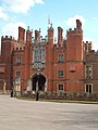 Hampton Court - geograph.org.uk - 396653.jpg 480 × 640; 68 KB
-
 Hampton Court garden - geograph.org.uk - 396633.jpg 640 × 480; 114 KB
-
 Harcamlow Way at Ashridge Common - geograph.org.uk - 396036.jpg 640 × 480; 102 KB
-
 Hatfield Moor, Nature Reserve. - geograph.org.uk - 397071.jpg 640 × 480; 73 KB
-
 Hay Bluff - panoramio - PJMarriott.jpg 3,072 × 2,304; 1.5 MB
-
 Hay Bluff - panoramio.jpg 3,072 × 2,304; 2.69 MB
-
 Hay on Wye - panoramio.jpg 3,072 × 2,304; 1.1 MB
-
 Head of the loch, Bunessan - geograph.org.uk - 457922.jpg 640 × 480; 53 KB
-
 Hergest Croft Gardens - panoramio - PJMarriott (1).jpg 3,072 × 2,304; 2.33 MB
-
 Hergest Croft Gardens - panoramio - PJMarriott (2).jpg 3,072 × 2,304; 2.13 MB
-
 Hergest Croft Gardens - panoramio - PJMarriott.jpg 3,072 × 2,304; 2.73 MB
-
 Hergest Croft Gardens - panoramio.jpg 3,072 × 2,304; 2.77 MB
-
 Heugh Hill Lighthouse, Holy Island - geograph.org.uk - 409658.jpg 444 × 640; 112 KB
-
 High Street Windows - geograph.org.uk - 396521.jpg 640 × 408; 70 KB
-
 High Street, Wootton Bassett - geograph.org.uk - 395930.jpg 640 × 444; 66 KB
-
 High Street, Wootton Bassett - geograph.org.uk - 395945.jpg 640 × 439; 76 KB
-
 Hills above Cleeton St Mary - geograph.org.uk - 453790.jpg 640 × 480; 152 KB
-
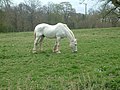 Horse grazing - geograph.org.uk - 398083.jpg 640 × 481; 118 KB
-
 Horse Grazing, near Codsall, Staffordshire - geograph.org.uk - 396323.jpg 1,299 × 1,080; 1.72 MB
-
 Houses on the Parrog - geograph.org.uk - 397006.jpg 640 × 463; 80 KB
-
 Iona fire station - geograph.org.uk - 456713.jpg 640 × 480; 56 KB
-
 Iona Post Office - geograph.org.uk - 455653.jpg 640 × 480; 75 KB
-
 Jumping field at Dale Farm - geograph.org.uk - 397706.jpg 640 × 481; 73 KB
-
 Killed Trees - geograph.org.uk - 485959.jpg 640 × 480; 172 KB
-
 Lakes at Bretby Hall - geograph.org.uk - 398996.jpg 640 × 481; 112 KB
-
 Largo Burn - geograph.org.uk - 403462.jpg 640 × 480; 165 KB
-
 Largo Law from its Subsidiary Top - geograph.org.uk - 403445.jpg 640 × 480; 75 KB
-
 Largo Serpentine Woodland - geograph.org.uk - 403457.jpg 640 × 480; 164 KB
-
 Lead downpipe on the School house - geograph.org.uk - 396826.jpg 480 × 640; 282 KB
-
-
 Limavady, Radisson Hotel.jpg 640 × 480; 146 KB
-
 Lime kiln hearth - geograph.org.uk - 399364.jpg 640 × 480; 149 KB
-
 Limestone outcrops and a lone tree - geograph.org.uk - 397891.jpg 450 × 600; 79 KB
-
 Loch Luichart dam - geograph.org.uk - 395981.jpg 512 × 384; 77 KB
-
 Loch Meig dam - geograph.org.uk - 395976.jpg 512 × 384; 65 KB
-
 Lochan by Cnoc Reamhar - geograph.org.uk - 457879.jpg 640 × 480; 66 KB
-
 Lodge at Farnley Cemetery - Tong Road - geograph.org.uk - 396073.jpg 636 × 464; 77 KB
-

-
 Looking NW to Fancott - geograph.org.uk - 395788.jpg 640 × 480; 50 KB
-
 Looking SE to Chalton - geograph.org.uk - 395785.jpg 480 × 640; 47 KB
-
 Looking SE to Chalton from Fancott - geograph.org.uk - 395848.jpg 640 × 439; 46 KB
-
 Looking SW along Sundon Road - geograph.org.uk - 395835.jpg 480 × 640; 50 KB
-
 Lossiemouth in Spring - geograph.org.uk - 679011.jpg 640 × 480; 63 KB
-
 Low Barn, Selside - geograph.org.uk - 398287.jpg 640 × 480; 139 KB
-
-
 Maespyllan - geograph.org.uk - 396549.jpg 640 × 480; 83 KB
-
 Manchester King Street - Stagecoach 18352 (MX55KOW) rear.jpg 2,048 × 1,536; 912 KB
-
 Mid Devon , A396 - geograph.org.uk - 1156786.jpg 640 × 480; 63 KB
-
 Middle Tongue Crag and screes - geograph.org.uk - 396298.jpg 640 × 427; 102 KB
-
 Moss's Motors, Thirsk - geograph.org.uk - 395989.jpg 640 × 480; 79 KB
-
 Mudchute farm pig side.jpg 2,272 × 1,704; 2.68 MB
-
 Nether Barn - geograph.org.uk - 398351.jpg 640 × 480; 94 KB
-
 New Water for Dale Farm - geograph.org.uk - 397756.jpg 640 × 481; 63 KB
-
 Newgate Wood - geograph.org.uk - 396044.jpg 640 × 480; 60 KB
-

-
 Newport Parrog - geograph.org.uk - 397023.jpg 640 × 480; 88 KB
-

-
 Newton Park Hotel - geograph.org.uk - 397648.jpg 640 × 481; 75 KB
-
 No 4 Littlemoor Road - geograph.org.uk - 396192.jpg 637 × 475; 61 KB
-
 Norman church within Ettington Park - panoramio.jpg 2,272 × 1,704; 2.18 MB
-


_rear.jpg)
.jpg)


,_Kingswood,_Staffordshire_-_geograph.org.uk_-_396404.jpg)


.jpg)
.jpg)


_rear.jpg)


