Category:United Kingdom photographs taken on 2007-06-03
Countries of Europe: Armenia‡ · Austria · Belgium · Bosnia and Herzegovina · Croatia · Czech Republic · Denmark · Estonia · Finland · France‡ · Georgia‡ · Germany · Greece · Hungary · Republic of Ireland · Italy · Latvia · Lithuania · Netherlands‡ · Norway · Poland · Romania · Russia‡ · Serbia · Slovakia · Spain‡ · Sweden · Switzerland · Turkey‡ · Ukraine · United Kingdom
Specific status: Isle of Man
‡: partly located in Europe
Specific status: Isle of Man
‡: partly located in Europe
| ← | 3 June 2007 | → | ||
| ← | June 2007 | → | ||

United Kingdom photographs taken on 3 June 2007.
Image files should be categorized here automatically using {{taken on}} template. Direct categorisation is also possible, if automatic is impossible.
Subcategories
This category has the following 7 subcategories, out of 7 total.
K
L
S
Media in category "United Kingdom photographs taken on 2007-06-03"
The following 200 files are in this category, out of 823 total.
(previous page) (next page)-
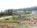
 'The Ride' is Closed - geograph.org.uk - 454234.jpg 600 × 450; 349 KB
-
 'Tin' barn, Nun Rig - geograph.org.uk - 454240.jpg 640 × 480; 53 KB
-

-
 A leafy lane - geograph.org.uk - 461916.jpg 640 × 480; 96 KB
-
-

-
 A360 towards Shrewton - geograph.org.uk - 454123.jpg 1,600 × 1,200; 618 KB
-
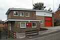
 Abergavenny Fire Station - geograph.org.uk - 460735.jpg 640 × 427; 168 KB
-
 Abersychan Fire Station - geograph.org.uk - 460716.jpg 640 × 427; 214 KB
-
 Absence of through route on Whiteley Lane - geograph.org.uk - 454602.jpg 640 × 427; 143 KB
-
 Access track for hop gardens - geograph.org.uk - 454273.jpg 640 × 480; 151 KB
-

-
 Adderbury Manor House - geograph.org.uk - 818088.jpg 640 × 355; 71 KB
-
 Air ambulance - geograph.org.uk - 454383.jpg 640 × 460; 93 KB
-
 Aldermaston railway station 1.JPG 2,160 × 1,440; 981 KB
-
 Aldermaston railway station 2.JPG 2,160 × 1,440; 882 KB
-
 All Terrain Buggies Jodie (1203532051).jpg 1,749 × 1,938; 2.13 MB
-
 Along Marriott's Way towards Reepham - geograph.org.uk - 454706.jpg 640 × 480; 92 KB
-
-
 Anchor at Jamaica Inn - geograph.org.uk - 462627.jpg 640 × 480; 78 KB
-
 Another urn at Anglesey Abbey - geograph.org.uk - 911477.jpg 640 × 441; 107 KB
-

-
 Approaching Garmartin - geograph.org.uk - 461928.jpg 640 × 480; 100 KB
-
 Ardmhor Ferry Terminus, Barra - geograph.org.uk - 602075.jpg 640 × 500; 68 KB
-
 Askernish House - geograph.org.uk - 603899.jpg 640 × 480; 62 KB
-
 AT Jodie (1203538991).jpg 2,130 × 2,169; 2.92 MB
-
 AT Linda1 (1203556069).jpg 2,820 × 1,935; 2.89 MB
-
 AT Linda2 (1204439534).jpg 2,415 × 1,599; 2.3 MB
-
 AT Sonia (1203545465).jpg 2,865 × 1,551; 2.58 MB
-
 AT Sonia2 (1203549275).jpg 1,680 × 1,256; 1.55 MB
-
 Axmouth Church Devon - geograph.org.uk - 454079.jpg 640 × 480; 88 KB
-
 Axmouth village - geograph.org.uk - 454077.jpg 480 × 640; 101 KB
-
 Aylestone Lane road bridge - geograph.org.uk - 457450.jpg 480 × 640; 146 KB
-
 B2150 approaching Brockbridge - geograph.org.uk - 457036.jpg 640 × 480; 132 KB
-
 B2150 north of Hambledon - geograph.org.uk - 456966.jpg 640 × 480; 91 KB
-

-
 B3134 near Warren Lodge - geograph.org.uk - 455357.jpg 640 × 480; 111 KB
-
 B3150 near Grenville Hall - geograph.org.uk - 456984.jpg 640 × 480; 91 KB
-
 B6270 at foot of Tailbridge Hill - geograph.org.uk - 459426.jpg 640 × 480; 111 KB
-
 Ballyscullion - geograph.org.uk - 455866.jpg 640 × 427; 115 KB
-
 Barley, Chilbolton - geograph.org.uk - 457242.jpg 640 × 480; 156 KB
-
 Barn near Stokepark Wood - geograph.org.uk - 454768.jpg 640 × 304; 58 KB
-
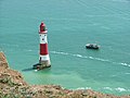 Beachy Head Lighthouse - geograph.org.uk - 465924.jpg 640 × 480; 82 KB
-
 Beacon on Cold Kitchen Hill - geograph.org.uk - 456474.jpg 480 × 640; 84 KB
-
 Beck Hole - geograph.org.uk - 701385.jpg 640 × 427; 146 KB
-
 Bishop's Terrace, Gaywood - geograph.org.uk - 453981.jpg 640 × 480; 118 KB
-
 Blackleg - geograph.org.uk - 454421.jpg 640 × 480; 77 KB
-
 Blaenavon Fire Station - geograph.org.uk - 460702.jpg 640 × 427; 170 KB
-
 Blea Tarn - geograph.org.uk - 454401.jpg 640 × 480; 78 KB
-
 Blue Anchor beach.jpg 640 × 425; 77 KB
-
 Boat Grounded in Ceann Loch - geograph.org.uk - 1062899.jpg 640 × 480; 66 KB
-
 Bora - geograph.org.uk - 455880.jpg 640 × 316; 168 KB
-
 Botany Bay - geograph.org.uk - 494410.jpg 640 × 480; 86 KB
-

-
 Brian and friends - geograph.org.uk - 456064.jpg 640 × 440; 110 KB
-

-
 Bridge over Bure Valley Railway track - geograph.org.uk - 453949.jpg 640 × 480; 90 KB
-
 Bridge Over Marriott's Way - geograph.org.uk - 454430.jpg 640 × 480; 72 KB
-
 Bridge over the River Meden - geograph.org.uk - 454135.jpg 640 × 480; 119 KB
-
 Broadbog Farm - geograph.org.uk - 455805.jpg 640 × 480; 82 KB
-
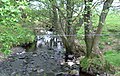 Brooklands burn - geograph.org.uk - 461806.jpg 640 × 405; 115 KB
-
 Brooklands burn 2 - geograph.org.uk - 461821.jpg 640 × 480; 141 KB
-
 Brooks Packhorse Bridge, Bleasdale - geograph.org.uk - 691340.jpg 640 × 427; 112 KB
-
 Brunswick Place - geograph.org.uk - 455624.jpg 640 × 479; 137 KB
-
 Bull Ring Water Feature - geograph.org.uk - 454313.jpg 640 × 426; 72 KB
-
 Bulls, near Chitterne - geograph.org.uk - 454227.jpg 640 × 480; 137 KB
-
 Bure Valley Railway track - geograph.org.uk - 453957.jpg 480 × 640; 98 KB
-
 Burras Methodist Church - geograph.org.uk - 453958.jpg 640 × 480; 89 KB
-
 Caldicot Fire Station - geograph.org.uk - 467338.jpg 640 × 427; 177 KB
-
 Capel y Bedyddwyr Blaenffos - geograph.org.uk - 466443.jpg 480 × 640; 92 KB
-
 Carpark at Jamaica Inn - geograph.org.uk - 462636.jpg 640 × 390; 38 KB
-
 Carpark at Sedgemoor - geograph.org.uk - 462625.jpg 640 × 480; 51 KB
-
 Carving on Stoke Gabriel church - geograph.org.uk - 457254.jpg 480 × 640; 100 KB
-
 Castlebay, Barra - geograph.org.uk - 602566.jpg 640 × 457; 49 KB
-
 Cattle judging - geograph.org.uk - 454265.jpg 640 × 470; 96 KB
-
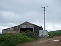 Cattle shed with mobile phone mast - geograph.org.uk - 455252.jpg 640 × 480; 50 KB
-
 Cazy Golf Great Yarmouth Seafront - geograph.org.uk - 1070337.jpg 640 × 480; 94 KB
-
 CD cds - geograph.org.uk - 1062981.jpg 640 × 480; 104 KB
-
 Cenotaph Willington Co. Durham - geograph.org.uk - 454782.jpg 640 × 480; 124 KB
-

-
 Chapel House - geograph.org.uk - 455001.jpg 640 × 480; 103 KB
-
 Chepstow Fire Station - geograph.org.uk - 467357.jpg 640 × 427; 180 KB
-
 Chepstow Old Fire Station - geograph.org.uk - 467364.jpg 640 × 427; 194 KB
-

-
 Church and Graveyard in Faceby - geograph.org.uk - 454814.jpg 640 × 480; 108 KB
-
 Church Hill - geograph.org.uk - 586749.jpg 640 × 427; 57 KB
-

-

-

-

-
 Coleford Fire Station - geograph.org.uk - 460812.jpg 640 × 426; 154 KB
-
 Confucius - geograph.org.uk - 455155.jpg 493 × 640; 143 KB
-
 Connected Dikes - geograph.org.uk - 455279.jpg 640 × 427; 93 KB
-
 Cottage in Blaenffos - geograph.org.uk - 463873.jpg 640 × 480; 89 KB
-
-
 Cows taking a rest - geograph.org.uk - 454871.jpg 640 × 477; 82 KB
-
 Cows, near Elston - geograph.org.uk - 454226.jpg 640 × 480; 109 KB
-
 Cutting grass for haymaking - geograph.org.uk - 454360.jpg 640 × 480; 123 KB
-
 Cwmbran Fire Station - geograph.org.uk - 467330.jpg 640 × 427; 158 KB
-
 Dead Oak Tree (detail) - geograph.org.uk - 455281.jpg 502 × 640; 154 KB
-
 Dead Oak Tree, Linleygreen, Shropshire - geograph.org.uk - 455285.jpg 480 × 640; 153 KB
-
 Derelict barn - geograph.org.uk - 455091.jpg 640 × 480; 94 KB
-
 Distinctive gate post, no longer in use - geograph.org.uk - 454955.jpg 640 × 479; 156 KB
-

-
 Disused Canal Bridge - geograph.org.uk - 454277.jpg 640 × 429; 89 KB
-

-
 Drive to Lairdlaugh - geograph.org.uk - 461978.jpg 640 × 480; 95 KB
-
 Driveway to Hackford Hall - geograph.org.uk - 454565.jpg 640 × 480; 87 KB
-
 Eardisley Fire Station - geograph.org.uk - 460739.jpg 640 × 427; 184 KB
-
 East End of Errington Woods - geograph.org.uk - 469255.jpg 640 × 427; 51 KB
-
 East Riding of Yorkshire Primary Care Trust Four Winds.jpg 640 × 480; 88 KB
-

-
 Edward VII letter box at Claonaig. - geograph.org.uk - 470650.jpg 640 × 427; 281 KB
-
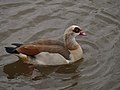 Egyptian Goose at Stoke Gabriel - geograph.org.uk - 457668.jpg 640 × 480; 76 KB
-
 Electricity Substation, Whiteley - geograph.org.uk - 454749.jpg 640 × 427; 175 KB
-
 Elgar's birthplace, Lower Broadheath - geograph.org.uk - 553455.jpg 640 × 480; 82 KB
-
-
 Entrance to Mollance - geograph.org.uk - 461482.jpg 640 × 480; 70 KB
-
 Entrance to Nether Craigenputtock - geograph.org.uk - 454958.jpg 640 × 479; 156 KB
-
 Entrance to Whitwell Hall - geograph.org.uk - 454554.jpg 640 × 480; 72 KB
-
 Essington Community Centre - geograph.org.uk - 454148.jpg 600 × 450; 208 KB
-
 Essington Fruit Farm - geograph.org.uk - 454029.jpg 600 × 450; 189 KB
-
 Essington Industrial Estate - geograph.org.uk - 453982.jpg 600 × 450; 219 KB
-
 Ewyas Harold Fire Station - geograph.org.uk - 460768.jpg 640 × 427; 189 KB
-
 Farlington Avenue - geograph.org.uk - 457921.jpg 640 × 480; 93 KB
-
 Farm Road - geograph.org.uk - 455584.jpg 479 × 640; 128 KB
-
 Farmland with sheep grazing - geograph.org.uk - 454903.jpg 640 × 479; 72 KB
-
 Farmland, Chilbolton - geograph.org.uk - 455738.jpg 640 × 480; 158 KB
-
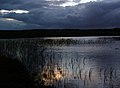 Fell Loch, dusk. - geograph.org.uk - 456042.jpg 640 × 467; 65 KB
-
 Fenland^ - geograph.org.uk - 494448.jpg 640 × 480; 138 KB
-
 Fennel Pit Farm - geograph.org.uk - 453996.jpg 600 × 420; 207 KB
-
 Field boundary, Lower Falkenham - geograph.org.uk - 454416.jpg 427 × 640; 123 KB
-
 Field opposite Leycourt Farm. - geograph.org.uk - 454702.jpg 640 × 480; 89 KB
-
 Fields near to Yelling - geograph.org.uk - 456195.jpg 640 × 480; 73 KB
-
 Fields opposite Fraserford - geograph.org.uk - 454978.jpg 479 × 640; 76 KB
-
 Figure on Stoke Gabriel church - geograph.org.uk - 457073.jpg 480 × 640; 107 KB
-
 Fire Tender near Lord Stones Cafe - geograph.org.uk - 454819.jpg 640 × 480; 132 KB
-

-
-

-
 Foal on Beaulieu Heath, New Forest - geograph.org.uk - 456942.jpg 640 × 480; 111 KB
-
 Footbridge over the River Divie. - geograph.org.uk - 455142.jpg 640 × 458; 203 KB
-
 Footpath - geograph.org.uk - 494488.jpg 640 × 480; 109 KB
-
 Footpath to Ashmore Park - geograph.org.uk - 454085.jpg 600 × 450; 308 KB
-
 Former Colliery Railway - geograph.org.uk - 454097.jpg 600 × 450; 205 KB
-
 Former Track of Narrow Gauge Railway - geograph.org.uk - 469249.jpg 427 × 640; 220 KB
-
 Fotherley Love - geograph.org.uk - 456157.jpg 640 × 480; 79 KB
-
 Fownhope Fire Station - geograph.org.uk - 460820.jpg 640 × 427; 227 KB
-
 Freemasons, Western Road - geograph.org.uk - 455612.jpg 479 × 640; 127 KB
-
 Garden at Garmartin - geograph.org.uk - 461933.jpg 640 × 480; 121 KB
-
 Garden, Gabriel Court Hotel - geograph.org.uk - 457702.jpg 640 × 480; 138 KB
-
 Garvie threshing machine - geograph.org.uk - 454338.jpg 640 × 480; 96 KB
-
 Gate on bridleway - geograph.org.uk - 455106.jpg 640 × 480; 113 KB
-
 Grain store in Sponden Lane - geograph.org.uk - 454205.jpg 640 × 480; 103 KB
-
 Green Lane - geograph.org.uk - 454363.jpg 640 × 480; 115 KB
-
 Grounds of Edale Youth Hostel - geograph.org.uk - 616477.jpg 640 × 480; 120 KB
-
-
 Harbour Inn Axmouth Devon - geograph.org.uk - 454052.jpg 640 × 480; 78 KB
-
 Harvesting timber in Blackhall Forest - geograph.org.uk - 454629.jpg 640 × 480; 121 KB
-
 Hatchet Moor car park, New Forest - geograph.org.uk - 456973.jpg 640 × 480; 69 KB
-
 Hedge End Trade Park.jpg 640 × 427; 147 KB
-
 Herne the Hunter - geograph.org.uk - 457646.jpg 480 × 640; 108 KB
-
 High Plains drifters - geograph.org.uk - 456173.jpg 640 × 480; 102 KB
-
 Hillock of Keig - geograph.org.uk - 455954.jpg 640 × 480; 58 KB
-
 Hinxden Farmhouse - geograph.org.uk - 454154.jpg 640 × 480; 116 KB
-
 Hinxden Lane - geograph.org.uk - 454158.jpg 640 × 480; 172 KB
-
 Hiscombe Wood - geograph.org.uk - 456487.jpg 640 × 489; 106 KB
-
 War Graves at All Saints Church, HOSM - geograph.org.uk - 586872.jpg 640 × 427; 96 KB
-

-

-

-

-

-

-

-

-

-
 Hop garden on Hoads Farm - geograph.org.uk - 454262.jpg 640 × 480; 149 KB
-

-

-

-
 Houghton on the Hill cricket ground.jpg 454 × 640; 102 KB
-
 House at Yelling - geograph.org.uk - 456187.jpg 640 × 607; 118 KB
-
 House near Stoke Lodge Farm - geograph.org.uk - 454781.jpg 640 × 640; 125 KB
-
 House on Swanton Hill, Swanton Abbott - geograph.org.uk - 453851.jpg 640 × 480; 69 KB
-

-
 HS125 (529508038).jpg 2,048 × 1,536; 829 KB
-
 Hull-Cottingham railway line - geograph.org.uk - 453722.jpg 480 × 640; 175 KB
-
 Iron Man - geograph.org.uk - 454249.jpg 425 × 640; 84 KB
-
 Irrigation lake and hop garden - geograph.org.uk - 454244.jpg 640 × 480; 120 KB
-
 Jamaica Inn - geograph.org.uk - 462626.jpg 640 × 321; 49 KB
-

-
 Jumpers for Goalposts, Brunswick Lawns - geograph.org.uk - 455903.jpg 640 × 491; 157 KB
-
 Junction at 39m - geograph.org.uk - 454657.jpg 640 × 480; 59 KB
-
 Kenilworth Agricultural Show - geograph.org.uk - 454243.jpg 640 × 480; 96 KB
-
 Kenilworth, Castle Green - geograph.org.uk - 1394192.jpg 640 × 476; 128 KB
-
 Kilkiffeth Farm entrance - geograph.org.uk - 455274.jpg 640 × 480; 98 KB
-
 George Lamb Memorial Chapel - geograph.org.uk - 453743.jpg 640 × 463; 167 KB
-
 Kington Fire Station - geograph.org.uk - 460727.jpg 640 × 427; 212 KB
-
 Knightwick - geograph.org.uk - 553439.jpg 640 × 480; 55 KB


.jpg)


.jpg)
.jpg)
.jpg)
.jpg)
.jpg)


,_Traigh_Eais_-_geograph.org.uk_-_603198.jpg)


_-_geograph.org.uk_-_455281.jpg)


.jpg)


