Category:United Kingdom photographs taken on 2007-12-26
Countries of Europe: Austria · Belgium · Czech Republic · Denmark · Finland · France‡ · Germany · Greece · Italy · Latvia · Lithuania · Netherlands‡ · Poland · Portugal‡ · Romania · Russia‡ · Slovakia · Spain‡ · Sweden · Switzerland · Turkey‡ · Ukraine · United Kingdom
Specific status: Isle of Man
‡: partly located in Europe
Specific status: Isle of Man
‡: partly located in Europe
| ← | 26 December 2007 | → | ||
| ← | December 2007 | → | ||

United Kingdom photographs taken on 26 December 2007.
Image files should be categorized here automatically using {{taken on}} template. Direct categorisation is also possible, if automatic is impossible.
Subcategories
This category has the following 2 subcategories, out of 2 total.
Media in category "United Kingdom photographs taken on 2007-12-26"
The following 200 files are in this category, out of 554 total.
(previous page) (next page)-
 "Hollow Trees", Worplesdon - geograph.org.uk - 640591.jpg 640 × 480; 97 KB
-
 "The Old Stables", Worplesdon - geograph.org.uk - 640624.jpg 640 × 480; 71 KB
-
 12 - 30 to Rawtenstall - geograph.org.uk - 640874.jpg 640 × 425; 67 KB
-
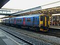
 143617 AND 143612 Exeter St Davids.JPG 1,881 × 992; 618 KB
-
 143617 Exeter St Davids.JPG 1,969 × 1,232; 872 KB
-
 150233 Exeter St Davids.JPG 2,048 × 1,536; 1.23 MB
-
 159103 First Class Interior.JPG 2,048 × 1,536; 1.01 MB
-
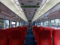 159103 Standard Class Interior.JPG 2,048 × 1,536; 1.04 MB
-
 Across Widewater Lagoon - geograph.org.uk - 641506.jpg 640 × 426; 84 KB
-
 Adur Railway Bridge - geograph.org.uk - 641563.jpg 640 × 426; 53 KB
-
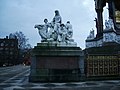 Albert Memorial - geograph.org.uk - 644283.jpg 640 × 480; 159 KB
-
 All at Sea Today - geograph.org.uk - 640691.jpg 640 × 480; 42 KB
-
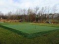 All weather golf - geograph.org.uk - 648088.jpg 640 × 479; 78 KB
-

-
 Alyth parish church - geograph.org.uk - 651218.jpg 426 × 640; 57 KB
-
 An end of Porson - geograph.org.uk - 648814.jpg 640 × 480; 80 KB
-

-
 Apartment blocks by the river. - geograph.org.uk - 640546.jpg 640 × 480; 97 KB
-

-
 Approaching Heywood - geograph.org.uk - 640878.jpg 640 × 502; 89 KB
-

-
 Barlby signal box - geograph.org.uk - 644774.jpg 640 × 442; 81 KB
-
 Barlby signal box - geograph.org.uk - 644777.jpg 640 × 427; 87 KB
-
 Barrow Close - geograph.org.uk - 647555.jpg 640 × 453; 61 KB
-
 Barrow Road - geograph.org.uk - 647565.jpg 640 × 480; 104 KB
-
 Barton Mills lock - geograph.org.uk - 641346.jpg 427 × 640; 96 KB
-
 Battersea Reach, River Thames - geograph.org.uk - 647284.jpg 640 × 480; 135 KB
-
 Battersea Reach, River Thames - geograph.org.uk - 647289.jpg 640 × 480; 147 KB
-
 Beach huts, Lancing Beach - geograph.org.uk - 641432.jpg 640 × 426; 95 KB
-
 Beach near Bride - geograph.org.uk - 640631.jpg 427 × 640; 101 KB
-
 Beacon, Stepper Point. - panoramio.jpg 2,816 × 2,112; 2.66 MB
-
 Beckenham Junction Railway Station - geograph.org.uk - 641190.jpg 640 × 480; 52 KB
-
 Bellair House - geograph.org.uk - 640755.jpg 640 × 480; 52 KB
-
 Berth Gwynne - geograph.org.uk - 641001.jpg 640 × 480; 98 KB
-
 Birds Lane - geograph.org.uk - 640456.jpg 640 × 480; 66 KB
-

-
 Blue cat with green eyes in Norfolk, England 2007 (cropped).jpg 480 × 480; 64 KB
-
 Boats at Danesfield - geograph.org.uk - 648869.jpg 640 × 480; 174 KB
-
 BOCM mills, Barlby, Selby - geograph.org.uk - 644762.jpg 640 × 397; 73 KB
-
 Boxing Day Meet - geograph.org.uk - 1135618.jpg 640 × 480; 72 KB
-
 Boxing Day sunrise at Southbury - geograph.org.uk - 1511300.jpg 640 × 480; 91 KB
-
 Boxing Day sunrise over May Hill - geograph.org.uk - 640647.jpg 640 × 480; 80 KB
-
 Bridge at Fowlmere Watercress Beds 2 - footings.jpg 640 × 480; 139 KB
-
 Bridleway, Ruscombe - geograph.org.uk - 648222.jpg 640 × 480; 180 KB
-
 Brigsteer - geograph.org.uk - 643352.jpg 640 × 428; 91 KB
-
 Broomhill Cottage - geograph.org.uk - 643585.jpg 2,000 × 3,008; 2.38 MB
-
 Bunkhole - geograph.org.uk - 643512.jpg 3,008 × 2,000; 3.03 MB
-
 Bunkhole - geograph.org.uk - 643711.jpg 2,000 × 3,008; 2.88 MB
-
 Bury bound - geograph.org.uk - 640887.jpg 499 × 640; 68 KB
-
 Carnegie Golf Course near Meikle Ferry - geograph.org.uk - 640598.jpg 640 × 480; 429 KB
-
 Carnegie Golf Course near Miekle Ferry - geograph.org.uk - 640602.jpg 640 × 480; 416 KB
-
 Chicken Shacks - geograph.org.uk - 1341345.jpg 640 × 480; 107 KB
-
 Christmas comes but once a year... - geograph.org.uk - 641037.jpg 640 × 480; 102 KB
-
 Christmas Lights - geograph.org.uk - 640348.jpg 640 × 486; 67 KB
-

-
 Churchyard of St. Andrew's, Dinedor - geograph.org.uk - 640637.jpg 640 × 468; 204 KB
-
 Cinnamon Row, Battersea SW11 - geograph.org.uk - 647290.jpg 640 × 480; 189 KB
-
 Cliff tops above Labrador Bay - geograph.org.uk - 640794.jpg 640 × 480; 79 KB
-
 Cloud comes down on Cerrig Lladron - geograph.org.uk - 640833.jpg 640 × 480; 68 KB
-
 Concrete tank trap pondfield cove dorset.jpg 2,816 × 1,877; 1.29 MB
-
 Conifer plantation - geograph.org.uk - 645860.jpg 640 × 480; 44 KB
-
 Connaught Road, Havant - geograph.org.uk - 640765.jpg 640 × 480; 72 KB
-
 Corner of Beechworth Road - geograph.org.uk - 640436.jpg 640 × 480; 69 KB
-
 Corner of Grove Road by footpath - geograph.org.uk - 640476.jpg 640 × 480; 93 KB
-

-
 Coven Post Office - geograph.org.uk - 640595.jpg 640 × 480; 212 KB
-

-
 Cremorne Bridge - geograph.org.uk - 647287.jpg 640 × 480; 145 KB
-
 Cuffley's oldest building - geograph.org.uk - 641015.jpg 640 × 378; 54 KB
-
 Cycle Path - geograph.org.uk - 643299.jpg 640 × 480; 87 KB
-
 Damp and shady track - geograph.org.uk - 643562.jpg 2,000 × 3,008; 2.07 MB
-
 Dawlish Warren - geograph.org.uk - 650029.jpg 640 × 480; 40 KB
-
 Deeping St James Bridge - geograph.org.uk - 641010.jpg 618 × 444; 128 KB
-
 Demolition behind The Taj Mahal - geograph.org.uk - 640428.jpg 640 × 480; 57 KB
-
 Dewey bagging - geograph.org.uk - 640888.jpg 640 × 480; 63 KB
-
 Diglake Farm, Butters Green - geograph.org.uk - 645886.jpg 640 × 480; 78 KB
-
 Dinedor Outdoor Centre - geograph.org.uk - 640572.jpg 640 × 480; 146 KB
-
 Dipping Pond or Boardwalk Pond - geograph.org.uk - 648986.jpg 640 × 480; 122 KB
-

-
 Disused watercress bed - geograph.org.uk - 648996.jpg 640 × 480; 97 KB
-
 Donard Forest, Newcastle (1) - geograph.org.uk - 640659.jpg 640 × 410; 71 KB
-
 Donard Forest, Newcastle (10) - geograph.org.uk - 640849.jpg 640 × 429; 116 KB
-
 Donard Forest, Newcastle (11) - geograph.org.uk - 640858.jpg 640 × 397; 87 KB
-
 Donard Forest, Newcastle (12) - geograph.org.uk - 640866.jpg 640 × 429; 92 KB
-
 Donard Forest, Newcastle (13) - geograph.org.uk - 640880.jpg 640 × 391; 105 KB
-
 Donard Forest, Newcastle (2) - geograph.org.uk - 640680.jpg 640 × 429; 119 KB
-
 Donard Forest, Newcastle (3) - geograph.org.uk - 640697.jpg 640 × 412; 129 KB
-
 Donard Forest, Newcastle (4) - geograph.org.uk - 640714.jpg 640 × 429; 118 KB
-
 Donard Forest, Newcastle (5) - geograph.org.uk - 640777.jpg 640 × 429; 134 KB
-
 Donard Forest, Newcastle (6) - geograph.org.uk - 640793.jpg 640 × 429; 119 KB
-
 Donard Forest, Newcastle (7) - geograph.org.uk - 640801.jpg 640 × 429; 123 KB
-
 Donard Forest, Newcastle (8) - geograph.org.uk - 640814.jpg 581 × 389; 94 KB
-
 Donard Forest, Newcastle (9) - geograph.org.uk - 640834.jpg 640 × 429; 106 KB
-
 Duck pond at Dinedor - geograph.org.uk - 640629.jpg 640 × 480; 169 KB
-
 East End Lodge Dental Surgery - geograph.org.uk - 640447.jpg 640 × 480; 68 KB
-
 Eggborough Power Station at sunset - geograph.org.uk - 644787.jpg 640 × 412; 48 KB
-
 Elm Road - geograph.org.uk - 640845.jpg 640 × 480; 84 KB
-
 Embellishments on the Iron Footbridge - geograph.org.uk - 640916.jpg 640 × 480; 105 KB
-
 Emley Moor Mast at Night (2) - geograph.org.uk - 640991.jpg 362 × 640; 156 KB
-
 Emley Moor Mast at Night (3) - geograph.org.uk - 640994.jpg 427 × 640; 215 KB
-
 Emley Moor mast at night - geograph.org.uk - 640988.jpg 640 × 427; 231 KB
-
 End of footpath to Wade Court Road - geograph.org.uk - 640826.jpg 640 × 480; 91 KB
-
 End of Porson Road - geograph.org.uk - 648799.jpg 640 × 480; 70 KB
-
 Cross roads near Radford, Oxfordshire - geograph.org.uk - 1041815.jpg 480 × 640; 112 KB
-
 Scots Pine, Cleveley, Oxfordshire - geograph.org.uk - 1041764.jpg 480 × 640; 106 KB
-

-
 Exeter Bus and Coach Station - geograph.org.uk - 647070.jpg 640 × 469; 70 KB
-
 Fagwyr Goch and Cerrig Lladron - geograph.org.uk - 640997.jpg 640 × 480; 55 KB
-
 Fairfield Road, footbridge - geograph.org.uk - 641207.jpg 640 × 481; 118 KB
-
 Farm between Dinedor and Dinedor Cross - geograph.org.uk - 640625.jpg 640 × 461; 109 KB
-
 Farm buildings below Dinedor Camp - geograph.org.uk - 640525.jpg 640 × 480; 113 KB
-
 Farmland near Swindon, Staffordshire - geograph.org.uk - 641680.jpg 640 × 447; 122 KB
-
 Felled beech at Dinedor Camp - geograph.org.uk - 640585.jpg 640 × 480; 221 KB
-
 Field Head Facing South - geograph.org.uk - 725812.jpg 640 × 480; 63 KB
-
 Fields and Himley Church, Staffordshire - geograph.org.uk - 642616.jpg 640 × 480; 163 KB
-
 Fisher Green, Ripon - geograph.org.uk - 640560.jpg 640 × 480; 75 KB
-
 Foggintor Quarry - geograph.org.uk - 1043207.jpg 640 × 480; 68 KB
-
 Footbridge across a stream near Foxdown Manor - geograph.org.uk - 643501.jpg 3,008 × 2,000; 4.28 MB
-
 Footbridge near Bunkhole - geograph.org.uk - 643703.jpg 3,008 × 2,000; 4.69 MB
-
 Footbridge over River Lark - geograph.org.uk - 641315.jpg 640 × 427; 104 KB
-
 Footpath along River Lark - geograph.org.uk - 641332.jpg 640 × 427; 113 KB
-
 Footpath bridge in Small Coombe - geograph.org.uk - 641404.jpg 640 × 480; 93 KB
-
 Footpath next to Coven Church - geograph.org.uk - 640536.jpg 640 × 480; 297 KB
-
 Footpath through to Wade Court Road - geograph.org.uk - 640823.jpg 640 × 480; 104 KB
-
 Ford entering Cranborne Farm - geograph.org.uk - 641074.jpg 640 × 430; 138 KB
-
-
 Former Williamson's works. - geograph.org.uk - 640538.jpg 640 × 480; 82 KB
-
 Fowlmere Car Park - geograph.org.uk - 648978.jpg 640 × 459; 66 KB
-
 Fowlmere Reception Hut - geograph.org.uk - 648984.jpg 640 × 480; 93 KB
-
 Gate on Lamb Rig - geograph.org.uk - 646445.jpg 640 × 480; 77 KB
-
 Gibson Mill - geograph.org.uk - 1082393.jpg 640 × 480; 105 KB
-
 Glenhurst School - geograph.org.uk - 640445.jpg 640 × 480; 85 KB
-
 Goldsborough Hall - geograph.org.uk - 640534.jpg 640 × 360; 86 KB
-
 Golf Club car park - geograph.org.uk - 648098.jpg 640 × 473; 66 KB
-
 Great Ouse River - geograph.org.uk - 647219.jpg 640 × 480; 43 KB
-
 Great Ouse River - geograph.org.uk - 647223.jpg 640 × 475; 50 KB
-
 Green farm shed in green field - geograph.org.uk - 640475.jpg 639 × 445; 53 KB
-
 Grey cat - geograph.org.uk - 640480.jpg 480 × 640; 87 KB
-

-
 OS Benchmark Hamerton Church - geograph.org.uk - 713171.jpg 480 × 640; 92 KB
-
 Havant Bus Station - geograph.org.uk - 640431.jpg 640 × 480; 53 KB
-
 Havant Library - geograph.org.uk - 640433.jpg 640 × 480; 59 KB
-
 Hay bales at Rosemount - geograph.org.uk - 650904.jpg 640 × 426; 68 KB
-
 Hebden Water - geograph.org.uk - 1082391.jpg 480 × 640; 137 KB
-
 Himley Church and Rectory, Staffordshire - geograph.org.uk - 642578.jpg 640 × 464; 152 KB
-
 Himley House Hotel, Staffordshire - geograph.org.uk - 640636.jpg 640 × 395; 148 KB
-
 Holly and the Chapel on Boxing Day - geograph.org.uk - 640672.jpg 640 × 427; 299 KB
-
 Home Farm, Goldsborough - geograph.org.uk - 640517.jpg 640 × 480; 76 KB
-
 Horkstow Church - geograph.org.uk - 779450.jpg 640 × 427; 101 KB
-
 Horkstow Church in December - geograph.org.uk - 640816.jpg 640 × 426; 93 KB
-
 Horkstow Church in December - geograph.org.uk - 640836.jpg 640 × 426; 99 KB
-
 Horkstow Church in December - geograph.org.uk - 640846.jpg 640 × 444; 131 KB
-
 Horkstow Church - geograph.org.uk - 779441.jpg 428 × 640; 90 KB
-
 Houses by the A39 - geograph.org.uk - 643477.jpg 2,000 × 3,008; 2.75 MB
-
 Howe of Anguston - geograph.org.uk - 661084.jpg 632 × 470; 119 KB
-
 Inchaffray Street - geograph.org.uk - 641092.jpg 640 × 424; 53 KB
-
 Interior of the Skyline Pavilion - geograph.org.uk - 654820.jpg 640 × 480; 385 KB
-
 Into the Humber - geograph.org.uk - 640573.jpg 640 × 472; 189 KB
-
 Isolated tree on the Firmounth Road - geograph.org.uk - 640936.jpg 480 × 640; 65 KB
-
 Jack Tree Lock, River Lark - geograph.org.uk - 641358.jpg 640 × 427; 108 KB
-
 Jewish Cemetery, Delhi Street, Hull - geograph.org.uk - 640505.jpg 640 × 444; 202 KB
-
 Jubilee Fields car park, Mildenhall - geograph.org.uk - 641326.jpg 640 × 427; 70 KB
-
 Junction of lanes - geograph.org.uk - 643469.jpg 3,008 × 2,000; 3.85 MB
-

-
 Lamb Rig - geograph.org.uk - 640496.jpg 640 × 480; 68 KB
-
 Lamb Rig - geograph.org.uk - 646442.jpg 640 × 480; 71 KB
-
 Along Widewater Lagoon - geograph.org.uk - 641528.jpg 640 × 426; 77 KB
-
 Lane at Higher Waytown - geograph.org.uk - 643460.jpg 3,008 × 2,000; 3.87 MB
-
 Lane behind Broomhill Cottage - geograph.org.uk - 643669.jpg 3,008 × 2,000; 2.78 MB
-

-
 Leeds After Dark - geograph.org.uk - 640972.jpg 640 × 223; 124 KB
-
 Leeds and Holbeck After Dark - geograph.org.uk - 640958.jpg 640 × 321; 171 KB
-
 Leeds City Centre After Dark - geograph.org.uk - 640969.jpg 640 × 223; 126 KB
-
 Lime kiln below Belling Crag - geograph.org.uk - 640900.jpg 640 × 480; 45 KB
-
 Ancient and Modern, Deeping St James - geograph.org.uk - 641056.jpg 640 × 480; 120 KB
-
 Lion Hotel Dulverton - geograph.org.uk - 681554.jpg 640 × 480; 92 KB
-
 Lions sponsored mystery - geograph.org.uk - 640477.jpg 640 × 480; 133 KB
-
 Lone gorse bush - geograph.org.uk - 645866.jpg 640 × 480; 70 KB
-
 Looking north from a new pontoon - geograph.org.uk - 640827.jpg 640 × 392; 68 KB
-
-
 Lydney Harbour - geograph.org.uk - 691302.jpg 640 × 480; 46 KB
-
 Lymbourn Wildflower Meadow - geograph.org.uk - 640464.jpg 640 × 480; 106 KB
-
 Mannings Lane South railway bridge - geograph.org.uk - 641203.jpg 640 × 481; 127 KB
-
 Marina at Southwick - geograph.org.uk - 641671.jpg 640 × 426; 70 KB
-
 Marlin weather vane - geograph.org.uk - 641174.jpg 640 × 431; 35 KB
-
 Merrist Wood Beasts - geograph.org.uk - 640634.jpg 640 × 480; 103 KB
-
 Merrist Wood Jumps - geograph.org.uk - 640642.jpg 640 × 480; 82 KB
-

-
 Mini roundabout - geograph.org.uk - 647559.jpg 640 × 444; 55 KB
-
 Miscanthus field - geograph.org.uk - 643482.jpg 3,008 × 2,000; 3.36 MB
-
 Mist and molehills above Swindale - geograph.org.uk - 640727.jpg 640 × 480; 56 KB
-
 Modest crossroads in Oaklands Road - geograph.org.uk - 640768.jpg 640 × 480; 71 KB
-
 Mountain fence - geograph.org.uk - 640810.jpg 640 × 480; 83 KB
-
 Muddy footpath at Diglake - geograph.org.uk - 645891.jpg 640 × 480; 172 KB
-
 New footbridge - geograph.org.uk - 640843.jpg 640 × 405; 69 KB
-

-
 New Rides Farm near Eastchurch Prison - geograph.org.uk - 641098.jpg 640 × 429; 84 KB
-
 Newmarket Bridge - geograph.org.uk - 644086.jpg 640 × 480; 60 KB
-
 Newton Lane Bridge - geograph.org.uk - 641211.jpg 640 × 481; 100 KB
-
 Nook - geograph.org.uk - 1082388.jpg 640 × 480; 97 KB


.jpg)


_-_geograph.org.uk_-_640659.jpg)
_-_geograph.org.uk_-_640849.jpg)
_-_geograph.org.uk_-_640858.jpg)
_-_geograph.org.uk_-_640866.jpg)
_-_geograph.org.uk_-_640880.jpg)
_-_geograph.org.uk_-_640680.jpg)
_-_geograph.org.uk_-_640697.jpg)
_-_geograph.org.uk_-_640714.jpg)
_-_geograph.org.uk_-_640777.jpg)
_-_geograph.org.uk_-_640793.jpg)
_-_geograph.org.uk_-_640801.jpg)
_-_geograph.org.uk_-_640814.jpg)
_-_geograph.org.uk_-_640834.jpg)


_-_geograph.org.uk_-_640991.jpg)
_-_geograph.org.uk_-_640994.jpg)


