Category:United Kingdom photographs taken on 2008-04-23
Countries of Europe: Austria · Belarus · Belgium · Czech Republic · Denmark · Finland · France‡ · Germany · Greece · Hungary · Republic of Ireland · Italy · Latvia · Netherlands‡ · Norway · Poland · Portugal‡ · Russia‡ · Spain‡ · Sweden · Switzerland · Turkey‡ · Ukraine · United Kingdom
‡: partly located in Europe
‡: partly located in Europe
| ← | 23 April 2008 | → | ||
| ← | April 2008 | → | ||

United Kingdom photographs taken on 23 April 2008.
Image files should be categorized here automatically using {{taken on}} template. Direct categorisation is also possible, if automatic is impossible.
Subcategories
This category has the following 3 subcategories, out of 3 total.
Media in category "United Kingdom photographs taken on 2008-04-23"
The following 200 files are in this category, out of 1,228 total.
(previous page) (next page)-
 'The Salisbury Arms' hotel - geograph.org.uk - 783033.jpg 640 × 441; 63 KB
-
 140 Cambridge Science Park - geograph.org.uk - 774860.jpg 640 × 480; 70 KB
-
 1939-45 Royal Artillery Wall Memorial - geograph.org.uk - 774854.jpg 640 × 480; 81 KB
-

-
 250 Cambridge Science Park - geograph.org.uk - 774878.jpg 640 × 470; 91 KB
-
 270 Cambridge Science Park - geograph.org.uk - 774888.jpg 640 × 480; 87 KB
-
 29 Cambridge Science Park - geograph.org.uk - 774911.jpg 640 × 480; 61 KB
-
 320-329 Cambridge Science Park - geograph.org.uk - 774897.jpg 640 × 481; 93 KB
-

-
 A Class 67 in late afternoon sun at Welwyn North. - panoramio.jpg 3,888 × 2,592; 3.39 MB
-
 A farmer's pride and joy in 1948^ - geograph.org.uk - 775742.jpg 640 × 426; 156 KB
-

-
 A rare collection^ - geograph.org.uk - 902891.jpg 640 × 311; 57 KB
-
 A Sea King over Din Dryfol - geograph.org.uk - 784889.jpg 640 × 303; 34 KB
-
 A touch of colour - geograph.org.uk - 774789.jpg 640 × 475; 88 KB
-
 A400 Kentish Town Road - geograph.org.uk - 781567.jpg 640 × 480; 88 KB
-
 A458 to Bridgnorth - geograph.org.uk - 775384.jpg 640 × 480; 64 KB
-
 A458 to Much Wenlock - geograph.org.uk - 775387.jpg 640 × 480; 85 KB
-
 A502 Haverstock Hill - geograph.org.uk - 781036.jpg 640 × 480; 70 KB
-
 A55 Expressway - geograph.org.uk - 775471.jpg 640 × 480; 62 KB
-
 A836 west of John O'Groats - geograph.org.uk - 902840.jpg 640 × 480; 78 KB
-
 Abandoned croft at Occumster - geograph.org.uk - 782014.jpg 640 × 480; 135 KB
-
 Abbey River with Abbey Bridge - geograph.org.uk - 776145.jpg 640 × 427; 212 KB
-
 Access Drive to the B9080 - geograph.org.uk - 794692.jpg 640 × 480; 88 KB
-
 Acharynie cemetery - geograph.org.uk - 902728.jpg 640 × 480; 113 KB
-
 Achavanich Standing Stones - geograph.org.uk - 902716.jpg 640 × 480; 92 KB
-
 Achrimsdale.jpg 640 × 480; 92 KB
-
 Across the field to Atterley Cottage - geograph.org.uk - 774794.jpg 640 × 480; 64 KB
-
 The Church at Acton Round - geograph.org.uk - 775370.jpg 640 × 480; 80 KB
-
 The Churchyard at Acton Round - geograph.org.uk - 775372.jpg 640 × 480; 69 KB
-
 Acton Round Hall - geograph.org.uk - 775367.jpg 640 × 480; 102 KB
-
 Acton Round Hall the Pagoda - geograph.org.uk - 775357.jpg 640 × 480; 90 KB
-
 Aerial View of Scout Moor Wind Farm - geograph.org.uk - 777684.jpg 640 × 374; 74 KB
-

-
 Aerial walkway at Ashleworth Quay - geograph.org.uk - 775252.jpg 640 × 426; 128 KB
-
 Afon Ogwen - geograph.org.uk - 810378.jpg 640 × 480; 124 KB
-
 Ainslie Street, Grimsby - geograph.org.uk - 776051.jpg 479 × 640; 91 KB
-
 Air India Boeing 777-300ER Lofting-2.jpg 1,280 × 847; 621 KB
-

-

-
-
 Allt Domhain - geograph.org.uk - 901490.jpg 640 × 480; 115 KB
-
 Almond Aqueduct - geograph.org.uk - 790666.jpg 640 × 480; 95 KB
-

-
 Along the river, Perth - geograph.org.uk - 777327.jpg 640 × 480; 31 KB
-
 An area of rough pasture - geograph.org.uk - 785108.jpg 640 × 338; 42 KB
-
 An inlet of Llyn Coron - geograph.org.uk - 783879.jpg 640 × 480; 48 KB
-
 An seann taigh - geograph.org.uk - 777316.jpg 640 × 480; 67 KB
-
 Ancient plane trees - geograph.org.uk - 774867.jpg 640 × 480; 157 KB
-

-

-
 Apartments, Victoria Dock - geograph.org.uk - 806021.jpg 480 × 640; 65 KB
-
 Approaching Bridge No 34 - geograph.org.uk - 791775.jpg 640 × 480; 130 KB
-
 Approaching Cae'r-wyn - geograph.org.uk - 784426.jpg 640 × 336; 53 KB
-

-
 Ashford House, Exeter - geograph.org.uk - 782963.jpg 640 × 490; 69 KB
-
 Ashford House, Exeter - geograph.org.uk - 783871.jpg 640 × 480; 98 KB
-
 Ashleworth Quay - geograph.org.uk - 775280.jpg 640 × 426; 68 KB
-
 At last spring is here in Allaway Avenue - geograph.org.uk - 774895.jpg 640 × 480; 107 KB
-
 Aultcraggie - geograph.org.uk - 902206.jpg 640 × 364; 63 KB
-
 Aultririe, West Clyne - geograph.org.uk - 779719.jpg 640 × 368; 68 KB
-
 Aylescott Lane - geograph.org.uk - 774580.jpg 640 × 480; 101 KB
-
 B of the Bang - geograph.org.uk - 774905.jpg 640 × 576; 93 KB
-
 B797 road to Leadhills - geograph.org.uk - 774947.jpg 640 × 480; 86 KB
-
 B870 at Westerdale - geograph.org.uk - 902749.jpg 640 × 480; 81 KB
-
 Back Lemon Street -Tyldesley - geograph.org.uk - 927662.jpg 640 × 426; 103 KB
-
 Back Wareing Street - Tyldesley - geograph.org.uk - 927667.jpg 426 × 640; 115 KB
-
 Balnacoil Lodge - geograph.org.uk - 901682.jpg 640 × 394; 83 KB
-
 Bargate Bridge - geograph.org.uk - 776775.jpg 640 × 429; 94 KB
-
 Barn, Over Kellet - geograph.org.uk - 891629.jpg 640 × 480; 78 KB
-
 Bayhead Street - geograph.org.uk - 1278564.jpg 640 × 425; 81 KB
-
 Beech trees, Cobham Frith - geograph.org.uk - 777451.jpg 640 × 480; 208 KB
-
 Beef on the hoof - geograph.org.uk - 902770.jpg 640 × 480; 96 KB
-
 Behind the sea wall - geograph.org.uk - 775354.jpg 640 × 480; 198 KB
-
 Belmont Street - geograph.org.uk - 781047.jpg 640 × 480; 86 KB
-
 Bench mark on Convivio - geograph.org.uk - 1503791.jpg 480 × 640; 165 KB
-
 Bend on the Soar road - geograph.org.uk - 784418.jpg 640 × 480; 53 KB
-
 Bickley Railway Station - geograph.org.uk - 774780.jpg 640 × 480; 74 KB
-
 Big Pit - geograph.org.uk - 779327.jpg 640 × 480; 104 KB
-
 Big Pit - geograph.org.uk - 779678.jpg 640 × 480; 85 KB
-
 Big Pit - geograph.org.uk - 779680.jpg 640 × 480; 71 KB
-
 Big Pit - geograph.org.uk - 779682.jpg 640 × 480; 85 KB
-
 Big Pit - geograph.org.uk - 779686.jpg 640 × 480; 99 KB
-
 Big Pit - geograph.org.uk - 779709.jpg 640 × 480; 130 KB
-
 Big Pit - geograph.org.uk - 779713.jpg 640 × 480; 66 KB
-
 Big stump with field beyond the driveway - geograph.org.uk - 775391.jpg 640 × 480; 104 KB
-
 Bin Collection on Newhouse Road. - geograph.org.uk - 790757.jpg 640 × 480; 100 KB
-

-
 Blackett St. Newcastle Upon Tyne. - geograph.org.uk - 808816.jpg 480 × 640; 84 KB
-
 Blickling Hall - east facade and moat - geograph.org.uk - 774826.jpg 480 × 640; 187 KB
-

-
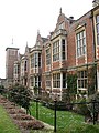
 Blickling Hall - geograph.org.uk - 774932.jpg 640 × 480; 202 KB
-
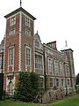 Blickling Hall - north facade - geograph.org.uk - 774833.jpg 480 × 640; 182 KB
-
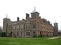 Blickling Hall - view from the northwest - geograph.org.uk - 774838.jpg 640 × 480; 133 KB
-
 Blickling Hall - west facade - geograph.org.uk - 774841.jpg 480 × 640; 181 KB
-
 Blickling Hall - west wing - geograph.org.uk - 774820.jpg 640 × 480; 163 KB
-
 Blickling Hall - west wing - geograph.org.uk - 774822.jpg 640 × 480; 181 KB
-
 Blickling Hall - west wing - geograph.org.uk - 774825.jpg 480 × 640; 170 KB
-
 Blickling Hall viewed from the southeast - geograph.org.uk - 774912.jpg 640 × 480; 169 KB
-
 Blossom time in Kings Hedges - geograph.org.uk - 774804.jpg 640 × 480; 121 KB
-
 Bluebell bank - geograph.org.uk - 774889.jpg 480 × 640; 218 KB
-

-
 Bluebells and daffodils - geograph.org.uk - 774996.jpg 480 × 640; 202 KB
-
 Bluebells at Castle Coppice - geograph.org.uk - 915923.jpg 640 × 480; 149 KB
-
 Bluebells at One Tree Hill near Sevenoaks - geograph.org.uk - 776717.jpg 640 × 472; 155 KB
-
 Bluebells, Cobham Frith, Savernake - geograph.org.uk - 775402.jpg 640 × 480; 82 KB
-
 Boats at Jetty Lochinver Harbour - geograph.org.uk - 777906.jpg 640 × 425; 138 KB
-
 Bodorgan Station - geograph.org.uk - 777302.jpg 640 × 259; 26 KB
-
 Bonny Street - geograph.org.uk - 781568.jpg 640 × 480; 94 KB
-
 Bournville Lane, Birmingham - geograph.org.uk - 2336041.jpg 1,600 × 1,379; 771 KB
-
 Bowness Swans - geograph.org.uk - 785162.jpg 640 × 427; 69 KB
-
 Bridge No. 39 on Union Canal - geograph.org.uk - 793550.jpg 640 × 480; 93 KB
-
 Bridge of Ord - geograph.org.uk - 782211.jpg 640 × 480; 114 KB
-
 Bridge over Glasgow-Edinburgh Railway - geograph.org.uk - 791801.jpg 640 × 480; 108 KB
-
 Bridge over the Merddwr - geograph.org.uk - 785006.jpg 640 × 495; 129 KB
-
 Bridge over the Union Canal - geograph.org.uk - 791770.jpg 640 × 480; 109 KB
-
-
 Bridge under the railway. - geograph.org.uk - 774967.jpg 640 × 480; 71 KB
-
 Broadway Reen - geograph.org.uk - 776090.jpg 640 × 481; 136 KB
-

-
 Building site on Broad Street - geograph.org.uk - 1224065.jpg 640 × 480; 75 KB
-
 Bungalows at Ackergill - geograph.org.uk - 902873.jpg 640 × 347; 48 KB
-
 Bungalows in Clacton Road - geograph.org.uk - 774914.jpg 640 × 480; 73 KB
-
 Burtness Comb - geograph.org.uk - 782596.jpg 640 × 480; 150 KB
-
 Burtness Comb - geograph.org.uk - 783154.jpg 640 × 480; 145 KB
-
-
 Bus, Scarva - geograph.org.uk - 774790 crop.jpg 184 × 204; 42 KB
-
 Bus, Scarva - geograph.org.uk - 774790.jpg 590 × 448; 90 KB
-
 Busking, Dundee - geograph.org.uk - 777303.jpg 640 × 480; 47 KB
-

-
 Byway towards Flamstone Farm - geograph.org.uk - 775032.jpg 640 × 480; 147 KB
-
 Cae'r-ddol - geograph.org.uk - 784341.jpg 640 × 480; 117 KB
-
 Cae'r-wyn cottage - geograph.org.uk - 784429.jpg 640 × 480; 57 KB
-
 Caernarfon Crown Court - geograph.org.uk - 807042.jpg 640 × 480; 77 KB
-
 Caernarfon Scene - geograph.org.uk - 807049.jpg 640 × 480; 66 KB
-
 Caird Hall, Dundee - geograph.org.uk - 777305.jpg 640 × 480; 51 KB
-
 Caithness arable land - geograph.org.uk - 781968.jpg 640 × 303; 54 KB
-
 Caithness pasture land - geograph.org.uk - 775236.jpg 640 × 480; 65 KB
-
 Cambrian Foods - geograph.org.uk - 775578.jpg 640 × 470; 86 KB
-
 Camden Town tube station 1.jpg 3,648 × 2,736; 4.4 MB
-
 Campsey Rd. Southery looking North - geograph.org.uk - 779671.jpg 640 × 479; 57 KB
-
 Campsey Road Southery looking South - geograph.org.uk - 779665.jpg 640 × 479; 78 KB
-
 Canal east of Linlithgow - geograph.org.uk - 794680.jpg 640 × 480; 54 KB
-
 Canal Feeder above River Almond - geograph.org.uk - 790639.jpg 640 × 480; 126 KB
-
 Canal West of Philipstoun - geograph.org.uk - 794588.jpg 640 × 480; 81 KB
-
 Canolfan Tenis Arfon - geograph.org.uk - 807799.jpg 640 × 438; 38 KB
-

-

-
 Carvossos at 210, Chiswick, W4 (2446503175).jpg 960 × 1,280; 324 KB
-
 Castle Street, Caernarfon - geograph.org.uk - 807044.jpg 480 × 640; 76 KB
-
 Castletown Drill Hall - geograph.org.uk - 902827.jpg 640 × 385; 55 KB
-

-
 Cattle at Occumster - geograph.org.uk - 902964.jpg 640 × 302; 54 KB
-

-
 Cattle grazing above Deiniolen - geograph.org.uk - 809657.jpg 640 × 480; 97 KB
-
 Cattle grazing at Bryn Howydd - geograph.org.uk - 783785.jpg 640 × 220; 19 KB
-

-
 Cattle grazing, Mynydd Llandegai - geograph.org.uk - 810377.jpg 640 × 437; 129 KB
-
 Cattle grid - geograph.org.uk - 774941.jpg 640 × 480; 81 KB
-
 Cattle grid near Apperley Court - geograph.org.uk - 775312.jpg 640 × 426; 91 KB
-
 Cattle in cowshed at Muckley, Shropshire, England.jpg 640 × 480; 81 KB
-
 Cattle near the A4080 - geograph.org.uk - 783600.jpg 640 × 297; 42 KB
-
 Cattle on Bryn Howydd Farm - geograph.org.uk - 783755.jpg 640 × 224; 23 KB
-
 Cattle on Fferam Rhosydd land - geograph.org.uk - 784831.jpg 640 × 352; 52 KB
-
 Cattle pasture near Torranreach - geograph.org.uk - 902957.jpg 640 × 480; 81 KB
-
 Cattle pasture south of the A9 - geograph.org.uk - 782001.jpg 640 × 359; 70 KB
-
 Cefncwmwd, Rhostrehwfa - geograph.org.uk - 780947.jpg 640 × 480; 61 KB
-
 Challochglass Moor - geograph.org.uk - 775336.jpg 640 × 480; 118 KB
-
 Chapel Crags - geograph.org.uk - 782508.jpg 640 × 480; 152 KB
-
 Cheglinch - geograph.org.uk - 774565.jpg 640 × 480; 124 KB
-
 Cheglinch Corner - geograph.org.uk - 774549.jpg 640 × 480; 69 KB
-
 St Peter's Church and War Memorial - geograph.org.uk - 776080.jpg 640 × 439; 158 KB
-
 Chertsey Woolies - geograph.org.uk - 776113.jpg 640 × 427; 135 KB
-
 Chester Youth Hostel 2008 - geograph.org.uk - 1505405.jpg 640 × 480; 143 KB
-
 Chester Youth Hostel Plaque - close up - geograph.org.uk - 1505416.jpg 640 × 480; 184 KB
-

-

-
 Churchill - geograph.org.uk - 774576.jpg 640 × 480; 111 KB
-
 City skyscape - geograph.org.uk - 777621.jpg 640 × 480; 49 KB
-
 Clearing, Rothiemurchus Forest - geograph.org.uk - 776064.jpg 640 × 480; 91 KB
-
 Cliffs east of Duncansby Head - geograph.org.uk - 902852.jpg 640 × 480; 80 KB
-
 Clifftop, Dunnet Head - geograph.org.uk - 777504.jpg 640 × 480; 67 KB
-
 Climbing at Dinorwic Quarry - geograph.org.uk - 809228.jpg 480 × 640; 107 KB
-
 Clyth Mains - geograph.org.uk - 775276.jpg 640 × 480; 61 KB
-
 Coastal Footpath near Hooper's Point - geograph.org.uk - 784955.jpg 640 × 480; 103 KB
-
 Coastal scene from Kemyel Point - geograph.org.uk - 781814.jpg 640 × 480; 188 KB
-
 Coed Llanfeirian woodland - geograph.org.uk - 782524.jpg 640 × 480; 124 KB
-
 Coed Llywelyn woodland - geograph.org.uk - 782654.jpg 640 × 351; 31 KB
-

-
 Colonnade, Caernarfon - geograph.org.uk - 807040.jpg 480 × 640; 69 KB
-
 Comb Crags - geograph.org.uk - 782556.jpg 640 × 480; 136 KB
-
 Completely off the Rails - geograph.org.uk - 774291.jpg 640 × 480; 65 KB
-
 Construction near Belfast docks - geograph.org.uk - 775490.jpg 640 × 556; 564 KB
-
 Coombe Hill Nature Reserve - geograph.org.uk - 774614.jpg 640 × 426; 97 KB
-
 Cottage near Kirkcolm - geograph.org.uk - 1478826.jpg 640 × 480; 68 KB
-
 Cottage near to B4327 - geograph.org.uk - 780265.jpg 640 × 480; 111 KB
-

-
 Cottages at Dwyran - geograph.org.uk - 781511.jpg 640 × 480; 68 KB
-

-


_-_geograph.org.uk_-_774887.jpg)


.jpg)


