Category:United Kingdom photographs taken on 2008-04-24
Countries of Europe: Austria · Belgium · Czech Republic · Denmark · Finland · France‡ · Germany · Greece · Hungary · Republic of Ireland · Italy · Latvia · Malta · Netherlands‡ · Norway · Poland · Portugal‡ · Romania · Russia‡ · Slovakia · Spain‡ · Sweden · Switzerland · Turkey‡ · Ukraine · United Kingdom · Vatican City
‡: partly located in Europe
‡: partly located in Europe
| ← | 24 April 2008 | → | ||
| ← | April 2008 | → | ||

United Kingdom photographs taken on 24 April 2008.
Image files should be categorized here automatically using {{taken on}} template. Direct categorisation is also possible, if automatic is impossible.
Subcategories
This category has the following 2 subcategories, out of 2 total.
Media in category "United Kingdom photographs taken on 2008-04-24"
The following 200 files are in this category, out of 497 total.
(previous page) (next page)-
 A BP Shop Petrol Station in Havant, Hampshire.jpg 2,816 × 2,112; 1.51 MB
-
 A Cornish welcome - geograph.org.uk - 782148.jpg 640 × 400; 184 KB
-
 A peaceful pasture - geograph.org.uk - 775736.jpg 640 × 480; 69 KB
-
 A room with a view - geograph.org.uk - 1194407.jpg 640 × 480; 161 KB
-
 A48 Road Junction - geograph.org.uk - 778985.jpg 640 × 480; 58 KB
-

-
 A830 at Kinlocheil - geograph.org.uk - 937183.jpg 640 × 480; 96 KB
-
 Abandoned croft - geograph.org.uk - 782944.jpg 640 × 480; 63 KB
-
 Abandoned sheds near Hambleton Hill - geograph.org.uk - 1269223.jpg 640 × 480; 206 KB
-
 Across Sand Hutton Common - geograph.org.uk - 778747.jpg 640 × 478; 224 KB
-
 Across the dunes to Marazion - geograph.org.uk - 778466.jpg 480 × 640; 159 KB
-
 Afon Merddwr - geograph.org.uk - 785008.jpg 640 × 480; 128 KB
-
 Aldby Park From the Bossall Road - geograph.org.uk - 778881.jpg 640 × 478; 231 KB
-
 Along Stockton Lane - geograph.org.uk - 778682.jpg 640 × 478; 251 KB
-
 Amble front - geograph.org.uk - 783265.jpg 640 × 480; 94 KB
-
 Amphitheatre Moridunum - geograph.org.uk - 777546.jpg 640 × 480; 111 KB
-
 An old railway bridge, Wigan - panoramio.jpg 2,048 × 1,536; 368 KB
-
 April showers on the way - geograph.org.uk - 776693.jpg 427 × 640; 41 KB
-
 Architectural Detail - geograph.org.uk - 777000.jpg 480 × 640; 110 KB
-
 Ballyholme Bay (5) - geograph.org.uk - 776528.jpg 640 × 480; 283 KB
-
 Bampton, Woodland Close - geograph.org.uk - 776159.jpg 640 × 427; 116 KB
-
 Belfast Lough sunset (1) - geograph.org.uk - 776533.jpg 640 × 424; 226 KB
-
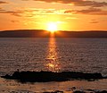 Belfast Lough sunset (2) - geograph.org.uk - 776536.jpg 640 × 554; 346 KB
-
 Belsize Park Underground Station - geograph.org.uk - 820479.jpg 640 × 480; 90 KB
-
 Big Gun, Grey Point Fort - geograph.org.uk - 776505.jpg 640 × 480; 393 KB
-
 Black headed gull, Bangor (2) - geograph.org.uk - 776520.jpg 640 × 480; 276 KB
-
 Blencathra - geograph.org.uk - 782232.jpg 640 × 357; 170 KB
-
 Borough Road Jarrow - geograph.org.uk - 1386493.jpg 640 × 480; 65 KB
-
 Borough Road Jarrow - geograph.org.uk - 1386496.jpg 640 × 480; 62 KB
-
 Bossall Church - geograph.org.uk - 778858.jpg 640 × 478; 240 KB
-
 Brandon, Ingram valley - geograph.org.uk - 784406.jpg 640 × 480; 89 KB
-
 Bridge over Red River, Marazion - geograph.org.uk - 782125.jpg 640 × 480; 136 KB
-
 Bridge over the River Llugwy - geograph.org.uk - 785016.jpg 640 × 480; 126 KB
-
 Brondesbury Villas - geograph.org.uk - 820360.jpg 640 × 480; 103 KB
-
 Bulford Close, Johnston - geograph.org.uk - 775665.jpg 640 × 480; 65 KB
-
 Burn beside the track - geograph.org.uk - 781342.jpg 640 × 480; 130 KB
-
 Buttercrambe Road - geograph.org.uk - 778890.jpg 640 × 478; 261 KB
-
 Capel Curig - geograph.org.uk - 785201.jpg 640 × 449; 96 KB
-
 St Michael's Church, Carlisle.jpg 640 × 480; 160 KB
-
 Casks away^ - geograph.org.uk - 777952.jpg 640 × 480; 111 KB
-
 Castle street, Warkworth - geograph.org.uk - 783222.jpg 640 × 480; 94 KB
-
 Castlerigg Stone Circle (2) - geograph.org.uk - 779533.jpg 640 × 270; 109 KB
-
 Castlerigg Stone Circle - geograph.org.uk - 779530.jpg 640 × 311; 134 KB
-
 Castlerigg Stone Circle - geograph.org.uk - 782238.jpg 640 × 427; 189 KB
-
 Cattle Grid near Reaveley - geograph.org.uk - 784502.jpg 640 × 480; 80 KB
-
 Cattle Grid, near Brandon - geograph.org.uk - 784410.jpg 640 × 480; 111 KB
-

-
 Causeway to Rough Island (1) - geograph.org.uk - 775687.jpg 640 × 411; 84 KB
-
 Causeway to Rough Island (2) - geograph.org.uk - 775690.jpg 640 × 403; 91 KB
-
 Children's Playground - geograph.org.uk - 820347.jpg 640 × 480; 95 KB
-
 Chimneys - Skegness - geograph.org.uk - 780043.jpg 640 × 480; 71 KB
-
 Church board, Warkworth - geograph.org.uk - 783220.jpg 640 × 480; 107 KB
-

-
 Church Street, Stanwix, Carlisle - geograph.org.uk - 2182539.jpg 640 × 480; 209 KB
-

-
 Cobbled causeway to Marazion - geograph.org.uk - 778468.jpg 640 × 480; 138 KB
-
 College Street, Grasmere - geograph.org.uk - 780199.jpg 640 × 480; 71 KB
-
 Commerans Farm Lane, St Just in Roseland - geograph.org.uk - 786812.jpg 640 × 558; 135 KB
-
 Commercial Street - geograph.org.uk - 784812.jpg 640 × 480; 132 KB
-
 Commerrans Farm, St Just in Roseland - geograph.org.uk - 780729.jpg 640 × 453; 69 KB
-
 Common House - geograph.org.uk - 782770.jpg 640 × 480; 123 KB
-
 Concrete works - geograph.org.uk - 776396.jpg 640 × 481; 104 KB
-
 Corporation Street, Manchester - panoramio.jpg 2,048 × 1,536; 440 KB
-
 Cover Lane, Marton le Moor - geograph.org.uk - 775865.jpg 480 × 640; 97 KB
-
 Cows Grazing - geograph.org.uk - 778996.jpg 640 × 482; 78 KB
-
 Cranes and lighthouse - geograph.org.uk - 775808.jpg 640 × 426; 296 KB
-
 Creag na Fionndalach - geograph.org.uk - 781328.jpg 640 × 425; 186 KB
-
 Croft Estate Cottages - geograph.org.uk - 775699.jpg 640 × 480; 84 KB
-
 Crop at Dowhill - geograph.org.uk - 776336.jpg 640 × 480; 49 KB
-
 Crossing Sand Hutton Common - geograph.org.uk - 778751.jpg 640 × 478; 300 KB
-
 Cullernose Point - geograph.org.uk - 776278.jpg 640 × 480; 69 KB
-
 Dalby Hall, Dalby - geograph.org.uk - 815065.jpg 640 × 480; 101 KB
-
 Dalby Hall, Dalby - geograph.org.uk - 815079.jpg 640 × 480; 72 KB
-
 Dargie Lane - geograph.org.uk - 1045494.jpg 640 × 480; 134 KB
-
 Darnick near Melrose - geograph.org.uk - 775735.jpg 640 × 480; 64 KB
-
 Date of building, 176 High Street - geograph.org.uk - 1048477.jpg 640 × 480; 104 KB
-
 Dinas from the north - geograph.org.uk - 785065.jpg 640 × 355; 66 KB
-
 East cemetery, Amble - geograph.org.uk - 783313.jpg 480 × 640; 67 KB
-
 East Markham view - geograph.org.uk - 789927.jpg 640 × 427; 57 KB
-
 Entering Bossall - geograph.org.uk - 778865.jpg 640 × 478; 259 KB
-
 Eskbank Road - geograph.org.uk - 1048475.jpg 640 × 480; 101 KB
-
 Ewe and Lamb at Birkrigg - geograph.org.uk - 782347.jpg 640 × 427; 255 KB
-
 Ewes and lambs, Hewer Hill - geograph.org.uk - 782723.jpg 640 × 480; 120 KB
-
 Farmland close to Sand Hutton - geograph.org.uk - 778781.jpg 640 × 478; 320 KB
-
 Farmland near Brandon - geograph.org.uk - 784408.jpg 640 × 480; 42 KB
-

-
 Farmland overlooking Brecon Beacons - geograph.org.uk - 808498.jpg 640 × 480; 77 KB
-
 Field of rape, near Warkworth - geograph.org.uk - 783476.jpg 640 × 483; 94 KB
-
 Fields above Cwm Rheidol - geograph.org.uk - 776667.jpg 640 × 428; 115 KB
-
 Fish and Chips, Marazion - geograph.org.uk - 782540.jpg 480 × 640; 107 KB
-
 Flank of Thack Moor - geograph.org.uk - 782938.jpg 640 × 480; 131 KB
-
 Foaming sea, Hengistbury Head - geograph.org.uk - 775793.jpg 640 × 480; 46 KB
-
 Follyfield Play Site - geograph.org.uk - 782154.jpg 640 × 480; 125 KB
-
 Food kiosk, High Street - geograph.org.uk - 784224.jpg 640 × 480; 150 KB
-
 Footpath at Dalby - geograph.org.uk - 815194.jpg 640 × 480; 105 KB
-

-
 Footpath to the south of Ormesby Hall - geograph.org.uk - 1269156.jpg 640 × 480; 189 KB
-
 Former chapel, Marazion - geograph.org.uk - 782544.jpg 640 × 470; 131 KB
-
 Frognal - geograph.org.uk - 820396.jpg 640 × 480; 93 KB
-
 Gas Main Renewal - geograph.org.uk - 1130934.jpg 640 × 480; 161 KB
-
 Gate and wall tiles, Newport Market - geograph.org.uk - 778003.jpg 640 × 481; 151 KB
-
 Gearr Aonach - the Middle Sister - geograph.org.uk - 937205.jpg 640 × 480; 63 KB
-
 Gloucester Primary School, Peckham North - geograph.org.uk - 1715200.jpg 1,024 × 768; 654 KB
-
 Govilon Wharf - geograph.org.uk - 777253.jpg 640 × 480; 92 KB
-
 Grantchester Meadows - geograph.org.uk - 778647.jpg 640 × 480; 118 KB
-
 Grantchester Meadows and River Cam - geograph.org.uk - 778627.jpg 640 × 480; 118 KB
-
 Grantchester Meadows and River Cam - geograph.org.uk - 778656.jpg 640 × 480; 117 KB
-
 Green Corner - geograph.org.uk - 776958.jpg 640 × 480; 105 KB
-
 Groyne, Hengistbury Head - geograph.org.uk - 775803.jpg 640 × 502; 75 KB
-

-
 Hardy's Monument - geograph.org.uk - 931885.jpg 640 × 480; 73 KB
-
 Haresceugh Fell - geograph.org.uk - 780148.jpg 640 × 480; 136 KB
-
 Haresceugh Fell - geograph.org.uk - 782890.jpg 640 × 480; 126 KB
-
 Harrier jump jet at Bletchley Park - geograph.org.uk - 1081595.jpg 640 × 480; 42 KB
-
 Haywood Farm - geograph.org.uk - 777409.jpg 640 × 477; 94 KB
-
 Hedgerow - Stockton Lane - geograph.org.uk - 778686.jpg 478 × 640; 333 KB
-
 High Hauxley - geograph.org.uk - 783350.jpg 640 × 480; 77 KB
-
 High Snab (farm) - geograph.org.uk - 782321.jpg 468 × 640; 232 KB
-
 High Street - geograph.org.uk - 784815.jpg 640 × 480; 124 KB
-
 Hillington East Station 02.JPG 640 × 480; 140 KB
-
 Hindscarth and Robinson - geograph.org.uk - 782297.jpg 640 × 284; 145 KB
-
 Homefield Rise - geograph.org.uk - 805560.jpg 640 × 480; 85 KB
-
 Horse Guards Ave - geograph.org.uk - 777035.jpg 480 × 640; 71 KB
-
 Hotel on the edge of Marazion - geograph.org.uk - 782145.jpg 640 × 480; 152 KB
-
 House on Sand Hutton Common - geograph.org.uk - 778767.jpg 640 × 478; 270 KB
-

-
-
 Island Reagh, Strangford Lough (1) - geograph.org.uk - 776063.jpg 640 × 440; 116 KB
-
 Island Reagh, Strangford Lough (2) - geograph.org.uk - 776109.jpg 640 × 396; 108 KB
-
 Island Reagh, Strangford Lough (3) - geograph.org.uk - 776330.jpg 590 × 511; 60 KB
-
 Island Reagh, Strangford Lough (4) - geograph.org.uk - 776333.jpg 640 × 436; 105 KB
-
 Island Reagh, Strangford Lough (5) - geograph.org.uk - 776337.jpg 640 × 477; 87 KB
-
 Island Reagh, Strangford Lough (6) - geograph.org.uk - 776344.jpg 640 × 438; 67 KB
-
 Island Reagh, Strangford Lough (7) - geograph.org.uk - 776350.jpg 640 × 468; 65 KB
-
 Island Reagh, Strangford Lough (8) - geograph.org.uk - 776365.jpg 628 × 537; 79 KB
-
 Island Reagh, Strangford Lough (9) - geograph.org.uk - 776399.jpg 556 × 422; 112 KB
-

-
 Junction of Hainton Road - geograph.org.uk - 798120.jpg 640 × 480; 64 KB
-

-

-
 Kings Arms pub, Market Place, Marazion - geograph.org.uk - 782173.jpg 640 × 463; 121 KB
-
 Kinlocheil Outdoor Centre - geograph.org.uk - 937180.jpg 640 × 478; 154 KB
-
 Kirkcowan Church - geograph.org.uk - 902089.jpg 640 × 480; 80 KB
-
 Kittiwakes,south of Cullernose Point - geograph.org.uk - 776284.jpg 640 × 480; 87 KB
-
 Knott End and High Crags - geograph.org.uk - 782284.jpg 427 × 640; 268 KB
-
 Knott End, High Crags and Maiden Moor - geograph.org.uk - 782288.jpg 640 × 427; 263 KB
-

-
 Leeds castle - geograph.org.uk - 775698.jpg 640 × 480; 72 KB
-
 Leitir Fura ruins - geograph.org.uk - 863369.jpg 640 × 480; 85 KB
-
 Lesser Celandine - geograph.org.uk - 775819.jpg 640 × 480; 125 KB
-
 Letter box, Nendrum near Comber - geograph.org.uk - 776021.jpg 640 × 453; 92 KB
-
 Library Street, Wigan - panoramio.jpg 2,048 × 1,536; 442 KB
-
 Little Town - geograph.org.uk - 782252.jpg 640 × 427; 247 KB
-
 Llynnau Mymbyr - geograph.org.uk - 785206.jpg 640 × 480; 68 KB
-
 Llynnau Mymbyr - geograph.org.uk - 785207.jpg 640 × 480; 65 KB
-
 Loch an Obain - geograph.org.uk - 777750.jpg 640 × 425; 176 KB
-

-
 Loch Bad nan Gad - geograph.org.uk - 777760.jpg 640 × 425; 238 KB
-
 Loch Etchachan and Carn Etchachan - geograph.org.uk - 790210.jpg 500 × 375; 37 KB
-
-
 Loch nan Claidhmhnean - geograph.org.uk - 777744.jpg 640 × 425; 149 KB
-
 Loch nan Eun - geograph.org.uk - 777369.jpg 640 × 480; 86 KB
-
 Log pile - geograph.org.uk - 778772.jpg 640 × 478; 306 KB
-
 Longtown Bridge over the River Esk.jpg 640 × 480; 151 KB
-
 Looking down to Loch nam Bonnach - geograph.org.uk - 777378.jpg 640 × 469; 52 KB
-

-

-

-
 Love Lane - geograph.org.uk - 777334.jpg 640 × 480; 121 KB
-
 Love Lane Bridleway, Hedon - geograph.org.uk - 777346.jpg 640 × 480; 214 KB
-
 Low tide, St Michael's Mount - geograph.org.uk - 778463.jpg 480 × 640; 140 KB
-
 Lozenge Pillbox , Embleton Bay - geograph.org.uk - 818565.jpg 640 × 427; 106 KB
-

-
 M74 extension - geograph.org.uk - 811793.jpg 640 × 426; 64 KB
-
 Magenta Turns to Red - geograph.org.uk - 776984.jpg 480 × 640; 72 KB
-
 Mains of Glamis, Farmhouse - geograph.org.uk - 776390.jpg 640 × 427; 45 KB
-
 Marazion Marsh Reserve - geograph.org.uk - 782113.jpg 480 × 640; 172 KB
-
 Marble quarry - geograph.org.uk - 782923.jpg 640 × 480; 60 KB
-
 Mark Lane - geograph.org.uk - 789916.jpg 640 × 427; 99 KB
-
 Market Arcade (1) - geograph.org.uk - 781357.jpg 640 × 481; 131 KB
-
 Market Arcade (2) - geograph.org.uk - 781363.jpg 483 × 640; 135 KB
-
 Market Hill housing development - geograph.org.uk - 775804.jpg 640 × 413; 83 KB
-
 Marton le Moor - geograph.org.uk - 775921.jpg 640 × 431; 82 KB
-
 Marton le Moor - north end - geograph.org.uk - 775959.jpg 640 × 423; 65 KB
-
 Marton manor park - geograph.org.uk - 775853.jpg 640 × 480; 86 KB
-
 Mast by Moor Lane - geograph.org.uk - 775832.jpg 480 × 640; 65 KB
-
 Maudlin-Old Barns, Warkworth - geograph.org.uk - 783227.jpg 640 × 480; 72 KB
-
 Maurice Raes Close. - geograph.org.uk - 1046962.jpg 640 × 480; 68 KB
-
 Maximes nightclub, Wigan - panoramio.jpg 1,536 × 2,048; 401 KB
-
 Menses Road, Wigan - panoramio.jpg 2,048 × 1,536; 327 KB
-
 Messack Farm Estate, St Just in Roseland - geograph.org.uk - 780477.jpg 640 × 480; 156 KB
-
 Messack Farm, St Just in Roseland - geograph.org.uk - 780443.jpg 640 × 480; 99 KB
-
 Methodist Church, Marazion - geograph.org.uk - 782552.jpg 480 × 640; 124 KB
-
 Metropolitan Scarecrow - geograph.org.uk - 776971.jpg 480 × 640; 90 KB
-
 Milestone in the nettles - geograph.org.uk - 782158.jpg 386 × 640; 173 KB
-
 Mill Lane Railway Lines - geograph.org.uk - 820375.jpg 640 × 480; 87 KB
-
 Ministry of Defence - geograph.org.uk - 777074.jpg 480 × 640; 106 KB
-
 Monk Stray - geograph.org.uk - 778667.jpg 640 × 478; 259 KB
-
 Moor Lane - geograph.org.uk - 775836.jpg 480 × 640; 115 KB
-
 Moorland south of Loch nam Bonnach - geograph.org.uk - 777385.jpg 640 × 480; 76 KB


_-_geograph.org.uk_-_776528.jpg)

_-_geograph.org.uk_-_776533.jpg)
_-_geograph.org.uk_-_776536.jpg)


_-_geograph.org.uk_-_776520.jpg)


_-_geograph.org.uk_-_779533.jpg)


_-_geograph.org.uk_-_775687.jpg)
_-_geograph.org.uk_-_775690.jpg)


_-_geograph.org.uk_-_782321.jpg)


_-_geograph.org.uk_-_776063.jpg)
_-_geograph.org.uk_-_776109.jpg)
_-_geograph.org.uk_-_776330.jpg)
_-_geograph.org.uk_-_776333.jpg)
_-_geograph.org.uk_-_776337.jpg)
_-_geograph.org.uk_-_776344.jpg)
_-_geograph.org.uk_-_776350.jpg)
_-_geograph.org.uk_-_776365.jpg)
_-_geograph.org.uk_-_776399.jpg)


_-_geograph.org.uk_-_781357.jpg)
_-_geograph.org.uk_-_781363.jpg)


