Category:United Kingdom photographs taken on 2008-06-02
Countries of Europe: Belarus · Belgium · Bosnia and Herzegovina · Bulgaria · Croatia · Czech Republic · Denmark · Estonia · Finland · France‡ · Germany · Greece · Republic of Ireland · Italy · Kazakhstan‡ · Latvia · Netherlands‡ · Norway · Poland · Portugal‡ · Russia‡ · Slovakia · Spain‡ · Sweden · Turkey‡ · Ukraine · United Kingdom
‡: partly located in Europe
‡: partly located in Europe
| ← | 2 June 2008 | → | ||
| ← | June 2008 | → | ||

United Kingdom photographs taken on 2 June 2008.
Image files should be categorized here automatically using {{taken on}} template. Direct categorisation is also possible, if automatic is impossible.
Subcategories
This category has the following 3 subcategories, out of 3 total.
Media in category "United Kingdom photographs taken on 2008-06-02"
The following 200 files are in this category, out of 479 total.
(previous page) (next page)-
 -2008-06-02 Town Green, Wymondham, Norfolk.jpg 640 × 480; 76 KB
-
 A crop of sugar beet - geograph.org.uk - 828905.jpg 480 × 640; 191 KB
-
 A missing lough - geograph.org.uk - 828528.jpg 640 × 480; 69 KB
-

-
 A variety of rhododendrons - geograph.org.uk - 829204.jpg 480 × 640; 197 KB
-
 A64 - geograph.org.uk - 827969.jpg 640 × 480; 49 KB
-
 Access ramp, Barnetby le Wold station - geograph.org.uk - 849043.jpg 640 × 480; 70 KB
-

-
 Archway to a castle - geograph.org.uk - 828151.jpg 640 × 480; 127 KB
-
 Artificial waterway - geograph.org.uk - 841697.jpg 640 × 480; 104 KB
-

-
 Ash road heading towards Ash Barton. - geograph.org.uk - 828456.jpg 640 × 480; 78 KB
-

-
-
 B6357 to Jedburgh - geograph.org.uk - 828632.jpg 640 × 480; 98 KB
-
 B6399 road heading south - geograph.org.uk - 828120.jpg 640 × 480; 74 KB
-
 Bale wrapper - geograph.org.uk - 1760040.jpg 640 × 480; 330 KB
-
 Ballymoney British Legion - geograph.org.uk - 830131.jpg 640 × 360; 63 KB
-
 Ballymoney Model School - geograph.org.uk - 830312.jpg 640 × 480; 114 KB
-
 Ballymoney Museum - geograph.org.uk - 830179.jpg 640 × 360; 50 KB
-
 Ballymoney Orange Hall.jpg 513 × 640; 102 KB
-

-
 Ballymoney Showgrounds - geograph.org.uk - 830308.jpg 640 × 480; 63 KB
-
 Ballymoney Town Clock and masonic Hall.jpg 640 × 360; 71 KB
-
 Ballymoney town hall.jpg 640 × 360; 60 KB
-
 Big ben - panoramio - nico.v.44 (2).jpg 960 × 1,280; 733 KB
-
 Big ben - panoramio - nico.v.44 (3).jpg 960 × 1,280; 618 KB
-
 Big ben - panoramio - nico.v.44 (4).jpg 960 × 1,280; 681 KB
-
 Big ben - panoramio - nico.v.44.jpg 1,280 × 960; 714 KB
-
 Big ben - panoramio.jpg 960 × 1,280; 664 KB
-

-
 Blue Peter Hotel, Main Street Kirkcolm - geograph.org.uk - 877791.jpg 640 × 480; 341 KB
-
 Blue Plaque - Portchester - geograph.org.uk - 830786.jpg 640 × 470; 91 KB
-
 Boar, Roves Farm, Sevenhampton - geograph.org.uk - 828221.jpg 640 × 480; 162 KB
-
 Boar, Roves Farm, Sevenhampton - geograph.org.uk - 828222.jpg 640 × 480; 132 KB
-

-
 Boode Road, Boode. - geograph.org.uk - 828372.jpg 640 × 480; 59 KB
-
 Bow Fiddle Rock - geograph.org.uk - 1210319.jpg 640 × 480; 93 KB
-
 Bow Fiddle Rock - geograph.org.uk - 1210326.jpg 640 × 480; 100 KB
-
 Box pews St Andrews Thurning.jpg 640 × 480; 158 KB
-
 Boys entrance - geograph.org.uk - 830403.jpg 640 × 480; 161 KB
-
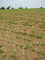
 Brassicas below turbine - geograph.org.uk - 827688.jpg 640 × 427; 50 KB
-
 Bray's Lane - geograph.org.uk - 828903.jpg 480 × 640; 152 KB
-
-
 Bridge over drain - geograph.org.uk - 828891.jpg 640 × 480; 196 KB
-
 Bridge over mill race - geograph.org.uk - 829608.jpg 640 × 480; 193 KB
-
 Bridge over the burn - geograph.org.uk - 828075.jpg 640 × 480; 119 KB
-
 Bridleway to Cwm-cafn - geograph.org.uk - 828145.jpg 640 × 428; 239 KB
-
 Bull's Head. - geograph.org.uk - 827845.jpg 640 × 480; 75 KB
-
 Burwell fire station - geograph.org.uk - 836361.jpg 640 × 427; 202 KB
-
 Buttermere Road, Burnley - geograph.org.uk - 828886.jpg 640 × 480; 165 KB
-
 Buxton Water Mill.JPG 480 × 640; 161 KB
-
 Cambridge fire station - geograph.org.uk - 836339.jpg 640 × 427; 245 KB
-
 Capel Moriah Llanystumdwy - geograph.org.uk - 840105.jpg 640 × 428; 96 KB
-
 Carlin Maggie - geograph.org.uk - 841651.jpg 640 × 480; 44 KB
-
 Castle hidden in the Trees - geograph.org.uk - 828680.jpg 640 × 480; 126 KB
-
 Cat Lane - geograph.org.uk - 827975.jpg 640 × 480; 42 KB
-
 Cattle Grid on B4280 - geograph.org.uk - 830181.jpg 640 × 480; 89 KB
-
 Cattle on Irton Fell - geograph.org.uk - 837401.jpg 640 × 427; 128 KB
-
 Cereal crops, Roves Farm, Sevenhampton - geograph.org.uk - 828229.jpg 480 × 640; 154 KB
-
 Charcoal can be purchased here - geograph.org.uk - 829178.jpg 480 × 640; 185 KB
-
 Chesters Fort - geograph.org.uk - 841293.jpg 640 × 480; 60 KB
-

-
 Church of Our Lady and St. Patrick - geograph.org.uk - 830316.jpg 640 × 480; 90 KB
-
-
 Claro House Farm - geograph.org.uk - 828950.jpg 640 × 427; 83 KB
-
 Cleascro - geograph.org.uk - 829078.jpg 627 × 434; 72 KB
-
 Collin Burn - geograph.org.uk - 828476.jpg 640 × 480; 109 KB
-
 Common horsetail (Equisetum arvense ) - geograph.org.uk - 828907.jpg 480 × 640; 195 KB
-
 Copse, Pensarn-fawr, Dihewyd - geograph.org.uk - 828479.jpg 640 × 480; 96 KB
-
 Corner shop - geograph.org.uk - 828371.jpg 640 × 480; 70 KB
-
 Cow and Gate - geograph.org.uk - 830194.jpg 640 × 480; 99 KB
-
 Cows with calves on former RAF base - geograph.org.uk - 1759981.jpg 640 × 480; 288 KB
-
 Crabgate Farm - geograph.org.uk - 829446.jpg 640 × 450; 144 KB
-
 Crabtree Farm and Cottages - geograph.org.uk - 829449.jpg 640 × 447; 136 KB
-
 Cribyn, Ceredigion.jpg 640 × 480; 118 KB
-
-
 Cromarty Place, Ross Street - geograph.org.uk - 827892.jpg 640 × 480; 74 KB
-
 Crossing the A15 - geograph.org.uk - 848959.jpg 640 × 480; 63 KB
-
 Cullen Bay - geograph.org.uk - 1210308.jpg 640 × 480; 62 KB
-
 Cullen Golf Links - geograph.org.uk - 1210307.jpg 640 × 480; 49 KB
-
 Cullen Seatown - geograph.org.uk - 1210299.jpg 640 × 480; 60 KB
-
 Cullen Seatown - geograph.org.uk - 1210303.jpg 640 × 480; 57 KB
-

-
 Cullen Viaduct - geograph.org.uk - 1210333.jpg 640 × 480; 93 KB
-
 Cullen, Seatown and Harbour - geograph.org.uk - 1210285.jpg 640 × 480; 72 KB
-

-
 Cwm of the Nant Wysg - geograph.org.uk - 828176.jpg 640 × 428; 225 KB
-
 Dail Bheithe 445972.jpg 640 × 480; 91 KB
-

-
 Dalriada Grammar School - geograph.org.uk - 830314.jpg 640 × 480; 106 KB
-
 Dane Park Road - geograph.org.uk - 828644.jpg 640 × 368; 149 KB
-
 Derelict Cinema - geograph.org.uk - 830154.jpg 640 × 360; 59 KB
-
 Derry Ormond station - geograph.org.uk - 828098.jpg 640 × 410; 213 KB
-
 Descent of Illgill Head - geograph.org.uk - 837691.jpg 640 × 427; 136 KB
-
 DG One, Leafield Road-Hoods Loaning - geograph.org.uk - 827731.jpg 640 × 480; 64 KB
-
 DG One, Main Entrance - geograph.org.uk - 827730.jpg 640 × 480; 57 KB
-
 Discarding the winter woollies - geograph.org.uk - 829594.jpg 640 × 480; 193 KB
-

-
 Disused Primitive Methodist Chapel - geograph.org.uk - 829464.jpg 480 × 640; 195 KB
-

-

-

-
 Downhill in the Rain - geograph.org.uk - 830188.jpg 640 × 480; 54 KB
-
 Downhill Run - geograph.org.uk - 830196.jpg 640 × 480; 62 KB
-
 Dyson Perrins school - main entrance - geograph.org.uk - 828389.jpg 640 × 480; 85 KB
-
 Elgol fishing boats at anchor. - panoramio.jpg 3,264 × 2,448; 2.61 MB
-
 Ely fire station - geograph.org.uk - 836346.jpg 640 × 427; 286 KB
-
 Ely old fire station - geograph.org.uk - 836351.jpg 640 × 427; 237 KB
-
 End of the Road - geograph.org.uk - 828401.jpg 640 × 480; 80 KB
-

-

-

-

-
 Entering South Ferriby - geograph.org.uk - 848883.jpg 640 × 480; 62 KB
-
 Entrance to Blaenplwyf farm - geograph.org.uk - 828205.jpg 640 × 428; 195 KB
-
 Entrance to Hermitage Farm - geograph.org.uk - 828513.jpg 640 × 480; 95 KB
-
 Eventide. - panoramio.jpg 3,264 × 2,448; 2.56 MB
-
 Exotic plants - geograph.org.uk - 829199.jpg 480 × 640; 188 KB
-

-
 Far Ings Nature Reserve - geograph.org.uk - 848816.jpg 640 × 480; 52 KB
-
 Farm house near Bught Knowe - geograph.org.uk - 829043.jpg 640 × 480; 76 KB
-
 Feeder loch for Loch an t Searraich - geograph.org.uk - 842343.jpg 640 × 360; 72 KB
-
 Ferrytoll park and ride (2) - geograph.org.uk - 831943.jpg 640 × 426; 70 KB
-
 Ferrytoll park and ride (3) - geograph.org.uk - 831944.jpg 640 × 425; 47 KB
-
 Ferrytoll park and ride (4) - geograph.org.uk - 831945.jpg 640 × 452; 61 KB
-
 Ferrytoll park and ride - geograph.org.uk - 831216.jpg 640 × 426; 105 KB
-
 Field on the hill - geograph.org.uk - 828133.jpg 640 × 428; 149 KB
-
 Fields by Cocklaw - geograph.org.uk - 828709.jpg 640 × 359; 80 KB
-
 Fields near Rhiwonnen - geograph.org.uk - 828184.jpg 640 × 428; 125 KB
-
 Filling station - geograph.org.uk - 827842.jpg 640 × 391; 59 KB
-
 First House in Heol-y-Cyw - geograph.org.uk - 830171.jpg 640 × 480; 76 KB
-
 Florendine Primary School - geograph.org.uk - 888467.jpg 640 × 427; 112 KB
-
 Florendine Primary School - geograph.org.uk - 888469.jpg 640 × 427; 81 KB
-
 Footbridge over the Nidd - geograph.org.uk - 829730.jpg 640 × 480; 98 KB
-
 Footpath from Rectory to Church - geograph.org.uk - 828807.jpg 480 × 640; 196 KB
-
 Footpath to Rectory - geograph.org.uk - 828798.jpg 480 × 640; 205 KB
-
 Forest Track at Whitropefoot - geograph.org.uk - 828375.jpg 640 × 480; 122 KB
-

-
 Former quarry near Antrim - geograph.org.uk - 828022.jpg 640 × 392; 102 KB
-
 Foxhunter's Carpark, Blorenge - geograph.org.uk - 1105375.jpg 640 × 480; 26 KB
-
 From Skye to Knoydart. - panoramio.jpg 2,592 × 1,007; 935 KB
-

-
 Gatwick North Terminal escalator up to Pier 6 passenger bridge.JPG 1,932 × 2,576; 1.25 MB
-
 Gatwick North Terminal Pier 6 passenger bridge (2)1.JPG 2,576 × 1,932; 1.25 MB
-
 Georgian terrace - geograph.org.uk - 830208.jpg 640 × 360; 57 KB
-
 Girls entrance - geograph.org.uk - 830407.jpg 640 × 480; 131 KB
-
 Glen Vale - geograph.org.uk - 841672.jpg 640 × 480; 52 KB
-

-
 Godolphin House - geograph.org.uk - 1580836.jpg 640 × 480; 81 KB
-
 Godolphin House - geograph.org.uk - 1580842.jpg 640 × 480; 105 KB
-
 Godolphin House - geograph.org.uk - 1580864.jpg 640 × 480; 94 KB
-
 Grazing Land at Burnfoot Farm - geograph.org.uk - 829018.jpg 640 × 480; 69 KB
-
 Greathall Gill on a misty day in June - geograph.org.uk - 837449.jpg 640 × 427; 147 KB
-
 Hagg Lane - geograph.org.uk - 827955.jpg 640 × 480; 46 KB
-
 Hall Farm - geograph.org.uk - 828897.jpg 480 × 640; 167 KB
-
 Hampston Hill Farm - geograph.org.uk - 828783.jpg 640 × 377; 172 KB
-
 Harbour of Light. - panoramio.jpg 3,264 × 2,448; 2.77 MB
-
 Heol-y-Cyw - geograph.org.uk - 830182.jpg 640 × 480; 55 KB
-
 Here be dragons - geograph.org.uk - 831339.jpg 640 × 480; 166 KB
-
 Higher Boode Farm. - geograph.org.uk - 828404.jpg 640 × 480; 96 KB
-
 Highland cow, Roves Farm, Sevenhampton - geograph.org.uk - 828224.jpg 640 × 480; 142 KB
-
 Highland cow, Roves Farm, Sevenhampton - geograph.org.uk - 828225.jpg 640 × 480; 121 KB
-
 Hillside on Marrogh - geograph.org.uk - 842368.jpg 640 × 360; 57 KB
-
 Hindolveston Road - geograph.org.uk - 828898.jpg 640 × 457; 153 KB
-
 Holmes Memorial Hall - geograph.org.uk - 830304.jpg 640 × 360; 58 KB
-
 Holy Cow - geograph.org.uk - 831285.jpg 640 × 480; 76 KB
-
 Horbury Quarry - geograph.org.uk - 827829.jpg 640 × 480; 91 KB
-
 House at the side of the track - geograph.org.uk - 828240.jpg 640 × 480; 67 KB
-
 House on the corner in Norton Corner - geograph.org.uk - 829171.jpg 480 × 640; 143 KB
-

-
 Humshaugh Medical Centre - geograph.org.uk - 841295.jpg 640 × 480; 63 KB
-

-
 Inside Turbine Tower No 17 - geograph.org.uk - 953836.jpg 640 × 480; 37 KB
-
 Interfield - track to Buckman's Farms - geograph.org.uk - 828268.jpg 640 × 480; 113 KB
-
 Inver River with Collin Top behind - geograph.org.uk - 828543.jpg 640 × 480; 68 KB
-
 Island, Loch Scadabhagh - geograph.org.uk - 842261.jpg 640 × 360; 48 KB
-
 Isleham old fire station - geograph.org.uk - 836389.jpg 640 × 427; 273 KB
-
 Jamestown Viaduct (2) - geograph.org.uk - 830053.jpg 640 × 330; 61 KB
-
 Jamestown Viaduct - geograph.org.uk - 830024.jpg 640 × 433; 70 KB
-
 Junction - geograph.org.uk - 827964.jpg 640 × 480; 34 KB
-
 Junction by Bryn-Madog-bâch - geograph.org.uk - 828236.jpg 640 × 428; 181 KB
-
 Junction with the A64 - geograph.org.uk - 827977.jpg 640 × 480; 44 KB
-
 Kintyre From Above Mid Thundergay - geograph.org.uk - 862820.jpg 640 × 426; 68 KB
-
 Kirkcolm Point and The Scar - geograph.org.uk - 1759994.jpg 640 × 480; 311 KB
-
 Lane and House, Blaen-tir, Dihewyd - geograph.org.uk - 828471.jpg 640 × 480; 102 KB
-
 Lane approaching Pennant - geograph.org.uk - 828434.jpg 640 × 472; 110 KB
-
 Lane to Ty'n-ffynnon - geograph.org.uk - 828448.jpg 640 × 480; 93 KB
-
 Lane, bangor - geograph.org.uk - 830882.jpg 480 × 640; 247 KB
-
 Latrigg, near its summit - geograph.org.uk - 838386.jpg 640 × 480; 93 KB
-
 Leahaugh Farm - geograph.org.uk - 828532.jpg 640 × 480; 81 KB
-
 Leehaugh Cottage - geograph.org.uk - 828559.jpg 640 × 480; 53 KB
-
-
 Lifebelt by mill race - geograph.org.uk - 829611.jpg 480 × 640; 169 KB
-

-

-
 Littleport fire station - geograph.org.uk - 836356.jpg 640 × 427; 193 KB
-
 Llama, Roves Farm, Sevenhampton - geograph.org.uk - 828226.jpg 640 × 480; 164 KB
-
 Llandyfrïog Parish Church - geograph.org.uk - 828425.jpg 640 × 480; 104 KB
-
 Loch a' Bhuna - geograph.org.uk - 829079.jpg 626 × 408; 76 KB


.jpg)
.jpg)
.jpg)


_-_geograph.org.uk_-_829207.jpg)


_-_geograph.org.uk_-_828907.jpg)


_-_geograph.org.uk_-_831943.jpg)
_-_geograph.org.uk_-_831944.jpg)
_-_geograph.org.uk_-_831945.jpg)


1.JPG)


_-_geograph.org.uk_-_830053.jpg)


