Category:United Kingdom photographs taken on 2008-11-16
| ← | Sunday 16 November 2008 | → | ||
| ← | November 2008 | → | ||

United Kingdom photographs taken on 16 November 2008.
Image files should be categorized here automatically using {{taken on}} template. Direct categorisation is also possible, if automatic is impossible.
Subcategories
This category has only the following subcategory.
Media in category "United Kingdom photographs taken on 2008-11-16"
The following 200 files are in this category, out of 1,196 total.
(previous page) (next page)-

-
 'Semi' on Norn Hill - geograph.org.uk - 1047456.jpg 640 × 472; 60 KB
-
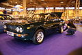 2008 NEC Classic Car Show IMG 2210 - Flickr - tonylanciabeta.jpg 3,888 × 2,592; 4.17 MB
-
 2008 NEC Classic Car Show IMG 2214 copy - Flickr - tonylanciabeta.jpg 3,888 × 2,592; 3.55 MB
-
 2008 NEC Classic Car Show IMG 2217 - Flickr - tonylanciabeta.jpg 3,888 × 2,592; 3.64 MB
-
 2008 NEC Classic Car Show IMG 2219 - Flickr - tonylanciabeta.jpg 3,888 × 2,592; 3.9 MB
-
 2008 NEC Classic Car Show IMG 2221 - Flickr - tonylanciabeta.jpg 3,888 × 2,592; 3.62 MB
-
 2008 NEC Classic Car Show IMG 2263 - Flickr - tonylanciabeta.jpg 3,888 × 2,592; 3.76 MB
-
 60 and 62 Westgate - geograph.org.uk - 1048583.jpg 584 × 640; 103 KB
-
 72 bus at the lights, Rocks Lane, Barnes - geograph.org.uk - 2680180.jpg 1,600 × 1,200; 169 KB
-
 A badly neglected cemetery - geograph.org.uk - 1048380.jpg 640 × 480; 141 KB
-
 A clear space on the Holiday Chalet site - geograph.org.uk - 1047968.jpg 640 × 427; 309 KB
-
 A groyne on Withernsea beach - geograph.org.uk - 1050927.jpg 427 × 640; 403 KB
-
 A horse's house on Holmpton Road, Hollym - geograph.org.uk - 1055514.jpg 640 × 427; 325 KB
-
 A model pier - geograph.org.uk - 1049816.jpg 640 × 427; 289 KB
-
 A rather large bike - geograph.org.uk - 1070287.jpg 640 × 480; 94 KB
-
 A view towards Chase Wood - geograph.org.uk - 1047873.jpg 640 × 480; 205 KB
-
 A view towards Leys Hill - geograph.org.uk - 1047856.jpg 640 × 480; 157 KB
-
 A35 crossing River Yarty - geograph.org.uk - 1055793.jpg 640 × 480; 74 KB
-
 A483 towards Beulah - geograph.org.uk - 1048956.jpg 640 × 480; 85 KB
-
 A483 towards Llanwrtyd Wells - geograph.org.uk - 1048951.jpg 640 × 480; 53 KB
-
 A6108 near Jervaulx Abbey - geograph.org.uk - 1047797.jpg 640 × 480; 106 KB
-
 A95 - Sign to Craggan Fishery - geograph.org.uk - 1410759.jpg 640 × 480; 77 KB
-
 Across Edale End to Lose Hill - geograph.org.uk - 1048096.jpg 640 × 480; 116 KB
-
 Air Bridge Memorial at Newark Cemetery - panoramio (1).jpg 1,728 × 2,304; 1.24 MB
-
 Air Bridge Memorial At Newark Cemetery - panoramio.jpg 2,304 × 1,728; 1.66 MB
-
 Air Bridge Memorial at Newark Cemetery - panoramio.jpg 1,728 × 2,304; 1.16 MB
-
 All the fun of the fair^ - geograph.org.uk - 1047516.jpg 640 × 480; 75 KB
-
 Allendale Hall - geograph.org.uk - 1093326.jpg 640 × 480; 56 KB
-
 Aller Bridge Chapel - geograph.org.uk - 1053352.jpg 640 × 426; 51 KB
-
 Allotments near Rusthall - geograph.org.uk - 1047574.jpg 640 × 430; 111 KB
-
 Allt Loch nan Uain - geograph.org.uk - 1166736.jpg 640 × 480; 117 KB
-
 Allt Mor Coming down from Rearquhar - geograph.org.uk - 1047743.jpg 640 × 480; 147 KB
-
 Alport Grain towards Gores Heights - geograph.org.uk - 1047843.jpg 640 × 480; 128 KB
-

-
 An imposing block - Regent Court - geograph.org.uk - 1047485.jpg 640 × 478; 78 KB
-
 Aqueduct near Rowlee Bridge - geograph.org.uk - 1047809.jpg 640 × 480; 118 KB
-
 Aqueduct over the River Brock - geograph.org.uk - 1050116.jpg 640 × 480; 134 KB
-
 Arable to the south of Nymet Rowland - geograph.org.uk - 1052008.jpg 640 × 426; 82 KB
-
-
 At the field edge - geograph.org.uk - 1050716.jpg 427 × 640; 141 KB
-
 Autumn at Lisburn - geograph.org.uk - 1048001.jpg 599 × 368; 90 KB
-
 Autumn beech leaves, Hembury Woods - geograph.org.uk - 1055975.jpg 640 × 451; 71 KB
-
 Autumn beech leaves, Hembury Woods - geograph.org.uk - 1055994.jpg 640 × 483; 156 KB
-
 Autumn by the Dart - geograph.org.uk - 1053178.jpg 480 × 640; 155 KB
-
 Autumn in Ward Park - geograph.org.uk - 1056929.jpg 640 × 560; 345 KB
-
 Autumn leaves, Hembury Woods - geograph.org.uk - 1056598.jpg 480 × 640; 178 KB
-
 Autumn on Coppett Hill - geograph.org.uk - 1047984.jpg 640 × 458; 185 KB
-
 Autumnal car park , Broadsands beach - geograph.org.uk - 1047052.jpg 640 × 519; 171 KB
-
 Bar Lush - geograph.org.uk - 1051021.jpg 426 × 640; 99 KB
-
 Barlett Creek - geograph.org.uk - 1049707.jpg 640 × 481; 49 KB
-
 Barn near Byerhope Farm - geograph.org.uk - 1057679.jpg 640 × 480; 109 KB
-

-
 Burgate - geograph.org.uk - 1054394.jpg 561 × 640; 162 KB
-
 St. Peter's Churchyard - geograph.org.uk - 1054382.jpg 640 × 480; 162 KB
-
 VR Postbox - Beck Hill - geograph.org.uk - 1047934.jpg 562 × 640; 137 KB
-
 Oakridge Church - geograph.org.uk - 1047308.jpg 640 × 490; 53 KB
-
 Beach and Groyne Hengistbury Head - geograph.org.uk - 1048041.jpg 640 × 482; 77 KB
-
 Beach and Huts at Hengistbury Head - geograph.org.uk - 1048274.jpg 640 × 389; 56 KB
-
 Beach at Hollym.jpg 404 × 640; 277 KB
-
 Beach debris, Old Hive - geograph.org.uk - 1048596.jpg 640 × 427; 341 KB
-
 Beach near Hengistbury head - geograph.org.uk - 1048000.jpg 640 × 417; 69 KB
-
 Beach, Hengistbury Head - geograph.org.uk - 1049980.jpg 640 × 399; 58 KB
-
 Beacon Fell Visitor Centre - geograph.org.uk - 1050229.jpg 640 × 480; 61 KB
-
 Beckinghyll Cottage, Silver Street - geograph.org.uk - 1057317.jpg 640 × 480; 99 KB
-
 Beech trees above Muirhead Reservoir - geograph.org.uk - 1053483.jpg 640 × 428; 135 KB
-
 Beehive pub - geograph.org.uk - 1049256.jpg 640 × 426; 57 KB
-

-
-

-

-

-
 Bellerby Beck - geograph.org.uk - 1047661.jpg 640 × 480; 72 KB
-
 Belted Galloway cattle, Bishopstone - geograph.org.uk - 1047599.jpg 640 × 480; 126 KB
-

-
 Between the houses - geograph.org.uk - 1047399.jpg 640 × 469; 67 KB
-
 Bickham Bridge and River Avon - geograph.org.uk - 1048369.jpg 640 × 427; 154 KB
-
 Biod an Athair - geograph.org.uk - 1048197.jpg 471 × 640; 105 KB
-
 Biod an Athair trig point - geograph.org.uk - 1048165.jpg 640 × 479; 173 KB
-
 Birch trees below Meall Garbh - geograph.org.uk - 1059527.jpg 640 × 480; 242 KB
-
 Birch woodland by Loch Leven cycle trail - geograph.org.uk - 1047562.jpg 640 × 360; 101 KB
-

-
 Black's Rolls, Clydebank - geograph.org.uk - 1070284.jpg 640 × 480; 127 KB
-
 Blackley Clough - geograph.org.uk - 1047829.jpg 640 × 480; 163 KB
-
 Blackpool Island - geograph.org.uk - 1052948.jpg 640 × 480; 146 KB
-
 BlueRoofRH.JPG 2,331 × 1,734; 1.07 MB
-
 Boat on Marsh Causeway - geograph.org.uk - 1049854.jpg 640 × 481; 46 KB
-
 Boats in Halstow Creek at Low-tide - geograph.org.uk - 1049764.jpg 640 × 481; 56 KB
-
 Boulder above Allt Buidhe - geograph.org.uk - 1059434.jpg 640 × 480; 222 KB
-
 Boulder at summit of Meall Clachach - geograph.org.uk - 1047936.jpg 640 × 480; 105 KB
-
 Boundary wall - geograph.org.uk - 1048435.jpg 640 × 480; 212 KB
-
 Boundary wall and Coldwell Wood - geograph.org.uk - 1048473.jpg 640 × 480; 251 KB
-
 Braenaloin, Rineten and Cnoc Chalmac - geograph.org.uk - 1053081.jpg 640 × 429; 91 KB
-
 Bridge across a stream in Shadwell Woods - geograph.org.uk - 1047523.jpg 640 × 430; 141 KB
-
 Bridge and signpost, Butterford Mill - geograph.org.uk - 1048946.jpg 640 × 427; 140 KB
-
 Bridge over Allt a'Mhuilinn - geograph.org.uk - 1047958.jpg 640 × 480; 134 KB
-
 Bridge over dismantled railway - geograph.org.uk - 1048080.jpg 640 × 427; 146 KB
-
 Bridge over disused railwayline - geograph.org.uk - 1052056.jpg 427 × 640; 86 KB
-
 Bridge over River Findhorn - geograph.org.uk - 1050455.jpg 640 × 480; 127 KB
-
 Bridge over the 'New' Leven Cut - geograph.org.uk - 1047678.jpg 640 × 360; 103 KB
-
 Bridge over the River Swale - geograph.org.uk - 1047620.jpg 640 × 480; 137 KB
-
 Bridge over the River Taw - geograph.org.uk - 1051949.jpg 640 × 426; 92 KB
-

-
 Bridge with Warning - geograph.org.uk - 1050463.jpg 640 × 480; 111 KB
-

-
 Bridleway, Horsebrook Bridge - geograph.org.uk - 1049316.jpg 640 × 427; 143 KB
-
 Broad Lane - geograph.org.uk - 1048060.jpg 640 × 480; 97 KB
-
 Brock valley - geograph.org.uk - 1050097.jpg 640 × 480; 78 KB
-
 Burn of Cantraydoune, looking downstream - geograph.org.uk - 1047790.jpg 427 × 640; 206 KB
-

-
 Bus on Dorking's South Street - geograph.org.uk - 1050419.jpg 640 × 480; 71 KB
-
 Butt Lane, Gt Wilbraham - geograph.org.uk - 1700512.jpg 4,272 × 2,848; 3.76 MB
-
 By Cliffe Road, North Newbald - geograph.org.uk - 1048132.jpg 480 × 640; 195 KB
-
 By the Dart in Hembury Woods - geograph.org.uk - 1052938.jpg 640 × 480; 139 KB
-
 Byerhope Moss (4) - geograph.org.uk - 1068890.jpg 640 × 480; 92 KB
-

-
 Cairn on top Gannoch - geograph.org.uk - 1049403.jpg 640 × 480; 65 KB
-
 Cairn, top of Tampie - geograph.org.uk - 1049398.jpg 640 × 480; 95 KB
-

-
 Carmyllie Hall - geograph.org.uk - 1048413.jpg 640 × 427; 77 KB
-
 Carved seat near Sallachy Lodge - geograph.org.uk - 1050701.jpg 640 × 480; 184 KB
-
 Castell-y-bwch Public house - geograph.org.uk - 1049154.jpg 640 × 480; 62 KB
-

-
 Cauldon Bus stop - geograph.org.uk - 1166393.jpg 640 × 479; 87 KB
-
 Cauldon Village - geograph.org.uk - 1166408.jpg 640 × 474; 110 KB
-
 Cauldron Waterfall - geograph.org.uk - 1112969.jpg 640 × 480; 100 KB
-
 Cave Bar - geograph.org.uk - 1051023.jpg 480 × 640; 97 KB
-
 Chatelherault - geograph.org.uk - 1058524.jpg 640 × 480; 92 KB
-

-
 Chester train station 2008 1.JPG 2,592 × 1,944; 1.34 MB
-
 Chester train station 2008 2.JPG 2,592 × 1,944; 1.51 MB
-

-
 Chicken Coops at Achvaich - geograph.org.uk - 1047853.jpg 640 × 480; 63 KB
-
 Chimney, Swalwell - geograph.org.uk - 1048875.jpg 413 × 640; 83 KB
-
 Choice of views near Staddicombe - geograph.org.uk - 1053853.jpg 640 × 480; 86 KB
-

-
 Church Bank, Cauldon - geograph.org.uk - 1166412.jpg 640 × 479; 128 KB
-
 Church Cottage, Lower Halstow - geograph.org.uk - 1049752.jpg 640 × 481; 99 KB
-
 Church End, Leckhampstead - geograph.org.uk - 1047498.jpg 640 × 506; 65 KB
-

-
 Church Street, Hadlow - geograph.org.uk - 1055430.jpg 640 × 480; 68 KB
-
 Citroen C6 (2).jpg 768 × 431; 134 KB
-
 Citroen C6 (3).jpg 768 × 397; 134 KB
-
 Clear views - for now - geograph.org.uk - 1047267.jpg 640 × 480; 94 KB
-
 Cleat - geograph.org.uk - 1051002.jpg 640 × 480; 57 KB
-
 Clibberswick cliffs - geograph.org.uk - 1047671.jpg 640 × 426; 121 KB
-
 Clibberswick, Haroldswick - geograph.org.uk - 1047587.jpg 640 × 426; 76 KB
-
 Clibberswick, Haroldswick - geograph.org.uk - 1047825.jpg 640 × 426; 96 KB
-
 Cliffline south of Biod an Athair - geograph.org.uk - 1048189.jpg 640 × 467; 132 KB
-
 Cliffs near Holmpton.jpg 640 × 427; 268 KB
-
 Climbing Bioda Buidhe - geograph.org.uk - 1051004.jpg 640 × 480; 93 KB
-
 Climbing up the hill into Speldhurst - geograph.org.uk - 1047455.jpg 640 × 430; 122 KB
-

-

-

-
-

-

-

-
 Clough adjacent to Lomas Lane - geograph.org.uk - 1053710.jpg 640 × 480; 141 KB
-
 Clydebank Titan Crane - geograph.org.uk - 1069892.jpg 640 × 480; 105 KB
-
 Coastal erosion south of Intack farm - geograph.org.uk - 1055483.jpg 640 × 427; 343 KB
-
 Coed Caeper-corn from the south - geograph.org.uk - 1048975.jpg 640 × 480; 56 KB
-
 Coldridge Barton Farm - geograph.org.uk - 1053360.jpg 640 × 426; 106 KB
-
 Coldridge Church - geograph.org.uk - 1053664.jpg 640 × 426; 50 KB
-
 Coldwell Rocks - geograph.org.uk - 1048778.jpg 640 × 480; 152 KB
-
 Come and share this bench with me...... - geograph.org.uk - 1050217.jpg 640 × 480; 124 KB
-
 Commonwealth and Polish War Graves At Newark Cemetery - panoramio.jpg 1,728 × 2,304; 540 KB
-

-
 Constituency office - geograph.org.uk - 1051019.jpg 480 × 640; 119 KB
-

-
 Corkscrew Car Park - geograph.org.uk - 1048354.jpg 640 × 480; 100 KB
-
 Corner of Bennet Close - geograph.org.uk - 1047405.jpg 640 × 482; 128 KB
-
 Cornwall Beach (3035932509).jpg 3,456 × 2,304; 4.38 MB
-
 Corsica Hall, Seaford - geograph.org.uk - 1048236.jpg 640 × 353; 51 KB
-

-
 Country road near Nymet Rowland - geograph.org.uk - 1051977.jpg 640 × 426; 79 KB
-
 Country road south of Nymet Rowland - geograph.org.uk - 1052015.jpg 640 × 426; 95 KB
-
 Countryside at Shuttaford - geograph.org.uk - 1053946.jpg 640 × 480; 80 KB
-
 Course of dismantled railway, Bickham - geograph.org.uk - 1048901.jpg 640 × 427; 144 KB
-

-

-
 Cramond Brig - geograph.org.uk - 1047352.jpg 640 × 480; 102 KB
-
 Crawshaw's Buildings off Carr Lane - geograph.org.uk - 1048731.jpg 640 × 480; 101 KB
-

-
 Creag na h-eanchainn - geograph.org.uk - 1047388.jpg 640 × 480; 93 KB
-
 Cressbrook Dale - geograph.org.uk - 1191246.jpg 640 × 426; 103 KB
-

-
 Crofting Land near River Evelix - geograph.org.uk - 1047819.jpg 640 × 480; 56 KB
-

-
 Cross Gates Centre.jpg 3,264 × 2,448; 1.32 MB
-
 Cross Gates Centre1.jpg 3,264 × 2,448; 1.46 MB
-
 Crow on a Post , Hengistbury Head - geograph.org.uk - 1048042.jpg 640 × 429; 96 KB
-

-

-
 Culverden Park - geograph.org.uk - 1047727.jpg 640 × 430; 50 KB
-
 Culverden Park Rd - geograph.org.uk - 1047690.jpg 640 × 430; 108 KB
-
 Currick below Dodd End (2) - geograph.org.uk - 1048882.jpg 480 × 640; 40 KB
-
 Cutsyke station (remains of) - geograph.org.uk - 1048124.jpg 640 × 462; 323 KB
-
 Cwm-bryn farm - geograph.org.uk - 1048971.jpg 640 × 480; 105 KB


.jpg)


_-1,_Manchester_Road,_Sheffield_-_geograph.org.uk_-_1079769.jpg)


_-_geograph.org.uk_-_1068890.jpg)


.jpg)
.jpg)


.jpg)


_-_geograph.org.uk_-_1048882.jpg)
_-_geograph.org.uk_-_1048124.jpg)
