Category:United Kingdom photographs taken on 2008-11-21
Countries of Europe: Armenia‡ · Austria · Belgium · Bulgaria · Denmark · Estonia · France‡ · Germany · Greece · Italy · Latvia · Malta · Netherlands‡ · Poland · Portugal‡ · Romania · Russia‡ · Slovakia · Spain‡ · Sweden · Switzerland · Turkey‡ · Ukraine · United Kingdom
‡: partly located in Europe
‡: partly located in Europe
| ← | 21 November 2008 | → | ||
| ← | November 2008 | → | ||

United Kingdom photographs taken on 21 November 2008.
Image files should be categorized here automatically using {{taken on}} template. Direct categorisation is also possible, if automatic is impossible.
Subcategories
This category has the following 2 subcategories, out of 2 total.
Media in category "United Kingdom photographs taken on 2008-11-21"
The following 200 files are in this category, out of 653 total.
(previous page) (next page)-
 "Stay on footpath or stay home" - geograph.org.uk - 1059577.jpg 640 × 574; 128 KB
-
 'Semis' along Beech Way - geograph.org.uk - 1054023.jpg 640 × 467; 70 KB
-
 'Semis' in Beech Way - geograph.org.uk - 1054012.jpg 640 × 472; 71 KB
-

-
 'The Jack Mytton Way' at Keepers Cottage - geograph.org.uk - 1065409.jpg 640 × 480; 114 KB
-
 The Queens Head Sign - geograph.org.uk - 1055084.jpg 3,072 × 2,304; 1.57 MB
-
 32 Station Road, New Barnet - geograph.org.uk - 1056070.jpg 432 × 640; 159 KB
-
 42-43 Cromwell Road - geograph.org.uk - 1054189.jpg 479 × 640; 95 KB
-
 A field of kale - geograph.org.uk - 1060809.jpg 640 × 480; 97 KB
-
-

-

-
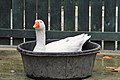 A goose bath^ - geograph.org.uk - 1055770.jpg 640 × 427; 331 KB
-
 A lichen - Collema flaccidum - geograph.org.uk - 1057723.jpg 640 × 480; 119 KB
-
 A lichen - Collema furfuraceum - geograph.org.uk - 1054150.jpg 640 × 480; 141 KB
-
 A lichen - Dermatocarpon luridum - geograph.org.uk - 1054164.jpg 640 × 480; 123 KB
-

-
 A lichen - Verrucaria mucosa - geograph.org.uk - 1055602.jpg 640 × 480; 126 KB
-
 A line of 'semis' - Beech Way - geograph.org.uk - 1054028.jpg 640 × 466; 63 KB
-
 A view along the shore from Ardoch - geograph.org.uk - 1057754.jpg 640 × 480; 105 KB
-

-
 Across the fields near Ashey - geograph.org.uk - 1054174.jpg 427 × 640; 99 KB
-
 Andover - Christmas Lights - geograph.org.uk - 1056194.jpg 640 × 480; 65 KB
-

-
 Arable land off Mill Lane - geograph.org.uk - 1055195.jpg 640 × 480; 201 KB
-
 Arwelfa, Bryn Du - geograph.org.uk - 1055890.jpg 640 × 329; 38 KB
-
 Ascending Bleaberry Knott - geograph.org.uk - 1055814.jpg 480 × 640; 78 KB
-
 Ascending Place Fell - geograph.org.uk - 1055768.jpg 640 × 480; 49 KB
-
 Ascending Place Fell - geograph.org.uk - 1055781.jpg 640 × 480; 56 KB
-

-
 Castle Street, Axminster - geograph.org.uk - 1059629.jpg 480 × 640; 62 KB
-
 Axminster Crossing - geograph.org.uk - 1059594.jpg 640 × 480; 74 KB
-
 Axminster Guildhall - geograph.org.uk - 1059561.jpg 640 × 480; 64 KB
-
 B1077 Cranley Green Road - geograph.org.uk - 1054786.jpg 3,072 × 2,304; 1.44 MB
-
 B1077 Cranley Green Road - geograph.org.uk - 1054789.jpg 3,072 × 2,304; 1.49 MB
-
 Back to back house interior - geograph.org.uk - 1054743.jpg 480 × 640; 91 KB
-
 Bae Aberffraw Bay - geograph.org.uk - 1058098.jpg 640 × 254; 22 KB
-

-
 Barjarg Tower Gatehouse - geograph.org.uk - 1057785.jpg 640 × 419; 87 KB
-
 Barn Complex at Pool Farm - geograph.org.uk - 1057688.jpg 640 × 480; 67 KB
-
 Barndennoch Farm - geograph.org.uk - 1057389.jpg 640 × 345; 46 KB
-
 Barnes Court - geograph.org.uk - 1056042.jpg 413 × 640; 208 KB
-
 Barnet Hill - geograph.org.uk - 1055998.jpg 640 × 406; 143 KB
-
 The Horkstow Road - geograph.org.uk - 282397.jpg 640 × 480; 134 KB
-
 Battered signpost - geograph.org.uk - 1054142.jpg 640 × 360; 117 KB
-
 Beattock.JPG 2,096 × 1,425; 1.06 MB
-
 Bedfield Village Sign - geograph.org.uk - 1055168.jpg 3,072 × 2,304; 1.43 MB
-
 Bedfield Village Sign - geograph.org.uk - 1055173.jpg 3,072 × 2,304; 1.21 MB
-
 Bedfield Village Sign - geograph.org.uk - 1055177.jpg 3,072 × 2,304; 1.44 MB
-
 Beech Way - geograph.org.uk - 1054019.jpg 640 × 464; 48 KB
-

-
 Belted Galloways near Langley - geograph.org.uk - 1080819.jpg 640 × 480; 92 KB
-
 Benchmark on Eaton Road - geograph.org.uk - 1053586.jpg 640 × 480; 240 KB
-
 Bexley station look east2.JPG 1,600 × 1,200; 452 KB
-
 Big Head, Eye - geograph.org.uk - 1054781.jpg 3,072 × 2,304; 1.4 MB
-
 Big Head, Eye - geograph.org.uk - 1054783.jpg 3,072 × 2,304; 1.52 MB
-
 Bird Hide Calf Hey - geograph.org.uk - 1054209.jpg 640 × 480; 147 KB
-
 Birthdays, High Street, Omagh - geograph.org.uk - 1054969.jpg 640 × 480; 62 KB
-
 Bleaberry Knott - geograph.org.uk - 1055801.jpg 640 × 480; 83 KB
-
 Blue Garages - geograph.org.uk - 1054081.jpg 640 × 473; 85 KB
-
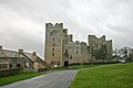 Bolton Castle - geograph.org.uk - 1056784.jpg 640 × 426; 63 KB
-
 Bolton Gill - geograph.org.uk - 1056796.jpg 640 × 426; 155 KB
-
 Boredale Hause - geograph.org.uk - 1055760.jpg 640 × 480; 56 KB
-
 Bowman Brewery at Wallops Wood - geograph.org.uk - 1057249.jpg 640 × 480; 76 KB
-
 Brackenley Grange - geograph.org.uk - 1054552.jpg 640 × 469; 55 KB
-

-
 Brandeston Village Sign - geograph.org.uk - 1055066.jpg 3,072 × 2,304; 1.51 MB
-
 Brandeston Village Sign - geograph.org.uk - 1055071.jpg 3,072 × 2,304; 1.44 MB
-
 Bransbury - Building Work - geograph.org.uk - 1056786.jpg 640 × 480; 89 KB
-
 Bransbury - Building Work - geograph.org.uk - 1056790.jpg 640 × 480; 63 KB
-
 Breakwater at entrance to dock - geograph.org.uk - 1057619.jpg 640 × 480; 52 KB
-
 Bridge on Old Paper Mill Race and Weir - geograph.org.uk - 1055075.jpg 640 × 460; 118 KB
-
 Bridge on the Tennant Canal - geograph.org.uk - 1618086.jpg 640 × 480; 100 KB
-

-
 Bridge over the River Rea - geograph.org.uk - 1065410.jpg 640 × 480; 126 KB
-
 Bridleway heading to Town End - geograph.org.uk - 1055745.jpg 640 × 480; 155 KB
-

-
 Bridleway, Laverstock - geograph.org.uk - 1054195.jpg 480 × 640; 124 KB
-
 Bridleway, Wexland Farm - geograph.org.uk - 1057068.jpg 640 × 480; 89 KB
-
 Bridleways crossing - geograph.org.uk - 1054149.jpg 640 × 480; 128 KB
-
 Broad Street, Eye - geograph.org.uk - 1054774.jpg 3,072 × 2,304; 1.36 MB
-
 Brook flowing downstream - geograph.org.uk - 1055202.jpg 480 × 640; 174 KB
-
 Brook House bus stop - geograph.org.uk - 1055207.jpg 640 × 480; 107 KB
-
 St Mark's Church - the Tower - geograph.org.uk - 1056452.jpg 427 × 640; 99 KB
-
 Brown fungus - geograph.org.uk - 1061260.jpg 640 × 480; 113 KB
-
 Bruach Caorainn Burn - geograph.org.uk - 1056426.jpg 640 × 480; 219 KB
-
-
 Builders' Merchant - geograph.org.uk - 1057255.jpg 640 × 480; 58 KB
-
 Bulwer Road - geograph.org.uk - 1057354.jpg 640 × 427; 145 KB
-
 Bungalows in Carlisle Close - geograph.org.uk - 1054002.jpg 640 × 472; 50 KB
-

-
 Burlington Coachworks - geograph.org.uk - 1056187.jpg 640 × 427; 133 KB
-
 Bus approaching Conwy - geograph.org.uk - 1073090.jpg 640 × 480; 109 KB
-
 Byway near Wexland Farm - geograph.org.uk - 1055880.jpg 640 × 426; 72 KB
-
 Byway near Wexland Farm - geograph.org.uk - 1057009.jpg 640 × 535; 89 KB
-
 Cairn, Bleaberry Knott - geograph.org.uk - 1055818.jpg 640 × 480; 58 KB
-
 Cairn, Low Birk Fell - geograph.org.uk - 1056077.jpg 640 × 480; 63 KB
-
 Calf Hey Reservoir Dam - geograph.org.uk - 1054232.jpg 640 × 480; 71 KB
-
 Canal Basin, Skipton - geograph.org.uk - 1057185.jpg 640 × 480; 65 KB
-
 Canal moorings, Skipton - geograph.org.uk - 1057202.jpg 640 × 480; 96 KB
-

-
 Carlisle Close houses - geograph.org.uk - 1054005.jpg 640 × 473; 65 KB
-
 Castle Hill House, Axminster - geograph.org.uk - 1059615.jpg 640 × 480; 77 KB
-

-
 Castle Lodge, Castle Square, Ludlow - geograph.org.uk - 1054079.jpg 640 × 480; 81 KB
-
 Castle Street, Skipton - geograph.org.uk - 1057179.jpg 640 × 480; 62 KB
-
 Cats Castle - geograph.org.uk - 1057768.jpg 640 × 480; 66 KB
-

-

-
 Cedar Trees - geograph.org.uk - 1056101.jpg 640 × 478; 79 KB
-
 ChapelAllertonMethChurch.jpg 2,919 × 2,025; 802 KB
-
 Chez Manu goes mobile - geograph.org.uk - 1054985.jpg 640 × 276; 31 KB
-

-

-
 Churchyard, St Michael and All Angels - geograph.org.uk - 1055847.jpg 640 × 480; 139 KB
-

-

-

-
 Clyde foreshore between Havoc and Ardoch - geograph.org.uk - 1054937.jpg 640 × 480; 104 KB
-
 Collier's Lane - geograph.org.uk - 1055696.jpg 640 × 480; 102 KB
-
 Collier's Lane - geograph.org.uk - 1055718.jpg 640 × 480; 96 KB
-
 Colwall Free Church - geograph.org.uk - 1055226.jpg 480 × 640; 112 KB
-
 Colwall Pharmacy - geograph.org.uk - 1055217.jpg 640 × 480; 82 KB
-
 Colwall Village Hall - geograph.org.uk - 1055165.jpg 640 × 480; 95 KB
-

-
 Confluence - geograph.org.uk - 1058219.jpg 640 × 480; 77 KB
-
 Conwy Castle, car park - geograph.org.uk - 1073083.jpg 640 × 480; 132 KB
-
 Conwy Castle, well - geograph.org.uk - 1073079.jpg 640 × 480; 128 KB
-
 Conwy harbour - geograph.org.uk - 1073096.jpg 640 × 480; 66 KB
-
 Conwy station at dusk - geograph.org.uk - 1073101.jpg 640 × 480; 99 KB
-
 Coomb Cheshire Home - geograph.org.uk - 1054218.jpg 640 × 480; 76 KB
-
 Corner houses - Beech Way - geograph.org.uk - 1054044.jpg 640 × 457; 55 KB
-

-
 Cottages above Porth Nobla - geograph.org.uk - 1059470.jpg 640 × 480; 42 KB
-
 Cottages, Old Street, Newchurch - geograph.org.uk - 1054099.jpg 640 × 480; 126 KB
-
 County boundary - geograph.org.uk - 1053868.jpg 640 × 480; 151 KB
-
 County boundary - geograph.org.uk - 1054074.jpg 640 × 360; 102 KB
-
 Court 15 Inge Street - geograph.org.uk - 1054729.jpg 480 × 640; 100 KB
-
 Cracoe Cricket Club - geograph.org.uk - 1058024.jpg 640 × 497; 65 KB
-
 Crag, with entrance of Dumbarton Cave - geograph.org.uk - 1054823.jpg 640 × 480; 130 KB
-
 Cromer Road - geograph.org.uk - 1056248.jpg 640 × 427; 140 KB
-
 Cromer Road Primary School - geograph.org.uk - 1056266.jpg 640 × 427; 134 KB
-
 Cross Street Car Park - geograph.org.uk - 1054746.jpg 3,072 × 2,304; 1.43 MB
-
 Cross Street,Eye - geograph.org.uk - 1054759.jpg 3,072 × 2,304; 1.44 MB
-

-
 Cynlas - a Victorian villa at Bryn Du - geograph.org.uk - 1055860.jpg 640 × 480; 100 KB
-
 St. John's church Darlington - geograph.org.uk - 1054231.jpg 640 × 480; 52 KB
-

-

-

-

-
 Down the Maidstone Road, Wigmore - geograph.org.uk - 1053994.jpg 640 × 480; 96 KB
-
 Duchray Water and Ben Lomond - geograph.org.uk - 1056478.jpg 480 × 640; 196 KB
-
 Dysynni Estuary - geograph.org.uk - 1078968.jpg 640 × 480; 86 KB
-
 Early nineteenth century graves - geograph.org.uk - 1055746.jpg 640 × 426; 111 KB
-
 Early sunset, Galmpton direction - geograph.org.uk - 1054323.jpg 640 × 480; 154 KB
-
 Eastern end of Beech Way - geograph.org.uk - 1054048.jpg 640 × 458; 57 KB
-
 Eastern view along Beech Way - geograph.org.uk - 1054026.jpg 640 × 466; 54 KB
-

-
 Eller Beck Skipton Wood.jpg 640 × 480; 107 KB
-
 Empty Plots on Grain Road, Wigmore - geograph.org.uk - 1054001.jpg 640 × 480; 51 KB
-
 Entrance of Dumbarton Cave - geograph.org.uk - 1054828.jpg 480 × 640; 117 KB
-
 Entrance to Marsh Farm - geograph.org.uk - 1053791.jpg 640 × 480; 113 KB
-
 Eroded cliff at Porth Nobla - geograph.org.uk - 1060773.jpg 640 × 372; 48 KB
-

-
 Eye banner Broad Street.jpg 3,072 × 439; 371 KB
-
 Eye Town Hall - geograph.org.uk - 1054763.jpg 3,072 × 2,304; 1.4 MB
-
 Eye Town Hall - geograph.org.uk - 1054765.jpg 3,072 × 2,304; 1.34 MB
-
 Fairview Garage and Shops - geograph.org.uk - 1053984.jpg 640 × 480; 51 KB
-
 Fairview Shops - geograph.org.uk - 1053988.jpg 640 × 480; 60 KB
-

-

-
-
 Field by lane to Tarrant Monkton - geograph.org.uk - 1061004.jpg 640 × 480; 89 KB
-
 Fields on Snow's Down - geograph.org.uk - 1060593.jpg 640 × 480; 117 KB
-
 Finchley Central Station - geograph.org.uk - 1055948.jpg 457 × 640; 195 KB
-
 Finchley Central Station - geograph.org.uk - 1055949.jpg 640 × 414; 157 KB
-
 Flag wall Hill End Lane - geograph.org.uk - 1054003.jpg 640 × 480; 86 KB
-

-
 Footbridge at Colwall Stone - geograph.org.uk - 1055221.jpg 640 × 480; 114 KB
-
 Footbridge on the path to Detton Hall - geograph.org.uk - 1065421.jpg 640 × 480; 128 KB
-
 Footbridge over the River Rea - geograph.org.uk - 1065414.jpg 640 × 480; 168 KB
-
 Footbridge, River Avon, Figheldean - geograph.org.uk - 1055833.jpg 640 × 480; 120 KB
-
 Footpath across the railway - geograph.org.uk - 1054654.jpg 640 × 480; 178 KB
-
 Footpath and stile near Detton Hall - geograph.org.uk - 1065411.jpg 640 × 480; 100 KB
-
 Footpath at Hebden - geograph.org.uk - 1056506.jpg 640 × 480; 101 KB
-
 Footpath by Mill Race - geograph.org.uk - 1055129.jpg 640 × 483; 68 KB
-

-

-
 Footpath from the foreshore to Brucehill - geograph.org.uk - 1054009.jpg 640 × 480; 109 KB
-

-
 Footpath to Ardoch - geograph.org.uk - 1054924.jpg 640 × 480; 116 KB
-
 Footpath to Calf Hey - geograph.org.uk - 1054212.jpg 640 × 480; 67 KB
-
 Footpath under the railway, Warrington - geograph.org.uk - 1055091.jpg 483 × 640; 106 KB
-
 Former chapel, Colwall Green - geograph.org.uk - 1054643.jpg 640 × 458; 116 KB
-

-
 Former MOD houses at Ty Croes - geograph.org.uk - 1200149.jpg 640 × 480; 68 KB
-
 Formerly Medway Road - geograph.org.uk - 1054018.jpg 640 × 480; 106 KB
-
 French Road Sign - geograph.org.uk - 1054752.jpg 3,072 × 2,304; 1.48 MB
-
 French Road Sign - geograph.org.uk - 1054757.jpg 3,072 × 2,304; 1.46 MB


_-_geograph.org.uk_-_1057655.jpg)


