Category:United Kingdom photographs taken on 2009-02-18
Countries of Europe: Austria · Belgium · Croatia · Czech Republic · Finland · France‡ · Germany · Greece · Republic of Ireland · Italy · Malta · Netherlands‡ · Norway · Poland · Portugal‡ · Romania · Russia‡ · Serbia · Spain‡ · Switzerland · Turkey‡ · Ukraine · United Kingdom
Specific status: Isle of Man
‡: partly located in Europe
Specific status: Isle of Man
‡: partly located in Europe
| ← | 18 February 2007 | → | ||
| ← | February 2007 | → | ||

United Kingdom photographs taken on 18 February 2007.
Image files should be categorized here automatically using {{taken on}} template. Direct categorisation is also possible, if automatic is impossible.
Subcategories
This category has only the following subcategory.
Media in category "United Kingdom photographs taken on 2009-02-18"
The following 200 files are in this category, out of 873 total.
(previous page) (next page)-

-
 (1926) Pale Brindled Beauty (Phigalia pilosaria) (3289788771).jpg 2,848 × 2,136; 1.45 MB
-
 (1926) Pale Brindled Beauty (Phigalia pilosaria) (3290608730).jpg 2,848 × 2,136; 1.44 MB
-

-
 2 Bessborough Gardens - geograph.org.uk - 1168723.jpg 525 × 640; 60 KB
-
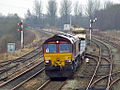 66193 Castleton East Junction.jpg 1,024 × 768; 454 KB
-
 7 miles to Festiniog - geograph.org.uk - 1171889.jpg 480 × 640; 148 KB
-

-
 A fine town house - geograph.org.uk - 1581367.jpg 640 × 471; 100 KB
-
 A misty Ridgeway - geograph.org.uk - 1172969.jpg 640 × 480; 112 KB
-
 A row of houses in Bedrule - geograph.org.uk - 1168276.jpg 640 × 480; 88 KB
-

-
 Abandoned star-wheel rake - geograph.org.uk - 1314237.jpg 640 × 480; 78 KB
-
 Above Hawkswick - geograph.org.uk - 1169101.jpg 640 × 480; 59 KB
-
 Access road to Ely Cathedral - geograph.org.uk - 1581803.jpg 640 × 480; 78 KB
-
 Access road to The Deanery - geograph.org.uk - 1581785.jpg 640 × 480; 101 KB
-
-
 Adapting the business - geograph.org.uk - 1169415.jpg 640 × 376; 229 KB
-
 Afon Eidda - geograph.org.uk - 1170705.jpg 640 × 480; 133 KB
-
 Afon Rhydyrhalen - geograph.org.uk - 1170715.jpg 480 × 640; 131 KB
-

-
 Alien spaceship, Llyn Conwy^ - geograph.org.uk - 1173371.jpg 640 × 480; 61 KB
-
 Allt Bàn - geograph.org.uk - 1170518.jpg 640 × 480; 158 KB
-
 Almonry Restaurant - Ely - geograph.org.uk - 1538845.jpg 640 × 478; 91 KB
-
 Almonry restaurant gardens - geograph.org.uk - 1538842.jpg 640 × 480; 118 KB
-
 Almonry restaurant gardens - geograph.org.uk - 1538858.jpg 640 × 465; 91 KB
-
 Almonry restaurant gardens - geograph.org.uk - 1538868.jpg 640 × 473; 90 KB
-
 Almonry restaurant gardens - geograph.org.uk - 1538873.jpg 640 × 454; 106 KB
-
 Almshouses, Ysbyty Ifan - geograph.org.uk - 1170468.jpg 640 × 480; 81 KB
-
 Alne Hall - geograph.org.uk - 1205366.jpg 640 × 480; 67 KB
-
 Alne Parish Church with name board - geograph.org.uk - 1206031.jpg 640 × 480; 90 KB
-
 Anaheim Drive - Baker Lane - geograph.org.uk - 1169529.jpg 640 × 404; 161 KB
-
 Approaching Cinderdale Common - geograph.org.uk - 1177706.jpg 640 × 425; 63 KB
-
 Approaching Sligachan hotel - geograph.org.uk - 1169356.jpg 640 × 480; 104 KB
-
 Approaching the canal bridge, Staplow - geograph.org.uk - 1169465.jpg 640 × 427; 287 KB
-
 Araucaria araucana branch, Dawyck Botanic Garden.jpg 3,888 × 2,592; 4.7 MB
-
 Arbroath Church Yard 02.jpg 2,767 × 4,110; 10.33 MB
-
 Arthur Street, Peacehaven - geograph.org.uk - 1188418.jpg 640 × 480; 76 KB
-
 Ashbury Chase - Ledger Lane - geograph.org.uk - 1169064.jpg 640 × 430; 160 KB
-
-
 Back alley, Colne - geograph.org.uk - 1168220.jpg 480 × 640; 125 KB
-
 Baker Lane - viewed from Rooks Nest Road - geograph.org.uk - 1169571.jpg 640 × 414; 167 KB
-
 Bandstand, Bedwellty Park, Tredegar - geograph.org.uk - 1180457.jpg 640 × 480; 135 KB
-
 Bardwell Court - Rushworth Close - geograph.org.uk - 1169552.jpg 640 × 480; 219 KB
-
 Barn at Whetstone House - geograph.org.uk - 1172125.jpg 640 × 480; 113 KB
-
 Barratts Shoes, Telford Town Centre - geograph.org.uk - 1168065.jpg 640 × 475; 305 KB
-

-
 Beaumaris foreshore - geograph.org.uk - 1257080.jpg 457 × 640; 69 KB
-
 Bedwellty Park, Tredegar - geograph.org.uk - 1180393.jpg 640 × 479; 174 KB
-
 Bedwelty 1180380 640b67ec.jpg 640 × 480; 120 KB
-
 Beniarth Terrace - geograph.org.uk - 1171809.jpg 640 × 480; 53 KB
-
 Bennet's Burn Ford - geograph.org.uk - 1174123.jpg 640 × 360; 85 KB
-

-
 Bishops Palace - Ely - geograph.org.uk - 1581771.jpg 640 × 480; 112 KB
-

-
 Blackfriars station (6814209444).jpg 4,416 × 3,312; 1.39 MB
-
 Blackfriars station (6960319287).jpg 4,416 × 3,312; 1.26 MB
-
 Blackfriars station (6960331031).jpg 4,416 × 3,312; 1.15 MB
-
 Blaen-y-Coed - geograph.org.uk - 1173547.jpg 640 × 480; 82 KB
-
 Blot on the landscape - geograph.org.uk - 1171653.jpg 640 × 480; 142 KB
-
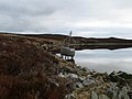
 Boathouse by Crummock Water - geograph.org.uk - 1177685.jpg 640 × 425; 62 KB
-
 Bolus Lane - Leeds Road - geograph.org.uk - 1169508.jpg 640 × 480; 220 KB
-
 Bournemouth , Bournemouth Pier - geograph.org.uk - 1213887.jpg 640 × 480; 36 KB
-
 Bracket Fungus (Many-Zoned Polypore) - geograph.org.uk - 1168160.jpg 640 × 480; 137 KB
-
 Braithwaite Hall, Coverdale - geograph.org.uk - 1579405.jpg 640 × 480; 63 KB
-
 Bramble Court - Ledger Lane - geograph.org.uk - 1169067.jpg 640 × 431; 169 KB
-
 Bread Street - Marygate - geograph.org.uk - 1170244.jpg 493 × 640; 235 KB
-
 Brickyard Farm - geograph.org.uk - 1206660.jpg 640 × 480; 79 KB
-
 Bridge across the River Irwell - geograph.org.uk - 1294555.jpg 640 × 480; 64 KB
-
 Bridge DOL2-15 - Ledger Lane - geograph.org.uk - 1169068.jpg 640 × 415; 130 KB
-
 Bridge over Allt Dubh - geograph.org.uk - 1169392.jpg 640 × 480; 111 KB
-
 Bridge over Allt Dubh - geograph.org.uk - 1169397.jpg 640 × 480; 105 KB
-
 Bridge over the Conwy - geograph.org.uk - 1170462.jpg 640 × 480; 103 KB
-
 Bridgeton Railway Station - geograph.org.uk - 1167992.jpg 640 × 480; 138 KB
-
-

-
 Bridleway S7 - geograph.org.uk - 1174506.jpg 640 × 480; 91 KB
-
 British Heart Foundation - geograph.org.uk - 1493580.jpg 480 × 640; 79 KB
-
 Broadmeadows - Rooks Nest Road - geograph.org.uk - 1169775.jpg 640 × 416; 191 KB
-
 Bryniau Duon - geograph.org.uk - 1173550.jpg 640 × 480; 68 KB
-
 Bush hotel, Park Row, Tredegar - geograph.org.uk - 1187417.jpg 640 × 480; 92 KB
-
 Cae Cwmpas - geograph.org.uk - 1171650.jpg 640 × 480; 56 KB
-
 Cairn on White Knott - geograph.org.uk - 1171671.jpg 640 × 480; 89 KB
-
 Canal Court - Canal Lane - geograph.org.uk - 1169526.jpg 640 × 480; 203 KB
-
 Canal towpath - geograph.org.uk - 1169368.jpg 640 × 440; 364 KB
-
 Canonry House - geograph.org.uk - 1581808.jpg 640 × 480; 126 KB
-
 Car park - The King's School, Ely - geograph.org.uk - 1581815.jpg 640 × 459; 70 KB
-
 Car park and Ely cathedral towers - geograph.org.uk - 1548075.jpg 640 × 433; 51 KB
-
 Car park entrance - geograph.org.uk - 1548064.jpg 640 × 458; 74 KB
-
 Carrog cottages - geograph.org.uk - 1171811.jpg 640 × 480; 73 KB
-
 Cats' burial ground, Caldbergh - geograph.org.uk - 1579415.jpg 640 × 480; 102 KB
-
 Cattle grid above Hafod Ifan - geograph.org.uk - 1170561.jpg 640 × 480; 71 KB
-
 Cattle grid on the Ffestiniog road - geograph.org.uk - 1171964.jpg 640 × 480; 109 KB
-
 Cattle grid on the Ffestiniog road - geograph.org.uk - 1173542.jpg 640 × 480; 70 KB
-

-
-
 Chapel interior, Swinmore Common - geograph.org.uk - 1169283.jpg 640 × 384; 237 KB
-
 Chequer Hall - Chequers Lane - geograph.org.uk - 1493589.jpg 640 × 473; 69 KB
-
 Chequers Lane - geograph.org.uk - 1493587.jpg 640 × 472; 65 KB
-
 Cherry Hill - geograph.org.uk - 1581787.jpg 640 × 480; 102 KB
-
 Cherry Hill - geograph.org.uk - 1581796.jpg 640 × 449; 70 KB
-

-

-

-

-
 Chinese guardian lion, Kew Gardens.jpg 2,112 × 2,816; 2.49 MB
-
 Church Lane - Ely - geograph.org.uk - 1548102.jpg 640 × 471; 72 KB
-
 Church Lane - geograph.org.uk - 1196952.jpg 640 × 476; 79 KB
-
 Church Lane - Leeds Road - geograph.org.uk - 1169515.jpg 640 × 409; 178 KB
-
 Church Lane, Ely - geograph.org.uk - 1548129.jpg 640 × 482; 94 KB
-
 Church Street - geograph.org.uk - 1168158.jpg 480 × 640; 53 KB
-
 Church View, Ysbyty Ifan - geograph.org.uk - 1170460.jpg 640 × 480; 63 KB
-

-
 Clear fell in the glen - geograph.org.uk - 1170546.jpg 640 × 480; 139 KB
-
 Clifton Avenue - Rooks Nest Road - geograph.org.uk - 1169764.jpg 640 × 480; 265 KB
-
 Clifton Suspension Bridge - geograph.org.uk - 1732074.jpg 427 × 640; 126 KB
-
 Clinton Cards - geograph.org.uk - 1493584.jpg 480 × 640; 78 KB
-
 Coal display, Bedwellty Park, Tredegar - geograph.org.uk - 1180442.jpg 640 × 480; 196 KB
-
 Coed Blaen-y-Coed - geograph.org.uk - 1173748.jpg 640 × 480; 89 KB
-
 Comberton Public Library - geograph.org.uk - 1172883.jpg 640 × 425; 60 KB
-

-

-
 Common Snowdrops (Galanthus) - geograph.org.uk - 1186169.jpg 640 × 426; 140 KB
-
 Converted farmhouse and buildings - geograph.org.uk - 1205006.jpg 640 × 480; 69 KB
-
 Corner Shop - geograph.org.uk - 1581824.jpg 640 × 482; 60 KB
-
-
 Corrybrough Lodge - geograph.org.uk - 1168093.jpg 640 × 480; 123 KB
-
 Cottage at Wishaw - geograph.org.uk - 1172069.jpg 640 × 480; 62 KB
-
 Cottage at Wishaw - geograph.org.uk - 1172071.jpg 640 × 480; 85 KB
-
 Cottages - The Gallery, Ely - geograph.org.uk - 1581379.jpg 640 × 480; 72 KB
-
 Cottages at Wishaw - geograph.org.uk - 1172074.jpg 640 × 480; 80 KB
-
 Country road to Bedrule - geograph.org.uk - 1168199.jpg 640 × 480; 55 KB
-
 Countryside around Aston Ingham - geograph.org.uk - 1168266.jpg 640 × 480; 167 KB
-
 Covered reservoir - geograph.org.uk - 1171669.jpg 640 × 480; 67 KB
-
 Crankley Grange - geograph.org.uk - 1206608.jpg 640 × 480; 51 KB
-
 Creag na Slice trig - geograph.org.uk - 1168122.jpg 640 × 480; 100 KB
-

-
 Crimea War Canon - geograph.org.uk - 1549379.jpg 640 × 438; 95 KB
-
 Crocus bed, Kew Gardens, Surrey - geograph.org.uk - 1186114.jpg 640 × 426; 172 KB
-
 Crocus bed, Kew Gardens, Surrey - geograph.org.uk - 1186132.jpg 640 × 426; 168 KB
-
 Crocus, Kew Gardens, Surrey - geograph.org.uk - 1186210.jpg 640 × 426; 150 KB
-
 Crocuses by Browns Bridge Road - geograph.org.uk - 1174545.jpg 496 × 640; 110 KB
-

-
 Crummock Water Lakeside - geograph.org.uk - 1177695.jpg 640 × 425; 80 KB
-
 Cuddy's Cleugh - geograph.org.uk - 1172082.jpg 640 × 480; 71 KB
-
 Cupressus nootkatensis (Nootka cypress) - Flickr - S. Rae.jpg 1,229 × 1,049; 271 KB
-
 Cwm Hafodyredwydd - geograph.org.uk - 1171970.jpg 640 × 480; 83 KB
-
 Cyclamen, Kew Gardens, Kew, Surrey - geograph.org.uk - 1172805.jpg 640 × 480; 176 KB
-
 Cyclamen, Kew Gardens, Kew, Surrey - geograph.org.uk - 1172818.jpg 640 × 480; 142 KB
-
 Cycle route to Felixstowe - geograph.org.uk - 1168096.jpg 640 × 480; 55 KB
-
 Dalmarnock Bridge - geograph.org.uk - 1167877.jpg 640 × 480; 111 KB
-
 Derelict house at Gornalwood, Dudley - geograph.org.uk - 1169169.jpg 640 × 488; 120 KB
-
 Derelict house at Gornalwood, Dudley - geograph.org.uk - 1169170.jpg 640 × 470; 147 KB
-
 Didcot Parkway - geograph.org.uk - 1169719.jpg 427 × 640; 133 KB
-
 Didcot Parkway - geograph.org.uk - 1169725.jpg 640 × 420; 154 KB
-
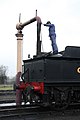
 Didcot Railway Centre - geograph.org.uk - 1169579.jpg 640 × 427; 121 KB
-
 Didcot Railway Centre - geograph.org.uk - 1169605.jpg 436 × 640; 167 KB
-
 Didcot Railway Centre - geograph.org.uk - 1169618.jpg 417 × 640; 161 KB
-
 Didcot Railway Centre - geograph.org.uk - 1169647.jpg 640 × 457; 167 KB
-
 Didcot Railway Centre - geograph.org.uk - 1169667.jpg 427 × 640; 103 KB
-
 Didcot Railway Centre - geograph.org.uk - 1169675.jpg 480 × 640; 85 KB
-
 Didcot Railway Centre - geograph.org.uk - 1169680.jpg 640 × 444; 177 KB
-
 Didcot Railway Centre - geograph.org.uk - 1169683.jpg 640 × 441; 98 KB
-
 Didcot Railway Centre - geograph.org.uk - 1169690.jpg 640 × 429; 140 KB
-
 Didcot Railway Centre - geograph.org.uk - 1169693.jpg 640 × 357; 138 KB
-
 Didcot Railway Centre - geograph.org.uk - 1169700.jpg 427 × 640; 94 KB
-
 Didcot Railway Centre - geograph.org.uk - 1169703.jpg 640 × 414; 170 KB
-
 Didcot Railway Centre - geograph.org.uk - 1169711.jpg 427 × 640; 115 KB
-
 Didcot Railway Centre - geograph.org.uk - 1190848.jpg 640 × 471; 222 KB
-
 Didcot Railway Centre - geograph.org.uk - 1190904.jpg 640 × 480; 177 KB
-
 Dodholm Farm cattle in barn - geograph.org.uk - 1181556.jpg 640 × 480; 50 KB
-
 Dodholm Farmhouse - geograph.org.uk - 1181561.jpg 640 × 480; 64 KB
-
 Don't Laugh this is for real - geograph.org.uk - 1181683.jpg 640 × 480; 55 KB
-
 Down the hill and in to town - geograph.org.uk - 1168637.jpg 640 × 480; 66 KB
-
 Drive-through bank on Ormskirk Road - geograph.org.uk - 1168465.jpg 640 × 426; 49 KB
-
 Driveway to The Deanery - geograph.org.uk - 1581800.jpg 640 × 466; 97 KB
-
 Dry stone wall on Llechwedd Oernant - geograph.org.uk - 1171798.jpg 640 × 480; 113 KB
-
 East Coast Main Line North - geograph.org.uk - 1206045.jpg 640 × 480; 63 KB
-
 East Coast Mainline at Newhailes - geograph.org.uk - 1168598.jpg 640 × 480; 106 KB
-
 Eastern end of Ely High Street - geograph.org.uk - 1581847.jpg 640 × 463; 60 KB
-
 Eaton Lane - geograph.org.uk - 1168735.jpg 538 × 640; 106 KB
-
 Edge of Withymoor Wood - geograph.org.uk - 1168245.jpg 640 × 480; 245 KB
-
 Edinburgh Suburban Railway - geograph.org.uk - 1168476.jpg 640 × 480; 70 KB
-
 Edinburgh Suburban Railway - geograph.org.uk - 1168484.jpg 640 × 480; 70 KB
-
 Edward Drive - Leeds Road - geograph.org.uk - 1169520.jpg 640 × 438; 154 KB
-
 Edward VII post box, Staplow - geograph.org.uk - 1172513.jpg 427 × 640; 309 KB
-
 Edwardian House on Davenport Avenue Hessle.jpg 518 × 640; 119 KB
-

-

-
 Effigies, Ysbyty Ifan - geograph.org.uk - 1170458.jpg 640 × 480; 80 KB
-
 Eilean Garave, Ascrib Islands. - geograph.org.uk - 1170155.jpg 640 × 427; 163 KB
-
 Ely Cathedral - North facade - geograph.org.uk - 1581833.jpg 640 × 473; 66 KB
-
 Ely Cathedral grounds - geograph.org.uk - 1538829.jpg 640 × 480; 73 KB
-
 Ely High Street - geograph.org.uk - 1493577.jpg 640 × 480; 67 KB
-
 Ely visitors car park - geograph.org.uk - 1548050.jpg 640 × 463; 68 KB
-
 Ember Hill Farm on a wet day - geograph.org.uk - 1181960.jpg 640 × 480; 45 KB
-
 Empty flats on Coed Pella Road, Colwyn Bay - geograph.org.uk - 1757238.jpg 1,280 × 1,024; 648 KB
-
 Entrance road to Newton Farm - geograph.org.uk - 1168123.jpg 640 × 480; 109 KB
-
 Entrance to forestry road - geograph.org.uk - 1170536.jpg 640 × 480; 114 KB
-
 Entrance to large house - geograph.org.uk - 1168191.jpg 640 × 480; 63 KB

_Pale_Brindled_Beauty_(Phigalia_pilosaria)_(3289788771).jpg)
_Pale_Brindled_Beauty_(Phigalia_pilosaria)_(3290608730).jpg)


_-_geograph.org.uk_-_1175759.jpg)
.jpg)
.jpg)
.jpg)


_-_geograph.org.uk_-_1168160.jpg)


_-_geograph.org.uk_-_1186169.jpg)


_-_Flickr_-_S._Rae.jpg)


