Category:United Kingdom photographs taken on 2009-04-20
Countries of Europe: Albania · Austria · Belgium · Czech Republic · Denmark · Estonia · Finland · France‡ · Germany · Greece · Hungary · Republic of Ireland · Italy · Latvia · Netherlands‡ · Norway · Poland · Portugal‡ · Romania · Russia‡ · Slovakia · Spain‡ · Sweden · Switzerland · Ukraine · United Kingdom
‡: partly located in Europe
‡: partly located in Europe
| ← | 20 April 2009 | → | ||
| ← | April 2009 | → | ||

United Kingdom photographs taken on 20 April 2009.
Image files should be categorized here automatically using {{taken on}} template. Direct categorisation is also possible, if automatic is impossible.
Subcategories
This category has the following 2 subcategories, out of 2 total.
Media in category "United Kingdom photographs taken on 2009-04-20"
The following 200 files are in this category, out of 1,598 total.
(previous page) (next page)-

-

-
 (Another) spring near High House Farm - geograph.org.uk - 1356754.jpg 640 × 480; 100 KB
-
-

-

-

-

-

-

-

-

-
 127 Main Street Shadwell 2009.jpg 3,264 × 2,448; 2.37 MB
-
 Westbury railway station MMB 01 158767 66186 66007.jpg 2,224 × 1,501; 1.46 MB
-
 57006 South Wingfield (3459270727).jpg 3,000 × 2,000; 1.85 MB
-
 66591 South Wingfield (3460145246).jpg 4,272 × 2,848; 3.09 MB
-
 A Motley Collection - geograph.org.uk - 1271670.jpg 640 × 605; 334 KB
-

-
 A small hillock on the moor. - geograph.org.uk - 1264782.jpg 640 × 480; 121 KB
-
 A stile west of Cowbridge - geograph.org.uk - 1264109.jpg 640 × 425; 85 KB
-
 A229 City Way, Rochester - geograph.org.uk - 1263437.jpg 640 × 480; 103 KB
-

-
 A360 heading north to Potterne - geograph.org.uk - 1279029.jpg 640 × 475; 157 KB
-
 A360 heading south near Potterne - geograph.org.uk - 1279095.jpg 640 × 545; 229 KB
-
 A360 heading south to Littleton Panell - geograph.org.uk - 1279048.jpg 640 × 487; 185 KB
-

-
 A40 near Abergavenny - geograph.org.uk - 1286249.jpg 640 × 426; 115 KB
-
 A49 at Endale - geograph.org.uk - 1277949.jpg 640 × 480; 105 KB
-
 A5 near Rarone - geograph.org.uk - 1263709.jpg 640 × 479; 56 KB
-
 Abandoned dam project - geograph.org.uk - 1263727.jpg 640 × 427; 101 KB
-
 Abandoned Graveyard - geograph.org.uk - 1294956.jpg 640 × 480; 163 KB
-

-
 Airedale Grove - Airedale Road - geograph.org.uk - 1265693.jpg 640 × 480; 257 KB
-
 Airedale Road - Aberford Road - geograph.org.uk - 1265689.jpg 640 × 483; 222 KB
-
 Airedale Terrace - Airedale Road - geograph.org.uk - 1265696.jpg 640 × 480; 258 KB
-
 Airedale View - Airedale Road - geograph.org.uk - 1265699.jpg 640 × 480; 253 KB
-
 Albert Road - Green Lea - geograph.org.uk - 1264767.jpg 640 × 436; 164 KB
-
 Aldi warehouse - geograph.org.uk - 1263744.jpg 640 × 480; 121 KB
-

-
 All but clear felled - geograph.org.uk - 1277861.jpg 640 × 480; 77 KB
-
 All Saints Road - Aberford Road - geograph.org.uk - 1265679.jpg 640 × 523; 200 KB
-
 Allotments - High Ridge Park - geograph.org.uk - 1264436.jpg 640 × 404; 174 KB
-
 Allotments in Beddington - geograph.org.uk - 1262920.jpg 640 × 360; 75 KB
-

-
 Amazona autumnalis lilacina -Chester Zoo -a pair-8a.jpg 1,600 × 1,535; 1.17 MB
-
 Amazona autumnalis lilacina -Chester Zoo -upper body-8a.jpg 1,248 × 1,068; 887 KB
-
-
 An Cnap - geograph.org.uk - 1271678.jpg 640 × 387; 218 KB
-
 An inlet on the shore of Loch Seaforth - geograph.org.uk - 1265247.jpg 640 × 480; 125 KB
-
 An unnamed lochan on Cithis Bheag - geograph.org.uk - 1265874.jpg 640 × 480; 89 KB
-
 Anglers Lane - geograph.org.uk - 1276730.jpg 640 × 480; 83 KB
-
 Another pond at Blackpole - geograph.org.uk - 1272390.jpg 640 × 480; 127 KB
-
 Another view of the Pond on Quy Fen - geograph.org.uk - 1263037.jpg 640 × 480; 101 KB
-
 Apethorn Farm - geograph.org.uk - 1279196.jpg 640 × 480; 143 KB
-
 Apethorn Lane Bridge - geograph.org.uk - 1279167.jpg 640 × 480; 187 KB
-
 Apple blossom in Bysing Wood - geograph.org.uk - 1261737.jpg 640 × 480; 172 KB
-
 Apple Tree Day Nursery - Wood Lane - geograph.org.uk - 1262645.jpg 640 × 480; 256 KB
-
 Applegarth - Church Street - geograph.org.uk - 1265547.jpg 640 × 445; 186 KB
-
 Appletree - geograph.org.uk - 1354840.jpg 640 × 480; 81 KB
-
 Approaching Crow Hill from the south - geograph.org.uk - 1266859.jpg 640 × 480; 163 KB
-

-
 Approaching Loch Fad - geograph.org.uk - 1288599.jpg 640 × 480; 69 KB
-

-
 Approaching the road junction - geograph.org.uk - 1262120.jpg 640 × 480; 121 KB
-
 Arable crop at Park Farm - geograph.org.uk - 1274292.jpg 640 × 480; 133 KB
-
 Arable land at Park Farm - geograph.org.uk - 1274326.jpg 640 × 480; 115 KB
-
 Arable land near Main Ditch - geograph.org.uk - 1274320.jpg 640 × 480; 116 KB
-
 Arable land west of Moreton Ride - geograph.org.uk - 1275061.jpg 640 × 480; 126 KB
-
 Arduaine - geograph.org.uk - 1271623.jpg 640 × 427; 249 KB
-
 Arduaine - geograph.org.uk - 1271663.jpg 640 × 427; 258 KB
-
 Arduaine Farm - geograph.org.uk - 1271638.jpg 640 × 427; 266 KB
-
 Arduaine from An Cnap - geograph.org.uk - 1271699.jpg 640 × 427; 262 KB
-
 Arduaine Point - geograph.org.uk - 1271650.jpg 640 × 427; 209 KB
-
 Arethusa Road, Rochester - geograph.org.uk - 1263442.jpg 640 × 480; 61 KB
-
 Ashleigh Gardens - Oulton Lane - geograph.org.uk - 1265527.jpg 640 × 480; 298 KB
-
 Assertive sheep, Kingston - geograph.org.uk - 1270128.jpg 640 × 462; 93 KB
-
 At the end of the lane from Coulston - geograph.org.uk - 1275674.jpg 640 × 499; 146 KB
-
 Atmospheric Radar Station at Capel Dewi - geograph.org.uk - 1262226.jpg 640 × 428; 129 KB
-
 Aughnaskeagh Road, Waringford - geograph.org.uk - 1262733.jpg 640 × 480; 81 KB
-
 Axmouth, and the River Axe - geograph.org.uk - 1264161.jpg 640 × 480; 67 KB
-
 Back Eshald Place - Airedale Road - geograph.org.uk - 1265690.jpg 640 × 480; 262 KB
-
 Back Lane, Baxenden - geograph.org.uk - 1263424.jpg 480 × 640; 115 KB
-
 Badge Brow - geograph.org.uk - 1263350.jpg 640 × 480; 69 KB
-
 Baggarah - geograph.org.uk - 1372373.jpg 640 × 480; 81 KB
-
 Ballynasaggart Church of Ireland - geograph.org.uk - 1262131.jpg 640 × 479; 55 KB
-
 Ballynasaggart Road - geograph.org.uk - 1262282.jpg 640 × 479; 58 KB
-
 Ballynasaggart Road - geograph.org.uk - 1263662.jpg 640 × 479; 68 KB
-
 Ballynasaggart Road - geograph.org.uk - 1263685.jpg 640 × 479; 67 KB
-
 Ballynasaggart Road, Crew - geograph.org.uk - 1262321.jpg 640 × 479; 64 KB
-
 Ballynasaggart Townland - geograph.org.uk - 1262327.jpg 640 × 479; 61 KB
-
 Ballynasaggart Townland - geograph.org.uk - 1262329.jpg 640 × 479; 68 KB
-
 Ballynasaggart Townland - geograph.org.uk - 1263656.jpg 640 × 479; 48 KB
-
 Ballynasaggart Townland - geograph.org.uk - 1263660.jpg 640 × 479; 51 KB
-
 Banstead church - geograph.org.uk - 1276246.jpg 640 × 480; 74 KB
-
 Barberry Water valley at Capton Bridge - geograph.org.uk - 1269517.jpg 640 × 480; 101 KB
-
 Barn at Crossways - Cowbridge - geograph.org.uk - 1264141.jpg 640 × 425; 192 KB
-
 Barn at Eyton - geograph.org.uk - 1289348.jpg 640 × 480; 93 KB
-
 Barn, Gort - geograph.org.uk - 1268535.jpg 640 × 479; 65 KB
-
 Barns at Appletree - geograph.org.uk - 1354807.jpg 640 × 480; 64 KB
-
 Barns south of Shuckburgh - geograph.org.uk - 1263468.jpg 640 × 425; 71 KB
-

-

-

-
 Bath Road, Quarry Bank - geograph.org.uk - 1264589.jpg 640 × 367; 93 KB
-
 Bath Road, Quarry Bank - geograph.org.uk - 1264597.jpg 640 × 397; 90 KB
-
 Bath Road, Quarry Bank - geograph.org.uk - 1264606.jpg 640 × 410; 89 KB
-
 Bath Road, Quarry Bank - geograph.org.uk - 1264612.jpg 640 × 417; 93 KB
-
 Bath Road, Quarry Bank - geograph.org.uk - 1264622.jpg 640 × 462; 93 KB
-
 Bathgate abattoir - geograph.org.uk - 1263765.jpg 640 × 480; 99 KB
-
 Baxenden Cricket Ground - geograph.org.uk - 1263436.jpg 640 × 480; 63 KB
-
 Bean field and pylons on Quy Fen - geograph.org.uk - 1264318.jpg 640 × 480; 97 KB
-
 Beddington Farm - geograph.org.uk - 1262299.jpg 640 × 360; 55 KB
-
 Beechwood - Church Street - geograph.org.uk - 1265551.jpg 640 × 466; 211 KB
-
 Beechwood - Church Street - geograph.org.uk - 1265554.jpg 640 × 427; 220 KB
-
 Bees nest near Scatterbrain Farm - 1 - geograph.org.uk - 1289435.jpg 480 × 640; 167 KB
-
 Bees nest near Scatterbrain Farm - 2 - geograph.org.uk - 1289437.jpg 640 × 480; 109 KB
-
 Begny Hill Road, Dromara - geograph.org.uk - 1263235.jpg 640 × 480; 47 KB
-

-

-

-
 Bell's Cottage and barn - geograph.org.uk - 1371012.jpg 640 × 480; 71 KB
-
 Belvedere Cafe, South Sands - geograph.org.uk - 1270325.jpg 640 × 480; 46 KB
-
 Bench Mark - geograph.org.uk - 1266855.jpg 640 × 480; 179 KB
-
 Bench, Capton Green - geograph.org.uk - 1269789.jpg 640 × 480; 92 KB
-
 Bend on the B4361 at Nordan - geograph.org.uk - 1290854.jpg 640 × 480; 93 KB
-
 Bentley Square - Calverley Road - geograph.org.uk - 1265718.jpg 640 × 480; 274 KB
-

-
 Berrington Hall parkland - geograph.org.uk - 1274998.jpg 640 × 480; 88 KB
-
-

-
 Beside the A45, Dunchurch - geograph.org.uk - 1261511.jpg 640 × 502; 106 KB
-
 Beyond the green - geograph.org.uk - 1277844.jpg 640 × 480; 68 KB
-
 Birch Avenue, Quarry Bank - geograph.org.uk - 1264534.jpg 640 × 356; 90 KB
-
 Birchen park, Wyre Forest track. - geograph.org.uk - 1262445.jpg 640 × 480; 128 KB
-
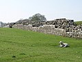
 Birdoswald (Banna) - geograph.org.uk - 1357934.jpg 640 × 480; 90 KB
-
-
 Birdoswald (Banna) - the east wall - geograph.org.uk - 1359198.jpg 640 × 480; 75 KB
-

-

-

-

-
-

-
 Birdoswald (Banna) - the south gate - geograph.org.uk - 1357957.jpg 640 × 480; 72 KB
-

-
-

-

-
 Birdoswald (Banna) and lamb - geograph.org.uk - 1357991.jpg 640 × 480; 128 KB
-
 Birdoswald - geograph.org.uk - 1357892.jpg 640 × 480; 85 KB
-
 Birdoswald - northwest corner - geograph.org.uk - 1357920.jpg 640 × 480; 125 KB
-

-
 Birds Edge Lane, Denby - geograph.org.uk - 1270055.jpg 640 × 480; 123 KB
-
 Birmingham - panoramio (50).jpg 2,816 × 2,112; 2.85 MB
-
 Black a moors Spinney - geograph.org.uk - 1293951.jpg 640 × 480; 161 KB
-
 Black a moors Spinney - geograph.org.uk - 1293955.jpg 640 × 480; 170 KB
-
 Black and White house at Luston - geograph.org.uk - 1286627.jpg 640 × 477; 56 KB
-
 Blasted tree - detail - geograph.org.uk - 1265672.jpg 480 × 640; 155 KB
-
 Blasted tree beside Fen Road - geograph.org.uk - 1265669.jpg 640 × 480; 122 KB
-
 Blossom north of Grandborough - geograph.org.uk - 1263322.jpg 640 × 423; 160 KB
-
 Boats at Loch Fad - geograph.org.uk - 1292349.jpg 640 × 446; 67 KB
-
 Boats in the Harbour - geograph.org.uk - 1270335.jpg 640 × 480; 103 KB
-
 Bonfire site near Harcamlow Way - geograph.org.uk - 1264493.jpg 640 × 480; 104 KB
-
 Bridge and pipe over Tinker Brook - geograph.org.uk - 1263372.jpg 640 × 480; 137 KB
-
 Bridge at Hallington - geograph.org.uk - 1264694.jpg 640 × 480; 140 KB
-
 Bridge on Caochan a' Chùil Track - geograph.org.uk - 1263080.jpg 640 × 480; 103 KB
-
 Bridge over Bottisham Lode - geograph.org.uk - 1264970.jpg 640 × 480; 115 KB
-
 Bridge over burn - geograph.org.uk - 1277744.jpg 640 × 480; 155 KB
-
 Bridge over the goit in April, Kirkstall - geograph.org.uk - 1322917.jpg 640 × 480; 158 KB
-
 Bridge Street, Colley Lane, Cradley - geograph.org.uk - 1269948.jpg 640 × 449; 92 KB
-
 Bridge Street, Cradley - geograph.org.uk - 1269937.jpg 640 × 472; 94 KB
-
 Bridge Street, Cradley - geograph.org.uk - 1269943.jpg 640 × 458; 95 KB
-
 Bridge Street, Cradley - geograph.org.uk - 1270005.jpg 636 × 480; 92 KB
-
 Bridge TJC3-329 - Pottery Lane - geograph.org.uk - 1265557.jpg 640 × 461; 230 KB
-
 Bridge, A705 - geograph.org.uk - 1263806.jpg 640 × 480; 100 KB
-
 Bridge, Ballynasaggart Road - geograph.org.uk - 1262292.jpg 640 × 479; 74 KB
-
 Bridleway heading to Ullock Pike - geograph.org.uk - 1274439.jpg 640 × 480; 113 KB
-

-
 Bridleway near Freckenham - geograph.org.uk - 1273952.jpg 427 × 640; 112 KB
-
 Bridleway near Park Farm - geograph.org.uk - 1274340.jpg 640 × 480; 108 KB
-
 Bridleway to Holmbush - geograph.org.uk - 1265627.jpg 640 × 427; 144 KB
-
 Bridleway to Horningsea - geograph.org.uk - 1262663.jpg 640 × 480; 114 KB
-
 Bridleway to Horningsea - geograph.org.uk - 1262801.jpg 640 × 480; 113 KB
-
 Bridlington Harbour - geograph.org.uk - 1270326.jpg 640 × 480; 91 KB
-
 Brisbane Street housing - geograph.org.uk - 1263716.jpg 640 × 480; 110 KB
-
 Brodie Gardens - geograph.org.uk - 1261890.jpg 640 × 480; 107 KB
-
 Brunswick Demolition.jpg 1,600 × 1,200; 471 KB
-
 BT Telephone Exchange, Dromara - geograph.org.uk - 1263187.jpg 640 × 480; 75 KB
-
 Buceros rhinoceros -Chester Zoo-8a.jpg 2,280 × 1,860; 5.54 MB
-
 Buds abursting - Cowbridge - geograph.org.uk - 1262572.jpg 640 × 425; 108 KB
-
 Building on the corner, Shepley - geograph.org.uk - 1263821.jpg 640 × 449; 108 KB
-
 Bumble Bee Lane - geograph.org.uk - 1265881.jpg 640 × 480; 85 KB
-

-
 Bungalows on Lonewood Way, Hadlow - geograph.org.uk - 1262010.jpg 640 × 427; 92 KB
-

-

-
 Byre near Halols Barn Farm - geograph.org.uk - 1263474.jpg 640 × 469; 123 KB
-
 Cairn, Thorn Moor, Barbondale - geograph.org.uk - 1289675.jpg 640 × 480; 62 KB
-
 Cairnbaan Bridge - geograph.org.uk - 1297687.jpg 640 × 480; 88 KB
-
 Canberra Avenue - geograph.org.uk - 1263712.jpg 640 × 480; 107 KB


_spring_near_High_House_Farm_-_geograph.org.uk_-_1356754.jpg)
_Hadrian%27s_Turf_Wall_and_its_north_defensive_ditch_east_of_Milecastle_51_-_geograph.org.uk_-_1354768.jpg)
_Hadrian%27s_Turf_Wall_and_its_north_defensive_ditch,_and_the_Vallum,_at_Appletree_-_geograph.org.uk_-_1354816.jpg)
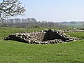
_Milecastle_50_(Stone_Wall)_(High_House)_(2)_-_geograph.org.uk_-_1356772.jpg)
_Milecastle_50_(Stone_Wall)_(High_House)_-_geograph.org.uk_-_1356771.jpg)
_Milecastle_51_(Wall_Bowers)_(2)_-_geograph.org.uk_-_1354757.jpg)
_Milecastle_51_(Wall_Bowers)_-_geograph.org.uk_-_1354753.jpg)
_Milecastle_51_(Wall_Bowers)_and_the_valley_of_Wall_Burn_-_geograph.org.uk_-_1354747.jpg)
_Turret_50a_(Turf_Wall)_near_High_House_Farm_-_geograph.org.uk_-_1356727.jpg)
_Turret_50b_(Turf_Wall)_near_Appletree_-_geograph.org.uk_-_1354842.jpg)


.jpg)
.jpg)


_-_geograph.org.uk_-_1357934.jpg)
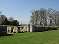
_-_part_of_the_main_east_gate_-_geograph.org.uk_-_1357962.jpg)
_-_the_east_wall_-_geograph.org.uk_-_1359198.jpg)
_-_the_east_wall_and_gate_(2)_-_geograph.org.uk_-_1357975.jpg)
_-_the_east_wall_and_gate_(3)_-_geograph.org.uk_-_1370935.jpg)
_-_the_east_wall_and_gate_-_geograph.org.uk_-_1357969.jpg)
_-_the_east_wall_and_lamb_-_geograph.org.uk_-_1359046.jpg)
_-_the_main_east_gate_(2)_-_geograph.org.uk_-_1357983.jpg)
_-_the_main_east_gate_-_geograph.org.uk_-_1357951.jpg)
_-_the_south_gate_-_geograph.org.uk_-_1357957.jpg)
_-_the_south_gate_and_wall_-_geograph.org.uk_-_1370922.jpg)
_-_the_south_wall_and_lamb_-_geograph.org.uk_-_1359189.jpg)
_-_the_southeast_angle_tower_and_lamb_-_geograph.org.uk_-_1359179.jpg)
_-_the_west_wall_and_modern_farm_buildings_-_geograph.org.uk_-_1370949.jpg)
_and_lamb_-_geograph.org.uk_-_1357991.jpg)


.jpg)


