Category:United Kingdom photographs taken on 2009-04-26
Countries of Europe: Austria · Azerbaijan‡ · Belarus · Belgium · Croatia · Czech Republic · Denmark · Estonia · Finland · France‡ · Germany · Greece · Hungary · Italy · Latvia · Netherlands‡ · Norway · Poland · Portugal‡ · Romania · Russia‡ · Serbia · Spain‡ · Sweden · Switzerland · Turkey‡ · Ukraine · United Kingdom
Specific status: Gibraltar
‡: partly located in Europe
Specific status: Gibraltar
‡: partly located in Europe
| ← | 26 April 2009 | → | ||
| ← | April 2009 | → | ||

United Kingdom photographs taken on 26 April 2009.
Image files should be categorized here automatically using {{taken on}} template. Direct categorisation is also possible, if automatic is impossible.
Subcategories
This category has the following 4 subcategories, out of 4 total.
Media in category "United Kingdom photographs taken on 2009-04-26"
The following 200 files are in this category, out of 1,339 total.
(previous page) (next page)-
 "The Vibe" in Station Road - geograph.org.uk - 1272735.jpg 640 × 480; 69 KB
-

-
 1885 The Restaurant - geograph.org.uk - 1273462.jpg 640 × 480; 62 KB
-

-
 A busy path in Richmond Park - geograph.org.uk - 1273578.jpg 640 × 480; 77 KB
-
 A clearly marked footpath, Broadwell - geograph.org.uk - 1275728.jpg 580 × 640; 160 KB
-
 A colourful floral display - geograph.org.uk - 1272882.jpg 640 × 480; 142 KB
-
 A Cottage In Dovedale - geograph.org.uk - 1274166.jpg 640 × 355; 90 KB
-
 A felled pylon (1) - geograph.org.uk - 1273308.jpg 640 × 426; 114 KB
-
 A felled pylon (2) - geograph.org.uk - 1273322.jpg 640 × 462; 108 KB
-
 A felled pylon (3) - geograph.org.uk - 1273336.jpg 640 × 420; 104 KB
-
 A field beside the River Bure - geograph.org.uk - 1273018.jpg 640 × 480; 106 KB
-
 A gravestone in Nenthorn Old Cemetery - geograph.org.uk - 1275262.jpg 640 × 427; 134 KB
-
 A Lake next to the River Neath - geograph.org.uk - 1276622.jpg 640 × 480; 53 KB
-
 A livestock drinking pool, Napton - geograph.org.uk - 1272874.jpg 640 × 467; 157 KB
-
 A lovely Spring day in Station Road - geograph.org.uk - 1272733.jpg 640 × 480; 79 KB
-

-
 A quiet spot along River Oykel - geograph.org.uk - 1433803.jpg 640 × 480; 69 KB
-

-
 A track leading to Courthill - geograph.org.uk - 1275233.jpg 640 × 427; 152 KB
-
-

-
 A32 south of Wickham - geograph.org.uk - 1273216.jpg 640 × 446; 268 KB
-
 A40 near Carmarthen - geograph.org.uk - 1276602.jpg 640 × 480; 37 KB
-
 A696 at Kirkwhelpington - geograph.org.uk - 1274141.jpg 640 × 480; 72 KB
-
 Abandoned farmstead, Colsterdale - geograph.org.uk - 1276227.jpg 480 × 640; 87 KB
-
 Abbey Tower - geograph.org.uk - 1281262.jpg 640 × 480; 74 KB
-
 Aberdeen Harbour - geograph.org.uk - 1272837.jpg 640 × 480; 96 KB
-

-
 Across the Kyles to Tighnabruaich - geograph.org.uk - 1322514.jpg 640 × 480; 50 KB
-
 Afon Claerwen - geograph.org.uk - 1275455.jpg 640 × 506; 108 KB
-
 Afon Dwyryd - geograph.org.uk - 1312220.jpg 640 × 480; 105 KB
-
 St James Alderholt - geograph.org.uk - 1296589.jpg 640 × 543; 115 KB
-
 All aboard - geograph.org.uk - 1276961.jpg 640 × 478; 75 KB
-
 All in a row - geograph.org.uk - 1276966.jpg 640 × 523; 85 KB
-
 All Saints Church - geograph.org.uk - 1273284.jpg 640 × 480; 115 KB
-
 All Saints church, Kemeys Commander. - geograph.org.uk - 1282636.jpg 640 × 426; 71 KB
-

-
 An old cart, Lower Fields, Napton - geograph.org.uk - 1272864.jpg 640 × 484; 148 KB
-

-
 Anthocharis cardamines (Orange Tip) - Flickr - S. Rae (3).jpg 1,780 × 1,426; 322 KB
-
 Apple blossom 1 - geograph.org.uk - 1274740.jpg 640 × 480; 248 KB
-
 Apple blossom 2 - geograph.org.uk - 1274747.jpg 480 × 640; 256 KB
-
 Apple Powdery Mildew - geograph.org.uk - 1274755.jpg 640 × 480; 262 KB
-
 Approaching Buxton Station - geograph.org.uk - 1272900.jpg 640 × 480; 145 KB
-

-
 Approaching High House Farm - geograph.org.uk - 1276247.jpg 640 × 480; 78 KB
-

-

-
 Arable farmland at Old Nenthorn - geograph.org.uk - 1275274.jpg 640 × 427; 127 KB
-
 Arable land above the River Usk - geograph.org.uk - 1280151.jpg 640 × 426; 92 KB
-
 Arable land beside the River Usk - geograph.org.uk - 1280145.jpg 640 × 426; 82 KB
-
 Archeolink Prehistory Park - geograph.org.uk - 1273705.jpg 640 × 426; 71 KB
-
 Archeolink Prehistory Park - geograph.org.uk - 1273728.jpg 640 × 426; 54 KB
-
 Ash trees in Perivale Wood - geograph.org.uk - 1279793.jpg 480 × 640; 439 KB
-
 Ashtead town centre - geograph.org.uk - 1274037.jpg 640 × 480; 65 KB
-
 Ashton Court Mansion - geograph.org.uk - 1281369.jpg 640 × 480; 67 KB
-
 Audley End - geograph.org.uk - 1273639.jpg 640 × 480; 94 KB
-
 Austwick village green - geograph.org.uk - 1726148.jpg 640 × 480; 141 KB
-
 Avenue, Canon Frome Court - geograph.org.uk - 1276316.jpg 640 × 412; 326 KB
-
 Avon Valley view - geograph.org.uk - 1287810.jpg 640 × 428; 76 KB
-

-
 B3082 Blandford Road - geograph.org.uk - 1295149.jpg 640 × 474; 84 KB
-
 Ballimore House Otter Ferry - geograph.org.uk - 1273153.jpg 640 × 480; 57 KB
-
 Balmoral Show poster, Belfast - geograph.org.uk - 1272988.jpg 640 × 403; 57 KB
-
 Baptist Church, Westcliff-on-Sea - geograph.org.uk - 1275703.jpg 640 × 425; 83 KB
-
 Barn and sheepdog at Lleiniau Hirion - geograph.org.uk - 1310442.jpg 640 × 480; 116 KB
-
 Barns north of Bere Farm - geograph.org.uk - 1273559.jpg 640 × 427; 164 KB
-
 Barrasford Green - geograph.org.uk - 1273044.jpg 640 × 425; 119 KB
-
 Barrasford Quarry - geograph.org.uk - 1272706.jpg 640 × 424; 145 KB
-
 New Hall, Barton Upon Humber - geograph.org.uk - 1275304.jpg 640 × 451; 112 KB
-
 Basingstoke Canal at Brookwood - geograph.org.uk - 1275121.jpg 640 × 480; 110 KB
-
 Bat and Ball - geograph.org.uk - 1287397.jpg 428 × 640; 95 KB
-
 Bavington Crags - geograph.org.uk - 1275001.jpg 640 × 480; 72 KB
-
 Beacon on Furze Hill - geograph.org.uk - 1278907.jpg 640 × 480; 46 KB
-
 Bee boles, Kellie Castle garden - geograph.org.uk - 1284650.jpg 640 × 480; 128 KB
-
 Being watched - geograph.org.uk - 1281122.jpg 640 × 426; 144 KB
-
 Beinn Sitheag - geograph.org.uk - 1273392.jpg 640 × 480; 107 KB
-
 Bend by Old Stocks Oak - geograph.org.uk - 1273147.jpg 640 × 480; 102 KB
-
 Bend in the road, East Cliff Rd - geograph.org.uk - 1277385.jpg 640 × 430; 67 KB
-
 Bentham Hill heading west - geograph.org.uk - 1276697.jpg 640 × 430; 91 KB
-

-
 Bere Farm - geograph.org.uk - 1273638.jpg 640 × 427; 196 KB
-
 Bere Farm - geograph.org.uk - 1273643.jpg 640 × 427; 178 KB
-
 Bere Farm House - geograph.org.uk - 1273567.jpg 640 × 427; 183 KB
-
 Berthin Brook, Usk - geograph.org.uk - 1281229.jpg 640 × 426; 115 KB
-
 Beukley - geograph.org.uk - 1272966.jpg 345 × 640; 42 KB
-
 Big Barn - geograph.org.uk - 1322279.jpg 640 × 480; 74 KB
-
 Bikers' Rendezvous - geograph.org.uk - 1312349.jpg 640 × 480; 90 KB
-
 Bilston Bus Station - geograph.org.uk - 1275888.jpg 640 × 480; 62 KB
-
 Bilston Central tram stop in 2009.jpg 640 × 480; 76 KB
-
 Bilston Central, tram - geograph.org.uk - 1275894.jpg 480 × 640; 92 KB
-
 Bilston, delivery office - geograph.org.uk - 1275883.jpg 640 × 480; 63 KB
-
 Bilston, post office - geograph.org.uk - 1275880.jpg 640 × 480; 59 KB
-
 Bilston, street art - geograph.org.uk - 1275869.jpg 640 × 480; 108 KB
-
 Bilston, The Crescent Metro - geograph.org.uk - 1275864.jpg 640 × 480; 96 KB
-
 Bilston, The Olde White Rose - geograph.org.uk - 1275876.jpg 480 × 640; 54 KB
-
 Birches, Glen Nant - geograph.org.uk - 1273702.jpg 359 × 640; 123 KB
-
 Bishearne Gardens - geograph.org.uk - 1272736.jpg 640 × 480; 79 KB
-

-
 Blakenhall, Bizspace Business Park - geograph.org.uk - 1275818.jpg 640 × 480; 64 KB
-
 Blakenhall, Cross Street - geograph.org.uk - 1275774.jpg 640 × 480; 85 KB
-
 Blakenhall, industrial units - geograph.org.uk - 1275781.jpg 640 × 480; 59 KB
-
 Blakenhall, Moorfields Works - geograph.org.uk - 1275792.jpg 640 × 480; 73 KB
-
 Blakenhall, Sikh temple - geograph.org.uk - 1275809.jpg 640 × 480; 88 KB
-
 Bleak moorland above Sleddale Beck - geograph.org.uk - 1621685.jpg 640 × 480; 73 KB
-

-
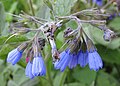 Blue comfrey - geograph.org.uk - 1279031.jpg 640 × 459; 139 KB
-
 Blue Studio (3490127225).jpg 678 × 1,024; 517 KB
-
 Bluebell wood - geograph.org.uk - 1279971.jpg 640 × 401; 117 KB
-
 Bluebell woods - geograph.org.uk - 1287359.jpg 428 × 640; 144 KB
-
 Bluebell woods - geograph.org.uk - 1287374.jpg 640 × 428; 146 KB
-
 Bluebell woods - geograph.org.uk - 1287807.jpg 640 × 428; 149 KB
-
 Bluebell Woods - geograph.org.uk - 1288079.jpg 640 × 428; 141 KB
-
 Bluebells (Hyacinthoides non-scripta) - geograph.org.uk - 1273324.jpg 559 × 640; 147 KB
-
 Bluebells - geograph.org.uk - 1273156.jpg 640 × 426; 59 KB
-
 Bonhams and Crocker Hill Chapel - geograph.org.uk - 1273659.jpg 640 × 427; 182 KB
-
 Boots Distribution Centre - geograph.org.uk - 1272661.jpg 640 × 471; 68 KB
-
 Border Counties Railway - geograph.org.uk - 1272790.jpg 427 × 640; 159 KB
-
 Border Counties Railway - geograph.org.uk - 1273008.jpg 640 × 409; 104 KB
-
 Border Counties Railway - geograph.org.uk - 1273025.jpg 640 × 368; 92 KB
-
 Boston Lodge - geograph.org.uk - 1312023.jpg 640 × 480; 128 KB
-
 Bournemouth , Red Hill Drive - geograph.org.uk - 1289125.jpg 640 × 480; 116 KB
-

-
 Branksome China - geograph.org.uk - 1287268.jpg 640 × 428; 73 KB
-
 Breamore House - geograph.org.uk - 1287819.jpg 640 × 428; 62 KB
-
 Breamore mill - geograph.org.uk - 1287409.jpg 640 × 428; 89 KB
-
 Brian Crescent and Brokes Way (2) - geograph.org.uk - 1276362.jpg 640 × 430; 92 KB
-
 Brian Crescent and Brokes Way junction - geograph.org.uk - 1276211.jpg 640 × 430; 112 KB
-
 Bridge 114, Napton - geograph.org.uk - 1273037.jpg 640 × 445; 124 KB
-
 Bridge near Felin Cwrt, Login - geograph.org.uk - 1273894.jpg 640 × 470; 94 KB
-
 Bridge near Felin Cwrt, Login - geograph.org.uk - 1273905.jpg 640 × 480; 123 KB
-
 Bridge over a small burn in Cally Woods - geograph.org.uk - 1373248.jpg 640 × 555; 135 KB
-
 Bridge over Mill Street - geograph.org.uk - 1272907.jpg 640 × 480; 148 KB
-
 Bridge over stream, Cwmmiles, Login - geograph.org.uk - 1273219.jpg 640 × 480; 126 KB
-

-
 Bridgeholme Farm, near Market Weighton - geograph.org.uk - 1281665.jpg 640 × 426; 185 KB
-
 Bridges, Newsholme Dean - geograph.org.uk - 1272566.jpg 1,024 × 683; 283 KB
-
 Bridleway from Exton Park - geograph.org.uk - 1276688.jpg 640 × 480; 70 KB
-
 Bridleway junction near Exton Park - geograph.org.uk - 1276714.jpg 640 × 480; 73 KB
-
 Bridleway past Body Close Farm - geograph.org.uk - 1276267.jpg 480 × 640; 112 KB
-
 Bridleway to Kings Hill Farm - geograph.org.uk - 1278832.jpg 640 × 480; 89 KB
-
 Broadmoor Hill - geograph.org.uk - 1278491.jpg 640 × 427; 49 KB
-
 House on Hayway Lane, Broadwell - geograph.org.uk - 1275672.jpg 600 × 451; 119 KB
-
 Broadwell brook - geograph.org.uk - 1275687.jpg 640 × 454; 180 KB
-
 Brokes Way (2) - geograph.org.uk - 1276358.jpg 640 × 430; 72 KB
-
 Brokes Way (3) - geograph.org.uk - 1276370.jpg 640 × 430; 66 KB
-
 Brokes Way - geograph.org.uk - 1276205.jpg 640 × 430; 75 KB
-
 Bromyard Downs car park - geograph.org.uk - 1277526 (cropped).jpg 640 × 360; 83 KB
-
 Bromyard Downs car park - geograph.org.uk - 1277526.jpg 640 × 480; 105 KB
-
 Brookwood Tunnel - geograph.org.uk - 1275344.jpg 640 × 480; 119 KB
-
 Bubblegum and gas, Omagh - geograph.org.uk - 1274253.jpg 640 × 480; 64 KB
-
 Bulbourne Works through Bridge 133 - geograph.org.uk - 1274244.jpg 640 × 480; 193 KB
-
 Burcot car boot sale - geograph.org.uk - 1272406.jpg 640 × 480; 110 KB
-
 Burgates - geograph.org.uk - 1273217.jpg 480 × 640; 112 KB
-
 Burn of Allanstank - geograph.org.uk - 1272894.jpg 640 × 480; 108 KB
-
 Burn of Auldmad - geograph.org.uk - 1272884.jpg 640 × 480; 159 KB
-
 Bus shelter at Burgates - geograph.org.uk - 1273200.jpg 640 × 480; 99 KB
-
 Bus Shelter, London Rd - geograph.org.uk - 1276467.jpg 640 × 430; 84 KB
-
 Bus Shelter, St John's Rd - geograph.org.uk - 1277380.jpg 640 × 430; 92 KB
-
 Bus Stop, St John's Rd - geograph.org.uk - 1277378.jpg 640 × 430; 68 KB
-
 Butlers bar - geograph.org.uk - 1287254.jpg 640 × 428; 78 KB
-
 Byre south of Napton - geograph.org.uk - 1273050.jpg 640 × 483; 109 KB
-
 Cairn at High Pike Hill - geograph.org.uk - 1274892.jpg 640 × 436; 82 KB
-
 Cairn on the summit of Brown Knowe - geograph.org.uk - 1274951.jpg 640 × 480; 83 KB
-
 Callander and Oban Railway, Achnacloich - geograph.org.uk - 1273681.jpg 640 × 480; 139 KB
-
 Cally Woods - geograph.org.uk - 1373186.jpg 640 × 480; 152 KB
-
 Canada geese on Hartleton Water - geograph.org.uk - 1274550.jpg 640 × 480; 232 KB
-
 Canada goose among the reeds - geograph.org.uk - 1273789.jpg 640 × 480; 200 KB
-
 Approach to Canon Frome Court - geograph.org.uk - 1274274.jpg 640 × 427; 276 KB
-
-
 Rose window, Canon Frome church - geograph.org.uk - 1276345.jpg 640 × 495; 278 KB
-
 War Memorial in Canon Frome church - geograph.org.uk - 1276324.jpg 305 × 640; 211 KB
-
 Canon Frome church - geograph.org.uk - 1274297.jpg 640 × 399; 261 KB
-
 Canon Frome Court - geograph.org.uk - 1274305.jpg 640 × 420; 329 KB
-
 Canon Frome court - geograph.org.uk - 1277941.jpg 640 × 423; 292 KB
-
-
 Capel-y-Groes - geograph.org.uk - 1274080.jpg 640 × 480; 82 KB
-
 Car park at Liss Village Centre - geograph.org.uk - 1279515.jpg 640 × 480; 102 KB
-
 Car Park by the church, Churchtown - geograph.org.uk - 1277833.jpg 640 × 480; 84 KB
-
 Car park for St Peter's, West Liss - geograph.org.uk - 1273210.jpg 640 × 480; 145 KB
-
 Caravan park - geograph.org.uk - 1277958.jpg 640 × 428; 59 KB
-
 Carey Place - geograph.org.uk - 1272333.jpg 640 × 480; 84 KB
-
 Castle Farm Lane - geograph.org.uk - 1273229.jpg 640 × 427; 202 KB
-
 Castle Farm Lane - geograph.org.uk - 1273342.jpg 640 × 427; 278 KB
-
 Castle Hill - geograph.org.uk - 1280997.jpg 640 × 480; 92 KB
-
 Castle Hill earthwork, Fordhall Farm - geograph.org.uk - 1280320.jpg 640 × 480; 161 KB
-
 Cattle near Holme on Spalding Moor - geograph.org.uk - 1280069.jpg 640 × 430; 174 KB
-
 Causeway to Homend - geograph.org.uk - 1276361.jpg 640 × 427; 239 KB
-
 Chainbridge Inn - geograph.org.uk - 1281356.jpg 640 × 426; 78 KB
-
 Chainbridge over the River Usk - geograph.org.uk - 1281336.jpg 640 × 426; 76 KB
-
 Chalets in Ballimore Estate - geograph.org.uk - 1275724.jpg 640 × 480; 143 KB
-
 Chapelcross Nuclear Power Station - geograph.org.uk - 1274138.jpg 640 × 480; 55 KB
-
 Chapelcross Power Station - geograph.org.uk - 1274136.jpg 640 × 480; 94 KB
-
 Charcoal burning platform - geograph.org.uk - 1459095.jpg 640 × 480; 158 KB
-
 Charity shop in Station Road - geograph.org.uk - 1279513.jpg 480 × 640; 60 KB
-
 Charles Street Centre, Charles St - geograph.org.uk - 1277369.jpg 640 × 430; 63 KB
-
 Chestnut trees in flower, Richmond Park - geograph.org.uk - 1273782.jpg 640 × 480; 167 KB
-
 Chew Clough on Long Ridge Moss - geograph.org.uk - 1273036.jpg 640 × 480; 173 KB
-
 Chilworth Buildings, Belfast - geograph.org.uk - 1274821.jpg 626 × 532; 102 KB


_-_geograph.org.uk_-_1273308.jpg)
_-_geograph.org.uk_-_1273322.jpg)
_-_geograph.org.uk_-_1273336.jpg)


_of_the_Leith-Hay_family_-_geograph.org.uk_-_1273777.jpg)


_-_Flickr_-_S._Rae_(3).jpg)


.jpg)


_-_geograph.org.uk_-_1273324.jpg)


_-_geograph.org.uk_-_1276362.jpg)


_-_geograph.org.uk_-_1276358.jpg)
_-_geograph.org.uk_-_1276370.jpg)

.jpg)


