Category:United Kingdom photographs taken on 2009-05-02
Countries of Europe: Austria · Belarus · Belgium · Bosnia and Herzegovina · Bulgaria · Croatia · Cyprus‡ · Czech Republic · Denmark · Finland · France‡ · Germany · Greece · Hungary · Italy · Kazakhstan‡ · Latvia · Netherlands‡ · Norway · Poland · Portugal‡ · Romania · Russia‡ · Serbia · Slovakia · Spain‡ · Sweden · Switzerland · Turkey‡ · Ukraine · United Kingdom
‡: partly located in Europe
‡: partly located in Europe
| ← | 2 May 2009 | → | ||
| ← | May 2009 | → | ||

United Kingdom photographs taken on 2 May 2009.
Image files should be categorized here automatically using {{taken on}} template. Direct categorisation is also possible, if automatic is impossible.
Subcategories
This category has the following 2 subcategories, out of 2 total.
E
Media in category "United Kingdom photographs taken on 2009-05-02"
The following 200 files are in this category, out of 2,382 total.
(previous page) (next page)-
 "Creation" - geograph.org.uk - 1283762.jpg 480 × 640; 70 KB
-
 "Executive" houses - geograph.org.uk - 1283364.jpg 640 × 426; 89 KB
-
 "Moses and the Exodus" - geograph.org.uk - 1283749.jpg 480 × 640; 71 KB
-
 "The Annunciation" - geograph.org.uk - 1283805.jpg 480 × 640; 78 KB
-
 "The Ark after the Flood" - geograph.org.uk - 1283750.jpg 480 × 640; 76 KB
-

-
 "The Nativity" - geograph.org.uk - 1283796.jpg 416 × 640; 61 KB
-

-

-

-

-

-
 'Tangmere' at Holton Heath - geograph.org.uk - 1281785.jpg 640 × 496; 85 KB
-
 (1251) Grapholita jungiella (3495281432).jpg 1,500 × 1,004; 1.15 MB
-
 (1251) Grapholita jungiella (3495281688).jpg 1,070 × 706; 45 KB
-
 (1648) Pebble Hook-tip (Drepana falcataria) (3494467219).jpg 1,500 × 1,004; 1.08 MB
-
 (1648) Pebble Hook-tip (Drepana falcataria) (3494468497).jpg 1,500 × 1,004; 1.05 MB
-
 (1651) Chinese Character (Cilix glaucata) (3494377035).jpg 1,500 × 1,004; 1.2 MB
-
 (2173) The Lychnis (Hadena bicruris) (3494377057).jpg 1,500 × 1,004; 1.53 MB
-
 (2397) Small Yellow Underwing (Panemeria tenebrata) (3494466011).jpg 1,500 × 1,004; 750 KB
-
-
 300 yards to go - geograph.org.uk - 1294210.jpg 640 × 473; 56 KB
-
 50 mph on the A30 - geograph.org.uk - 1691514.jpg 640 × 417; 73 KB
-
 A battered oak, Croft - geograph.org.uk - 1459957.jpg 640 × 480; 116 KB
-
 A bridge over the Blackadder Water - geograph.org.uk - 1291858.jpg 640 × 427; 138 KB
-

-
 A country road at Printonan Hill - geograph.org.uk - 1292122.jpg 640 × 427; 120 KB
-
 A detail at Fogo Kirk - geograph.org.uk - 1286862.jpg 640 × 427; 148 KB
-
-
 A field at Todheugh - geograph.org.uk - 1286896.jpg 640 × 427; 130 KB
-
 A footbridge over the Whiteadder Water - geograph.org.uk - 1291791.jpg 640 × 427; 142 KB
-

-

-
 A gravestone in Edrom Churchyard - geograph.org.uk - 1297164.jpg 427 × 640; 155 KB
-
 A gunner's view - geograph.org.uk - 1287692.jpg 426 × 640; 57 KB
-

-
 A long thin field, Hatfield - geograph.org.uk - 1298183.jpg 640 × 359; 67 KB
-

-

-
 A row of vacant shops, Church Rd - geograph.org.uk - 1287490.jpg 640 × 430; 81 KB
-
 A Spring day in Warblington Close - geograph.org.uk - 1282228.jpg 640 × 480; 82 KB
-
 A symbolic gravestone in Fogo Kirkyard - geograph.org.uk - 1286877.jpg 427 × 640; 140 KB
-
 A track leading to Broomhouse Mains Farm - geograph.org.uk - 1291818.jpg 640 × 427; 115 KB
-

-
 A18 junction - geograph.org.uk - 1283359.jpg 640 × 480; 46 KB
-
 A18 Roundabout Brigg - geograph.org.uk - 1283391.jpg 640 × 480; 49 KB
-
 A18 towards Gunness - geograph.org.uk - 1282355.jpg 640 × 345; 35 KB
-
 A30 approaching Basingstoke - geograph.org.uk - 1691512.jpg 640 × 437; 55 KB
-
 A30 by Dummer Garden Centre - geograph.org.uk - 1691507.jpg 640 × 480; 115 KB
-
 A382 near Lustleigh - geograph.org.uk - 1290537.jpg 640 × 425; 63 KB
-
 A396 to Exeter next to Stoke Woods - geograph.org.uk - 1281817.jpg 640 × 480; 172 KB
-
 A396 to Tiverton next to Stoke Woods - geograph.org.uk - 1281820.jpg 640 × 480; 170 KB
-
 A431 about to leave Bitton - geograph.org.uk - 1305002.jpg 640 × 473; 183 KB
-
 A431 approaching Willsbridge - geograph.org.uk - 1287782.jpg 640 × 487; 129 KB
-
 A431 at Bitton - geograph.org.uk - 1287511.jpg 640 × 501; 120 KB
-
 A431 near Willsbridge - geograph.org.uk - 1309064.jpg 640 × 500; 150 KB
-
 A591 - geograph.org.uk - 1281861.jpg 640 × 480; 56 KB
-
 A638 Doncaster Road near Upton - geograph.org.uk - 1282210.jpg 640 × 480; 69 KB
-
 A70, Old Toll - geograph.org.uk - 1289443.jpg 640 × 479; 82 KB
-
 A70, Old Toll - geograph.org.uk - 1289446.jpg 640 × 479; 66 KB
-
 A947-Greenburn Drive junction - geograph.org.uk - 1283356.jpg 640 × 426; 60 KB
-
 Abandoned Excavating Machinery - geograph.org.uk - 1305751.jpg 640 × 455; 94 KB
-
 Abandoned Excavating Machinery - geograph.org.uk - 1305771.jpg 640 × 448; 126 KB
-
 Abandoned Excavating Machinery - geograph.org.uk - 1305782.jpg 640 × 427; 84 KB
-
 Abandoned house-farm known as Cwm-trwsgl - geograph.org.uk - 1286252.jpg 640 × 426; 164 KB
-

-
 Aberdeen to Inverness line - geograph.org.uk - 1283396.jpg 640 × 426; 106 KB
-
 Above Armboth - geograph.org.uk - 1282795.jpg 640 × 480; 99 KB
-
 Above Fishercrag Plantation - geograph.org.uk - 1284951.jpg 640 × 480; 89 KB
-
 Above Fishercrag Plantation - geograph.org.uk - 1284953.jpg 640 × 480; 54 KB
-
 Above Harley Dingle - geograph.org.uk - 1300426.jpg 640 × 426; 195 KB
-
 Above Iron Crag - geograph.org.uk - 1285393.jpg 640 × 480; 95 KB
-
 Above Iron Crag - geograph.org.uk - 1285419.jpg 640 × 480; 81 KB
-
 Above Mere Gill - geograph.org.uk - 1285486.jpg 640 × 480; 87 KB
-
 Above The Riggles - geograph.org.uk - 1300580.jpg 640 × 426; 198 KB
-
 Above Three Riggles - geograph.org.uk - 1300473.jpg 640 × 427; 181 KB
-
 Above Warren Plantation - geograph.org.uk - 1300360.jpg 640 × 427; 219 KB
-
 Acre Close - Acre Crescent - geograph.org.uk - 1282190.jpg 640 × 480; 280 KB
-
 Acre Crescent - Acre Avenue - geograph.org.uk - 1282192.jpg 640 × 448; 160 KB
-
 Acre Drive - Acre Crescent - geograph.org.uk - 1282152.jpg 640 × 480; 260 KB
-
 Acre Lane - Stone Hall Lane - geograph.org.uk - 1282200.jpg 640 × 480; 224 KB
-
 Across Harley Dingle - geograph.org.uk - 1300514.jpg 640 × 426; 189 KB
-

-
 Afon Dwyfor - geograph.org.uk - 1286014.jpg 640 × 426; 110 KB
-
 Afon Elan - River Elan - geograph.org.uk - 1282630.jpg 640 × 480; 120 KB
-
 Afon Gwy - River Wye - geograph.org.uk - 1282418.jpg 640 × 480; 138 KB
-
 Afon Gwy - River Wye - geograph.org.uk - 1282533.jpg 640 × 480; 110 KB
-
 Afon Gwy - River Wye - geograph.org.uk - 1282597.jpg 640 × 480; 138 KB
-
 Afon Gwy - River Wye - geograph.org.uk - 1282614.jpg 640 × 480; 67 KB
-
 After the Climb - geograph.org.uk - 1285979.jpg 480 × 640; 90 KB
-
 Airport Boundary Gate - geograph.org.uk - 1283480.jpg 640 × 426; 59 KB
-
 Aisled Barn Interior, Wycoller - geograph.org.uk - 1282274.jpg 1,024 × 683; 196 KB
-
 Aisled Barn, Wycoller - geograph.org.uk - 1282288.jpg 1,024 × 683; 222 KB
-
 Aldi supermarket, Shipley - geograph.org.uk - 1282547.jpg 640 × 470; 91 KB
-
 Alfa Romeo (10122850734).jpg 3,472 × 2,490; 5.46 MB
-
 Alfa Romeo (10401149906).jpg 3,262 × 2,448; 7.85 MB
-
 Alfa takes on Test Hill (10472798505).jpg 2,692 × 1,964; 4.52 MB
-
 Alfriston panorama, England - May 2009.jpg 4,645 × 1,038; 2.78 MB
-
 Alien weeds, Fishpools Valley - geograph.org.uk - 1461568.jpg 640 × 480; 165 KB
-
 All aglow - geograph.org.uk - 1290059.jpg 640 × 480; 235 KB
-
 All Saints church - geograph.org.uk - 1287731.jpg 640 × 427; 175 KB
-
 All Saints Church, Broad Chalke - geograph.org.uk - 1395139.jpg 640 × 480; 73 KB
-
-
 Allotments - geograph.org.uk - 1283314.jpg 640 × 426; 107 KB
-
 Allotments in Westgate - geograph.org.uk - 1397238.jpg 640 × 480; 120 KB
-
 Alpacas near Westcott - geograph.org.uk - 1291666.jpg 640 × 431; 103 KB
-
 Alpacas near Westcott - geograph.org.uk - 1291761.jpg 640 × 480; 102 KB
-
-
-

-
 An interested spectator in Bath Road - geograph.org.uk - 1285511.jpg 640 × 480; 106 KB
-
 An old oak - geograph.org.uk - 1461589.jpg 480 × 640; 175 KB
-
 Ancient Trackway - geograph.org.uk - 1291731.jpg 640 × 428; 145 KB
-
 Animal see-saw - geograph.org.uk - 1324960.jpg 640 × 480; 231 KB
-
 Another closure due to recession. - geograph.org.uk - 1282141.jpg 640 × 480; 63 KB
-

-

-
 Anthocharis cardamines - geograph.org.uk - 1292386.jpg 640 × 445; 51 KB
-

-
 Apple Blossom, Barton Upon Humber - geograph.org.uk - 1282894.jpg 640 × 480; 249 KB
-
 Approach to Quay Cottage, Port Quin - geograph.org.uk - 1290799.jpg 640 × 426; 116 KB
-
 Approaching Butter Hole from the west - geograph.org.uk - 1300707.jpg 640 × 445; 106 KB
-
 Approaching Halifax station - geograph.org.uk - 1291632.jpg 640 × 427; 98 KB
-
 Approaching Hatch Warren roundabout - geograph.org.uk - 1294139.jpg 640 × 461; 60 KB
-
 Approaching High Seat - geograph.org.uk - 1285184.jpg 640 × 480; 87 KB
-
 Approaching junction 7 - M3 - geograph.org.uk - 1282773.jpg 640 × 475; 45 KB
-
-

-

-

-
 Approaching tram near Colyford - geograph.org.uk - 1285279.jpg 640 × 480; 110 KB
-
 Approaching West Ham roundabout - geograph.org.uk - 1294197.jpg 640 × 471; 58 KB
-

-
 Approaching Westcott - geograph.org.uk - 1291342.jpg 640 × 480; 128 KB
-
 Arable land near Drayton - geograph.org.uk - 1281605.jpg 640 × 427; 65 KB
-

-

-
 Arwyddbost Llwybyr - Footpath Signpost - geograph.org.uk - 1287405.jpg 640 × 480; 136 KB
-
 Ascending Armboth Fell - geograph.org.uk - 1284934.jpg 480 × 640; 139 KB
-
 Ascending Armboth Fell - geograph.org.uk - 1285131.jpg 640 × 480; 66 KB
-
 Ash plantation - Micheldever Woods - geograph.org.uk - 1672162.jpg 480 × 640; 159 KB
-
 Ash plantation - Micheldever Woods - geograph.org.uk - 1672168.jpg 480 × 640; 158 KB
-
 Ashbourne Avenue - Ashbourne Road - geograph.org.uk - 1283961.jpg 640 × 465; 277 KB
-
 Ashbourne Avenue - Ashbourne Way - geograph.org.uk - 1284026.jpg 640 × 480; 254 KB
-
 Ashbourne Bank - Ashbourne Road - geograph.org.uk - 1283972.jpg 640 × 480; 319 KB
-
 Ashbourne Close - Ashbourne Way - geograph.org.uk - 1283998.jpg 640 × 457; 214 KB
-
 Ashbourne Crescent - Bolton Lane - geograph.org.uk - 1283946.jpg 640 × 480; 265 KB
-
 Ashbourne Drive - Ashbourne Road - geograph.org.uk - 1283975.jpg 640 × 480; 307 KB
-
 Ashbourne Garth - Ashbourne Way - geograph.org.uk - 1284036.jpg 640 × 480; 230 KB
-
 Ashbourne Grove - Ashbourne Road - geograph.org.uk - 1283956.jpg 640 × 480; 278 KB
-
 Ashbourne Haven - Ashbourne Road - geograph.org.uk - 1283984.jpg 640 × 480; 233 KB
-
 Ashbourne Oval - Ashbourne Road - geograph.org.uk - 1283981.jpg 640 × 480; 232 KB
-
 Ashbourne Oval - Ashbourne Way - geograph.org.uk - 1284002.jpg 640 × 439; 173 KB
-
 Ashbourne Road - Bolton Lane - geograph.org.uk - 1283944.jpg 640 × 480; 265 KB
-
 Ashbourne Way - Grove House Road - geograph.org.uk - 1284047.jpg 640 × 480; 234 KB
-

-

-
 Ashdown Close, Molyneux Park Rd - geograph.org.uk - 1287324.jpg 640 × 430; 111 KB
-
 Askrigg Drive - Dudley Hill Road - geograph.org.uk - 1282477.jpg 640 × 429; 184 KB
-
 At Lower Elsford - geograph.org.uk - 1290694.jpg 640 × 473; 129 KB
-
 Auchencairn Bay.jpg 640 × 480; 49 KB
-
 Aulich Hill - geograph.org.uk - 1329296.jpg 640 × 480; 55 KB
-
 Avenue of pine trees - geograph.org.uk - 1282413.jpg 465 × 640; 146 KB
-
 Avon Valley Railway and cyclepath (2) - geograph.org.uk - 1305445.jpg 640 × 496; 175 KB
-
 Avon Valley Railway and cyclepath - geograph.org.uk - 1287738.jpg 640 × 462; 201 KB
-
 Axe estuary at high tide - geograph.org.uk - 1285307.jpg 640 × 480; 68 KB
-
 Axmouth across the Axe estuary - geograph.org.uk - 1285313.jpg 640 × 480; 58 KB
-

-
 B1249 Towards Foxholes - geograph.org.uk - 1283118.jpg 640 × 480; 81 KB
-
 B1249 Towards Foxholes - geograph.org.uk - 1283125.jpg 640 × 480; 82 KB
-
 B3212 near Doccombe - geograph.org.uk - 1292792.jpg 640 × 399; 85 KB
-
 B3212 near Pilgrim Farm - geograph.org.uk - 1291647.jpg 640 × 480; 101 KB
-
 B3212 near Westcott - geograph.org.uk - 1291798.jpg 640 × 480; 128 KB
-
 Back Dudley Hill Road - Wellington Road - geograph.org.uk - 1283035.jpg 640 × 480; 239 KB
-
 Back Manor Street - Undercliffe Road - geograph.org.uk - 1282460.jpg 480 × 640; 242 KB
-
 Back Pasture - geograph.org.uk - 1288265.jpg 640 × 340; 39 KB
-
 Back-street Garage - geograph.org.uk - 1286549.jpg 426 × 640; 56 KB
-
 Backwarden Scene - geograph.org.uk - 1282177.jpg 640 × 428; 78 KB
-
 Bagmoor Poultry Farm - geograph.org.uk - 1282411.jpg 640 × 480; 58 KB
-
 Bagmoor Wind farm - geograph.org.uk - 1283168.jpg 640 × 480; 44 KB
-
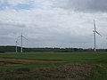 Bagmoor Wind farm - geograph.org.uk - 1283172.jpg 640 × 480; 36 KB
-
 Bagmoor Wind farm - geograph.org.uk - 1283176.jpg 640 × 480; 31 KB
-
 Balloons ahead in Far Meadow Way - geograph.org.uk - 1283403.jpg 640 × 480; 53 KB
-
 Balloons ahead in Park Crescent - geograph.org.uk - 1283432.jpg 640 × 480; 85 KB
-
 Ballymeanoch stone - panoramio.jpg 2,000 × 3,008; 2.72 MB
-
 Bandstand - geograph.org.uk - 1585527.jpg 640 × 480; 110 KB
-
 Bank Farm - geograph.org.uk - 1462250.jpg 640 × 359; 54 KB
-

-
 Bare House - geograph.org.uk - 1288418.jpg 640 × 480; 74 KB
-
 Bargaly Glen - geograph.org.uk - 1281929.jpg 640 × 480; 97 KB
-
 Bargaly Glen East - geograph.org.uk - 1281983.jpg 640 × 480; 86 KB
-
 Bargaly Glen Track - geograph.org.uk - 1281961.jpg 640 × 480; 112 KB
-

-
 Barn sheltering some cabins - geograph.org.uk - 1672251.jpg 640 × 480; 63 KB
-
 Barns beside the River Usk - geograph.org.uk - 1287270.jpg 640 × 426; 81 KB
-
 Bashurst Hill - geograph.org.uk - 1282584.jpg 640 × 480; 119 KB
-
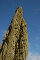
 Bastie Monument.jpg 421 × 640; 137 KB
-
 Battersby Junction Railway Station - geograph.org.uk - 1286205.jpg 618 × 412; 75 KB
-
 Elizabeth II Postbox, Wycoller - geograph.org.uk - 1282257.jpg 683 × 1,024; 185 KB
-
 Beach at Newborough Warren - geograph.org.uk - 1293380.jpg 640 × 480; 53 KB


_Grapholita_jungiella_(3495281432).jpg)
_Grapholita_jungiella_(3495281688).jpg)
_Pebble_Hook-tip_(Drepana_falcataria)_(3494467219).jpg)
_Pebble_Hook-tip_(Drepana_falcataria)_(3494468497).jpg)
_Chinese_Character_(Cilix_glaucata)_(3494377035).jpg)
_The_Lychnis_(Hadena_bicruris)_(3494377057).jpg)
_Small_Yellow_Underwing_(Panemeria_tenebrata)_(3494466011).jpg)


.jpg)
.jpg)
.jpg)


.jpg)


_-_geograph.org.uk_-_1395739.jpg)


_-_geograph.org.uk_-_1305445.jpg)


