Category:United Kingdom photographs taken on 2009-05-05
Countries of Europe: Austria · Belarus · Belgium · Bulgaria · Czech Republic · Denmark · Estonia · Finland · France‡ · Germany · Greece · Hungary · Republic of Ireland · Italy · Latvia · Montenegro · Netherlands‡ · Poland · Portugal‡ · Russia‡ · Slovakia · Slovenia · Spain‡ · Sweden · Turkey‡ · Ukraine · United Kingdom
‡: partly located in Europe
‡: partly located in Europe
| ← | 5 May 2009 | → | ||
| ← | May 2009 | → | ||

United Kingdom photographs taken on 5 May 2009.
Image files should be categorized here automatically using {{taken on}} template. Direct categorisation is also possible, if automatic is impossible.
Media in category "United Kingdom photographs taken on 2009-05-05"
The following 200 files are in this category, out of 450 total.
(previous page) (next page)-
 (1011) Pseudargyrotoza conwagana (3504627481).jpg 1,500 × 1,004; 1.21 MB
-
 (1011) Pseudargyrotoza conwagana (3505437932).jpg 1,500 × 1,004; 1,009 KB
-
 A footbridge in Six Acre Wood. - geograph.org.uk - 1302631.jpg 640 × 480; 157 KB
-

-
 A road junction in Lee. - geograph.org.uk - 1302670.jpg 640 × 480; 61 KB
-
 A windswept Llyn Pen Moelyn - geograph.org.uk - 1312308.jpg 640 × 480; 70 KB
-
 Abandoned steading near Nigg. - geograph.org.uk - 1292831.jpg 640 × 480; 203 KB
-
 Afon Biga - geograph.org.uk - 1288681.jpg 640 × 480; 106 KB
-
 Aird na Meacan - geograph.org.uk - 1288870.jpg 640 × 474; 180 KB
-
 All Saints Parish Church, Wokingham - geograph.org.uk - 1288638.jpg 640 × 480; 92 KB
-
 Amisfield Mains, Haddington - geograph.org.uk - 1295181.jpg 640 × 426; 54 KB
-
 Another stile near windcutter hill. - geograph.org.uk - 1302642.jpg 640 × 480; 133 KB
-
 Approaching Llyn Pen Moelyn - geograph.org.uk - 1312295.jpg 640 × 480; 35 KB
-
 Approaching the A435 at Perrots Brook - geograph.org.uk - 1288610.jpg 640 × 427; 114 KB
-
 Arch in the wall - geograph.org.uk - 1298771.jpg 640 × 426; 104 KB
-
 Ardnameacan - geograph.org.uk - 1288862.jpg 640 × 480; 190 KB
-
 Arncliffe Wood, Bluebells - geograph.org.uk - 1290464.jpg 640 × 427; 111 KB
-
 Arthog Woods from the Mawddach Trail - geograph.org.uk - 1312000.jpg 640 × 480; 72 KB
-
 Ashton-Under-Lyne Library - geograph.org.uk - 1289059.jpg 640 × 480; 62 KB
-
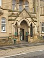 Ashton-Under-Lyne Library, Entrance - geograph.org.uk - 1289060.jpg 480 × 640; 88 KB
-

-

-
 Auster Wood - geograph.org.uk - 1290138.jpg 640 × 427; 94 KB
-
 Back Thornhill Street - Rushton Street - geograph.org.uk - 1287982.jpg 480 × 640; 230 KB
-
 Bagendon Church - geograph.org.uk - 1288595.jpg 640 × 427; 81 KB
-
 Balfour Harbour, Shapinsay - geograph.org.uk - 1320860.jpg 640 × 427; 75 KB
-
 Banhadlog - geograph.org.uk - 1288391.jpg 640 × 480; 112 KB
-
 Beckwith Drive - Harrogate Road - geograph.org.uk - 1289158.jpg 640 × 480; 300 KB
-
 Beinn Clachach western summit - geograph.org.uk - 1318123.jpg 640 × 480; 71 KB
-
 Beldray Works - geograph.org.uk - 1402499.jpg 640 × 480; 95 KB
-
 Bilston Court - geograph.org.uk - 1402520.jpg 640 × 480; 87 KB
-
 Blakesley Hall - panoramio.jpg 2,816 × 2,112; 2.68 MB
-
 Blakesley Hall, Blakesley Road, Birmingham - panoramio (1).jpg 2,816 × 2,112; 2.33 MB
-
 Blakesley Hall, Blakesley Road, Birmingham - panoramio (2).jpg 2,816 × 2,112; 2.76 MB
-
 Blakesley Hall, Blakesley Road, Birmingham - panoramio.jpg 2,816 × 2,112; 2.7 MB
-
 Blood Donation Centre, Derriford - geograph.org.uk - 1289752.jpg 640 × 480; 61 KB
-
 Bluebell carpet - panoramio.jpg 2,035 × 1,389; 1.02 MB
-
 Bluebell woods - geograph.org.uk - 1288102.jpg 640 × 480; 125 KB
-
 Bluebells by the Bishop's Walk, Nigg. - geograph.org.uk - 1292700.jpg 640 × 480; 305 KB
-
 Bluebells in Vollature Wood. - geograph.org.uk - 1302647.jpg 640 × 480; 155 KB
-

-

-
 Bridge at Membury Services - geograph.org.uk - 1289900.jpg 427 × 640; 49 KB
-
 Bridge over Walla Brook - geograph.org.uk - 1288170.jpg 640 × 427; 110 KB
-

-
 Butterfly World, Lasswade - geograph.org.uk - 1296028.jpg 640 × 426; 69 KB
-
 Caecethin - geograph.org.uk - 1288347.jpg 640 × 480; 98 KB
-
 Café and shop, Trebarwith Strand - geograph.org.uk - 1383904.jpg 640 × 425; 95 KB
-
 Cairn on Creag a' Mhuilinn - geograph.org.uk - 1287845.jpg 640 × 362; 259 KB
-
 Cairn, Creag a' Mhuilinn - geograph.org.uk - 1287827.jpg 640 × 427; 273 KB
-
-
 Cairns on Blawith Knott - geograph.org.uk - 1287915.jpg 640 × 480; 47 KB
-

-
 Capel Court - Capel Street - geograph.org.uk - 1287967.jpg 640 × 458; 187 KB
-
 Capel Street - Shell Lane - geograph.org.uk - 1287898.jpg 640 × 480; 237 KB
-
 Car Dealer, Borough Green - geograph.org.uk - 1288217.jpg 640 × 480; 63 KB
-

-
 Carr Hill Drive - geograph.org.uk - 1288155.jpg 640 × 425; 226 KB
-
 Carr Hill Nook - Upper Carr Lane - geograph.org.uk - 1288147.jpg 640 × 480; 245 KB
-
 Carr Hill Rise - Upper Carr Lane - geograph.org.uk - 1288151.jpg 640 × 480; 296 KB
-
 Castle Street - geograph.org.uk - 1290737.jpg 640 × 481; 69 KB
-
 Castle Street - geograph.org.uk - 1290739.jpg 640 × 480; 73 KB
-
 Caves above the River Traligill - geograph.org.uk - 1289697.jpg 640 × 480; 75 KB
-
 Chapel Clock - geograph.org.uk - 1287885.jpg 640 × 416; 273 KB
-
 Chapel Wall Stone - geograph.org.uk - 1287894.jpg 640 × 480; 291 KB
-
 Chestnut Grove - Clarke Street - geograph.org.uk - 1287991.jpg 640 × 480; 264 KB
-
 Chittaford Down cist - geograph.org.uk - 1302319.jpg 640 × 427; 106 KB
-
 Cist at Roundy Park Settlement - geograph.org.uk - 1288228.jpg 640 × 427; 97 KB
-
 Cist on Lakehead Hill - geograph.org.uk - 1289268.jpg 640 × 427; 124 KB
-
 Cist on Lakehead Hill - geograph.org.uk - 1289279.jpg 640 × 427; 113 KB
-
 Cist south-west of Chittaford Down - geograph.org.uk - 1288195.jpg 640 × 427; 86 KB
-
 Col on Cnoc an t-Sidhein Mor - geograph.org.uk - 1309601.jpg 640 × 480; 117 KB
-
 Collindale Close - Roundwood Glen - geograph.org.uk - 1288360.jpg 640 × 448; 166 KB
-
 Connaught Avenue in Spring - geograph.org.uk - 1288684.jpg 640 × 480; 140 KB
-
 Corner detail, Omagh Leisure Centre - geograph.org.uk - 1289529.jpg 480 × 640; 51 KB
-
 Cottage at Waterloo - geograph.org.uk - 1288733.jpg 640 × 426; 222 KB
-
 Cottages At Gulpher - geograph.org.uk - 1288041.jpg 640 × 480; 123 KB
-
 Cowgate, Edinburgh - geograph.org.uk - 1295756.jpg 640 × 426; 74 KB
-
 Cowmire Hall - geograph.org.uk - 1287979.jpg 640 × 480; 95 KB
-
 Creag na h-Uamha - geograph.org.uk - 1287861.jpg 640 × 347; 262 KB
-
 Cregennen Lakes - geograph.org.uk - 1312032.jpg 640 × 480; 43 KB
-

-

-

-
 Culloden Battlefield Memorial Cairn.jpg 2,592 × 3,888; 3.39 MB
-
 Cwm Cottage - geograph.org.uk - 1290862.jpg 640 × 480; 85 KB
-
 Cwm Creignant - geograph.org.uk - 1288735.jpg 640 × 480; 110 KB
-
 Dandilion Clock - panoramio.jpg 2,048 × 1,536; 619 KB
-
 Derelict buildings - geograph.org.uk - 1288277.jpg 640 × 438; 62 KB
-
 Digging up the pavement - geograph.org.uk - 1290271.jpg 640 × 465; 61 KB
-

-
 Dobbies Garden Centre, Lasswade - geograph.org.uk - 1295279.jpg 640 × 426; 79 KB
-
 Dundee Street, Edinburgh - geograph.org.uk - 1295770.jpg 640 × 426; 80 KB
-
 East view from Border - geograph.org.uk - 1305648.jpg 640 × 480; 76 KB
-
 Easter Island, Plas Newydd - geograph.org.uk - 1293521.jpg 640 × 480; 114 KB
-
 Edenderry village near Belfast (2) - geograph.org.uk - 1288805.jpg 640 × 341; 79 KB
-
 Edenderry village near Belfast (3) - geograph.org.uk - 1288852.jpg 640 × 409; 78 KB
-
 Edenderry village near Belfast (4) - geograph.org.uk - 1288894.jpg 586 × 343; 85 KB
-

-
 Edgeley Park - geograph.org.uk - 1290745.jpg 640 × 480; 143 KB
-
 Edinburgh bypass at Lasswade - geograph.org.uk - 1295704.jpg 640 × 426; 65 KB
-
 Edinburgh tenement - geograph.org.uk - 1295100.jpg 426 × 640; 77 KB
-
 Elderwood Gardens - Rimswell Holt - geograph.org.uk - 1288333.jpg 640 × 480; 215 KB
-
 Elizabethan House Garden - geograph.org.uk - 1289828.jpg 480 × 640; 116 KB
-
 Empty benches at Silloth - geograph.org.uk - 1305566.jpg 640 × 480; 48 KB
-
 Enterng the woods near windcutter hill. - geograph.org.uk - 1302636.jpg 640 × 480; 144 KB
-
 Farmland At the End Of Marsh Lane - geograph.org.uk - 1288025.jpg 640 × 480; 104 KB
-
 Farmland At the End Of Marsh Lane - geograph.org.uk - 1288031.jpg 640 × 480; 127 KB
-
 Farmland Beside Marsh Lane - geograph.org.uk - 1288021.jpg 640 × 480; 106 KB
-
 Ferne Park - geograph.org.uk - 1287940.jpg 640 × 480; 162 KB
-
 Firing aperture - panoramio.jpg 2,048 × 1,536; 1.17 MB
-
 Flooded sandstone quarry on Nigg Hill. - geograph.org.uk - 1292633.jpg 640 × 481; 199 KB
-
 Flower Garth - Harrogate Road - geograph.org.uk - 1289155.jpg 640 × 480; 296 KB
-

-
 Footpath - geograph.org.uk - 1289098.jpg 480 × 640; 66 KB
-
 Footpath - geograph.org.uk - 1290746.jpg 480 × 640; 119 KB
-

-
 Footpath at Trebarwith Strand - geograph.org.uk - 1383891.jpg 640 × 480; 138 KB
-

-
 Footpath in Arncliffe Wood - geograph.org.uk - 1289572.jpg 640 × 427; 110 KB
-
 Footpath in Arncliffe Wood - geograph.org.uk - 1289581.jpg 427 × 640; 89 KB
-
 Footpath near Rowberry Farm - geograph.org.uk - 1287950.jpg 640 × 480; 218 KB
-
 Footpath on to Reservoir Road - geograph.org.uk - 1290747.jpg 480 × 640; 103 KB
-

-
 Footpath, Rowberry Farm - geograph.org.uk - 1287954.jpg 640 × 481; 204 KB
-
 Forester's Call, Old Street - geograph.org.uk - 1289063.jpg 640 × 480; 63 KB
-
 Former public swimming baths - geograph.org.uk - 1289021.jpg 640 × 480; 61 KB
-
 Former public swimming baths - geograph.org.uk - 1289069.jpg 480 × 640; 52 KB
-
 Former public swimming baths - geograph.org.uk - 1289072.jpg 640 × 480; 53 KB
-

-
 Four Seasons Guest House, Edinburgh - geograph.org.uk - 1295737.jpg 640 × 426; 78 KB
-
 Foxholes Crescent - Foxholes Lane - geograph.org.uk - 1287897.jpg 640 × 446; 195 KB
-
 Foxholes Lane - Foxholes Crescent - geograph.org.uk - 1287895.jpg 640 × 417; 163 KB
-
 Foxholes Lane - Shell Lane - geograph.org.uk - 1287903.jpg 640 × 480; 205 KB
-

-
 Friendship - geograph.org.uk - 1289039.jpg 640 × 480; 64 KB
-
 Geese on Llyn Pen Moelyn - geograph.org.uk - 1312311.jpg 640 × 480; 56 KB
-
 Gleann Dubh from Cnoc nan Uamh - geograph.org.uk - 1289734.jpg 640 × 480; 61 KB
-
 Gliddon Road W14 - geograph.org.uk - 1288244.jpg 640 × 479; 84 KB
-
 God is in his grotto - geograph.org.uk - 1294852.jpg 640 × 480; 144 KB
-
 Goodhope Mill - geograph.org.uk - 1289068.jpg 640 × 480; 63 KB
-
 Grave by the holly bush - geograph.org.uk - 1298812.jpg 400 × 600; 71 KB
-
 GYOHZhenHua6.JPG 2,592 × 1,944; 1.63 MB
-
 Hairpin bend on track to mast - geograph.org.uk - 1287854.jpg 640 × 427; 328 KB
-
 Hammersmith West London College - geograph.org.uk - 1288282.jpg 640 × 479; 90 KB
-
 Hartland Tor - geograph.org.uk - 1288248.jpg 640 × 427; 68 KB
-
 Heading towards Woodmancote - geograph.org.uk - 1288780.jpg 640 × 427; 59 KB
-
 Herb-Robert (Geranium robertianum). - geograph.org.uk - 1306854.jpg 640 × 480; 251 KB
-
 Herbaceous beds, Trerice, Newlyn - geograph.org.uk - 1370991.jpg 640 × 474; 174 KB
-
 Hexagonal Cottage - geograph.org.uk - 1288048.jpg 640 × 480; 122 KB
-
 High Street (A25), Seal - geograph.org.uk - 1288230.jpg 640 × 480; 67 KB
-
 High Street (A25), Seal - geograph.org.uk - 1288235.jpg 640 × 480; 87 KB
-
 Hollin Park Drive - Upper Carr Lane - geograph.org.uk - 1288120.jpg 640 × 480; 290 KB
-
 Hollin Park Road - Upper Carr Lane - geograph.org.uk - 1288123.jpg 640 × 401; 152 KB
-
 Hollin Park Road - Victoria Street - geograph.org.uk - 1288114.jpg 640 × 433; 173 KB
-
 Holme Cultram Abbey - geograph.org.uk - 1305730.jpg 640 × 480; 61 KB
-
 Hope and Anchor, Wokingham - geograph.org.uk - 1288015.jpg 640 × 480; 97 KB
-
 Hope farm - panoramio.jpg 2,048 × 1,536; 1.12 MB
-
 Horse chestnut tree - geograph.org.uk - 1463089.jpg 640 × 480; 104 KB
-
 House at Bagendon - geograph.org.uk - 1288668.jpg 640 × 427; 119 KB
-
 Icône parc d'attraction.svg 684 × 746; 164 KB
-

-
 India House - a modern impression - geograph.org.uk - 1333447.jpg 640 × 480; 74 KB
-
 Jacob sheep and lambs, near Nigg. - geograph.org.uk - 1292692.jpg 640 × 482; 224 KB
-
 James Street - geograph.org.uk - 1402502.jpg 640 × 480; 78 KB
-
 Junction in Bagendon - geograph.org.uk - 1288720.jpg 640 × 427; 60 KB
-
 Junction in Poulton - geograph.org.uk - 1288511.jpg 640 × 427; 79 KB
-
 Junction in Woodmancote - geograph.org.uk - 1448448.jpg 640 × 427; 105 KB
-
 Junction on the A435 - geograph.org.uk - 1288565.jpg 640 × 427; 61 KB
-
 Junction on the road - geograph.org.uk - 1298682.jpg 640 × 426; 57 KB
-
 Killerton House from the north west - geograph.org.uk - 1289745.jpg 640 × 480; 117 KB
-
 St Peter's Church, Kings Ripton - geograph.org.uk - 1376583.jpg 640 × 480; 57 KB
-
 Kings Youth Hostel - geograph.org.uk - 1310880.jpg 640 × 480; 118 KB
-
 Kings Youth Hostel - geograph.org.uk - 1310885.jpg 640 × 480; 101 KB
-
 Kings Youth Hostel - geograph.org.uk - 1310887.jpg 640 × 480; 121 KB
-
 Kings Youth Hostel - geograph.org.uk - 1310889.jpg 640 × 480; 101 KB
-
 Lane from Cwm-mawr - geograph.org.uk - 1288882.jpg 640 × 480; 150 KB
-
 Lane near Llwyncanol, two horses - geograph.org.uk - 1288249.jpg 640 × 480; 80 KB
-
 Lane to Cefngoleugoed - geograph.org.uk - 1288488.jpg 640 × 480; 146 KB
-
 Lane to Fronlwyd - geograph.org.uk - 1288765.jpg 640 × 480; 131 KB
-
 Lane to Tan-y-cefn - geograph.org.uk - 1288281.jpg 640 × 480; 108 KB
-

-
 Leith Walk, Edinburgh - geograph.org.uk - 1295118.jpg 640 × 435; 88 KB
-
 Lewis Street View - geograph.org.uk - 1402509.jpg 640 × 480; 149 KB
-
 Liberton High School, Edinburgh - geograph.org.uk - 1295725.jpg 640 × 425; 68 KB
-
 Bourne Woods off the A151 road - geograph.org.uk - 1290154.jpg 640 × 427; 83 KB
-
 Llwybyr Llyn Idwal - geograph.org.uk - 1433289.jpg 480 × 640; 107 KB
-

-
 Llyn Wylfa - geograph.org.uk - 1312318.jpg 640 × 480; 108 KB
-
 Llyn Wylfa - geograph.org.uk - 1312321.jpg 640 × 480; 88 KB
-
 Llyn Wylfa - geograph.org.uk - 1312323.jpg 640 × 480; 80 KB
-
 Llyn Wylfa - geograph.org.uk - 1312326.jpg 640 × 480; 88 KB
-
 Llyn Wylfa - geograph.org.uk - 1313347.jpg 640 × 480; 95 KB
-
 Llyn y Fan in the distance - geograph.org.uk - 1288522.jpg 640 × 480; 74 KB
-
 Loch Eilanach - geograph.org.uk - 1297899.jpg 640 × 478; 87 KB
-

-

-
 Looking along the green - geograph.org.uk - 1298674.jpg 640 × 426; 79 KB
-
 Looking out - panoramio - Mutzy.jpg 2,048 × 1,536; 1.16 MB
-
 Looking up Gleann Dubh to Conival - geograph.org.uk - 1289743.jpg 640 × 480; 94 KB
_Pseudargyrotoza_conwagana_(3504627481).jpg)
_Pseudargyrotoza_conwagana_(3505437932).jpg)


.jpg)
.jpg)


_-_geograph.org.uk_-_1288805.jpg)
_-_geograph.org.uk_-_1288852.jpg)
_-_geograph.org.uk_-_1288894.jpg)


._-_geograph.org.uk_-_1306854.jpg)


,_Seal_-_geograph.org.uk_-_1288230.jpg)
,_Seal_-_geograph.org.uk_-_1288235.jpg)


_-_geograph.org.uk_-_1333296.jpg)
_-_geograph.org.uk_-_1333322.jpg)


