Category:United Kingdom photographs taken on 2009-05-26
Countries of Europe: Austria · Belarus · Belgium · Bulgaria · Czech Republic · Denmark · Estonia · Finland · France‡ · Germany · Greece · Hungary · Republic of Ireland · Italy · Malta · Netherlands‡ · Poland · Portugal‡ · Romania · Russia‡ · Slovakia · Spain‡ · Sweden · Switzerland · Ukraine · United Kingdom
Specific status: Jersey
‡: partly located in Europe
Specific status: Jersey
‡: partly located in Europe
| ← | 26 May 2009 | → | ||
| ← | May 2009 | → | ||

United Kingdom photographs taken on 26 May 2009.
Image files should be categorized here automatically using {{taken on}} template. Direct categorisation is also possible, if automatic is impossible.
Media in category "United Kingdom photographs taken on 2009-05-26"
The following 200 files are in this category, out of 1,566 total.
(previous page) (next page)-
 (1361) Pyrausta aurata (3565085661).jpg 1,500 × 1,004; 1.45 MB
-
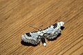
 (1689) Mullein Wave (Scopula marginepunctata) (3565088501).jpg 1,500 × 1,004; 1.41 MB
-
 (1825) Lime-speck Pug (Eupithecia centaureata) (3565082723).jpg 1,500 × 1,004; 1.27 MB
-
-
 158793 North Wingfield.jpg 3,000 × 2,078; 3.84 MB
-
 666 The Beast finally discovered^ - geograph.org.uk - 1342925.jpg 640 × 480; 105 KB
-
 A beet stand east of Kings Lynn - geograph.org.uk - 1322650.jpg 640 × 504; 141 KB
-

-

-

-
 A deep ditch west of Gayton - geograph.org.uk - 1324034.jpg 483 × 637; 177 KB
-
 A Disused Quarry - geograph.org.uk - 1345863.jpg 640 × 480; 107 KB
-
 A Disused Quarry - geograph.org.uk - 1345871.jpg 640 × 480; 131 KB
-
 A Drain at Windyridge - geograph.org.uk - 1345818.jpg 640 × 480; 153 KB
-
 A Drain for Farmland - geograph.org.uk - 1345861.jpg 640 × 372; 47 KB
-
 A Dwelling at Lossiemouth - geograph.org.uk - 1345869.jpg 640 × 432; 73 KB
-

-
 A field-woodland boundary - geograph.org.uk - 1323831.jpg 640 × 480; 125 KB
-

-
 A Garden at Windyridge - geograph.org.uk - 1345809.jpg 640 × 480; 142 KB
-
 A Gun Hole at The Palace of Spynie - geograph.org.uk - 1341520.jpg 640 × 480; 113 KB
-
 A Herons Nest near Spynie Loch - geograph.org.uk - 1345688.jpg 480 × 640; 73 KB
-
 A Herring Gull - geograph.org.uk - 1327526.jpg 640 × 477; 167 KB
-
 A level crossing east of Kings Lynn - geograph.org.uk - 1322683.jpg 640 × 426; 123 KB
-
 A Nesting Swan at Spynie - geograph.org.uk - 1345646.jpg 640 × 480; 111 KB
-
 A passing point on the Eskdale Railway - geograph.org.uk - 1333255.jpg 640 × 609; 172 KB
-
 A pond west of Gayton - geograph.org.uk - 1324038.jpg 640 × 426; 163 KB
-
 A Railway Bridge over the Spynie Canal - geograph.org.uk - 1345675.jpg 640 × 480; 108 KB
-
 A row of cottages, Dalegarth Station - geograph.org.uk - 1333295.jpg 640 × 403; 77 KB
-
 A small herd of cattle, or "some coos" - geograph.org.uk - 1338362.jpg 640 × 480; 111 KB
-
 A small stream near Boot - geograph.org.uk - 1333318.jpg 640 × 430; 94 KB
-
 A Stand of Conifers - geograph.org.uk - 1333488.jpg 640 × 430; 102 KB
-
 A Stile at Windyridge - geograph.org.uk - 1345845.jpg 640 × 480; 178 KB
-
 A variety of livestock - geograph.org.uk - 1333001.jpg 640 × 480; 221 KB
-
 A Victorian style lamppost on Clapham Common - geograph.org.uk - 1325260.jpg 1,698 × 2,263; 568 KB
-
 A view from Scrabo - geograph.org.uk - 1324252.jpg 640 × 513; 382 KB
-
 A view from Scrabo - geograph.org.uk - 1324255.jpg 640 × 418; 323 KB
-
 A view from Scrabo - geograph.org.uk - 1324261.jpg 640 × 474; 268 KB
-
 A view from Scrabo - geograph.org.uk - 1325822.jpg 640 × 388; 303 KB
-

-
 A well-maintained path - geograph.org.uk - 1322386.jpg 640 × 480; 132 KB
-

-
 A wooded corner west of Gayton - geograph.org.uk - 1322691.jpg 640 × 426; 159 KB
-
 A161 junction - geograph.org.uk - 1322630.jpg 640 × 480; 70 KB
-

-
 A49 and A4137 junction - geograph.org.uk - 1325165.jpg 640 × 480; 172 KB
-
 A631 at Beckingham - geograph.org.uk - 1322665.jpg 640 × 480; 54 KB
-
 A631 Roundabout - geograph.org.uk - 1322607.jpg 640 × 480; 49 KB
-
 Abandoned railway line, Eskdale - geograph.org.uk - 1333335.jpg 640 × 430; 106 KB
-
 Abandoned vehicle, Lower Ollach - geograph.org.uk - 1322988.jpg 640 × 480; 173 KB
-
 Abbey Churchyard - geograph.org.uk - 1323350.jpg 640 × 426; 115 KB
-
 Abbey Close - geograph.org.uk - 1322393.jpg 640 × 426; 62 KB
-
 Abbeyfield House Carradale - geograph.org.uk - 1334804.jpg 640 × 480; 61 KB
-

-
 Abhainn Mhuilean Domhnuill - geograph.org.uk - 1364230.jpg 640 × 480; 288 KB
-
 Abhainn Strath na Seilge - geograph.org.uk - 1323314.jpg 640 × 480; 89 KB
-
 Above Port Bàn Mhic-a-phi - geograph.org.uk - 1328269.jpg 640 × 480; 98 KB
-
 Above Stanah - geograph.org.uk - 1323069.jpg 480 × 640; 112 KB
-
 Access land near the Mariner's Way - geograph.org.uk - 1333681.jpg 640 × 480; 126 KB
-

-
 Acres Hall Crescent - Acres Hall Avenue - geograph.org.uk - 1321883.jpg 640 × 480; 234 KB
-
 Acres Hall Crescent - Acres Hall Avenue - geograph.org.uk - 1321887.jpg 640 × 480; 230 KB
-
 Acres Hall Crescent - Acres Hall Drive - geograph.org.uk - 1321865.jpg 640 × 480; 245 KB
-
 Acres Hall Crescent - Acres Hall Drive - geograph.org.uk - 1321870.jpg 640 × 480; 248 KB
-
 Acres Hall Drive - Valley Road - geograph.org.uk - 1321677.jpg 640 × 480; 233 KB
-

-

-
 Ageing trains, Whitehead (1) - geograph.org.uk - 1323468.jpg 640 × 379; 68 KB
-
 Ageing trains, Whitehead (2) - geograph.org.uk - 1323485.jpg 640 × 415; 98 KB
-
 Airport trail at EMA - geograph.org.uk - 1343956.jpg 640 × 480; 98 KB
-
 All Saints, Ilkley - geograph.org.uk - 1329592.jpg 480 × 640; 134 KB
-
 Allathasdal - geograph.org.uk - 1363179.jpg 640 × 480; 328 KB
-
 Allt Garb near Port Bàn Mhic-a-phi - geograph.org.uk - 1328318.jpg 640 × 480; 124 KB
-
 Allt na Caillich - geograph.org.uk - 1344991.jpg 640 × 480; 136 KB
-
 Alltnacaillich in Strath More - geograph.org.uk - 1344960.jpg 640 × 480; 160 KB
-
 Along the drystane dyke to Purin Hill - geograph.org.uk - 1339115.jpg 640 × 480; 122 KB
-
 Am Fraoch-eilean - geograph.org.uk - 1349602.jpg 638 × 382; 60 KB
-
 Ambersham Bridge - geograph.org.uk - 1338100.jpg 640 × 480; 187 KB
-
 Ambersham Bridge - geograph.org.uk - 1338151.jpg 640 × 480; 161 KB
-
 An Gorm-loch - geograph.org.uk - 1345045.jpg 640 × 480; 142 KB
-
 Ancient and modern, Heyshott - geograph.org.uk - 1337877.jpg 480 × 640; 146 KB
-
 Ancient cliff line and raised beach - geograph.org.uk - 1328158.jpg 640 × 480; 122 KB
-
 Ancient Flying Saucer buried at Cwm Nash - geograph.org.uk - 1324110.jpg 2,848 × 2,136; 4.06 MB
-
 Angel With A Halo - geograph.org.uk - 1328605.jpg 480 × 640; 37 KB
-

-

-
 Approaching Eriskay - geograph.org.uk - 1367532.jpg 640 × 425; 240 KB
-
 Approaching the summit of Gulvain - geograph.org.uk - 1326823.jpg 640 × 480; 79 KB
-
 Approaching Wren Crag - geograph.org.uk - 1325442.jpg 640 × 480; 85 KB
-
 Ardaneaskan - geograph.org.uk - 1348822.jpg 640 × 427; 51 KB
-
 Ardivot Farm - geograph.org.uk - 1346292.jpg 640 × 480; 73 KB
-
 Armont House from Low Birker - geograph.org.uk - 1333532.jpg 640 × 430; 69 KB
-
 Ashdene Crescent - Fartown - geograph.org.uk - 1321437.jpg 640 × 480; 241 KB
-
 At the Back of Warwick Services - geograph.org.uk - 1325664.jpg 640 × 480; 170 KB
-
 At the sea's edge - geograph.org.uk - 1323136.jpg 640 × 480; 53 KB
-
 Autherley Junction near Wolverhampton - geograph.org.uk - 1359083.jpg 640 × 433; 156 KB
-
 Autherley Junction near Wolverhampton - geograph.org.uk - 1359120.jpg 640 × 442; 160 KB
-

-
 Avenue of Lime Trees, Kentwell Hall - geograph.org.uk - 1323011.jpg 640 × 425; 95 KB
-
 Avenue of trees at Dumbarnie - geograph.org.uk - 1339140.jpg 640 × 480; 126 KB
-
 Badger Farm. - geograph.org.uk - 1322549.jpg 640 × 393; 111 KB
-
 Ballard's Old Garage - geograph.org.uk - 1321266.jpg 640 × 480; 71 KB
-
 Barclays, Grassington - geograph.org.uk - 1329693.jpg 640 × 480; 75 KB
-
 Barley field adjoining footpath - geograph.org.uk - 1322396.jpg 640 × 480; 93 KB
-
 Barn at Lletty Gwilym Isaf - geograph.org.uk - 1322141.jpg 640 × 480; 223 KB
-
 Barn by the bridleway - geograph.org.uk - 1333763.jpg 504 × 640; 146 KB
-
 Barn by the Eskdale Railway - geograph.org.uk - 1333247.jpg 640 × 430; 85 KB
-
 Barn Hill From Warwick Services - geograph.org.uk - 1325666.jpg 480 × 640; 182 KB
-
 Barn, Stanah - geograph.org.uk - 1323233.jpg 640 × 480; 86 KB
-
 Barra Golf Course - geograph.org.uk - 1363084.jpg 640 × 458; 254 KB
-
 Barra Golf Course - geograph.org.uk - 1363120.jpg 480 × 640; 274 KB
-
 Barrage balloon anchor, Stormont - geograph.org.uk - 1324231.jpg 640 × 497; 426 KB
-
 Barrow Lodge, Muncaster - geograph.org.uk - 1335451.jpg 640 × 430; 77 KB
-
 Beach at Allathasdal - geograph.org.uk - 1364170.jpg 640 × 480; 239 KB
-
 Beach at Allathasdal - geograph.org.uk - 1364176.jpg 640 × 424; 229 KB
-
 Beach at Allathasdal - geograph.org.uk - 1364194.jpg 640 × 466; 261 KB
-
 Beach at Littlestone - geograph.org.uk - 1323214.jpg 640 × 480; 47 KB
-
 Beach Inlet - geograph.org.uk - 1363169.jpg 480 × 640; 278 KB
-
 Beamish Town - geograph.org.uk - 1334072.jpg 480 × 640; 99 KB
-
 Beamish Town - geograph.org.uk - 1334095.jpg 640 × 480; 96 KB
-
 Beckfoot Quarry - geograph.org.uk - 1333265.jpg 640 × 317; 55 KB
-
 Bedford Hall - geograph.org.uk - 1323394.jpg 640 × 426; 61 KB
-
 Bedford Hall - geograph.org.uk - 1323398.jpg 640 × 426; 61 KB
-
 Bedlam Barn Farm - geograph.org.uk - 1338399.jpg 640 × 480; 114 KB
-
 Bedlam Barn Farm - geograph.org.uk - 1338422.jpg 640 × 480; 122 KB
-
 Bedlam Barn Farm - geograph.org.uk - 1338446.jpg 640 × 480; 101 KB
-
 Beeston High Road - geograph.org.uk - 1323878.jpg 640 × 480; 136 KB
-
 Belmont Reservoir - geograph.org.uk - 1322446.jpg 640 × 539; 90 KB
-
 Below Ilkley Crags - geograph.org.uk - 1332334.jpg 640 × 480; 124 KB
-
 Below Ilkley Moor - geograph.org.uk - 1332270.jpg 640 × 480; 104 KB
-
 Ben Hope trig point S7061 - geograph.org.uk - 1345021.jpg 640 × 480; 134 KB
-
 Ben Rhydding - geograph.org.uk - 1329573.jpg 640 × 480; 105 KB
-
 Ben Rhydding Methodist Church - geograph.org.uk - 1332349.jpg 640 × 480; 80 KB
-
 Bestwood Lodge Drive - geograph.org.uk - 1340343.jpg 640 × 427; 107 KB
-
 Bestwood Lodge formal gardens - geograph.org.uk - 1340463.jpg 640 × 427; 121 KB
-
 Bestwood Lodge Hotel - geograph.org.uk - 1340394.jpg 640 × 427; 89 KB
-
 Bestwood Lodge Hotel - geograph.org.uk - 1340457.jpg 640 × 427; 110 KB
-
 Bhatarsaigh Causeway Quarry - geograph.org.uk - 1364312.jpg 640 × 480; 335 KB
-
 Bicester Village - geograph.org.uk - 1335617.jpg 480 × 640; 86 KB
-
 Bicester Village Parking - geograph.org.uk - 1335599.jpg 640 × 480; 133 KB
-

-
 Bishopston Fundamental Benchmark - geograph.org.uk - 1371265.jpg 640 × 480; 115 KB
-
 Black Brook - geograph.org.uk - 1338480.jpg 640 × 480; 139 KB
-
 Black Brook Loughborough - geograph.org.uk - 1338110.jpg 640 × 480; 129 KB
-
 Black Brook Loughborough - geograph.org.uk - 1338116.jpg 640 × 480; 143 KB
-
 Black Brook Loughborough - geograph.org.uk - 1338215.jpg 640 × 480; 139 KB
-

-

-
 Black Brook Shepshed - geograph.org.uk - 1340118.jpg 640 × 480; 135 KB
-
 Black Brook Shepshed - geograph.org.uk - 1340177.jpg 480 × 640; 131 KB
-
 Black Brook Shepshed - geograph.org.uk - 1340191.jpg 640 × 480; 118 KB
-
 Black Brook Shepshed under the M1 - geograph.org.uk - 1340151.jpg 480 × 640; 117 KB
-
 Black Horse Hotel - geograph.org.uk - 1329687.jpg 640 × 480; 88 KB
-
 Blaen-Y-Cwm Nature Reserve Entrance - geograph.org.uk - 1323243.jpg 640 × 480; 145 KB
-
 Blencathra - summit cairn - geograph.org.uk - 1463541.jpg 640 × 480; 84 KB
-
 Blue Bells by the Palace - geograph.org.uk - 1345527.jpg 640 × 480; 158 KB
-
 Bluebells on banks near Hookney - geograph.org.uk - 1333750.jpg 640 × 435; 117 KB
-
 Bluebells on Easdon Down (2) - geograph.org.uk - 1333520.jpg 640 × 480; 164 KB
-
 Bluebells on Easdon Down (3) - geograph.org.uk - 1333569.jpg 640 × 480; 140 KB
-
 Bluebells on Easdon Down (4) - geograph.org.uk - 1333581.jpg 640 × 480; 158 KB
-
 Bluebells on Easdon Down (5) - geograph.org.uk - 1333593.jpg 640 × 480; 133 KB
-
 Bluebells on Easdon Down - geograph.org.uk - 1333506.jpg 640 × 480; 135 KB
-
 Bluebells, bracken and baa-lambs - geograph.org.uk - 1322997.jpg 640 × 480; 152 KB
-
 Blyton Warping Drain - geograph.org.uk - 1322822.jpg 640 × 480; 70 KB
-
 Boathouse, Inverinate House - geograph.org.uk - 1349566.jpg 640 × 480; 87 KB
-
-
 Bog north of Cnoc a'Chùirn Mhòir - geograph.org.uk - 1328440.jpg 640 × 480; 66 KB
-
 Bolton Abbey Font - geograph.org.uk - 1335969.jpg 480 × 640; 72 KB
-
 Bolton Abbey Windows - geograph.org.uk - 1335967.jpg 480 × 640; 103 KB
-
 Bolton Castle, at Castle Bolton - geograph.org.uk - 1390969.jpg 640 × 480; 105 KB
-
 Bolton Gill - geograph.org.uk - 1391767.jpg 480 × 640; 184 KB
-
 Bolton Gill and Bolton Gill Plantation - geograph.org.uk - 1391762.jpg 640 × 480; 172 KB
-
 Bolton Priory Carvings - geograph.org.uk - 1335974.jpg 640 × 480; 95 KB
-
 Boulevard High School - geograph.org.uk - 1322050.jpg 480 × 640; 124 KB
-
 Bowood House - geograph.org.uk - 1467658.jpg 640 × 427; 68 KB
-
 Brackagh Moss - geograph.org.uk - 1327710.jpg 640 × 480; 109 KB
-
 Brackagh moss - geograph.org.uk - 1327940.jpg 480 × 640; 145 KB
-
 Brackagh Moss - geograph.org.uk - 1327948.jpg 640 × 480; 152 KB
-
 Brackagh Moss - geograph.org.uk - 1327964.jpg 640 × 480; 155 KB
-
 Brackagh Moss - geograph.org.uk - 1327979.jpg 480 × 640; 135 KB
-
 Brackagh Moss - geograph.org.uk - 1327988.jpg 640 × 480; 135 KB
-
 Brackagh Moss - geograph.org.uk - 1328008.jpg 640 × 480; 122 KB
-
 Brackagh Moss - geograph.org.uk - 1328016.jpg 640 × 480; 135 KB
-
 Brackagh Moss - geograph.org.uk - 1328023.jpg 640 × 480; 110 KB
-
 Brackagh Moss Road - geograph.org.uk - 1327698.jpg 480 × 640; 89 KB
-
 Bracken, Pteridium aquilinum - geograph.org.uk - 1334890.jpg 640 × 427; 82 KB
-
 Brackish pool at Bodha a'Chùirn - geograph.org.uk - 1327956.jpg 640 × 480; 88 KB
-

-

-

-
 Bridge on the Dismantled Railway - geograph.org.uk - 1345858.jpg 640 × 480; 122 KB
-
 Bridge over Allt Garbh - geograph.org.uk - 1328426.jpg 640 × 360; 79 KB
-
 Bridge Over The A42 - geograph.org.uk - 1343004.jpg 640 × 480; 76 KB
-
 Bridge Over The A42 - geograph.org.uk - 1343018.jpg 640 × 480; 77 KB
-
 Bridge over the River Eamont - geograph.org.uk - 1321564.jpg 600 × 450; 92 KB
-
 Bridge over the River Loanan - geograph.org.uk - 1337371.jpg 640 × 480; 105 KB
-
 Bridleway along the edge of the woods - geograph.org.uk - 1333514.jpg 640 × 430; 116 KB
-
 Bridleway crests the small hill - geograph.org.uk - 1333517.jpg 640 × 430; 71 KB
-
 Bridleway crosses the railway - geograph.org.uk - 1332248.jpg 640 × 458; 105 KB
-
 Bridleway junction south of Boot - geograph.org.uk - 1333342.jpg 640 × 430; 73 KB
_Pyrausta_aurata_(3565085661).jpg)
_Mullein_Wave_(Scopula_marginepunctata)_(3565088501).jpg)
_Lime-speck_Pug_(Eupithecia_centaureata)_(3565082723).jpg)


_-_geograph.org.uk_-_1323468.jpg)
_-_geograph.org.uk_-_1323485.jpg)


_-_geograph.org.uk_-_1333520.jpg)
_-_geograph.org.uk_-_1333569.jpg)
_-_geograph.org.uk_-_1333581.jpg)
_-_geograph.org.uk_-_1333593.jpg)


