Category:United Kingdom photographs taken on 2009-05-21
Countries of Europe: Austria · Belgium · Czech Republic · Denmark · Estonia · Finland · France‡ · Germany · Greece · Hungary · Republic of Ireland · Italy · Latvia · Netherlands‡ · Norway · Poland · Portugal‡ · Russia‡ · Serbia · Slovakia · Spain‡ · Sweden · Switzerland · Turkey‡ · Ukraine · United Kingdom
‡: partly located in Europe
‡: partly located in Europe
| ← | 21 May 2009 | → | ||
| ← | May 2009 | → | ||

United Kingdom photographs taken on 21 May 2009.
Image files should be categorized here automatically using {{taken on}} template. Direct categorisation is also possible, if automatic is impossible.
Media in category "United Kingdom photographs taken on 2009-05-21"
The following 200 files are in this category, out of 1,335 total.
(previous page) (next page)-
 (looking towards) Inverkeithing Church, Inverkeithing.jpg 3,264 × 2,448; 3.06 MB
-
 14th Tee Austin Lodge Golf Course - geograph.org.uk - 1315056.jpg 640 × 480; 72 KB
-
 16th Tee Austin Lodge Golf Course - geograph.org.uk - 1315060.jpg 640 × 480; 85 KB
-
 A Bee on Nellie Moser Clematis. - geograph.org.uk - 1423585.jpg 640 × 453; 63 KB
-
-
 A filled ditch, Broadwell (2) - geograph.org.uk - 1313888.jpg 640 × 516; 140 KB
-
 A filled ditch, Broadwell - geograph.org.uk - 1313879.jpg 531 × 640; 164 KB
-

-
 A Gaggle of Geese - geograph.org.uk - 1314653.jpg 640 × 480; 108 KB
-
 A muddy field near Strabane - geograph.org.uk - 1313763.jpg 640 × 479; 70 KB
-
 A solitary tree east of Broadwell - geograph.org.uk - 1313916.jpg 582 × 640; 119 KB
-
 A sparkling granite wall, Lundy - geograph.org.uk - 1339543.jpg 640 × 480; 120 KB
-
 A view of Millcombe House - geograph.org.uk - 1339159.jpg 640 × 480; 164 KB
-
 A woodland walk - geograph.org.uk - 1322857.jpg 640 × 480; 157 KB
-
 A417 to Rowstock at Harwell - geograph.org.uk - 1315598.jpg 640 × 427; 81 KB
-
 Abbey House Gardens, Winchester - geograph.org.uk - 1316347.jpg 640 × 480; 111 KB
-
 Abbey House Gardens, Winchester - geograph.org.uk - 1316348.jpg 640 × 480; 92 KB
-
 Abbey House, Winchester - geograph.org.uk - 1316346.jpg 480 × 640; 99 KB
-
 Abbot's Knoll - geograph.org.uk - 1321060.jpg 640 × 457; 300 KB
-
 Abbot's Park - geograph.org.uk - 1321068.jpg 640 × 457; 418 KB
-
 Abbot's Park - geograph.org.uk - 1321076.jpg 640 × 457; 372 KB
-
-
 Ackland's Moor, Lundy - geograph.org.uk - 1339616.jpg 640 × 480; 96 KB
-
 Ackland's Moor, Lundy - geograph.org.uk - 1340578.jpg 640 × 444; 109 KB
-
 Across Lundy's airstrip - geograph.org.uk - 1339632.jpg 640 × 480; 99 KB
-
-

-

-

-

-

-

-

-

-

-

-
 Alchin's Wood - geograph.org.uk - 1314933.jpg 640 × 480; 66 KB
-
 All Saints church in Chilton - geograph.org.uk - 1315982.jpg 640 × 427; 70 KB
-

-

-
 Allt a'Chairn Leith - geograph.org.uk - 1322751.jpg 480 × 640; 112 KB
-
 Allt Creag nan Gobhar - geograph.org.uk - 1313802.jpg 480 × 640; 98 KB
-

-
 Along Fore Street, Ilfracombe - geograph.org.uk - 1338913.jpg 640 × 467; 84 KB
-
 An overgrown ditch, Broadwell - geograph.org.uk - 1313926.jpg 569 × 640; 165 KB
-
-
-

-
 Appleford Bridge over the River Thames - geograph.org.uk - 1353207.jpg 640 × 403; 106 KB
-
 Appleford level crossing - geograph.org.uk - 1353216.jpg 640 × 417; 91 KB
-
 Appleford railway station platforms in 2009.jpg 640 × 422; 102 KB
-

-
 Approaching Marisco Castle, Lundy - geograph.org.uk - 1341542.jpg 640 × 477; 108 KB
-
 Approaching the bridge over the M40 - geograph.org.uk - 1332709.jpg 640 × 427; 88 KB
-
 Approaching the curve at Clattercote - geograph.org.uk - 1330163.jpg 640 × 419; 78 KB
-

-
 Approaching the jetty, Lundy - geograph.org.uk - 1322634.jpg 479 × 640; 90 KB
-

-

-

-
 Approaching Tyrley Wharf, Shropshire - geograph.org.uk - 1590649.jpg 640 × 480; 144 KB
-
 Arable field on Bury Down - geograph.org.uk - 1316065.jpg 640 × 427; 82 KB
-
 Arable field on Bury Down - geograph.org.uk - 1316072.jpg 640 × 427; 84 KB
-
 Arable field on Bury Down - geograph.org.uk - 1316084.jpg 640 × 427; 108 KB
-
 Arches Café - geograph.org.uk - 1313786.jpg 640 × 479; 45 KB
-

-
 Ashworth Street - geograph.org.uk - 1314407.jpg 640 × 480; 89 KB
-

-

-

-

-

-

-

-

-

-

-

-

-
 Avenue (3550570377).jpg 3,168 × 4,160; 10.37 MB
-
 Aynho Flyover Bridge - geograph.org.uk - 1325042.jpg 640 × 427; 81 KB
-
 Aynho Flyover heading south - geograph.org.uk - 1345614.jpg 640 × 427; 77 KB
-

-
 Aynho loop on the left - geograph.org.uk - 1345623.jpg 640 × 427; 75 KB
-
 Aynho Wharf Bridge - geograph.org.uk - 1325036.jpg 640 × 399; 80 KB
-
-
 B536 Spout Road, Dergalt - geograph.org.uk - 1313742.jpg 640 × 479; 53 KB
-
 B72 Liskey Road - geograph.org.uk - 1313761.jpg 640 × 479; 83 KB
-
 B72 Liskey Road - geograph.org.uk - 1313779.jpg 640 × 479; 59 KB
-
 Back entry, Belfast - geograph.org.uk - 1313930.jpg 640 × 388; 96 KB
-
 Back Newchurch Road - geograph.org.uk - 1315841.jpg 640 × 480; 83 KB
-
 Back of De Lacy Mount, Kirkstall - geograph.org.uk - 1314043.jpg 479 × 640; 101 KB
-
 Backs Water - geograph.org.uk - 1322468.jpg 640 × 480; 73 KB
-
 Ballycolin Road near Belfast - geograph.org.uk - 1315150.jpg 640 × 479; 352 KB
-
 Ballynasollus Road. Plumbridge - geograph.org.uk - 1313696.jpg 640 × 479; 58 KB
-
 Ballynasollus Townland - geograph.org.uk - 1313698.jpg 640 × 479; 74 KB
-
 Ballynasollus Townland - geograph.org.uk - 1313699.jpg 640 × 479; 85 KB
-
 Hennef Way bridge in Banbury - geograph.org.uk - 1327724.jpg 640 × 409; 79 KB
-
 Banbury North Signal Box - geograph.org.uk - 1334855.jpg 640 × 427; 71 KB
-
 Banbury South Box - geograph.org.uk - 1325140.jpg 640 × 427; 79 KB
-
 Banbury South Signal Box - geograph.org.uk - 1334861.jpg 640 × 411; 74 KB
-
 Banbury Station - geograph.org.uk - 1334858.jpg 640 × 407; 70 KB
-

-
 Barafundle Bay beach (May 2009).jpg 2,592 × 1,944; 1.85 MB
-
 Barnfield - geograph.org.uk - 1323354.jpg 640 × 479; 144 KB
-
 Battersea Power Station - geograph.org.uk - 1313526.jpg 640 × 480; 51 KB
-
 Beer garden - geograph.org.uk - 1690585.jpg 640 × 408; 55 KB
-
 Belmont Road - geograph.org.uk - 1335382.jpg 480 × 640; 97 KB
-
 Belmont Road - geograph.org.uk - 1335391.jpg 640 × 480; 101 KB
-
 Belmont Road - geograph.org.uk - 1335395.jpg 640 × 480; 99 KB
-
 Ben Skievie and Allt a'Chairn Leith - geograph.org.uk - 1322758.jpg 480 × 640; 113 KB
-
 Benchmark in Souters Lane - geograph.org.uk - 1358513.jpg 480 × 640; 243 KB
-
 Beneath Gilnockie Bridge - geograph.org.uk - 1396080.jpg 640 × 416; 285 KB
-

-

-
 Birdsfoot Trefoil (Lotus corniculatus) - geograph.org.uk - 1313737.jpg 640 × 460; 121 KB
-

-

-
 Black Horse Public House - geograph.org.uk - 1691073.jpg 640 × 426; 107 KB
-

-
 Blind young Blue tit and Adult bird.jpg 2,108 × 1,539; 1.47 MB
-
 Blue House on Wharf Hill - geograph.org.uk - 1316459.jpg 480 × 640; 70 KB
-
 Blue Sky Yellow Field - geograph.org.uk - 1315925.jpg 480 × 640; 105 KB
-
 Bluebells and Silver Birch. - geograph.org.uk - 1314892.jpg 640 × 480; 168 KB
-
 Bomb crater - geograph.org.uk - 1322903.jpg 640 × 480; 96 KB
-
 Bonnington old and new - geograph.org.uk - 1315499.jpg 640 × 480; 66 KB
-
 Bonnington Primary School - geograph.org.uk - 1315520.jpg 640 × 480; 86 KB
-
 Boulder - geograph.org.uk - 1313773.jpg 640 × 480; 84 KB
-
 Boulderfield on Creag Chlacharnach - geograph.org.uk - 1313762.jpg 640 × 480; 89 KB
-
 Boundary stone - geograph.org.uk - 1323914.jpg 640 × 480; 160 KB
-
 Boundary stone - geograph.org.uk - 1323918.jpg 640 × 480; 150 KB
-
 Bower Cottage - geograph.org.uk - 1314938.jpg 640 × 480; 93 KB
-
 Brands Hatch Grand Stand - geograph.org.uk - 1314883.jpg 640 × 480; 69 KB
-
 Brandy Cove Point - geograph.org.uk - 1322977.jpg 640 × 480; 86 KB
-
 Brerachan Water - geograph.org.uk - 1323512.jpg 640 × 480; 95 KB
-
 Bridge by Temple Herdewyke - geograph.org.uk - 1334817.jpg 640 × 405; 92 KB
-

-
-

-
-
 Bridge No 52 near Soudley, Shropshire - geograph.org.uk - 1462120.jpg 640 × 480; 144 KB
-

-

-

-
 Bridge on the river Aln - geograph.org.uk - 1320793.jpg 640 × 480; 84 KB
-
 Bridge over a farm track at Somerton - geograph.org.uk - 1324962.jpg 640 × 427; 84 KB
-
 Bridge Over Afon Cywyn - geograph.org.uk - 1313911.jpg 640 × 480; 182 KB
-
 Bridge over Garbh Uisge - geograph.org.uk - 1319035.jpg 640 × 424; 97 KB
-
 Bridge over Glengap Burn at Fingland - geograph.org.uk - 1316556.jpg 640 × 480; 100 KB
-
 Bridge over M20 Motorway - geograph.org.uk - 1314912.jpg 640 × 480; 102 KB
-
 Bridge over the Crawick Water - geograph.org.uk - 1316592.jpg 640 × 480; 134 KB
-
 Bridge over the Crawick Water - geograph.org.uk - 1316598.jpg 640 × 480; 130 KB
-
 Bridge over the line at Northend - geograph.org.uk - 1332704.jpg 640 × 427; 107 KB
-
 Bridge over the M40 at Banbury - geograph.org.uk - 1334845.jpg 640 × 427; 70 KB
-

-
 Bridge over the main road at Somerton - geograph.org.uk - 1324967.jpg 640 × 427; 106 KB
-

-

-

-
 Bridge over the railway at Appleford - geograph.org.uk - 1353210.jpg 640 × 416; 106 KB
-
 Bridge over the railway at Claydon - geograph.org.uk - 1330190.jpg 640 × 427; 82 KB
-
 Bridge over the railway at Enslow - geograph.org.uk - 1323696.jpg 640 × 413; 84 KB
-

-

-

-
-

-

-

-

-
 Bridge Over the River Itchen, Winchester - geograph.org.uk - 1314014.jpg 640 × 480; 111 KB
-
 Bridge over the road to Cropredy - geograph.org.uk - 1330085.jpg 640 × 413; 89 KB
-
 Bridge over Whitecleuch Lane - geograph.org.uk - 1316668.jpg 640 × 480; 98 KB
-
 Bridge Street - geograph.org.uk - 1322717.jpg 640 × 457; 340 KB
-
 Bridge Street, Winchester - geograph.org.uk - 1314081.jpg 640 × 480; 100 KB
-
 Bridge to Hardwick Farm - geograph.org.uk - 1327748.jpg 640 × 410; 72 KB
-
 Bridge to Sutton Lodge Farm - geograph.org.uk - 1325099.jpg 640 × 419; 82 KB
-
 Bridges at Crawick - geograph.org.uk - 1314136.jpg 640 × 480; 113 KB
-
 Bridleway by Harwell - geograph.org.uk - 1315534.jpg 640 × 427; 79 KB
-
 Bridleway climbing onto Rhiw Goch - geograph.org.uk - 1314119.jpg 640 × 480; 136 KB
-
 Bridleway heading for Rhiw Goch - geograph.org.uk - 1314139.jpg 640 × 480; 182 KB
-
 Bridleway in High Castle Wood - geograph.org.uk - 1315019.jpg 480 × 640; 109 KB
-
 Bridleway in Hog Wood - geograph.org.uk - 1315014.jpg 640 × 480; 131 KB
-
 Bridleway near Maplebank Farm - geograph.org.uk - 1314989.jpg 640 × 480; 136 KB
-
 Bridleway to Lining Wood - geograph.org.uk - 1313807.jpg 640 × 480; 230 KB
-
 Bridleway to Maplescombe Lane - geograph.org.uk - 1315001.jpg 640 × 480; 138 KB
-
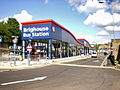 Brighouse Bus Station 2009.jpg 640 × 480; 95 KB
-
 Broadwell Brook close-up - geograph.org.uk - 1313925.jpg 551 × 640; 228 KB
-

-
 Brook Lane - geograph.org.uk - 1314130.jpg 480 × 640; 93 KB
-
 Brook Lane - geograph.org.uk - 1314144.jpg 480 × 640; 145 KB
-
 Brookfield House Crossing - geograph.org.uk - 1325082.jpg 640 × 417; 80 KB
-
 Brooklime (Veronica beccabunga) - geograph.org.uk - 1395570.jpg 468 × 640; 220 KB
-
 Brooksby Lane - geograph.org.uk - 1323272.jpg 640 × 479; 115 KB
-

-
 Brougham Street, Hull - geograph.org.uk - 1314996.jpg 640 × 475; 98 KB
-

-
 Bull Park Lane - geograph.org.uk - 1323456.jpg 640 × 426; 223 KB
-
 Bull Point Lighthouse from the sea - geograph.org.uk - 1342246.jpg 640 × 480; 85 KB
-
_Inverkeithing_Church,_Inverkeithing.jpg)


_-_geograph.org.uk_-_1313888.jpg)


.jpg)


.jpg)


_-_geograph.org.uk_-_1313737.jpg)
,_Knighton,_Staffordshire_-_geograph.org.uk_-_1459553.jpg)


_-_geograph.org.uk_-_1395570.jpg)


