Category:United Kingdom photographs taken on 2009-09-27
Countries of Europe: Austria · Belarus · Belgium · Bosnia and Herzegovina · Bulgaria · Czech Republic · Finland · France‡ · Germany · Greece · Hungary · Republic of Ireland · Italy · Kazakhstan‡ · Latvia · Lithuania · Moldova · Netherlands‡ · Poland · Portugal‡ · Romania · Russia‡ · Slovakia · Spain‡ · Sweden · Switzerland · Turkey‡ · Ukraine · United Kingdom
Specific status: Jersey
‡: partly located in Europe
Specific status: Jersey
‡: partly located in Europe
| ← | 27 September 2009 | → | ||
| ← | September 2009 | → | ||

United Kingdom photographs taken on 27 September 2009.
Image files should be categorized here automatically using {{taken on}} template. Direct categorisation is also possible, if automatic is impossible.
Subcategories
This category has the following 2 subcategories, out of 2 total.
K
S
Media in category "United Kingdom photographs taken on 2009-09-27"
The following 200 files are in this category, out of 1,703 total.
(previous page) (next page)-
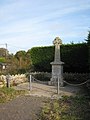 1914-1918 war memorial at Bolventor - geograph.org.uk - 1522637.jpg 480 × 640; 75 KB
-
 29 Fairfax Place, Dartmouth - geograph.org.uk - 1515203.jpg 640 × 480; 89 KB
-
 508137 at Hooton.JPG 3,648 × 2,736; 3.54 MB
-
 76 Mount Ephraim, Molyneux Place - geograph.org.uk - 1517503.jpg 640 × 430; 131 KB
-

-
 A busy-looking electricity pole - geograph.org.uk - 1510857.jpg 443 × 640; 96 KB
-
 A former off licence, Mount Ephraim - geograph.org.uk - 1517587.jpg 640 × 430; 134 KB
-

-
-

-
 A Route 2 Hire Routemaster bus RM1403 (403 CLT), Showbus 2009.jpg 3,872 × 2,592; 1.8 MB
-
-

-
 A21 Lamberhurst By-pass - geograph.org.uk - 1515539.jpg 640 × 427; 55 KB
-
 A21 Lamberhurst By-pass Road bridge - geograph.org.uk - 1515532.jpg 640 × 427; 77 KB
-
 A264, Church Rd - geograph.org.uk - 1517510.jpg 640 × 430; 93 KB
-
 Abbot's Hill - geograph.org.uk - 1511450.jpg 640 × 480; 90 KB
-
 Abbot's Hill School - geograph.org.uk - 1511434.jpg 640 × 480; 101 KB
-
 ALH House - geograph.org.uk - 1514490.jpg 480 × 640; 78 KB
-
 All Saints Great Ashfield - geograph.org.uk - 1509336.jpg 480 × 640; 113 KB
-
 All Saints Rd - geograph.org.uk - 1518171.jpg 640 × 404; 97 KB
-
 Allt a' Chull Mhaim - geograph.org.uk - 1536740.jpg 480 × 640; 117 KB
-
 Alpha Baby Centre - Lowtown - geograph.org.uk - 1510283.jpg 460 × 640; 82 KB
-
 An adder below Knap Head - geograph.org.uk - 1521939.jpg 640 × 548; 175 KB
-
 Ancient and modern - geograph.org.uk - 1515442.jpg 480 × 640; 73 KB
-

-
 Ancient Monument Sign - geograph.org.uk - 1579853.jpg 640 × 480; 96 KB
-
 Ancient settlement at Higher Langdon - geograph.org.uk - 1521136.jpg 640 × 480; 55 KB
-
 Anzac Street, Dartmouth - geograph.org.uk - 1515197.jpg 497 × 640; 72 KB
-
 Arduaine Garden The Inside Garden - geograph.org.uk - 1551629.jpg 640 × 480; 112 KB
-

-
 Arriva Bus Depot, St John's Rd - geograph.org.uk - 1518061.jpg 640 × 449; 83 KB
-
 Arriva buses, Showbus 2009.jpg 3,872 × 2,592; 1.67 MB
-
 Arriva Kent & Sussex bus 1502 (YJ58 CEA), Showbus 2009.jpg 3,872 × 2,592; 1.71 MB
-
 Arriva Midlands bus 2985 (YJ09 LBK), Showbus 2009.jpg 3,872 × 2,592; 1.44 MB
-
 Arriva Midlands bus 3731 (YJ57 BRV), Showbus 2009.jpg 3,872 × 2,592; 1.83 MB
-

-

-

-

-
 Market Square, Axbridge, Somerset - geograph.org.uk - 1607708.jpg 640 × 360; 51 KB
-
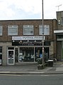
 B - Jays Newsagents - Waterloo Road - geograph.org.uk - 1512185.jpg 470 × 640; 86 KB
-
 B8025 at Tayvallich - geograph.org.uk - 1578467.jpg 640 × 480; 66 KB
-
 B8025 Near Barrahormid - geograph.org.uk - 1578493.jpg 640 × 480; 56 KB
-
 B845 at Bellanoch - geograph.org.uk - 1546270.jpg 640 × 480; 92 KB
-

-
 Baddinsgill Burn - geograph.org.uk - 1509362.jpg 480 × 640; 139 KB
-
 Baddinsgill Reservoir - geograph.org.uk - 1517888.jpg 640 × 275; 48 KB
-
 Balliggan Townland - geograph.org.uk - 1509830.jpg 640 × 480; 88 KB
-
 Ballybryan Road, Greyabbey - geograph.org.uk - 1509785.jpg 640 × 480; 95 KB
-
 Ballybryan Road, Greyabbey - geograph.org.uk - 1509790.jpg 640 × 480; 128 KB
-
 Ballybryan Townland - geograph.org.uk - 1509787.jpg 640 × 480; 81 KB
-
 Ballybryan Townland - geograph.org.uk - 1509802.jpg 640 × 480; 91 KB
-

-
 Banjo's Deli - Bradford Road - geograph.org.uk - 1513192.jpg 424 × 640; 72 KB
-
 Bar 57 - Lidget Hill - geograph.org.uk - 1510192.jpg 525 × 640; 101 KB
-
 Barberry Farm - geograph.org.uk - 1516466.jpg 510 × 640; 91 KB
-
 Barcode - Lowtown - geograph.org.uk - 1510271.jpg 640 × 484; 70 KB
-
 Bargain Booze - Galloway Lane - geograph.org.uk - 1512855.jpg 486 × 640; 94 KB
-
 Barn and out building, Smockham Farm - geograph.org.uk - 1516282.jpg 640 × 430; 155 KB
-
 Beach below Coombe Valley - geograph.org.uk - 1579536.jpg 640 × 480; 100 KB
-
 Bean, St John's Rd - geograph.org.uk - 1518148.jpg 640 × 414; 88 KB
-

-

-
 Below Vicarage Cliff - geograph.org.uk - 1567746.jpg 480 × 640; 84 KB
-
 Beltring Rd - geograph.org.uk - 1518043.jpg 640 × 455; 123 KB
-
 Bench beside Great Lake, Bedgebury Park - geograph.org.uk - 1512656.jpg 640 × 427; 101 KB
-

-
 Bench by the path above Happy Valley - geograph.org.uk - 1516538.jpg 640 × 430; 187 KB
-
 Bench by the path above Happy Valley - geograph.org.uk - 1516541.jpg 640 × 430; 197 KB
-
 Bench on Knap Head - geograph.org.uk - 1555085.jpg 640 × 480; 122 KB
-
 Bend in All Saints Rd - geograph.org.uk - 1518172.jpg 640 × 430; 88 KB
-

-
 Berrier - geograph.org.uk - 1510263.jpg 640 × 480; 64 KB
-
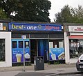 Best-one - Chapeltown - geograph.org.uk - 1512101.jpg 640 × 579; 123 KB
-
 Bishopthorpe Palace - geograph.org.uk - 1512385.jpg 640 × 480; 66 KB
-
 Bismilla Medina - Lidget Hill - geograph.org.uk - 1510198.jpg 458 × 640; 75 KB
-
 Black Abbey Townland - geograph.org.uk - 1509804.jpg 640 × 480; 98 KB
-
 Black Horse House, St John's Rd - geograph.org.uk - 1518058.jpg 640 × 430; 133 KB
-
 Blackabbey Road, Greyabbey - geograph.org.uk - 1509806.jpg 640 × 480; 115 KB
-
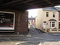
 Evenlode Tower in Blackbird Leys - geograph.org.uk - 1510091.jpg 640 × 427; 88 KB
-
 Blackbird Leys Leisure Centre - geograph.org.uk - 1510084.jpg 640 × 416; 62 KB
-
 Blackbird Leys Park - geograph.org.uk - 1510087.jpg 640 × 421; 62 KB
-
 Blackpool Drier Sentinel shunter.jpg 1,024 × 768; 133 KB
-
 Blackstaff Road, Ballycranbeg - geograph.org.uk - 1510001.jpg 640 × 480; 88 KB
-

-
 Blundeston Mill - Mill House - geograph.org.uk - 1510061.jpg 480 × 640; 125 KB
-
 Blundeston Mill - Mill House - geograph.org.uk - 1510063.jpg 513 × 640; 125 KB
-
 Bojangles Wine Bar - Lowtown - geograph.org.uk - 1510827.jpg 640 × 480; 71 KB
-
 Bomb crater, Blowers Wood, Hempstead - geograph.org.uk - 1511094.jpg 640 × 480; 150 KB
-
 Boots - Church Lane - geograph.org.uk - 1511190.jpg 640 × 472; 79 KB
-
 Boots Pharmacy - Galloway Lane - geograph.org.uk - 1512872.jpg 453 × 640; 87 KB
-
 Elms Parade clock - geograph.org.uk - 1510153.jpg 640 × 427; 43 KB
-
 Elms Parade shops in West Way - geograph.org.uk - 1510151.jpg 640 × 409; 74 KB
-
 Railings at West Way Shopping Centre - geograph.org.uk - 1510149.jpg 640 × 427; 92 KB
-

-

-
 Bournemouth Beach - panoramio - Mountain-Eric (1).jpg 516 × 660; 238 KB
-
 Bournemouth Beach - panoramio - Mountain-Eric (2).jpg 516 × 660; 337 KB
-
 Bournemouth Beach - panoramio - Mountain-Eric.jpg 516 × 660; 257 KB
-
 Bournemouth Beach - panoramio.jpg 516 × 660; 353 KB
-
 Bournemouth Pier - panoramio.jpg 516 × 660; 286 KB
-
 Bourton-Motel Nursery - geograph.org.uk - 1519509.jpg 640 × 524; 35 KB
-
 Bourton-Popehill Spinneys - geograph.org.uk - 1509177.jpg 640 × 480; 74 KB
-
 Bowls Pavilion in West Park - geograph.org.uk - 1513610.jpg 640 × 480; 120 KB
-
 BP filling station, St John's Rd - geograph.org.uk - 1518081.jpg 640 × 430; 80 KB
-
 Brendon Drive Claygate - geograph.org.uk - 1520973.jpg 640 × 480; 80 KB
-

-

-
 Bridge over the A39 Trispen by pass - geograph.org.uk - 1510420.jpg 640 × 480; 82 KB
-
 Bridge over the lake , St James's Park - geograph.org.uk - 1510766.jpg 640 × 480; 131 KB
-

-
 Bridge over the River Fowey - geograph.org.uk - 1521193.jpg 640 × 480; 112 KB
-

-
 Bridge to Cornwall - geograph.org.uk - 1556731.jpg 640 × 480; 120 KB
-
 Bridleway alongside Highden Barn - geograph.org.uk - 1513450.jpg 640 × 480; 72 KB
-
 Bridleway descending to the A 24 - geograph.org.uk - 1513503.jpg 640 × 480; 92 KB
-

-

-
 Broadsands beach huts - geograph.org.uk - 1518797.jpg 640 × 480; 41 KB
-
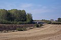
 Broadwell Brook - geograph.org.uk - 1520009.jpg 640 × 480; 132 KB
-

-
 Browns Hill, Dartmouth - geograph.org.uk - 1515911.jpg 467 × 640; 87 KB
-

-
 Burgess Park lake - geograph.org.uk - 1717951.jpg 640 × 480; 54 KB
-
 Bus stop on the A 24 southbound - geograph.org.uk - 1513616.jpg 640 × 480; 102 KB
-
 Bus stop on West Way - geograph.org.uk - 1510158.jpg 640 × 427; 71 KB
-
 Byng Hall - geograph.org.uk - 1518154.jpg 640 × 430; 180 KB
-

-
 Cafe Atlanta - Lowtown - geograph.org.uk - 1510886.jpg 466 × 640; 83 KB
-
 Calshot Road, Fawley. - geograph.org.uk - 1541901.jpg 640 × 480; 60 KB
-
 Canalbank, Kings Langley - geograph.org.uk - 1511571.jpg 640 × 480; 107 KB
-
 Car park next to Kilmartin Church - geograph.org.uk - 1580337.jpg 640 × 480; 87 KB
-
 Caravan Club Site, Pandy - geograph.org.uk - 1510759.jpg 640 × 481; 112 KB
-
 Carousel Buses bus MB51 (CB51 BUS), Showbus 2009.jpg 3,872 × 2,592; 1.5 MB
-

-
 Cateran Trail near Bamff - geograph.org.uk - 1532336.jpg 640 × 480; 152 KB
-
 Cattle drinking point on the River Fowey - geograph.org.uk - 1520335.jpg 640 × 480; 116 KB
-

-
 Cattle grid on St Cleer Downs - geograph.org.uk - 1520102.jpg 640 × 480; 61 KB
-
 Cattle pasture beside Pound Lane - geograph.org.uk - 1510081.jpg 640 × 465; 122 KB
-
 Chapel unknown origin - geograph.org.uk - 1509281.jpg 640 × 481; 91 KB
-
 Chapter House Garden - geograph.org.uk - 1515612.jpg 640 × 480; 81 KB
-
 Chasing The Fox - geograph.org.uk - 1513460.jpg 640 × 480; 31 KB
-
 Chic Boutique - Robin Lane - geograph.org.uk - 1510903.jpg 423 × 640; 73 KB
-

-
 Chipperfield Font - geograph.org.uk - 1513262.jpg 480 × 640; 78 KB
-
 Chipperfield War Memorial - geograph.org.uk - 1513273.jpg 640 × 480; 96 KB
-

-
 Church Farm Barn - geograph.org.uk - 1515721.jpg 640 × 427; 134 KB
-
 Church Farm Oast - geograph.org.uk - 1515717.jpg 640 × 427; 63 KB
-
 Church Lane Pharmacy - Church Lane - geograph.org.uk - 1511201.jpg 434 × 640; 62 KB
-
 Church Lane, Langford - geograph.org.uk - 1520052.jpg 640 × 480; 88 KB
-
 Church Rd (A264) - geograph.org.uk - 1517520.jpg 640 × 430; 160 KB
-

-
 Church Road past Thurlton Bowls Club - geograph.org.uk - 1510842.jpg 640 × 488; 81 KB
-
 Church Road, Whimple - geograph.org.uk - 1509979.jpg 640 × 480; 85 KB
-
 Church Sign - geograph.org.uk - 1509053.jpg 640 × 479; 100 KB
-

-

-

-

-

-

-

-

-

-
-

-

-

-

-

-

-

-

-

-
-

-

-

-
-

-

-

-

-

-

-

-

-

-

-

-

-

-

-
 Cissbury Ring - geograph.org.uk - 1514944.jpg 640 × 480; 85 KB
-

-
 Clarence Hill, Dartmouth - geograph.org.uk - 1516012.jpg 474 × 640; 87 KB
-
 Clayton Hill - geograph.org.uk - 1509338.jpg 640 × 480; 115 KB


,_Showbus_2009.jpg)


,_Showbus_2009.jpg)
,_Showbus_2009.jpg)
,_Showbus_2009.jpg)


_-_geograph.org.uk_-_1509878.jpg)


.jpg)
.jpg)


,_Showbus_2009.jpg)


_-_geograph.org.uk_-_1517520.jpg)


_-_geograph.org.uk_-_1532638.jpg)
_-_geograph.org.uk_-_1532713.jpg)
_-_geograph.org.uk_-_1532721.jpg)
_-_geograph.org.uk_-_1532727.jpg)
_-_geograph.org.uk_-_1532736.jpg)
_-_geograph.org.uk_-_1532743.jpg)
_-_geograph.org.uk_-_1532755.jpg)
_-_geograph.org.uk_-_1532770.jpg)
_-_geograph.org.uk_-_1532773.jpg)
_-_geograph.org.uk_-_1532776.jpg)
_-_geograph.org.uk_-_1532780.jpg)
_-_geograph.org.uk_-_1532646.jpg)
_-_geograph.org.uk_-_1532783.jpg)
_-_geograph.org.uk_-_1532787.jpg)
_-_geograph.org.uk_-_1532793.jpg)
_-_geograph.org.uk_-_1532796.jpg)
_-_geograph.org.uk_-_1532801.jpg)
_-_geograph.org.uk_-_1532807.jpg)
_-_geograph.org.uk_-_1532814.jpg)
_-_geograph.org.uk_-_1532820.jpg)
_-_geograph.org.uk_-_1532827.jpg)
_-_geograph.org.uk_-_1532838.jpg)
_-_geograph.org.uk_-_1532652.jpg)
_-_geograph.org.uk_-_1532840.jpg)
_-_geograph.org.uk_-_1532843.jpg)
_-_geograph.org.uk_-_1532847.jpg)
_-_geograph.org.uk_-_1532851.jpg)
_-_geograph.org.uk_-_1532859.jpg)
_-_geograph.org.uk_-_1532862.jpg)
_-_geograph.org.uk_-_1532869.jpg)
_-_geograph.org.uk_-_1532880.jpg)
_-_geograph.org.uk_-_1532655.jpg)
_-_geograph.org.uk_-_1532663.jpg)
_-_geograph.org.uk_-_1532669.jpg)
_-_geograph.org.uk_-_1532678.jpg)
_-_geograph.org.uk_-_1532691.jpg)
_-_geograph.org.uk_-_1532702.jpg)


