Category:United Kingdom photographs taken on 2009-09-29
Countries of Europe: Austria · Belarus · Belgium · Bosnia and Herzegovina · Bulgaria · Cyprus‡ · Denmark · Estonia · Finland · France‡ · Germany · Greece · Hungary · Republic of Ireland · Italy · Latvia · Montenegro · Netherlands‡ · Norway · Poland · Portugal‡ · Romania · Russia‡ · Slovenia · Spain‡ · Sweden · Switzerland · Turkey‡ · Ukraine · United Kingdom
‡: partly located in Europe
‡: partly located in Europe
| ← | 29 September 2009 | → | ||
| ← | September 2009 | → | ||

United Kingdom photographs taken on 29 September 2009.
Image files should be categorized here automatically using {{taken on}} template. Direct categorisation is also possible, if automatic is impossible.
Subcategories
This category has only the following subcategory.
Media in category "United Kingdom photographs taken on 2009-09-29"
The following 200 files are in this category, out of 907 total.
(previous page) (next page)-
 121 - 123 Hermes Crescent, Manor Farm, Coventry.jpg 3,056 × 2,292; 1.08 MB
-
 31-45 Corinthian Place, Manor Farm.jpg 2,292 × 3,056; 937 KB
-
 A brighter bridleway - geograph.org.uk - 1515590.jpg 540 × 640; 246 KB
-

-
 A350 heading north near Upper Pertwood - geograph.org.uk - 1537501.jpg 640 × 538; 202 KB
-
 A350 heading north over Rook Hill - geograph.org.uk - 1515702.jpg 640 × 486; 124 KB
-
 A350 heading south near Higher Pertwood - geograph.org.uk - 1537508.jpg 640 × 461; 122 KB
-
 A350 heading south on Rook Hill - geograph.org.uk - 1537598.jpg 640 × 530; 181 KB
-
 A350 layby near Lower Pertwood - geograph.org.uk - 1537563.jpg 640 × 500; 184 KB
-
 A361 heading south away from Burford - geograph.org.uk - 1521725.jpg 640 × 427; 47 KB
-
 A9 Trunk Road - geograph.org.uk - 1530148.jpg 640 × 428; 62 KB
-
 Abhainn Ghlas - geograph.org.uk - 1525970.jpg 640 × 480; 122 KB
-
 Aireville Drive - Daisy Hill - geograph.org.uk - 1513716.jpg 640 × 480; 70 KB
-
 St Mary's Church Aldermaston - geograph.org.uk - 1513230.jpg 430 × 640; 100 KB
-

-
 Allesley Hall Drive - geograph.org.uk - 1514292.jpg 640 × 480; 96 KB
-
 Allesley Park walled garden - geograph.org.uk - 1514180.jpg 640 × 480; 100 KB
-
 Allesley Park walled garden, east gate - geograph.org.uk - 1514190.jpg 640 × 480; 100 KB
-
 Alver Valley BMX track (1) - geograph.org.uk - 1520315.jpg 640 × 480; 72 KB
-
 Alver Valley BMX track (2) - geograph.org.uk - 1520331.jpg 640 × 480; 62 KB
-
 Alver Valley BMX track (3) - geograph.org.uk - 1520338.jpg 640 × 480; 61 KB
-
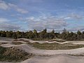 Alver Valley BMX track (4) - geograph.org.uk - 1520345.jpg 640 × 480; 57 KB
-
 An overgrown track - geograph.org.uk - 1623981.jpg 640 × 479; 88 KB
-

-
 Ancient Native Woodland - geograph.org.uk - 1519510.jpg 640 × 480; 117 KB
-
 Approaching Kirkcolm - geograph.org.uk - 1622805.jpg 640 × 456; 88 KB
-
 Approaching Langford - geograph.org.uk - 1521538.jpg 640 × 427; 71 KB
-
 Argyll and Bute, UK - panoramio (6).jpg 1,047 × 785; 279 KB
-
 Asparagus beds near Tydd Gote - geograph.org.uk - 1513608.jpg 640 × 480; 102 KB
-
 B3095 passing through Brixton Deverill - geograph.org.uk - 1522183.jpg 640 × 506; 122 KB
-

-
 Back Briggate - Skipton Road - geograph.org.uk - 1514448.jpg 480 × 640; 72 KB
-
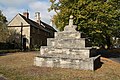 Bainton village cross - geograph.org.uk - 1513560.jpg 640 × 426; 101 KB
-
 Banana boat - geograph.org.uk - 1514997.jpg 640 × 480; 136 KB
-
 Banklands - Bolton Road - geograph.org.uk - 1513979.jpg 640 × 480; 65 KB
-
 Banklands Avenue - Dale View - geograph.org.uk - 1514025.jpg 640 × 480; 59 KB
-
 Bar Street, Scarborough - geograph.org.uk - 1513210.jpg 640 × 480; 90 KB
-
 Barn at Woodcombe Farm - geograph.org.uk - 1522758.jpg 640 × 512; 186 KB
-
 Barn, Hellings Farm - geograph.org.uk - 1521160.jpg 640 × 498; 118 KB
-
 Batchy Hill junction with the B4348 - geograph.org.uk - 1512383.jpg 640 × 481; 106 KB
-
 Bean Harvesting - geograph.org.uk - 1524077.jpg 640 × 427; 61 KB
-
 Beeny Cliff - geograph.org.uk - 1565213.jpg 480 × 640; 89 KB
-
 Bell Square - Bolton Road - geograph.org.uk - 1513978.jpg 640 × 480; 63 KB
-
 Bird life on a pond in Hampstead - geograph.org.uk - 1563491.jpg 640 × 480; 76 KB
-
 Birkett Common - geograph.org.uk - 1671301.jpg 640 × 480; 54 KB
-
 Blue Peter Hotel, Kirkcolm - geograph.org.uk - 1622862.jpg 640 × 492; 79 KB
-
 Boats moored in Boscastle Harbour - geograph.org.uk - 1566745.jpg 640 × 480; 79 KB
-
 Bolton Terrace - Dale View - geograph.org.uk - 1513993.jpg 640 × 480; 61 KB
-
 Boscastle from Penally Hill - geograph.org.uk - 1566735.jpg 640 × 480; 103 KB
-
 Bradley Rise - Bradley Avenue - geograph.org.uk - 1514312.jpg 640 × 480; 65 KB
-
 Bradley Road - Bridge Street - geograph.org.uk - 1514300.jpg 640 × 480; 103 KB
-
 Breakmoor Avenue - North Street - geograph.org.uk - 1514039.jpg 640 × 480; 71 KB
-
 Bridge at Beddgelert - geograph.org.uk - 1588537.jpg 640 × 426; 120 KB
-
 Bridge over the Kirminoch Burn - geograph.org.uk - 1622991.jpg 640 × 457; 88 KB
-
 Bridge Street - geograph.org.uk - 1514124.jpg 640 × 480; 79 KB
-
 Bridge TJC3-76B - Station Road - geograph.org.uk - 1513303.jpg 640 × 480; 64 KB
-
 Briggate - Kirkgate - geograph.org.uk - 1513975.jpg 640 × 480; 71 KB
-
 Briggate - Skipton Road - geograph.org.uk - 1514443.jpg 640 × 480; 70 KB
-

-
 Knights Templar Chapel, Brimpton - geograph.org.uk - 1513215.jpg 640 × 440; 111 KB
-
 Knights Templar Chapel, Brimpton - geograph.org.uk - 1513218.jpg 640 × 418; 105 KB
-
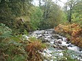
 Broadwell Brook - geograph.org.uk - 1521507.jpg 640 × 427; 81 KB
-
 Brootally Road - geograph.org.uk - 1516205.jpg 640 × 480; 68 KB
-
 Brotally Road - geograph.org.uk - 1516197.jpg 640 × 480; 107 KB
-
 Browcliffe - Breakmoor Avenue - geograph.org.uk - 1514043.jpg 640 × 480; 71 KB
-
 Browcliffe - Breakmoor Avenue - geograph.org.uk - 1514046.jpg 640 × 480; 93 KB
-
 Brown Bank Lane - off Bolton Road - geograph.org.uk - 1514032.jpg 640 × 480; 99 KB
-
 Bryn Eglwys Hotel - geograph.org.uk - 1588578.jpg 640 × 325; 68 KB
-
 Building - Bradley Road - geograph.org.uk - 1514317.jpg 640 × 480; 60 KB
-
 Burial ground at Bracadale - geograph.org.uk - 1513120.jpg 640 × 480; 116 KB
-
 Burn, Haca - geograph.org.uk - 1527340.jpg 450 × 600; 326 KB
-
 Burn, Haca - geograph.org.uk - 1527354.jpg 450 × 600; 272 KB
-
 By Road to Old Hall Farm - geograph.org.uk - 1521250.jpg 3,072 × 2,304; 1.45 MB
-
 Car park in Burford - geograph.org.uk - 1521656.jpg 640 × 427; 94 KB
-
 Carbisdale Castle - geograph.org.uk - 1530109.jpg 640 × 428; 76 KB
-

-
 Carrion Crow flock - geograph.org.uk - 1514172.jpg 640 × 480; 71 KB
-
 Cattle on Pen Hill - geograph.org.uk - 1528064.jpg 640 × 530; 141 KB
-
 Cattle, Pyncombe Farm - geograph.org.uk - 1520930.jpg 640 × 423; 68 KB
-
 Cemetery, Gairloch - geograph.org.uk - 1525928.jpg 640 × 480; 70 KB
-
 Church of Scotland, An Ard - geograph.org.uk - 1526030.jpg 640 × 480; 56 KB
-

-
 Claymore Rise - Ingsway - geograph.org.uk - 1513746.jpg 640 × 428; 65 KB
-
 Clifford Street - Skipton Road - geograph.org.uk - 1514468.jpg 640 × 480; 61 KB
-
 Cliffs above The Strangles - geograph.org.uk - 1560973.jpg 480 × 640; 98 KB
-
 Cnoc Glas Heilla - geograph.org.uk - 1517403.jpg 640 × 480; 71 KB
-
 Coast above Grower Gut - geograph.org.uk - 1566756.jpg 640 × 480; 75 KB
-
 Coast near Beeny - geograph.org.uk - 1565212.jpg 640 × 480; 75 KB
-
 Coast near Trevalga - geograph.org.uk - 1566758.jpg 640 × 480; 85 KB
-
 Coast path above Tremoutha Haven - geograph.org.uk - 1560955.jpg 640 × 480; 94 KB
-
 Coast path approaching Tintagel - geograph.org.uk - 1588386.jpg 640 × 480; 91 KB
-
 Coast path on High Cliff - geograph.org.uk - 1561011.jpg 480 × 640; 103 KB
-
 Coast viewed from Penally Hill - geograph.org.uk - 1566732.jpg 640 × 480; 71 KB
-
 Coastal defences at Abereiddy bay - geograph.org.uk - 1517675.jpg 640 × 480; 101 KB
-
 Coberley Mill. - geograph.org.uk - 1512729.jpg 640 × 480; 100 KB
-
 Copse on a ploughed hillside - geograph.org.uk - 1528032.jpg 640 × 470; 127 KB
-
 Corinthian Place, Coventry.jpg 3,056 × 2,292; 1.08 MB
-
 Cottage in ruins, Gorticashel Lower - geograph.org.uk - 1514256.jpg 640 × 479; 75 KB
-
 Cottages and cart Beddgelert - geograph.org.uk - 1588597.jpg 640 × 358; 111 KB
-
 Countryside near Hellings Farm - geograph.org.uk - 1521142.jpg 640 × 390; 72 KB
-
 Cows, Garvagh - geograph.org.uk - 1512954.jpg 640 × 479; 64 KB
-
 Cows, Meenadoo - geograph.org.uk - 1512629.jpg 640 × 479; 57 KB
-
 Cragg View - Banklands - geograph.org.uk - 1513986.jpg 640 × 480; 72 KB
-
 Craven Avenue - Craven Drive - geograph.org.uk - 1513687.jpg 640 × 480; 50 KB
-
 Craven Avenue - Craven Drive - geograph.org.uk - 1513707.jpg 640 × 480; 53 KB
-
 Craven Court - Daisy Hill - geograph.org.uk - 1513712.jpg 640 × 480; 76 KB
-
 Craven Drive - Daisy Hill - geograph.org.uk - 1513709.jpg 640 × 480; 48 KB
-
 Craven Grove - Craven Drive - geograph.org.uk - 1513708.jpg 640 × 412; 58 KB
-

-
 Croft Field - Hainsworth Road - geograph.org.uk - 1513668.jpg 640 × 480; 59 KB
-
 Croft house at Fiskavaig - geograph.org.uk - 1517328.jpg 640 × 480; 66 KB
-
 Croft house at Totardor - geograph.org.uk - 1512925.jpg 640 × 480; 75 KB
-

-
 Croftland at Fiskavaig - geograph.org.uk - 1517338.jpg 640 × 480; 70 KB
-

-
 Crossroads on Witnry Street, Burford - geograph.org.uk - 1521695.jpg 640 × 427; 56 KB
-
 Curved wall, Allesley Park - geograph.org.uk - 1514169.jpg 640 × 480; 97 KB
-

-
 Dale View - Bolton Road - geograph.org.uk - 1513992.jpg 640 × 480; 56 KB
-
 Dead Thistles Coldwell Bottom - geograph.org.uk - 1512702.jpg 640 × 480; 134 KB
-
 Derelict Building at Council Depot - geograph.org.uk - 1513130.jpg 640 × 427; 80 KB
-
 Derelict Farmhouse, Gortnagarn - geograph.org.uk - 1514288.jpg 640 × 479; 90 KB
-
 Dessicated paddling pool, Allesley Park - geograph.org.uk - 1514248.jpg 640 × 480; 100 KB
-
 Dobsons Wharf - Ingsway - geograph.org.uk - 1513750.jpg 640 × 480; 69 KB
-

-
 Domestic garden at Roch Bridge - geograph.org.uk - 1518295.jpg 640 × 480; 99 KB
-
 Down the track from Brims Down - geograph.org.uk - 1515206.jpg 640 × 479; 183 KB
-

-
 Dried up pond - geograph.org.uk - 1522970.jpg 2,304 × 3,072; 2.65 MB
-
 Driver Terrace - Dale View - geograph.org.uk - 1514016.jpg 640 × 480; 68 KB
-

-
 Druidston Hotel - geograph.org.uk - 1518300.jpg 640 × 480; 58 KB
-
 Druidston Hotel from the back garden - geograph.org.uk - 1518321.jpg 640 × 480; 75 KB
-

-
 Dunkeld Cathedral - geograph.org.uk - 1586191.jpg 640 × 480; 88 KB
-
 Dunkeld Post Office - geograph.org.uk - 1584610.jpg 640 × 480; 78 KB
-
 East from the lane to Keysley Farm - geograph.org.uk - 1526623.jpg 640 × 427; 115 KB
-
 East View - Skipton Road - geograph.org.uk - 1514452.jpg 640 × 480; 82 KB
-
 Eastborough, Scarborough - geograph.org.uk - 1514980.jpg 640 × 480; 76 KB
-

-
 Edge of Blaisdon Wood - geograph.org.uk - 1513826.jpg 640 × 480; 222 KB
-
 Edge of Flaxley Woods - geograph.org.uk - 1513875.jpg 640 × 480; 218 KB
-
 Elliott Street - Kirkgate - geograph.org.uk - 1513964.jpg 640 × 480; 64 KB
-
 Elm Grove - Laurel Grove - geograph.org.uk - 1514557.jpg 640 × 480; 86 KB
-
 Elm Grove - Skipton Road - geograph.org.uk - 1514474.jpg 640 × 480; 65 KB
-
 Empty car park in Burford - geograph.org.uk - 1521628.jpg 640 × 427; 68 KB
-
 Entering Kirkcolm - geograph.org.uk - 1622824.jpg 640 × 490; 102 KB
-
 Entrance gates near Church House - geograph.org.uk - 1512316.jpg 640 × 480; 136 KB
-

-
 Entrance to Boscastle Harbour - geograph.org.uk - 1566730.jpg 640 × 480; 83 KB
-
 Entrance to Godfrey House, Finsbury - geograph.org.uk - 1514899.jpg 480 × 640; 87 KB
-

-
 Entrance to Monk Hill Farm - geograph.org.uk - 1513852.jpg 640 × 480; 204 KB
-
 Entrance to Pantile Lane Madley - geograph.org.uk - 1513219.jpg 640 × 480; 107 KB
-
 Entrance to the car park, Kirkcolm - geograph.org.uk - 1622844.jpg 640 × 463; 57 KB
-
 Entrance to the Navan Fort Armagh - geograph.org.uk - 1516235.jpg 640 × 480; 108 KB
-

-
 Ervie Bridge on the B798 - geograph.org.uk - 1622973.jpg 640 × 462; 72 KB
-

-
 Exit from Northwick Lido, Worcester - geograph.org.uk - 1514545.jpg 640 × 475; 95 KB
-
 Eynort River - geograph.org.uk - 1518215.jpg 640 × 414; 97 KB
-
 Eyton water pumping station - geograph.org.uk - 1513039.jpg 640 × 480; 57 KB
-
 Farm building in Glen Eynort - geograph.org.uk - 1518224.jpg 640 × 480; 62 KB
-
 Farm buildings at Portnalong - geograph.org.uk - 1517430.jpg 640 × 480; 69 KB
-
 Farm buildings at Totardor - geograph.org.uk - 1512912.jpg 640 × 480; 66 KB
-
 Farm track east of Catlings Farm - geograph.org.uk - 1513532.jpg 640 × 480; 92 KB
-
 Farmland by Holly Lane - geograph.org.uk - 1514339.jpg 640 × 480; 109 KB
-
 Field beside Summer Cleave Lane - geograph.org.uk - 1521050.jpg 640 × 480; 93 KB
-
 Field Entrance off Reepham Road - geograph.org.uk - 1521277.jpg 3,072 × 2,304; 1.51 MB
-
 Field off Reepham Road - geograph.org.uk - 1522930.jpg 3,072 × 2,304; 1.35 MB
-
 Field off Reepham Road - geograph.org.uk - 1522932.jpg 3,072 × 2,304; 1.34 MB
-
 Field south of Bathealton - geograph.org.uk - 1522105.jpg 640 × 480; 108 KB
-
 Road through Filkins - geograph.org.uk - 1524754.jpg 640 × 427; 99 KB
-

-
 Fire Hydrant in Reepham Road - geograph.org.uk - 1521260.jpg 2,304 × 3,072; 3 MB
-
 Fire Hydrant in Reepham Road - geograph.org.uk - 1521268.jpg 2,304 × 3,072; 2.48 MB
-
 Flaxley Valley 1 - geograph.org.uk - 1513861.jpg 640 × 480; 222 KB
-
 Flaxley Valley 2 - geograph.org.uk - 1513862.jpg 640 × 480; 239 KB
-
 Flowerdale House - geograph.org.uk - 1525937.jpg 640 × 480; 107 KB
-
 Flowerdale Mains - geograph.org.uk - 1525949.jpg 640 × 480; 103 KB
-
 Flowerdale Waterfall - geograph.org.uk - 1525986.jpg 480 × 640; 99 KB
-

-
 Footpath - Bolton Road - geograph.org.uk - 1514027.jpg 480 × 640; 79 KB
-
 Footpath - Craven Drive - geograph.org.uk - 1513689.jpg 480 × 640; 70 KB
-
 Footpath - Dradishaw Road - geograph.org.uk - 1514520.jpg 480 × 640; 130 KB
-
 Footpath - Elm Grove - geograph.org.uk - 1514562.jpg 480 × 640; 146 KB
-
 Footpath - Keighley Road - geograph.org.uk - 1513658.jpg 483 × 640; 150 KB
-
 Footpath - Keighley Road - geograph.org.uk - 1513660.jpg 480 × 640; 57 KB
-
 Footpath - North Street - geograph.org.uk - 1514037.jpg 640 × 480; 84 KB
-
 Footpath at Milton - geograph.org.uk - 1581828.jpg 640 × 480; 105 KB
-
 Footpath by Broadwell Brook - geograph.org.uk - 1521525.jpg 427 × 640; 76 KB
-
 Footpath through Moor Plantation - geograph.org.uk - 1521425.jpg 640 × 480; 143 KB
-
 Footpath to Broughton Poggs - geograph.org.uk - 1521551.jpg 640 × 427; 39 KB
-
 Footpath to Trelystan - geograph.org.uk - 1512321.jpg 640 × 480; 94 KB
-
 Footpath warning - geograph.org.uk - 1512412.jpg 640 × 481; 143 KB
-
 Footpaths in the Flaxley Valley 1 - geograph.org.uk - 1513868.jpg 640 × 480; 236 KB
-
 Footpaths in the Flaxley Valley 2 - geograph.org.uk - 1513872.jpg 640 × 480; 232 KB
-
 Forest track in Glen Fyne - geograph.org.uk - 1512685.jpg 640 × 480; 87 KB
-
 Forest track in Glen Fyne - geograph.org.uk - 1512712.jpg 640 × 480; 105 KB
-
 Forest track in Glen Fyne - geograph.org.uk - 1512722.jpg 640 × 480; 92 KB


_-_geograph.org.uk_-_1520315.jpg)
_-_geograph.org.uk_-_1520331.jpg)
_-_geograph.org.uk_-_1520338.jpg)
_-_geograph.org.uk_-_1520345.jpg)


.jpg)


