Category:United Kingdom photographs taken on 2009-10-06
| ← | Tuesday 6 October 2009 | → | ||
| ← | October 2009 | → | ||
United Kingdom photographs taken on 6 October 2009.
Image files should be categorized here automatically using {{taken on}} template. Direct categorisation is also possible, if automatic is impossible.
Subcategories
This category has the following 3 subcategories, out of 3 total.
Media in category "United Kingdom photographs taken on 2009-10-06"
The following 163 files are in this category, out of 163 total.
-
A different looking Antonine Wall - geograph.org.uk - 1523264.jpg 640 × 480; 102 KB
-
Adwell Square off from West Street - geograph.org.uk - 1525095.jpg 640 × 480; 84 KB
-
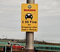
Anti-litter sign, Belfast - geograph.org.uk - 1526127.jpg 640 × 549; 53 KB
-
Antonine Wall near Westerwood - geograph.org.uk - 1523012.jpg 640 × 480; 127 KB
-
Any old anchors, Johnshaven - geograph.org.uk - 1544629.jpg 640 × 480; 190 KB
-
Apartments, Grange over Sands - geograph.org.uk - 1528476.jpg 640 × 479; 56 KB
-
Axminster Station - geograph.org.uk - 1525464.jpg 640 × 480; 78 KB
-
Big-Pink.jpg 720 × 480; 265 KB
-
Boarded up windows, Johnshaven - geograph.org.uk - 1544393.jpg 480 × 640; 178 KB
-
Boarding the sleeper. (4363871978).jpg 2,000 × 1,525; 680 KB
-
Bus stop, Belfast - geograph.org.uk - 1524699.jpg 640 × 416; 98 KB
-
Cannon guarding the Estuary - geograph.org.uk - 1529817.jpg 640 × 423; 87 KB
-
Carpark, Holker Hall - geograph.org.uk - 1528608.jpg 640 × 359; 41 KB
-
Castle Street, Caernarfon - geograph.org.uk - 1531985.jpg 640 × 480; 239 KB
-
Cenotaph, Blackpool.jpg 472 × 640; 95 KB
-
Conifers in Glen Feshie - geograph.org.uk - 1528895.jpg 640 × 480; 160 KB
-
Costcutter in Ramshill Road, Scarborough - geograph.org.uk - 1527780.jpg 640 × 480; 128 KB
-
Cottage, Johnshaven - geograph.org.uk - 1544579.jpg 640 × 480; 118 KB
-
Crest of arms, Holker Hall - geograph.org.uk - 1528512.jpg 640 × 479; 68 KB
-
Cropland at Ardtole - geograph.org.uk - 1522012.jpg 640 × 258; 33 KB
-
Crossroads at Calver Sough - geograph.org.uk - 1731542.jpg 2,560 × 1,920; 878 KB
-
Crouching lion - geograph.org.uk - 1528603.jpg 640 × 479; 98 KB
-
Damp day in Shooters Way - geograph.org.uk - 1803687.jpg 800 × 600; 83 KB
-
Dundonald bus, Belfast - geograph.org.uk - 1526019.jpg 640 × 464; 117 KB
-
East end of Caernarfon's shopping area - geograph.org.uk - 1532064.jpg 640 × 480; 224 KB
-
Entrance to the graveyard in Chatham - geograph.org.uk - 1526058.jpg 640 × 480; 98 KB
-
Eternal optimism - geograph.org.uk - 1531944.jpg 640 × 481; 295 KB
-
Faire Donn - geograph.org.uk - 1555871.jpg 640 × 449; 92 KB
-
Farmland around Pinford Farm - geograph.org.uk - 1527135.jpg 640 × 450; 117 KB
-
Fields in West Cambridge site area - geograph.org.uk - 1528274.jpg 640 × 480; 209 KB
-
Filey Road and a bench mark - geograph.org.uk - 1527794.jpg 640 × 480; 165 KB
-
Footbridge over the Feshie - geograph.org.uk - 1528862.jpg 640 × 496; 109 KB
-
Footbridge over the Feshie - geograph.org.uk - 1528870.jpg 640 × 480; 111 KB
-
Footpath signs, Westmuir - geograph.org.uk - 1544267.jpg 480 × 640; 106 KB
-
Former Blythe Chemical Works - geograph.org.uk - 1523817.jpg 640 × 480; 50 KB
-
Former Blythe Chemical Works - geograph.org.uk - 1523818.jpg 640 × 480; 49 KB
-
Former Blythe Chemical Works - geograph.org.uk - 1523822.jpg 640 × 480; 64 KB
-
Former Blythe Chemical Works, Gate - geograph.org.uk - 1523826.jpg 640 × 480; 59 KB
-
Former Chapel, Johnshaven - geograph.org.uk - 1544383.jpg 640 × 480; 89 KB
-
Fungus, Lisburn (5) - geograph.org.uk - 1524362.jpg 640 × 524; 132 KB
-
Gorge, Dunnottar - geograph.org.uk - 1544799.jpg 640 × 480; 112 KB
-
Gourdon Harbour - geograph.org.uk - 1544662.jpg 640 × 480; 90 KB
-
Grange-over Sands - geograph.org.uk - 1528468.jpg 640 × 479; 69 KB
-
Grange-over Sands - geograph.org.uk - 1528473.jpg 640 × 479; 54 KB
-
Grazing land, Mains of Dunnotter - geograph.org.uk - 1544785.jpg 640 × 480; 108 KB
-
Green and blue at Tod Head - geograph.org.uk - 1546364.jpg 640 × 480; 119 KB
-
Grounds, Holker Hall - geograph.org.uk - 1528544.jpg 640 × 479; 61 KB
-
Harbour footbridge, Caernarfon - geograph.org.uk - 1531970.jpg 640 × 480; 255 KB
-
Harbour, Johnshaven - geograph.org.uk - 1544357.jpg 640 × 480; 82 KB
-
Harbour, Johnshaven - geograph.org.uk - 1544598.jpg 640 × 480; 90 KB
-
Harbour, Johnshaven - geograph.org.uk - 1544609.jpg 640 × 480; 90 KB
-
Harbour, Johnshaven - geograph.org.uk - 1544638.jpg 640 × 481; 127 KB
-
Hassop Station - geograph.org.uk - 1726076.jpg 2,560 × 1,920; 1.38 MB
-
Gravel Hill - geograph.org.uk - 1532581.jpg 640 × 480; 83 KB
-
West Lane, off from West Street - geograph.org.uk - 1525092.jpg 640 × 480; 60 KB
-
Holker Hall - geograph.org.uk - 1528481.jpg 640 × 479; 65 KB
-
Holker Hall - geograph.org.uk - 1528484.jpg 640 × 479; 65 KB
-
Holker Hall - geograph.org.uk - 1528601.jpg 640 × 479; 91 KB
-
Inigo Jones statue, Holker Hall - geograph.org.uk - 1528594.jpg 640 × 479; 97 KB
-
Ironbridge construction at Blists Hill - geograph.org.uk - 1754320.jpg 4,224 × 2,376; 4.72 MB
-
Large fern, Holker Hall - geograph.org.uk - 1528591.jpg 640 × 479; 97 KB
-
Lobster pots, Johnshaven - geograph.org.uk - 1544519.jpg 480 × 640; 138 KB
-
Loch Insh Watersports Centre - geograph.org.uk - 1528969.jpg 640 × 481; 78 KB
-
M3 sliproad, Belfast (3) - geograph.org.uk - 1524565.jpg 640 × 386; 84 KB
-
Maiden Island - geograph.org.uk - 1779144.jpg 3,648 × 2,736; 4.55 MB
-
Marker off Caernarfon quay - geograph.org.uk - 1531962.jpg 640 × 640; 196 KB
-
Mason's Yard at Blists Hill - geograph.org.uk - 1754309.jpg 1,600 × 900; 397 KB
-
Mature tree, Holker Hall - geograph.org.uk - 1528597.jpg 640 × 479; 94 KB
-
Mercat Cross, Stonehaven - geograph.org.uk - 1544756.jpg 480 × 640; 117 KB
-
Misleading sign - geograph.org.uk - 1528884.jpg 640 × 480; 117 KB
-
Neptune cascade, Holker Hall - geograph.org.uk - 1528549.jpg 640 × 479; 91 KB
-
Neptune statue, Holker Hall - geograph.org.uk - 1528553.jpg 640 × 479; 99 KB
-
Night Shift - geograph.org.uk - 1527522.jpg 640 × 427; 118 KB
-
Nightingale Lane - geograph.org.uk - 1527234.jpg 480 × 640; 83 KB
-
Old railway line has trains again - geograph.org.uk - 1534380.jpg 640 × 480; 98 KB
-
Old shop in Bangor Street, Caernarfon - geograph.org.uk - 1532035.jpg 480 × 640; 247 KB
-
Owen's Butcher Shop, Caernarfon - geograph.org.uk - 1532045.jpg 480 × 640; 222 KB
-
Palace Street, Caernarfon - geograph.org.uk - 1531929.jpg 640 × 480; 242 KB
-
Palace Street, Caernarfon - geograph.org.uk - 1531947.jpg 640 × 480; 246 KB
-
Path plaque, Belfast - geograph.org.uk - 1525619.jpg 640 × 415; 100 KB
-
Pathway to Sainsbury's - geograph.org.uk - 1527931.jpg 480 × 640; 67 KB
-
Portaferry bus, Belfast - geograph.org.uk - 1525834.jpg 640 × 319; 90 KB
-
Rain at Last^ - geograph.org.uk - 1525071.jpg 447 × 640; 122 KB
-
Ranfurly - geograph.org.uk - 1523470.jpg 640 × 480; 76 KB
-
River Feshie upstream of Achleum - geograph.org.uk - 1528857.jpg 640 × 480; 107 KB
-
Road up the west side of Glen Feshie - geograph.org.uk - 1528908.jpg 480 × 640; 124 KB
-
Rock outcrops, Catterline Harbour - geograph.org.uk - 1544819.jpg 640 × 481; 163 KB
-
Rocky foreshore, East Long Skelly - geograph.org.uk - 1544648.jpg 640 × 480; 130 KB
-
Rocky shoreline, Catterline - geograph.org.uk - 1546341.jpg 640 × 481; 123 KB
-
Scrabo Street, Belfast - geograph.org.uk - 1524431.jpg 640 × 408; 111 KB
-
Seagull, Stonehaven - geograph.org.uk - 1544727.jpg 640 × 480; 87 KB
-
Short Strand bus depot, Belfast - geograph.org.uk - 1524885.jpg 640 × 351; 54 KB
-
Sign for the Anchor Hotel - geograph.org.uk - 1544481.jpg 479 × 640; 101 KB
-
Sirocco Quays, Belfast (10) - geograph.org.uk - 1524775.jpg 640 × 391; 73 KB
-
Sirocco Quays, Belfast (11) - geograph.org.uk - 1524812.jpg 640 × 391; 84 KB
-
Stepping stones Morpeth - geograph.org.uk - 1533870.jpg 640 × 480; 109 KB
-
Stonehaven Bay - geograph.org.uk - 1544669.jpg 640 × 480; 128 KB
-
Stonehaven Harbour - geograph.org.uk - 1544695.jpg 640 × 481; 110 KB
-
Stonehaven Harbour - geograph.org.uk - 1544704.jpg 640 × 482; 103 KB
-
Stonehaven Harbour - geograph.org.uk - 1544718.jpg 640 × 480; 146 KB
-
Stonehaven Harbour - geograph.org.uk - 1544738.jpg 640 × 480; 75 KB
-
Stryd Newydd, Caernarfon - geograph.org.uk - 1532079.jpg 640 × 480; 230 KB
-
Stryd Y Llyn, Caernarfon - geograph.org.uk - 1532073.jpg 640 × 480; 237 KB
-
Stryd Y Porth Mawr, Caernarfon - geograph.org.uk - 1532010.jpg 640 × 480; 239 KB
-
Tandle Brae - geograph.org.uk - 1523426.jpg 640 × 480; 98 KB
-
Telephone box at Ruthven - geograph.org.uk - 1544183.jpg 640 × 480; 162 KB
-
Telephone box, Johnshaven - geograph.org.uk - 1544504.jpg 640 × 480; 106 KB
-
The "Boat" site, Belfast (22) - geograph.org.uk - 1525668.jpg 640 × 422; 83 KB
-
The Allt Fhearnasdail - geograph.org.uk - 1528943.jpg 480 × 640; 129 KB
-
The Anglesey Hotel - geograph.org.uk - 1531977.jpg 640 × 480; 253 KB
-
The backs of Bont Bridd - geograph.org.uk - 1532025.jpg 640 × 480; 287 KB
-
The Bridge Warden, Rochester - geograph.org.uk - 1526080.jpg 640 × 480; 66 KB
-
The Crown Inn, Now a Free House - geograph.org.uk - 1523868.jpg 640 × 480; 86 KB
-
The Crown, High Street, Caernarfon - geograph.org.uk - 1531998.jpg 480 × 640; 214 KB
-
The Dun Beag Broch on Skye.jpg 4,752 × 3,168; 7.68 MB
-
The Ninth Hole - geograph.org.uk - 1569639.jpg 480 × 640; 60 KB
-
The South Marston Hotel - geograph.org.uk - 1527229.jpg 640 × 480; 72 KB
-
The track above Caisteal Grugaig - geograph.org.uk - 1568784.jpg 640 × 361; 70 KB
-
Tiverton , Phoenix Lane and Phonebox - geograph.org.uk - 1523885.jpg 640 × 480; 86 KB
-
Tod Head Lighthouse - geograph.org.uk - 1546352.jpg 640 × 480; 81 KB
-
Tod Head Lighthouse - geograph.org.uk - 1546378.jpg 640 × 480; 98 KB
-
Track junction near Stronetoper - geograph.org.uk - 1528891.jpg 640 × 480; 123 KB
-
Trevithick locomotive in action - Blists Hill - geograph.org.uk - 1754302.jpg 1,600 × 900; 350 KB
-
Trout Sculpture - geograph.org.uk - 1524156.jpg 480 × 640; 77 KB
-
Twll Yn Wal, Caernarfon - geograph.org.uk - 1531921.jpg 640 × 640; 342 KB
-
Waiting for the rain to stop - geograph.org.uk - 1531936.jpg 640 × 480; 248 KB
-
Watersports at Loch Insh - geograph.org.uk - 1528961.jpg 640 × 473; 81 KB
-
Weather vane, Johnshaven - geograph.org.uk - 1544568.jpg 640 × 480; 59 KB
-
Holy Trinity Church, Westbury on Trym, at night.jpg 2,000 × 3,008; 1.44 MB
-
Across the Rudhall Brook - geograph.org.uk - 1527111.jpg 640 × 480; 136 KB
-
Sheltered footpath by the Rudhall Brook - geograph.org.uk - 1527123.jpg 640 × 480; 111 KB
-
Sloping pasture, Linton - geograph.org.uk - 1527090.jpg 640 × 430; 138 KB
-
Trees on the turn - geograph.org.uk - 1527148.jpg 640 × 450; 111 KB
-
View over the golf course - geograph.org.uk - 1527100.jpg 640 × 440; 117 KB


