Category:United Kingdom photographs taken on 2010-03-05
Countries of Europe: Austria · Belgium · Cyprus‡ · Czech Republic · Estonia · Finland · France‡ · Germany · Greece · Republic of Ireland · Italy · Kazakhstan‡ · Latvia · Malta · Netherlands‡ · Norway · Poland · Portugal‡ · Romania · Russia‡ · Serbia · Slovakia · Spain‡ · Sweden · Switzerland · Turkey‡ · Ukraine · United Kingdom
Limited recognition: Kosovo
‡: partly located in Europe
Limited recognition: Kosovo
‡: partly located in Europe
| ← | 5 March 2010 | → | ||
| ← | March 2010 | → | ||

United Kingdom photographs taken on 5 March 2010.
Image files should be categorized here automatically using {{taken on}} template. Direct categorisation is also possible, if automatic is impossible.
Subcategories
This category has the following 2 subcategories, out of 2 total.
Media in category "United Kingdom photographs taken on 2010-03-05"
The following 200 files are in this category, out of 1,023 total.
(previous page) (next page)-
 'Aerial archaeology' from West Hill - geograph.org.uk - 1739443.jpg 1,024 × 769; 376 KB
-
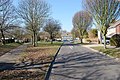
 261 Weddington Road - geograph.org.uk - 1746957.jpg 640 × 480; 209 KB
-
 66131 , North Wingfield (4409437850).jpg 3,500 × 1,947; 1.31 MB
-
 A flood gate^ Guyhirn Wash - The Nene Washes - geograph.org.uk - 1737851.jpg 2,848 × 2,136; 2.94 MB
-
 A hollow tree trunk - geograph.org.uk - 1739230.jpg 640 × 480; 175 KB
-

-
 A scene near Woodend in Peeblesshire - geograph.org.uk - 1737435.jpg 640 × 480; 71 KB
-
 A strip of young conifers - geograph.org.uk - 1739225.jpg 640 × 480; 165 KB
-
 A walk in Shouldham Warren - geograph.org.uk - 1739333.jpg 640 × 480; 171 KB
-
 A1120 Badingham Road - geograph.org.uk - 1740863.jpg 2,304 × 3,072; 1.47 MB
-
 A444, Weddington - geograph.org.uk - 1746965.jpg 640 × 480; 193 KB
-
 A701 heading south. - geograph.org.uk - 1737465.jpg 606 × 640; 102 KB
-
 A82 near Glen Gloy - geograph.org.uk - 1738868.jpg 800 × 531; 198 KB
-
 A82 near Glen Gloy - geograph.org.uk - 1738875.jpg 800 × 531; 235 KB
-
 Abbotts Lodge Farm - geograph.org.uk - 1741172.jpg 800 × 482; 97 KB
-
-
 Adnitt Road - geograph.org.uk - 1739633.jpg 640 × 480; 74 KB
-
 Aerials, Irton Moor - geograph.org.uk - 1741549.jpg 640 × 427; 256 KB
-
 All Saint's Church interior, Tudeley - geograph.org.uk - 1738728.jpg 3,488 × 2,616; 2.15 MB
-

-
 Alveley Church - geograph.org.uk - 1748668.jpg 600 × 800; 177 KB
-
 Alveley Cottage - geograph.org.uk - 1748672.jpg 800 × 600; 104 KB
-
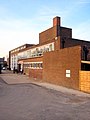
 Alveley Industrial Estate - geograph.org.uk - 1748685.jpg 600 × 800; 153 KB
-
-
 Ancient Yew tree, Much Marcle Church - geograph.org.uk - 1738226.jpg 1,600 × 1,061; 703 KB
-
 Approach Peasenhall X Roads - geograph.org.uk - 1740777.jpg 3,072 × 2,304; 1.49 MB
-

-

-
 Ashbridge, near West Hill - geograph.org.uk - 1737590.jpg 1,600 × 1,200; 589 KB
-
 Aylesbeare Cross - geograph.org.uk - 1737127.jpg 1,600 × 1,199; 427 KB
-
 Aylesford new bridge - geograph.org.uk - 1741232.jpg 640 × 480; 83 KB
-

-
 B3098 at Edington - geograph.org.uk - 1770178.jpg 640 × 481; 101 KB
-
 B3098 at Flinty Knapp - geograph.org.uk - 1771330.jpg 640 × 464; 106 KB
-

-
 B3098 heading west out of Erlestoke - geograph.org.uk - 1771507.jpg 640 × 494; 89 KB
-
 B3098 High Street, Erlestoke - geograph.org.uk - 1771475.jpg 640 × 518; 91 KB
-
 B3098 looking east at Flinty Knapp - geograph.org.uk - 1771357.jpg 640 × 521; 128 KB
-
 B3098 near Upper Baynton Farm - geograph.org.uk - 1771149.jpg 640 × 528; 146 KB
-
 B3098 near Upper Baynton Farm - geograph.org.uk - 1771167.jpg 640 × 494; 113 KB
-

-
 B3098 Westbury Road at Edington - geograph.org.uk - 1769801.jpg 640 × 486; 85 KB
-
 Backglen Road - geograph.org.uk - 1738793.jpg 640 × 480; 62 KB
-

-

-
 Ballynaquilly Townland - geograph.org.uk - 1738830.jpg 640 × 480; 44 KB
-
 Beach kiosk, Preston - geograph.org.uk - 1745504.jpg 488 × 640; 58 KB
-
 Beach kiosk, Preston - geograph.org.uk - 1745505.jpg 640 × 480; 62 KB
-

-
 Beautiport Farm - geograph.org.uk - 1737090.jpg 1,600 × 1,200; 748 KB
-
 Bedford Terrace, Tunbridge Wells - geograph.org.uk - 1738885.jpg 3,488 × 2,616; 2.13 MB
-
 Beeston Bandstand - geograph.org.uk - 1737623.jpg 1,024 × 683; 315 KB
-
 Bench mark on step of Cambridge Observatory - geograph.org.uk - 1736926.jpg 2,848 × 2,136; 1.47 MB
-
 Bench Mark, Bangor - geograph.org.uk - 1743433.jpg 640 × 430; 458 KB
-
 Bench Mark, Bangor - geograph.org.uk - 1743441.jpg 640 × 396; 449 KB
-
 Benches and bandstand - geograph.org.uk - 1737615.jpg 1,024 × 683; 383 KB
-
 Benches on a frosty morning - geograph.org.uk - 1736635.jpg 1,024 × 683; 237 KB
-
 St Thomas Church Biggin - geograph.org.uk - 1738923.jpg 640 × 426; 126 KB
-
 Bike shop, Torquay - geograph.org.uk - 1745213.jpg 640 × 469; 100 KB
-
 Black Horse, Pembury - geograph.org.uk - 1739082.jpg 3,488 × 2,616; 2.12 MB
-
 Block of flats, Kings Terrace - geograph.org.uk - 1742566.jpg 480 × 640; 192 KB
-
 Boardwalk Around Throxenby Mere - geograph.org.uk - 1741516.jpg 427 × 640; 304 KB
-
 Boat on Shoreline - geograph.org.uk - 1738073.jpg 3,888 × 2,592; 1.3 MB
-
 Boats on Foreshore - geograph.org.uk - 1738148.jpg 3,888 × 2,592; 1.4 MB
-
 Boothtown Methodist Church - geograph.org.uk - 1739896.jpg 640 × 480; 141 KB
-
 Borth Sunset banner.jpg 2,100 × 300; 243 KB
-
 Bridge over River Avon, Lilbourne - geograph.org.uk - 1737650.jpg 1,024 × 768; 136 KB
-
 Bridge over Severn - geograph.org.uk - 1748728.jpg 800 × 600; 108 KB
-
 Bridleway through the park - geograph.org.uk - 1746629.jpg 640 × 480; 329 KB
-
 Brookers Oast, Beltring - geograph.org.uk - 1739462.jpg 3,488 × 2,616; 2.2 MB
-
 Brune Lane (1) - geograph.org.uk - 1775268.jpg 640 × 428; 93 KB
-
 Brune Lane (2) - geograph.org.uk - 1775280.jpg 640 × 428; 106 KB
-
 Brune Lane (3) - geograph.org.uk - 1775300.jpg 640 × 428; 71 KB
-

-

-
 Bruntsfield House arch - geograph.org.uk - 1738247.jpg 640 × 480; 96 KB
-
 Bruntsfield House entrance - geograph.org.uk - 1738254.jpg 640 × 480; 79 KB
-
 Bruntsfield House wall tablets - geograph.org.uk - 1738260.jpg 640 × 480; 97 KB
-
 Bruntsfield House windows - geograph.org.uk - 1738241.jpg 640 × 480; 98 KB
-
 Bruntsfield House, Whitehouse Loan - geograph.org.uk - 1738193.jpg 640 × 480; 79 KB
-
 Bruntsfield House, Whitehouse Loan - geograph.org.uk - 1738216.jpg 640 × 480; 73 KB
-
 Bruntsfield House, Whitehouse Loan - geograph.org.uk - 1738225.jpg 640 × 480; 88 KB
-
 Bruntsfield House, Whitehouse Loan - geograph.org.uk - 1738233.jpg 480 × 640; 87 KB
-
 Bruntsfield House, Whitehouse Loan - geograph.org.uk - 1738236.jpg 640 × 480; 73 KB
-
 Bruntsfield House, Whitehouse Loan - geograph.org.uk - 1738239.jpg 480 × 640; 82 KB
-
 Builder's tablet, Marchmont Street - geograph.org.uk - 1738375.jpg 480 × 640; 77 KB
-
 Burn at Easter Happrew in Peebbleshire - geograph.org.uk - 1737264.jpg 640 × 480; 125 KB
-
 Burnhead Farm - geograph.org.uk - 1740528.jpg 4,000 × 3,000; 2.99 MB
-
 Burnhead Farm with Wildgoose Hill behind - geograph.org.uk - 1740536.jpg 4,000 × 3,000; 3.04 MB
-
 Bus shelter, Marsh Green - geograph.org.uk - 1738093.jpg 1,024 × 768; 253 KB
-
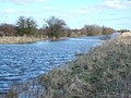 Bushes on the bank of Morton's Leam, Guyhirn Wash - geograph.org.uk - 1737876.jpg 2,848 × 2,136; 3.05 MB
-
 By-way in Sutton Park - geograph.org.uk - 1746636.jpg 640 × 480; 272 KB
-
 Byway on Stoke Hill - geograph.org.uk - 1740130.jpg 640 × 476; 111 KB
-
 Car-park, Llandough Hospital - geograph.org.uk - 1737767.jpg 3,296 × 2,472; 1.86 MB
-
 Carson's Lane sign near Lisburn - geograph.org.uk - 1737500.jpg 640 × 377; 87 KB
-
 Cassidy's Tunbridge Wells - geograph.org.uk - 1739043.jpg 3,488 × 2,616; 2.16 MB
-
 Castelnau 9850.jpg 3,648 × 2,736; 3.66 MB
-
 Castle and motte, Lilbourne - geograph.org.uk - 1737755.jpg 1,024 × 768; 168 KB
-
 Castle and motte, Lilbourne - geograph.org.uk - 1737809.jpg 1,024 × 768; 157 KB
-
 Charlton Arms pub sign - geograph.org.uk - 1738018.jpg 2,480 × 3,508; 302 KB
-
-
 Chevrons near Lisburn - geograph.org.uk - 1737047.jpg 625 × 386; 106 KB
-
 Christ Church (Methodist), Lower Addiscombe Road - geograph.org.uk - 1737833.jpg 3,300 × 2,190; 5.9 MB
-

-
 Church of St. Peter and St. Paul, Thruxton, Hampshire - geograph.org.uk - 1737694.jpg 1,600 × 1,064; 744 KB
-
 Church, Lisanelly Barracks, Omagh - geograph.org.uk - 1745179.jpg 640 × 480; 73 KB
-
 Churchyard, Church of St Gregory, Kirknewton - geograph.org.uk - 1737711.jpg 1,024 × 768; 230 KB
-
 Circular walk in Shouldham Warren - geograph.org.uk - 1739317.jpg 640 × 480; 113 KB
-
 Circular walk in Shouldham Warren - geograph.org.uk - 1739348.jpg 640 × 480; 111 KB
-
 Clam Bridge over Bar Brook - geograph.org.uk - 1737422.jpg 3,296 × 2,472; 1.08 MB
-
 Clanrye Mills, Newry, March 2010 (02).JPG 4,272 × 2,848; 5.67 MB
-
 Clanrye Mills, Newry, March 2010 (03).JPG 2,848 × 4,272; 4.84 MB
-
 Clanrye Mills, Newry, March 2010 (04).JPG 2,848 × 4,272; 4.55 MB
-
 Clanrye Mills, Newry, March 2010 (05).JPG 2,848 × 4,272; 4.51 MB
-
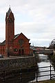 Clanrye River and Riverside Church, Newry, March 2010.JPG 2,848 × 4,272; 3.42 MB
-
 Clanrye River, Newry, March 2010 (01).JPG 4,272 × 2,848; 4.59 MB
-
 Clanrye River, Newry, March 2010 (02).JPG 2,848 × 4,272; 3.95 MB
-
 Clanrye River, Newry, March 2010 (03).JPG 4,272 × 2,848; 4.37 MB
-
 Class 170 unit 396 at the stops, Glasgow Queen Street - panoramio.jpg 3,264 × 2,448; 2.28 MB
-
 Clearfell in Shouldham Warren - geograph.org.uk - 1739245.jpg 640 × 480; 141 KB
-
 Clearfell in Shouldham Warren - geograph.org.uk - 1739258.jpg 640 × 480; 145 KB
-
 Clearfell in Shouldham Warren - geograph.org.uk - 1739344.jpg 640 × 480; 142 KB
-

-
 Cliff base, Hollicombe Beach - geograph.org.uk - 1745474.jpg 640 × 470; 100 KB
-
 Cliffs, Hollicombe Beach - geograph.org.uk - 1745395.jpg 640 × 480; 94 KB
-
 Cliffside Cottages - geograph.org.uk - 1753034.jpg 640 × 480; 103 KB
-
 Close Brook and culvert - geograph.org.uk - 1737617.jpg 2,816 × 2,112; 1.86 MB
-
 Co-op convenience store, Fore Street, Heavitree, Exeter - geograph.org.uk - 1738243.jpg 1,600 × 1,200; 336 KB
-
 Cock Hollow - geograph.org.uk - 1741592.jpg 640 × 427; 307 KB
-
 Cold Ashby-Road to Naseby - geograph.org.uk - 1737412.jpg 640 × 480; 101 KB
-
 College Burn south of Westnewton - geograph.org.uk - 1740215.jpg 1,024 × 768; 243 KB
-
 College Burn towards Westnewton - geograph.org.uk - 1740232.jpg 1,024 × 768; 255 KB
-
 College Valley - geograph.org.uk - 1738306.jpg 1,024 × 768; 256 KB
-
-
 College Valley south of Westnewton - geograph.org.uk - 1740240.jpg 1,024 × 768; 250 KB
-

-

-
 Connecting road, St Lucia, Omagh - geograph.org.uk - 1776942.jpg 640 × 480; 48 KB
-
 Continuation of Southbrook Lane - geograph.org.uk - 1766870.jpg 640 × 443; 123 KB
-
 Cookhouse, Lisanelly Camp, Omagh - geograph.org.uk - 1777925.jpg 640 × 480; 38 KB
-
 Coppiced beech, Hodgemoor Wood - geograph.org.uk - 1737225.jpg 1,200 × 1,600; 797 KB
-
 Corbie Craig - geograph.org.uk - 1740445.jpg 4,000 × 3,000; 3.15 MB
-
 Corporal's Mess, St Lucia, Omagh - geograph.org.uk - 1745085.jpg 640 × 480; 83 KB
-
 Countryside at Lilbourne - geograph.org.uk - 1737794.jpg 1,024 × 768; 116 KB
-

-
 Courtneys Restaurant, Newry, March 2010.JPG 2,848 × 4,272; 3.55 MB
-
 Cowcliffe Convenience Store AB2.JPG 3,581 × 2,388; 2.62 MB
-
 Cowcliffe Convenience Store door AB1.JPG 2,410 × 3,615; 2.32 MB
-
 Cramond Kirk - geograph.org.uk - 1736688.jpg 1,600 × 1,067; 509 KB
-
 Cramond Kirk Gravestone - geograph.org.uk - 1736699.jpg 1,600 × 1,067; 565 KB
-
 Crick, milestone - geograph.org.uk - 1740012.jpg 640 × 480; 104 KB
-
 Crick-West Haddon Road - geograph.org.uk - 1738164.jpg 640 × 480; 86 KB
-
 Crookhaugh in Peeblesshire - geograph.org.uk - 1737972.jpg 640 × 480; 82 KB
-
 Crosh Road - geograph.org.uk - 1738808.jpg 640 × 480; 66 KB
-
 Crosh Townland - geograph.org.uk - 1738814.jpg 640 × 480; 79 KB
-
 Crosh Townland - geograph.org.uk - 1738818.jpg 640 × 480; 65 KB
-
 Crossing the Severn - geograph.org.uk - 1748724.jpg 800 × 600; 100 KB
-
 Crossways Cottage, Aylesbeare - geograph.org.uk - 1737132.jpg 1,600 × 1,200; 414 KB
-
 Croydon, Cherry Orchard Gardens - geograph.org.uk - 1739771.jpg 3,456 × 2,304; 7.16 MB
-
 Croydon, Houses 169 to 161, Oval Road - geograph.org.uk - 1739632.jpg 3,456 × 2,304; 4.54 MB
-
 Croydon, The 'Builders Arms', Leslie Park Road - geograph.org.uk - 1739540.jpg 3,366 × 2,202; 4.56 MB
-
 Croydon, The 'Builders Arms', Leslie Park Road - geograph.org.uk - 1739572.jpg 2,310 × 1,704; 2.66 MB
-
 Croydon, The 'Oval Tavern', Oval Road - geograph.org.uk - 1739678.jpg 3,456 × 2,304; 5.4 MB
-
 Cuckfield Church gate - geograph.org.uk - 1772809.jpg 3,072 × 2,304; 1.6 MB
-

-
 Cygnus olor -Nottingham, England -two flying over water-8.jpg 2,421 × 1,611; 1.26 MB
-

-
 Daventry St James Street - geograph.org.uk - 1740911.jpg 640 × 426; 79 KB
-

-
 Daventry, Ashby Road - geograph.org.uk - 1738364.jpg 640 × 433; 116 KB
-
 Daventry, Ashby Road - geograph.org.uk - 1738366.jpg 640 × 426; 113 KB
-
 Daventry, Ashby Road - geograph.org.uk - 1741147.jpg 640 × 407; 84 KB
-
 Daventry, Ashby Road - geograph.org.uk - 1741170.jpg 640 × 426; 121 KB
-
 Daventry, Ashby Road - geograph.org.uk - 1741174.jpg 640 × 426; 79 KB
-
 Daventry, Ashby Road - geograph.org.uk - 1741325.jpg 640 × 426; 96 KB
-
 Daventry, behind Charles Terrace - geograph.org.uk - 1741652.jpg 640 × 408; 89 KB
-
 Daventry, behind Sheaf Street - geograph.org.uk - 1741396.jpg 640 × 426; 98 KB
-
 Daventry, behind St James Street - geograph.org.uk - 1741683.jpg 640 × 426; 117 KB
-
 Daventry, behind St James Street - geograph.org.uk - 1741692.jpg 640 × 426; 94 KB
-
 Daventry, Bowen Square at dusk - geograph.org.uk - 1738376.jpg 640 × 424; 101 KB
-
 Daventry, Bowen square shops at dusk - geograph.org.uk - 1738384.jpg 640 × 428; 90 KB
-
 Daventry, bowling green and pavilion - geograph.org.uk - 1741649.jpg 640 × 428; 86 KB
-
-

-

-

-

-
 Daventry, Chaucer Way and Clare Avenue - geograph.org.uk - 1741270.jpg 640 × 426; 125 KB
-
 Daventry, Chaucer Way car park - geograph.org.uk - 1741259.jpg 640 × 426; 86 KB
-

-
 Daventry, Clare Avenue - geograph.org.uk - 1738360.jpg 640 × 426; 103 KB
-
 Daventry, disused garages - geograph.org.uk - 1741076.jpg 640 × 426; 154 KB
-

-
 Daventry, disused houses on Brook Street - geograph.org.uk - 1741276.jpg 640 × 426; 106 KB
-

-

-

-

-
 Daventry, down London Road - geograph.org.uk - 1741486.jpg 640 × 426; 125 KB
-


.jpg)


_-_geograph.org.uk_-_1775268.jpg)
_-_geograph.org.uk_-_1775280.jpg)
_-_geograph.org.uk_-_1775300.jpg)


,_Lower_Addiscombe_Road_-_geograph.org.uk_-_1737833.jpg)


.JPG)
.JPG)
.JPG)
.JPG)

.JPG)
.JPG)
.JPG)


