Category:United Kingdom photographs taken on 2010-03-08
Countries of Europe: Austria · Bulgaria · Czech Republic · Denmark · Finland · France‡ · Georgia‡ · Germany · Hungary · Iceland · Republic of Ireland · Italy · Latvia · Lithuania · Netherlands‡ · North Macedonia · Norway · Poland · Portugal‡ · Romania · Russia‡ · Slovakia · Spain‡ · Sweden · Switzerland · Turkey‡ · Ukraine · United Kingdom
Specific status: Isle of Man
‡: partly located in Europe
Specific status: Isle of Man
‡: partly located in Europe
| ← | 8 March 2010 | → | ||
| ← | March 2010 | → | ||

United Kingdom photographs taken on 8 March 2010.
Image files should be categorized here automatically using {{taken on}} template. Direct categorisation is also possible, if automatic is impossible.
Subcategories
This category has only the following subcategory.
Media in category "United Kingdom photographs taken on 2010-03-08"
The following 200 files are in this category, out of 1,011 total.
(previous page) (next page)-
 "Sean the Baptist" ^ - geograph.org.uk - 1748332.jpg 640 × 480; 53 KB
-

-

-
 1GL bench mark on Frodsham Library - geograph.org.uk - 1745431.jpg 640 × 480; 171 KB
-

-
 1GL bench mark on Sutton Bridge - geograph.org.uk - 1745271.jpg 640 × 480; 207 KB
-
 222005 & 222014 , Chesterfield (4418049196).jpg 2,500 × 2,172; 1.71 MB
-
 A carpet of Knots - geograph.org.uk - 1752204.jpg 640 × 480; 157 KB
-
 A cloud of Knots - geograph.org.uk - 1752200.jpg 640 × 480; 116 KB
-
 A dwelling at Carfraemill - geograph.org.uk - 1743243.jpg 640 × 480; 52 KB
-

-
 A697 towards Coldstream - geograph.org.uk - 1743214.jpg 640 × 480; 62 KB
-
 Aberdeen March Stone 59 (in situ).jpg 2,048 × 1,536; 2.45 MB
-
 Aberdeen March Stone 59.jpg 1,536 × 2,048; 2.02 MB
-
 Aberdeen March Stone 60 (in situ).jpg 1,536 × 2,048; 1.62 MB
-
 Aberdeen March Stone 60.jpg 1,535 × 2,048; 2.3 MB
-
 Advertising hoarding, Bangor - geograph.org.uk - 1744201.jpg 640 × 410; 247 KB
-
 Agricultural building at Glengrasco - geograph.org.uk - 1779454.jpg 640 × 480; 91 KB
-
-
 Alcan Silos - geograph.org.uk - 1743267.jpg 600 × 450; 236 KB
-

-
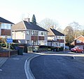
 Alexandra Road, Shirley. - geograph.org.uk - 1743906.jpg 640 × 480; 52 KB
-
 Allt a' Chràdh-leathaid - geograph.org.uk - 1750205.jpg 2,880 × 2,250; 1.7 MB
-
 Allt an Tiadhain - geograph.org.uk - 1750508.jpg 2,880 × 2,304; 1.72 MB
-
 Allt Mhungain falls to the sea - geograph.org.uk - 1750488.jpg 1,080 × 1,280; 502 KB
-
 Allt nan Airichean waterfall at sunset - geograph.org.uk - 1751036.jpg 2,304 × 3,072; 2.28 MB
-
 Amey 'Puma' passing through Kintbury - geograph.org.uk - 1745017.jpg 1,440 × 1,080; 1 MB
-

-
-
 Andover Road, Freemantle. - geograph.org.uk - 1743961.jpg 640 × 480; 66 KB
-
 Aoineadh Beinn na Sroine - geograph.org.uk - 1750214.jpg 2,880 × 2,205; 1.45 MB
-
 Approach to Carfraemill - geograph.org.uk - 1743125.jpg 640 × 480; 62 KB
-
 Approaching Bow, from the North - geograph.org.uk - 1747844.jpg 1,024 × 768; 226 KB
-
 Ardnadam Pier Holy Loch - geograph.org.uk - 1750930.jpg 3,648 × 2,736; 2.14 MB
-
 Ardnish - geograph.org.uk - 1745969.jpg 1,024 × 768; 763 KB
-
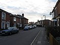
 Arthur Street, Withernsea - geograph.org.uk - 1743249.jpg 800 × 600; 114 KB
-
 Ashaig cemetery - geograph.org.uk - 1746177.jpg 1,024 × 710; 654 KB
-
 Ashaig cemetery - geograph.org.uk - 1746181.jpg 1,024 × 768; 765 KB
-
 Ashaig cemetery - geograph.org.uk - 1746188.jpg 1,024 × 697; 631 KB
-
 Ashaig cemetery - geograph.org.uk - 1746191.jpg 1,024 × 647; 663 KB
-
 Ashaig cemetery - geograph.org.uk - 1746195.jpg 1,024 × 768; 837 KB
-
 Tesco Supermarket in Ashford - panoramio.jpg 3,648 × 2,736; 3.44 MB
-
 Ashford Hospital - panoramio.jpg 3,618 × 2,694; 1.3 MB
-
 Asquith Hall - geograph.org.uk - 1765275.jpg 640 × 480; 114 KB
-
 At North Third - geograph.org.uk - 1744971.jpg 1,024 × 768; 604 KB
-

-

-
 Avebury Stones at Sunset with Contrail - panoramio.jpg 2,448 × 3,264; 1.46 MB
-
 B4231, towards Bream - geograph.org.uk - 1756565.jpg 640 × 480; 248 KB
-
 Back of the Eisenhower Pier, Bangor - geograph.org.uk - 1744387.jpg 640 × 512; 339 KB
-
 Banqueting Hall, Belfast City Hall - geograph.org.uk - 1748302.jpg 640 × 480; 67 KB
-
 Barn, near Little Hole Farm - geograph.org.uk - 1745962.jpg 768 × 1,024; 184 KB
-
 Barris House, Lapford - geograph.org.uk - 1744551.jpg 1,600 × 1,236; 417 KB
-
 Beach North of Withernsea - geograph.org.uk - 1743305.jpg 800 × 600; 110 KB
-
 BedfordBunyanStatueRelief1.JPG 1,112 × 855; 548 KB
-
 Belfast City - geograph.org.uk - 1747371.jpg 640 × 480; 47 KB
-
 Belfast Public Library - geograph.org.uk - 1747441.jpg 640 × 480; 73 KB
-
 Bell Lane, Cossington - geograph.org.uk - 1743251.jpg 3,488 × 2,616; 2.23 MB
-
 Belmaduthy Chambered Cairn - geograph.org.uk - 1743131.jpg 1,200 × 900; 243 KB
-
 Belmaduthy Chambered Cairn - geograph.org.uk - 1743144.jpg 1,200 × 906; 435 KB
-
 Ben Buie alpenglow - geograph.org.uk - 1749243.jpg 1,280 × 920; 539 KB
-
 Bench by the path - geograph.org.uk - 1745952.jpg 1,024 × 768; 760 KB
-

-
 Bench Mark, Belfast - geograph.org.uk - 1743322.jpg 465 × 640; 133 KB
-
 Bench Mark, Belfast - geograph.org.uk - 1743333.jpg 640 × 623; 843 KB
-
 Bench Mark, Belfast - geograph.org.uk - 1744154.jpg 640 × 462; 509 KB
-
 Bench Mark, Belfast - geograph.org.uk - 1744157.jpg 640 × 428; 441 KB
-
 Bench Mark, Belfast - geograph.org.uk - 1744161.jpg 640 × 417; 385 KB
-
 Birch on Crompton Moor - geograph.org.uk - 1743349.jpg 444 × 640; 152 KB
-
 Black Hill, A429 - geograph.org.uk - 1750387.jpg 2,000 × 1,491; 166 KB
-
 Blackberry Gate, near Lapford - geograph.org.uk - 1745393.jpg 1,600 × 1,200; 385 KB
-
 Blaise Castle - geograph.org.uk - 1762286.jpg 640 × 480; 65 KB
-
 Blaise Castle House Folly - geograph.org.uk - 1762263.jpg 480 × 640; 107 KB
-
 Blaise Castle House Grotto - geograph.org.uk - 1762337.jpg 640 × 480; 124 KB
-
 Blakemoor Links, Cresswell - geograph.org.uk - 1744823.jpg 600 × 450; 200 KB
-
 Blenheim Baptist Church 8 March 2010 entrance.jpg 4,416 × 3,312; 1.5 MB
-
 Blenheim Palace from the garden - geograph.org.uk - 1748794.jpg 640 × 480; 67 KB
-
 Boathouse by the lake at Blenheim - geograph.org.uk - 1748792.jpg 640 × 480; 97 KB
-
 Boats at Cambois - geograph.org.uk - 1744714.jpg 600 × 450; 278 KB
-
 Boats by the River Medway - geograph.org.uk - 1743040.jpg 3,488 × 2,616; 2.19 MB
-
 Bombay Street, Belfast - geograph.org.uk - 1747466.jpg 640 × 480; 43 KB
-
 Bookmaker, Bangor - geograph.org.uk - 1744279.jpg 640 × 463; 262 KB
-
 Bournemouth , Beswick Avenue - geograph.org.uk - 1745623.jpg 3,264 × 2,448; 3.32 MB
-
 Bournemouth , Beswick Avenue - geograph.org.uk - 1745627.jpg 3,264 × 2,448; 3.91 MB
-
 Bournemouth , Boundary Road - geograph.org.uk - 1744776.jpg 3,264 × 2,448; 3.42 MB
-
 Bournemouth , Columbia Road - geograph.org.uk - 1745642.jpg 3,264 × 2,448; 3.22 MB
-
 Bournemouth , Columbia Road and Training Bus - geograph.org.uk - 1745648.jpg 3,264 × 2,448; 3.55 MB
-
 Bournemouth , Eidon Road - geograph.org.uk - 1744837.jpg 3,264 × 2,448; 3.76 MB
-
 Bournemouth , Frost Road - geograph.org.uk - 1746597.jpg 3,264 × 2,448; 3.54 MB
-
 Bournemouth , Kinson Footpath - geograph.org.uk - 1746421.jpg 3,264 × 2,448; 3.87 MB
-
 Bournemouth , Moorside Road - geograph.org.uk - 1746290.jpg 3,264 × 2,448; 3.99 MB
-
 Bournemouth , Ringwood Road, Lidl - geograph.org.uk - 1747253.jpg 3,264 × 2,448; 3.29 MB
-
 Bournemouth , West Howe Playground - geograph.org.uk - 1746293.jpg 3,264 × 2,448; 3.8 MB
-
 Bournemouth , Winton - Namu Road - geograph.org.uk - 1744678.jpg 3,264 × 2,448; 3.76 MB
-
 Breakwater on the River Medway - geograph.org.uk - 1743149.jpg 3,488 × 2,616; 2.08 MB
-
 Bridleway from Tormarton village - geograph.org.uk - 1743484.jpg 4,379 × 2,562; 2.66 MB
-
 Bridleway runs along the field boundary - geograph.org.uk - 1748360.jpg 640 × 480; 106 KB
-
 Bridleway to Enstone - geograph.org.uk - 1805462.jpg 4,000 × 3,000; 2.57 MB
-
 Bridleway to Magpie Farm - geograph.org.uk - 1748322.jpg 640 × 480; 112 KB
-
 Bridleway to Southcoombe - geograph.org.uk - 1800312.jpg 4,000 × 3,000; 3.58 MB
-
 Bridleway, beside M4 - geograph.org.uk - 1743456.jpg 1,600 × 1,148; 634 KB
-
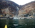
 Broadford Bay - geograph.org.uk - 1745896.jpg 1,024 × 768; 715 KB
-
 Broadford Bay - geograph.org.uk - 1745899.jpg 1,024 × 768; 757 KB
-
 Brushes Clough car park - geograph.org.uk - 1743372.jpg 640 × 441; 119 KB
-
 Bungalows, at Highfield, Lapford - geograph.org.uk - 1746815.jpg 1,024 × 732; 133 KB
-
 Bungalows, in Highfield, Lapford - geograph.org.uk - 1746793.jpg 1,024 × 686; 148 KB
-
 Bus shelter and post box, Zeal Monachorum - geograph.org.uk - 1747647.jpg 1,338 × 1,600; 629 KB
-
 Bus shelter, Lapford - geograph.org.uk - 1744599.jpg 1,024 × 768; 192 KB
-
 C S Lewis statue, Belfast - geograph.org.uk - 1747358.jpg 640 × 449; 84 KB
-
 Cabot Tower - geograph.org.uk - 1762242.jpg 480 × 640; 59 KB
-
 Caldwell Spring Wood from A439 Black Hill - geograph.org.uk - 1742887.jpg 2,000 × 1,506; 191 KB
-
 Cambois Beach looking North - geograph.org.uk - 1744654.jpg 600 × 450; 242 KB
-
 Cambois Beach looking North - geograph.org.uk - 1744675.jpg 600 × 450; 230 KB
-
 Cambois Beach looking South - geograph.org.uk - 1744661.jpg 600 × 450; 231 KB
-
 Cambois Beach looking South - geograph.org.uk - 1744683.jpg 600 × 450; 186 KB
-
 Cambois Beach looking South - geograph.org.uk - 1744689.jpg 600 × 450; 201 KB
-
 Car park rear of Kintbury Railway Station - geograph.org.uk - 1745391.jpg 1,440 × 965; 711 KB
-
 Castle and Bridge, Underbank Reservoir, Stocksbridge - geograph.org.uk - 1746732.jpg 2,576 × 1,932; 1,015 KB
-
 Castlecary Viaduct - geograph.org.uk - 1742750.jpg 1,044 × 629; 162 KB
-
 Cement Works, 20-20 Estate, Maidstone - geograph.org.uk - 1743219.jpg 3,488 × 2,616; 2.1 MB
-
 Cemetery wall - geograph.org.uk - 1746183.jpg 1,024 × 625; 541 KB
-
 Chapel Lane, Enstone - geograph.org.uk - 1800270.jpg 4,000 × 3,000; 2.62 MB
-
 Church of St Mary the Virgin and Church House - geograph.org.uk - 1744616.jpg 1,600 × 1,200; 415 KB
-
 Church of St Thomas of Canterbury, Lapford - geograph.org.uk - 1744587.jpg 1,206 × 1,600; 467 KB
-
 Church Street railway bridge, Frodsham - geograph.org.uk - 1745378.jpg 640 × 480; 114 KB
-

-

-
 Churchyard, St Mary's Church, Kintbury - geograph.org.uk - 1745455.jpg 1,440 × 1,080; 898 KB
-
 Cliff Top Track, Tunstall Cliffs - geograph.org.uk - 1743049.jpg 800 × 600; 72 KB
-
 Cliffs at Lag a' Chomhaich - geograph.org.uk - 1750188.jpg 2,304 × 2,880; 1.67 MB
-
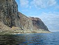
 Cliffs south of Cnoc na Faire - geograph.org.uk - 1756882.jpg 1,280 × 800; 257 KB
-
 Clock, Thornton's Arcade 8 March 2010.jpg 2,620 × 2,052; 2.13 MB
-

-
 Clonard RC Church, Belfast - geograph.org.uk - 1747463.jpg 640 × 480; 62 KB
-
 Close Turf Farm House - geograph.org.uk - 1756605.jpg 640 × 480; 246 KB
-
 Cloud reflections in Loch Ness - geograph.org.uk - 1743111.jpg 3,264 × 2,448; 2.54 MB
-
 Combe village green - geograph.org.uk - 1748848.jpg 640 × 480; 105 KB
-
 Commuter train towards Reading, Kintbury - geograph.org.uk - 1744999.jpg 1,440 × 1,080; 839 KB
-
 Corner of moat, Wells - geograph.org.uk - 1752831.jpg 640 × 480; 126 KB
-
 Cottage garden gate - geograph.org.uk - 1743296.jpg 640 × 470; 167 KB
-
 Cottage, at Forches Cross - geograph.org.uk - 1745894.jpg 1,024 × 768; 241 KB
-
 Cottages at Cambois - geograph.org.uk - 1744697.jpg 600 × 450; 242 KB
-

-
 Courtyard, Belfast City Hall - geograph.org.uk - 1748321.jpg 640 × 480; 63 KB
-
 Cow and Calf Sign, Skew Hill Lane, Grenoside, near Sheffield - geograph.org.uk - 1749319.jpg 1,932 × 2,576; 1.08 MB
-
 Cow and Calf, Skew Hill Lane, Grenoside, near Sheffield - 1 - geograph.org.uk - 1749327.jpg 2,576 × 1,932; 1.39 MB
-
 Cow and Calf, Skew Hill Lane, Grenoside, near Sheffield - 2 - geograph.org.uk - 1749334.jpg 2,576 × 1,932; 1.26 MB
-
 Cow and Calf, Skew Hill Lane, Grenoside, near Sheffield - 3 - geograph.org.uk - 1749347.jpg 2,576 × 1,932; 1.14 MB
-
 Cow and Calf, Skew Hill Lane, Grenoside, near Sheffield - 4 - geograph.org.uk - 1749358.jpg 1,932 × 2,576; 1.43 MB
-
 Cow and Calf, Skew Hill Lane, Grenoside, near Sheffield - 5 - geograph.org.uk - 1749367.jpg 2,172 × 1,446; 1,022 KB
-
 Cranes at the airstrip - geograph.org.uk - 1746121.jpg 640 × 363; 46 KB
-
 Cresswell Beach looking North - geograph.org.uk - 1744818.jpg 600 × 450; 246 KB
-
 Cresswell Beach looking South - geograph.org.uk - 1744814.jpg 600 × 450; 254 KB
-
 Crimble - geograph.org.uk - 1743371.jpg 2,816 × 2,112; 1.36 MB
-
 Crimble and Crimble Mill - geograph.org.uk - 1743402.jpg 2,816 × 2,112; 842 KB
-
 Crimble from Crimble Lane - geograph.org.uk - 1743418.jpg 2,816 × 2,112; 911 KB
-
 Crimble Lane - geograph.org.uk - 1743426.jpg 2,816 × 2,112; 1.56 MB
-
 Crimble Mill - geograph.org.uk - 1743384.jpg 2,816 × 2,112; 1.84 MB
-
 Croft building at Glengrasco - geograph.org.uk - 1779432.jpg 640 × 480; 79 KB
-
 Croft building at Glenmore - geograph.org.uk - 1779381.jpg 640 × 480; 103 KB
-
 Croftland at Eyre - geograph.org.uk - 1779632.jpg 640 × 480; 80 KB
-
 Croftland at Eyre - geograph.org.uk - 1779636.jpg 640 × 480; 86 KB
-
 Croftland at Glenmore - geograph.org.uk - 1779383.jpg 640 × 480; 101 KB
-
 Crossing to Wales - geograph.org.uk - 1743458.jpg 640 × 480; 214 KB
-

-
 Crow Knowl's three masts - geograph.org.uk - 1743360.jpg 640 × 443; 80 KB
-
 Dale Dyke Reservoir from the south - geograph.org.uk - 1743850.jpg 2,608 × 1,952; 1.5 MB
-
 Deer fence near Copster Green - geograph.org.uk - 1745888.jpg 640 × 480; 108 KB
-
 Detail of Kingussie station - geograph.org.uk - 1747329.jpg 1,806 × 2,262; 1.49 MB
-
 Development site, Blandford Forum - geograph.org.uk - 1744915.jpg 640 × 480; 143 KB
-
 Development site, Minnowburn, Belfast - geograph.org.uk - 1743013.jpg 564 × 378; 111 KB
-
 Dewhurst House - geograph.org.uk - 1743169.jpg 640 × 480; 109 KB
-
 Dilapidated croft house at Eyre - geograph.org.uk - 1779627.jpg 640 × 480; 99 KB
-
 Discovery Museum, Blandford Square - geograph.org.uk - 1743582.jpg 1,600 × 1,036; 508 KB
-
 Dismantled railway arches Holbeck Leeds - geograph.org.uk - 1743317.jpg 640 × 412; 119 KB
-
 Display, Belfast City Hall - geograph.org.uk - 1747604.jpg 640 × 480; 57 KB
-
 Display, Belfast City Hall - geograph.org.uk - 1747608.jpg 640 × 480; 59 KB
-
 Disused beacon on Sgeirean Glasa - geograph.org.uk - 1747008.jpg 640 × 480; 71 KB
-
 Disused Quarry near Cresswell - geograph.org.uk - 1744798.jpg 600 × 450; 233 KB
-
 Dome, Belfast City Hall - geograph.org.uk - 1747624.jpg 640 × 480; 46 KB
-
 Downstream Leader Burn - geograph.org.uk - 1743173.jpg 640 × 480; 117 KB
-
 Drain entering the forest - geograph.org.uk - 1750674.jpg 2,048 × 1,536; 1.14 MB
-
 Driveway to Heythrop Park - geograph.org.uk - 1800296.jpg 4,000 × 3,000; 4.11 MB
-
 Driveway to Manor Farm - geograph.org.uk - 1801770.jpg 4,000 × 3,000; 2.97 MB
-
 Driveway to Stone Farm - geograph.org.uk - 1801814.jpg 4,000 × 3,000; 4.64 MB
-
 Drystane dyke at Skeabost - geograph.org.uk - 1779489.jpg 640 × 480; 92 KB
-
 Dundas Arms Hotel, Kintbury - geograph.org.uk - 1745413.jpg 1,440 × 1,079; 905 KB
-
 Dunmurry Railway Station - geograph.org.uk - 1748345.jpg 640 × 480; 67 KB
-
 Eastington, Devon - geograph.org.uk - 1746124.jpg 1,600 × 1,200; 367 KB
-
 Eat, sleep, eat, sleep, eat - geograph.org.uk - 1750807.jpg 640 × 434; 223 KB
-
 Edge of Marles Wood - geograph.org.uk - 1743193.jpg 2,592 × 1,944; 1.59 MB
-
 Emley Moor Mast, from Green Moor, near Wortley - geograph.org.uk - 1751261.jpg 1,932 × 2,576; 643 KB
-
 Across the road - geograph.org.uk - 1801771.jpg 4,000 × 3,000; 3.33 MB
-
 Enstone and Church Enstone - geograph.org.uk - 1805498.jpg 4,000 × 3,000; 2.91 MB
-
 Entrance to Barming Station - geograph.org.uk - 1743203.jpg 3,488 × 2,616; 2.12 MB
-
 Entrance to Glebe Farm, Plaistow - geograph.org.uk - 1743280.jpg 640 × 480; 106 KB
-
 Entrance to lay-by, Llwyn-onn reservoir - geograph.org.uk - 1744423.jpg 1,600 × 1,200; 795 KB
-
 Epsom Sainsbury's interior 2.jpg 1,600 × 1,200; 229 KB
-
 Epsom Sainsbury's interior 3.jpg 1,600 × 1,200; 244 KB
-
 Eurofix Car Repairs, Dunmurry - geograph.org.uk - 1748365.jpg 640 × 480; 45 KB


.jpg)


.jpg)

.jpg)


