File:1776 Karte Gemeinheitsweide Dorf Halden.jpg
Size of this preview: 769 × 600 pixels. Other resolutions: 308 × 240 pixels | 616 × 480 pixels | 985 × 768 pixels | 1,036 × 808 pixels.
Original file (1,036 × 808 pixels, file size: 411 KB, MIME type: image/jpeg)
Captions
Captions
Add a one-line explanation of what this file represents
Summary
edit
| Description |
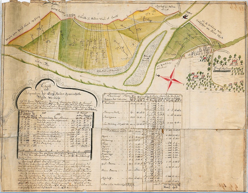
Deutsch: Karte „Halden an der Lenne. Gemeinheitsweide Charte und Designation der Dorff-Halder Gemeinheits Weyde 1776.“ 42 x 54 cm. Kolorierte Zeichnung von Johann Peter Hobrack, KSA Nr. 1058. |
| Date | |
| Source | Landesarchiv NRW Abteilung Westfalen – DFG-Viewer Kartensammlung A, Nr. 5859 |
| Author | Johann Peter Hobrack |
Licensing
edit
|
This work is in the public domain in its country of origin and other countries and areas where the copyright term is the author's life plus 100 years or fewer. This work is in the public domain in the United States because it was published (or registered with the U.S. Copyright Office) before January 1, 1929. | |
| This file has been identified as being free of known restrictions under copyright law, including all related and neighboring rights. | |
File history
Click on a date/time to view the file as it appeared at that time.
| Date/Time | Thumbnail | Dimensions | User | Comment | |
|---|---|---|---|---|---|
| current | 12:16, 21 January 2021 | | 1,036 × 808 (411 KB) | Bärwinkel,Klaus (talk | contribs) | {{Information |Description={{de|1=Halden an der Lenne (Hagen) Gemeinheitsweide Charte und Designation der Dorff-Halder Gemeinheits Weyde 1776 o.M. 42 x 54 kol. Zeichnung Johann Peter Hobrack KSA Nr. 1058. }} |Source=Landesarchiv NRW Abteilung Westfalen – DFG-Viewer Kartensammlung A, Nr. 5859 |Date=1776 |Author=Johann Peter Hobrack |Permission= |other_versions= }} == {{int:license}} == {{free screenshot|license={{GPL}} }} Category:Halden (Hagen) |
You cannot overwrite this file.
File usage on Commons
There are no pages that use this file.