File:Atlas mexicano. LOC 2007627316-10.jpg

Size of this preview: 666 × 599 pixels. Other resolutions: 267 × 240 pixels | 533 × 480 pixels | 854 × 768 pixels | 1,138 × 1,024 pixels | 2,276 × 2,048 pixels | 7,139 × 6,424 pixels.
Original file (7,139 × 6,424 pixels, file size: 6.25 MB, MIME type: image/jpeg)
Captions
Captions
Add a one-line explanation of what this file represents
Summary
edit| Description |
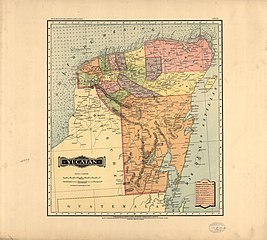
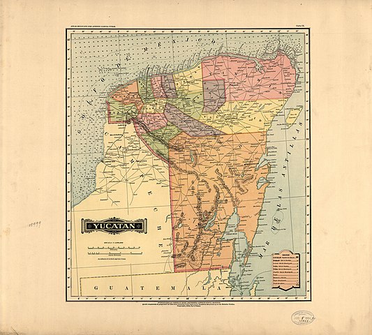
English: Running title. Issued in sheets. Maps dated 1884 to 1886; no. 28 and [29] are numbered 28. Phillips 2685 Available also through the Library of Congress Web site as a raster image. Form AACR2: ga36 2007-02-08 |
||
| Title | Atlas mexicano. | ||
| Shelf ID | G1545.G328 1884 | ||
| Parent | https://www.loc.gov/resource/g4410m.gct00091/ | ||
| Sheet title | Yucatan | ||
| Date | |||
| Source | https://www.loc.gov/item/2007627316/ | ||
| Author | García Cubas, Antonio | ||
| Permission (Reusing this file) |
|
||
| Other versions |
|
||
| Location | Mexico | ||
| Part of | American Memory · General Maps · Catalog · Geography And Map Division | ||
| Subject | Maps · Mexico |


Licensing
edit
|
This is a faithful photographic reproduction of a two-dimensional, public domain work of art. The work of art itself is in the public domain for the following reason:
The official position taken by the Wikimedia Foundation is that "faithful reproductions of two-dimensional public domain works of art are public domain".
This photographic reproduction is therefore also considered to be in the public domain in the United States. In other jurisdictions, re-use of this content may be restricted; see Reuse of PD-Art photographs for details. | ||||
File history
Click on a date/time to view the file as it appeared at that time.
| Date/Time | Thumbnail | Dimensions | User | Comment | |
|---|---|---|---|---|---|
| current | 04:10, 12 July 2018 | | 7,139 × 6,424 (6.25 MB) | Fæ (talk | contribs) | LOC Maps multisheet https://www.loc.gov/item/2007627316/ sheet 10 of 31 #187 |
You cannot overwrite this file.
File usage on Commons
The following page uses this file: