File:Atlas of the town of Framingham, Mass. LOC 2007626793-8.jpg

Size of this preview: 471 × 599 pixels. Other resolutions: 188 × 240 pixels | 377 × 480 pixels | 603 × 768 pixels | 805 × 1,024 pixels | 2,289 × 2,913 pixels.
Original file (2,289 × 2,913 pixels, file size: 716 KB, MIME type: image/jpeg)
Captions
Captions
Add a one-line explanation of what this file represents
Summary edit
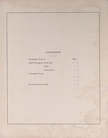
| Description |
English: LeGear. Atlases of the United States, 4919 Available also through the Library of Congress Web site as a raster image. Includes index. LC copy imperfect: Minor liquid staining throughout. Vendor: John Carbonell (eBay auction) Acquisitions control no. 2007-019 |
||
| Title | Atlas of the town of Framingham, Mass. | ||
| Shelf ID | G1234.F7 B3 1895 | ||
| Parent | https://www.loc.gov/resource/g3764fm.gla00011/ | ||
| Sheet title | Image 8 of Atlas of the town of Framingham, Mass. | ||
| Date | |||
| Source | https://www.loc.gov/item/2007626793/ | ||
| Author | Barnes & Jenks; Beirne, James P. | ||
| Permission (Reusing this file) |
|
||
| Other versions |
|
||
| Location | United States · Massachusetts · Framingham | ||
| Part of | County Landownership Maps · Cultural Landscapes · Cities And Towns · Catalog · American Memory · Geography And Map Division | ||
| Subject | Directories · United States · Maps · Framingham (Mass.) · Framingham · Real Property · Landowners · Massachusetts |


Licensing edit
|
This is a faithful photographic reproduction of a two-dimensional, public domain work of art. The work of art itself is in the public domain for the following reason:
The official position taken by the Wikimedia Foundation is that "faithful reproductions of two-dimensional public domain works of art are public domain".
This photographic reproduction is therefore also considered to be in the public domain in the United States. In other jurisdictions, re-use of this content may be restricted; see Reuse of PD-Art photographs for details. | ||||
File history
Click on a date/time to view the file as it appeared at that time.
| Date/Time | Thumbnail | Dimensions | User | Comment | |
|---|---|---|---|---|---|
| current | 09:46, 13 July 2018 | | 2,289 × 2,913 (716 KB) | Fæ (talk | contribs) | LOC Maps multisheet https://www.loc.gov/item/2007626793/ sheet 8 of 27 #12020 |
You cannot overwrite this file.
File usage on Commons
The following page uses this file: