File:Battlefield of Winchester, Va. Sept. 19 - 1864, 3 PM LOC 2005625360.jpg
Size of this preview: 800 × 565 pixels. Other resolutions: 320 × 226 pixels | 640 × 452 pixels | 1,024 × 723 pixels | 1,280 × 904 pixels | 2,780 × 1,963 pixels.
Original file (2,780 × 1,963 pixels, file size: 537 KB, MIME type: image/jpeg)
Captions
Captions
Add a one-line explanation of what this file represents
Summary
edit| Description |
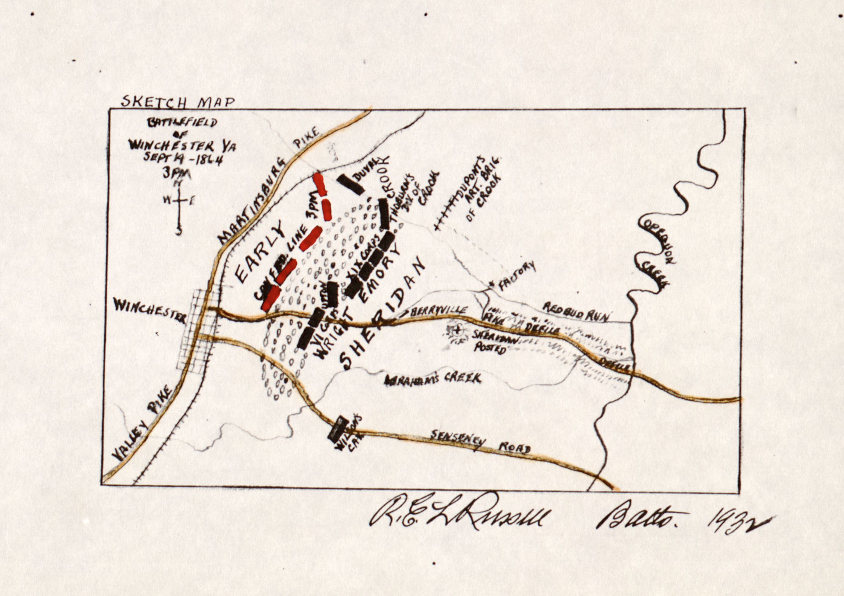
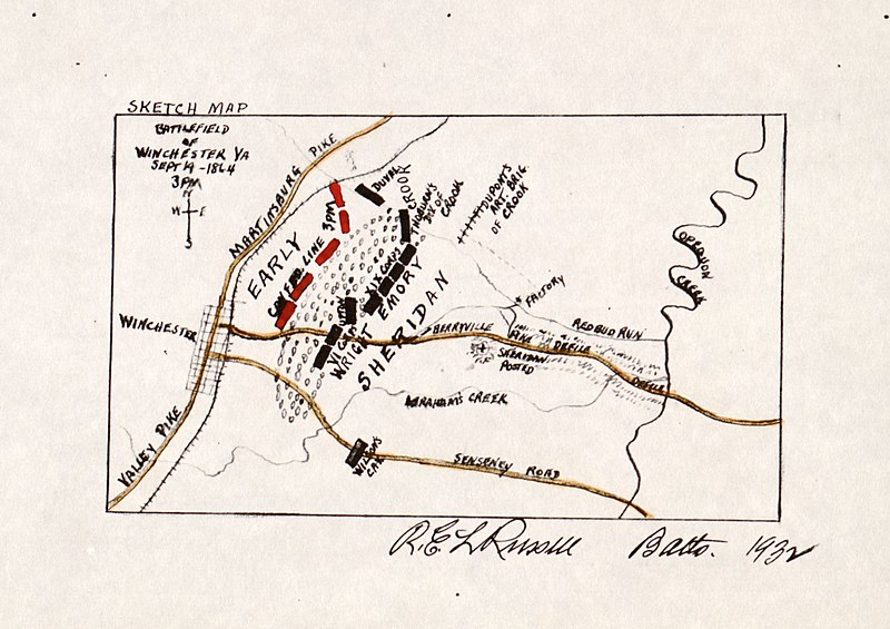
English: Handcolored photocopy showing Confederate position in red and roads in yellow. "Sketch map" LC Civil War maps (2nd ed.), 672 Available also through the Library of Congress Web site as a raster image. |
||
| Title | Battlefield of Winchester, Va. Sept. 19 - 1864, 3 PM | ||
| Shelf ID | G3884.W6S5 1864 .R83 | ||
| Date | |||
| Source | https://www.loc.gov/item/2005625360/ | ||
| Author | Russell, Robert E. L. | ||
| Permission (Reusing this file) |
|
||
| Other versions |
|
||
| Location | United States · Winchester Region · Virginia | ||
| Part of | Military Battles And Campaigns · American Memory · Civil War Maps · Catalog · Geography And Map Division | ||
| Subject | Winchester, 3Rd Battle Of, Winchester, Va · Maps · Winchester, 3Rd Battle Of, Winchester, Va. · Virginia · United States · Winchester Region · Winchester Region (Va.) |


Licensing
edit
|
This is a faithful photographic reproduction of a two-dimensional, public domain work of art. The work of art itself is in the public domain for the following reason:
The official position taken by the Wikimedia Foundation is that "faithful reproductions of two-dimensional public domain works of art are public domain".
This photographic reproduction is therefore also considered to be in the public domain in the United States. In other jurisdictions, re-use of this content may be restricted; see Reuse of PD-Art photographs for details. | ||||
File history
Click on a date/time to view the file as it appeared at that time.
| Date/Time | Thumbnail | Dimensions | User | Comment | |
|---|---|---|---|---|---|
| current | 12:56, 7 June 2018 | | 2,780 × 1,963 (537 KB) | Fæ (talk | contribs) | LOC Maps https://www.loc.gov/item/2005625360/ #7551 |
You cannot overwrite this file.
File usage on Commons
The following page uses this file: