File:Bautzen - 32-51.jpg
Size of this preview: 384 × 599 pixels. Other resolutions: 154 × 240 pixels | 307 × 480 pixels | 492 × 768 pixels | 656 × 1,024 pixels | 1,312 × 2,048 pixels | 3,194 × 4,985 pixels.
Original file (3,194 × 4,985 pixels, file size: 3.51 MB, MIME type: image/jpeg)
Captions
Captions
Add a one-line explanation of what this file represents
|
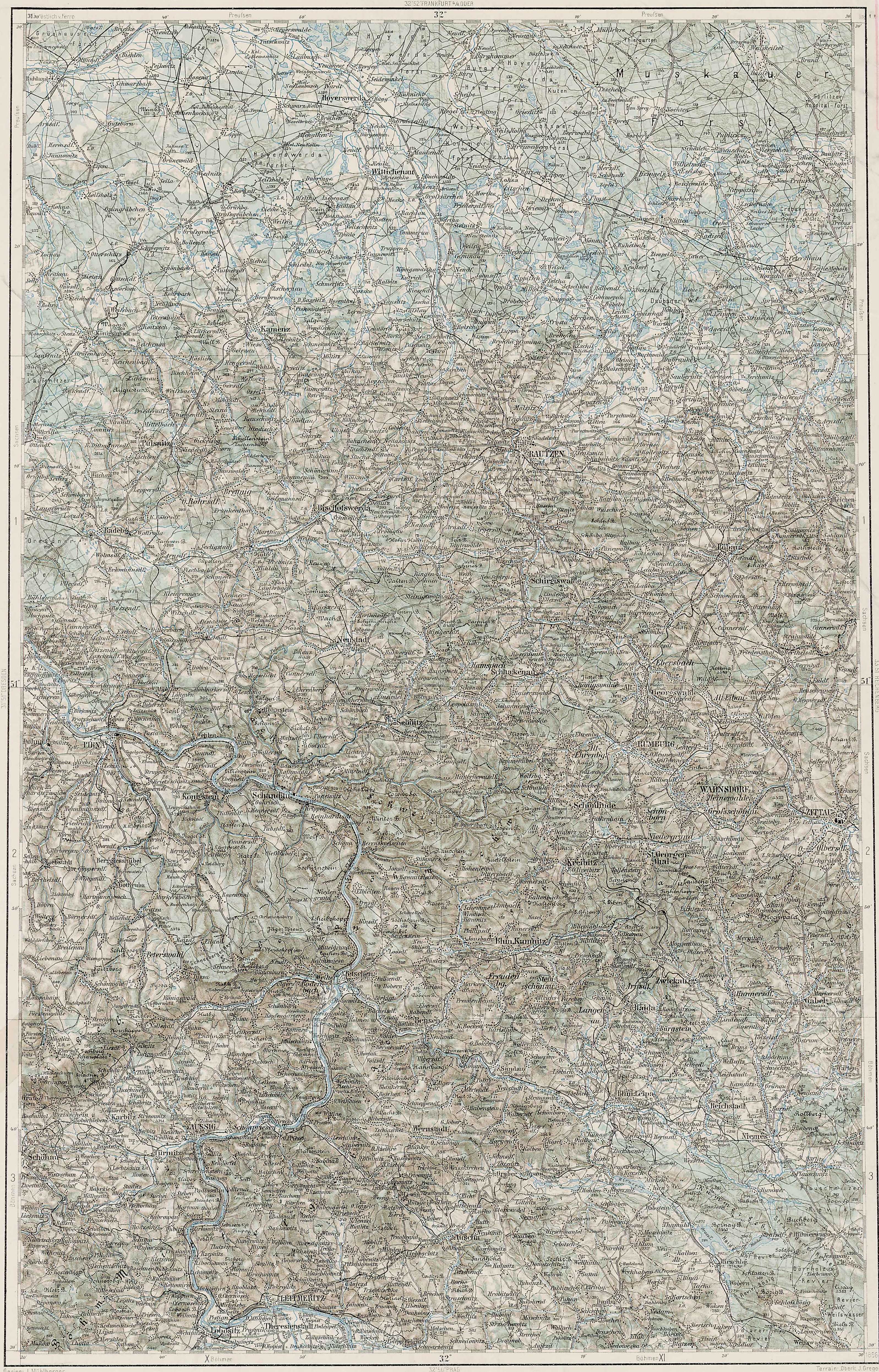
Deutsch: Blatt 32-51 der Generalkarte von Mitteleuropa 1:200.000 der Franzisco-Josephinischen Landesaufnahme, Österreich-Ungarn, ab 1887. Die Blattmitte liegt bei 51° n.Br. und 32° ö.L. (östlich von Ferro, nicht Greenwich!). English: Sheet 32-51 of the General Map of Central Europe, scale 1:200,000, edited 1887 ff. See 3rd Military Mapping Survey of Austria-Hungary for details. The center of the sheet is 51° North, 32° East (east of Ferro, not Greenwich!).
← Nachbarblätter. Klicken Sie auf eine Miniatur, um zu diesem Blatt zu gelangen.
← Neighbouring sheets. Click thumbnail to navigate |


.jpg)
Summary
edit
| Description | 3rd Military Mapping Survey of Austria-Hungary - Bautzen |
| Date | |
| Source | http://lazarus.elte.hu/hun/moterkep.htm - László ZENTAI |
| Author | Military mapping authority of Austria-Hungary |
Licensing
edit
|
This work is in the public domain in its country of origin and other countries and areas where the copyright term is the author's life plus 70 years or fewer. | |
| This file has been identified as being free of known restrictions under copyright law, including all related and neighboring rights. | |
File history
Click on a date/time to view the file as it appeared at that time.
| Date/Time | Thumbnail | Dimensions | User | Comment | |
|---|---|---|---|---|---|
| current | 12:56, 14 March 2007 | | 3,194 × 4,985 (3.51 MB) | Szilas (talk | contribs) | == Összefoglaló == 3rd Military Mapping Survey of Austria-Hungary - Bautzen Source: http://lazarus.elte.hu/hun/moterkep.htm - László ZENTAI Category:3rd Military Mapping Survey of Austria-Hungary == Licensing == {{PD-old}} |
You cannot overwrite this file.
File usage on Commons
The following 4 pages use this file:
File usage on other wikis
The following other wikis use this file:
- Usage on hu.wikibooks.org