File:Bequia or Becouya, the northernmost of the Granadilles, LOC 73697202.tif

Size of this JPG preview of this TIF file: 800 × 587 pixels. Other resolutions: 320 × 235 pixels | 640 × 469 pixels | 1,024 × 751 pixels | 1,280 × 939 pixels | 2,560 × 1,877 pixels | 5,719 × 4,194 pixels.
Original file (5,719 × 4,194 pixels, file size: 68.62 MB, MIME type: image/tiff)
Captions
Captions
Add a one-line explanation of what this file represents
Summary
edit| Description |
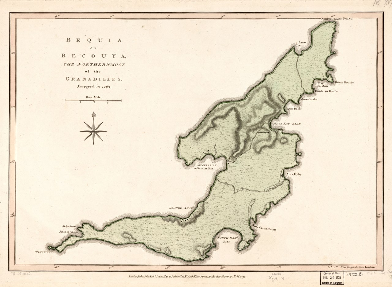
English: Scale ca. 1:23,300. Hand colored. Relief shown by hachures. "XII." "64." LC Maps of North America, 1750-1789, 2096 Available also through the Library of Congress Web site as a raster image. Vault AACR2 |
||
| Title | Bequia or Becouya, the northernmost of the Granadilles, | ||
| Shelf ID | G5122.B4 1763 .J4 | ||
| Date | |||
| Source | https://www.loc.gov/item/73697202/ | ||
| Author | Jefferys, Thomas; Sayer, Robert | ||
| Permission (Reusing this file) |
|
||
| Other versions |
|
||
| Location | The Grenadines · Bequia Island. · Bequia Island · Saint Vincent And The Grenadines · Saint Vincent | ||
| Part of | Military Battles And Campaigns · American Memory · Catalog · Geography And Map Division · American Revolution And Its Era: Maps And Charts Of North America And The West Indies, 1750-1789 | ||
| Subject | Maps · Early Works To 1800 · Bequia Island · Saint Vincent And The Grenadines · Bequia Island (Saint Vincent And The Grenadines) |


Licensing
edit|
This is a faithful photographic reproduction of a two-dimensional, public domain work of art. The work of art itself is in the public domain for the following reason:
The official position taken by the Wikimedia Foundation is that "faithful reproductions of two-dimensional public domain works of art are public domain".
This photographic reproduction is therefore also considered to be in the public domain in the United States. In other jurisdictions, re-use of this content may be restricted; see Reuse of PD-Art photographs for details. | ||||
File history
Click on a date/time to view the file as it appeared at that time.
| Date/Time | Thumbnail | Dimensions | User | Comment | |
|---|---|---|---|---|---|
| current | 18:03, 12 June 2019 |  | 5,719 × 4,194 (68.62 MB) | Fæ (talk | contribs) | LOC Maps https://www.loc.gov/item/73697202/ #1511 |
You cannot overwrite this file.
File usage on Commons
The following page uses this file: