File:COIN (FindID 1014055).jpg

Size of this preview: 800 × 468 pixels. Other resolutions: 320 × 187 pixels | 640 × 374 pixels | 1,024 × 599 pixels | 1,280 × 749 pixels | 2,560 × 1,497 pixels | 3,561 × 2,083 pixels.
Original file (3,561 × 2,083 pixels, file size: 1.92 MB, MIME type: image/jpeg)
Captions
Captions
Add a one-line explanation of what this file represents
| Camera location | | View this and other nearby images on: OpenStreetMap |
|---|
.jpg¶ms=050.782711_N_-000.944097_E_globe:Earth_type:camera_alt:38.47_source:exif_&language=en)
Summary
edit.jpg&action=edit§ion=1)
| COIN | |||
|---|---|---|---|
| Photographer |
The Portable Antiquities Scheme, Simon Maslin, 2020-10-23 15:36:06 |
||
| Title |
COIN |
||
| Description |
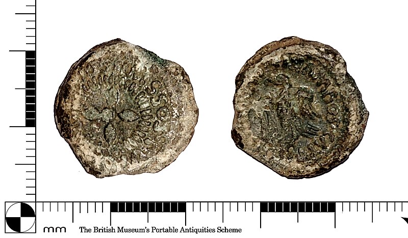
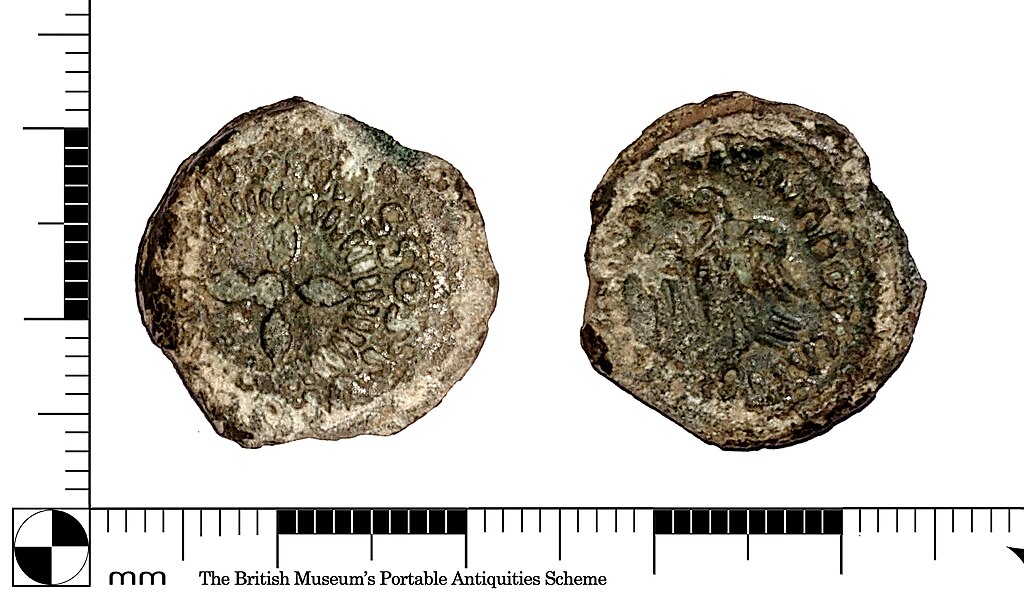
English: A Gaulish copper alloy Semis à l’aigle from the Lisieux region / Lexovii dating to 50-40 BC. Obverse: quatrefoil, PVBLICOS.LIXOVIO.SIMISSOS. Reverse: eagle, left, CISIAMBOS.CATTOS.VERCOBRETO. |
||
| Depicted place | (County of findspot) Hampshire | ||
| Date | between 50 BC and 40 BC | ||
| Accession number |
FindIdentifier: 1014055 |
||
| Credit line |
|
||
| Source |
https://finds.org.uk/database/ajax/download/id/1119801 Catalog: https://finds.org.uk/database/images/image/id/1119801/recordtype/artefacts archive copy at the Wayback Machine |
||
| Permission (Reusing this file) |
Attribution License version 2.0 (verified 12 November 2020) | ||
Licensing
edit.jpg&action=edit§ion=2)
This file is licensed under the Creative Commons Attribution 2.0 Generic license.
Attribution: The Portable Antiquities Scheme
- You are free:
- to share – to copy, distribute and transmit the work
- to remix – to adapt the work
- Under the following conditions:
- attribution – You must give appropriate credit, provide a link to the license, and indicate if changes were made. You may do so in any reasonable manner, but not in any way that suggests the licensor endorses you or your use.
File history
Click on a date/time to view the file as it appeared at that time.
| Date/Time | Thumbnail | Dimensions | User | Comment | |
|---|---|---|---|---|---|
| current | 09:34, 8 November 2020 | | 3,561 × 2,083 (1.92 MB) | Fæ (talk | contribs) | Portable Antiquities Scheme, HAMP (slurp), FindID: 1014055-1119801, iron age, page 14, batch count 240 |
You cannot overwrite this file.
File usage on Commons
The following page uses this file:
.jpg)
.jpg&oldid=871023818)