File:Carte réduite de l'Île Royale, assujettie aux observations astronomiques et nautiques, aux operations géodésiques, à différentes routes et à leur direction, faites par M. le marquis de Chabert. Avec LOC 73695948.jpg

Size of this preview: 412 × 599 pixels. Other resolutions: 165 × 240 pixels | 330 × 480 pixels | 528 × 768 pixels | 704 × 1,024 pixels | 1,408 × 2,048 pixels | 7,557 × 10,990 pixels.
Original file (7,557 × 10,990 pixels, file size: 12.65 MB, MIME type: image/jpeg)
Captions
Captions
Add a one-line explanation of what this file represents
Summary
edit| Warning | The original file is very high-resolution. It might not load properly or could cause your browser to freeze when opened at full size. |
|---|
| Description |
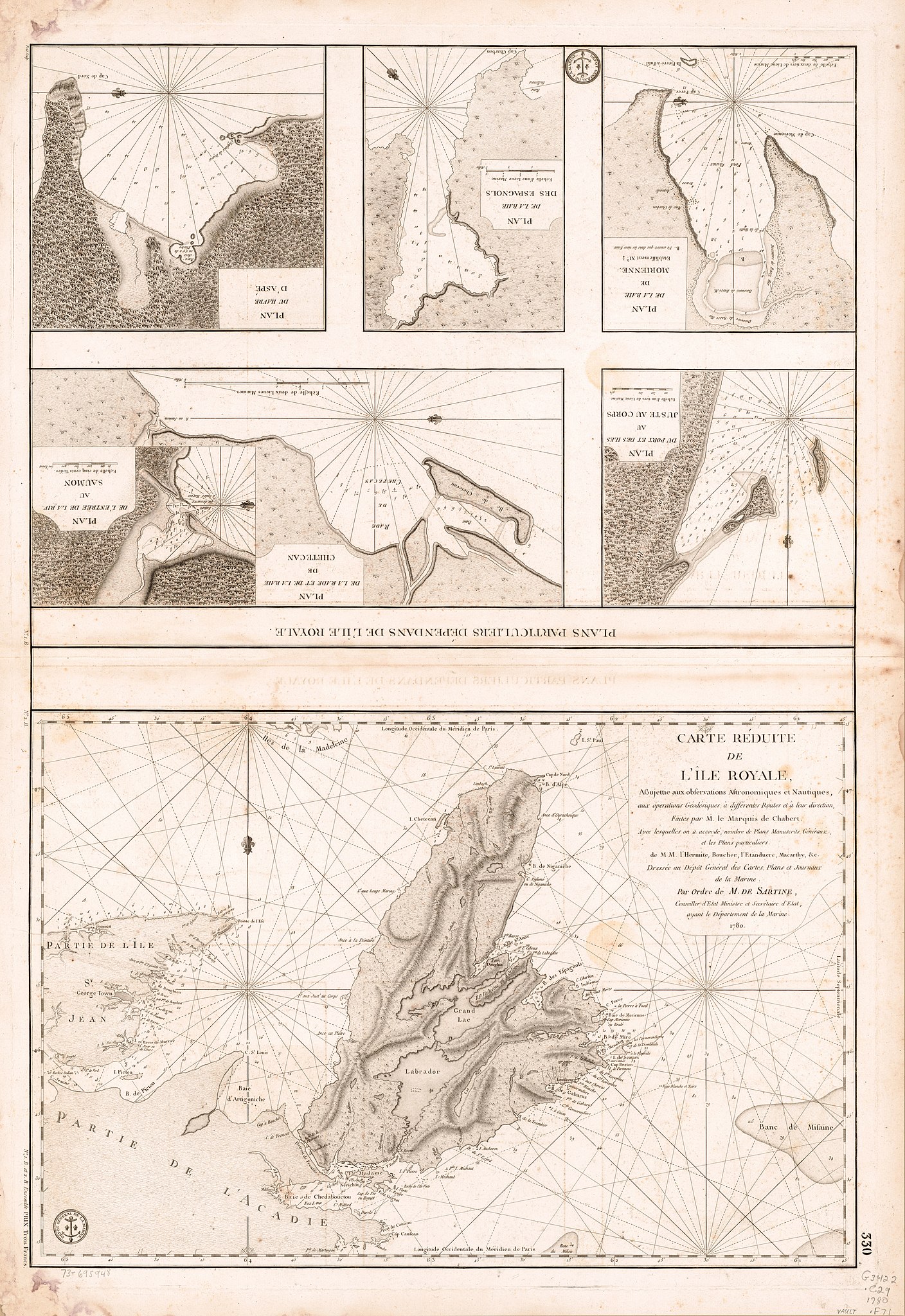
English: Scales vary. Relief shown by hachures. Depths shown by soundings. "Longitude occidentale du méridien de Paris." "No. 1. B." and "No. 2. B." located outside of left border. "4." located below lower right corner of border. Available also through the Library of Congress Web site as a raster image. Vault AACR2: 110; 651/1; 650/2 |
||
| Title | Carte réduite de l'Île Royale, assujettie aux observations astronomiques et nautiques, aux operations géodésiques, à différentes routes et à leur direction, faites par M. le marquis de Chabert. Avec lesquelles on a accordé, nombre de plans manuscrits, généraux, et les plans particuliers de MM. L'Hermite, Boucher, L'Etanduere, Macarthy, &c. | ||
| Shelf ID | G3422.C29 1780 .F71 | ||
| Date | |||
| Source | https://www.loc.gov/item/73695948/ | ||
| Author | France. Dépôt Des Cartes Et Plans De La Marine; Chabert De Cogolin, Joseph Bernard; Petit | ||
| Permission (Reusing this file) |
|
||
| Other versions |
|
||
| Location | Cape Breton Island · Canada · Cape Breton Island. · Nova Scotia | ||
| Part of | American Memory · General Maps · Catalog · Geography And Map Division | ||
| Subject | Canada · Nautical Charts · Maps · Early Works To 1800 · Nova Scotia · Cape Breton Island (N.S.) · Cape Breton Island |


Licensing
edit
|
This is a faithful photographic reproduction of a two-dimensional, public domain work of art. The work of art itself is in the public domain for the following reason:
The official position taken by the Wikimedia Foundation is that "faithful reproductions of two-dimensional public domain works of art are public domain".
This photographic reproduction is therefore also considered to be in the public domain in the United States. In other jurisdictions, re-use of this content may be restricted; see Reuse of PD-Art photographs for details. | ||||
File history
Click on a date/time to view the file as it appeared at that time.
| Date/Time | Thumbnail | Dimensions | User | Comment | |
|---|---|---|---|---|---|
| current | 09:30, 6 June 2018 | | 7,557 × 10,990 (12.65 MB) | Fæ (talk | contribs) | LOC Maps https://www.loc.gov/item/73695948/ #21660 |
You cannot overwrite this file.
File usage on Commons
The following page uses this file: