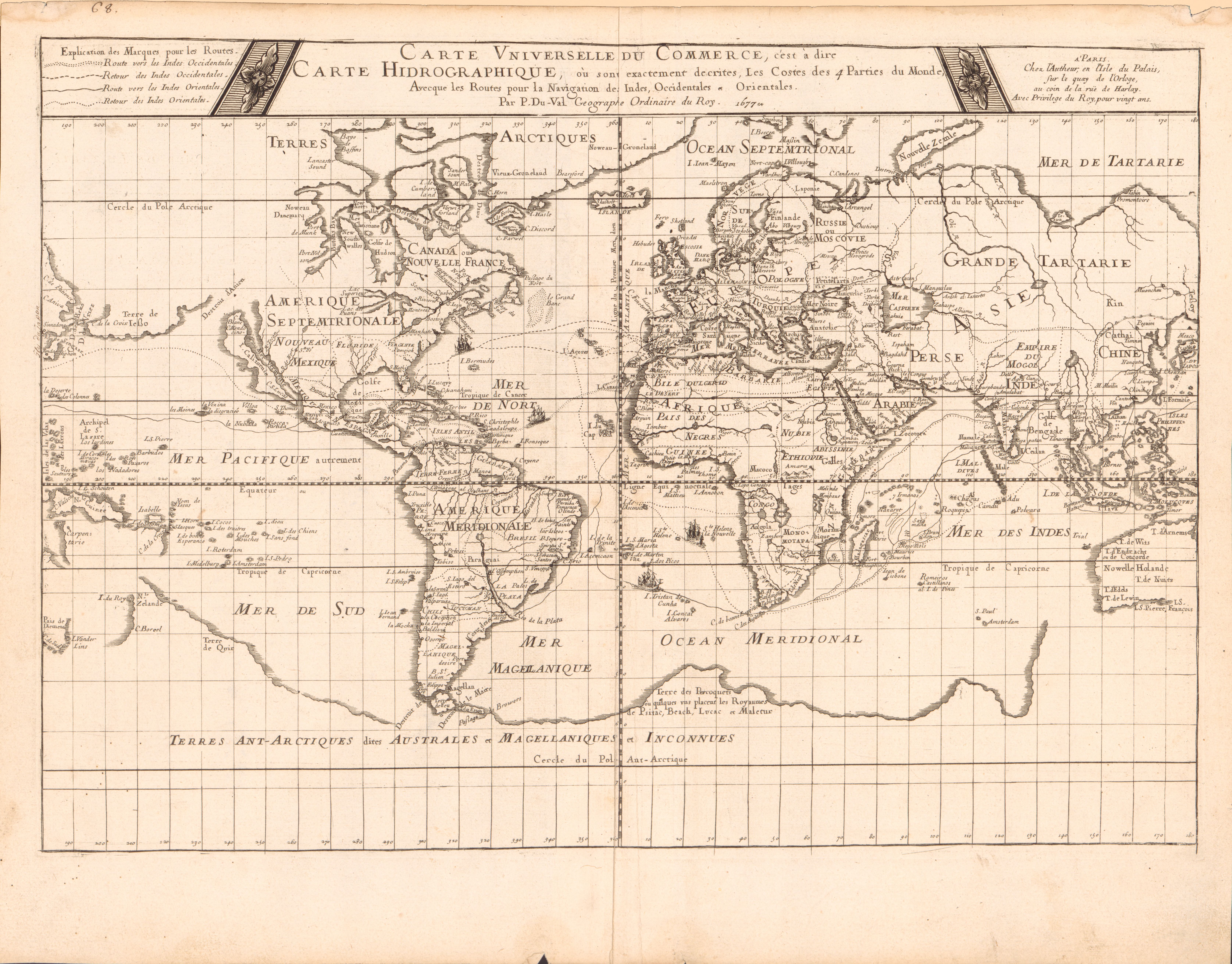
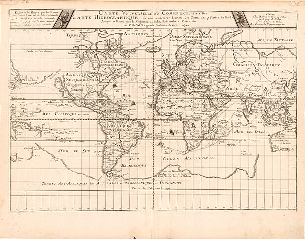
File:Carte vniverselle du commerce, c'est à dire carte hidrographique, où sont exactement decrites les costes des 4 parties du monde, avecque les routes pour la navigation des Indes occidentales et LOC 2017585711.jpg
Size of this preview: 767 × 600 pixels. Other resolutions: 307 × 240 pixels | 614 × 480 pixels | 982 × 768 pixels | 1,280 × 1,001 pixels | 2,560 × 2,002 pixels | 6,701 × 5,241 pixels.
Original file (6,701 × 5,241 pixels, file size: 4.87 MB, MIME type: image/jpeg)
Captions
Captions
Add a one-line explanation of what this file represents
Summary
edit| Description |
English: Relief shown pictorially. Includes illustrations of ships on trade routes. Shows California as an island. LC copy foldlined. Stamped on verso: 6849. Shirley, R.W. Mapping of the world, 364 Available also through the Library of Congress Web site as a raster image. |
||
| Title | Carte vniverselle du commerce, c'est à dire carte hidrographique, où sont exactement decrites les costes des 4 parties du monde, avecque les routes pour la navigation des Indes occidentales et orientales | ||
| Shelf ID | G3200 1677 .D8 | ||
| Date | |||
| Source | https://www.loc.gov/item/2017585711/ | ||
| Author | Duval, P. (Pierre) | ||
| Permission (Reusing this file) |
|
||
| Other versions |
|
||
| Location | Earth (Planet) | ||
| Part of | American Memory · General Maps · Catalog · Geography And Map Division | ||
| Subject | Commerce · Trade Routes · World Maps · Early Maps · Maps · Earth (Planet) |

Licensing
edit
|
This is a faithful photographic reproduction of a two-dimensional, public domain work of art. The work of art itself is in the public domain for the following reason:
The official position taken by the Wikimedia Foundation is that "faithful reproductions of two-dimensional public domain works of art are public domain".
This photographic reproduction is therefore also considered to be in the public domain in the United States. In other jurisdictions, re-use of this content may be restricted; see Reuse of PD-Art photographs for details. | ||||
File history
Click on a date/time to view the file as it appeared at that time.
| Date/Time | Thumbnail | Dimensions | User | Comment | |
|---|---|---|---|---|---|
| current | 02:40, 7 June 2018 | | 6,701 × 5,241 (4.87 MB) | Fæ (talk | contribs) | LOC Maps https://www.loc.gov/item/2017585711/ #7174 |
You cannot overwrite this file.
File usage on Commons
The following page uses this file: