File:Comprehensive plan for the National Capital, major thoroughfare plan. LOC 75697292.jpg

Size of this preview: 784 × 600 pixels. Other resolutions: 314 × 240 pixels | 628 × 480 pixels | 1,004 × 768 pixels | 1,280 × 979 pixels | 2,560 × 1,959 pixels | 8,854 × 6,774 pixels.
Original file (8,854 × 6,774 pixels, file size: 11.97 MB, MIME type: image/jpeg)
Captions
Captions
Add a one-line explanation of what this file represents
Summary
edit| Description |
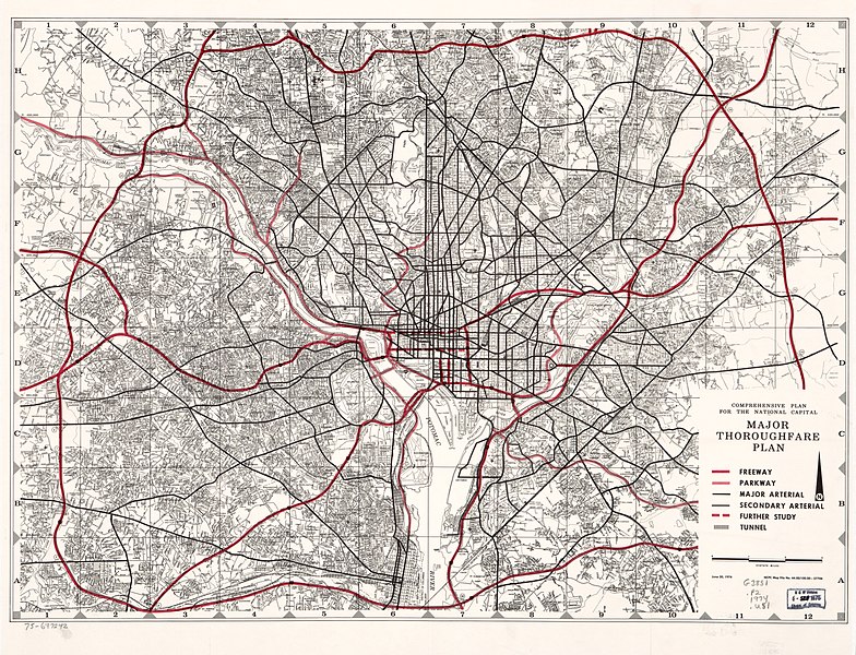
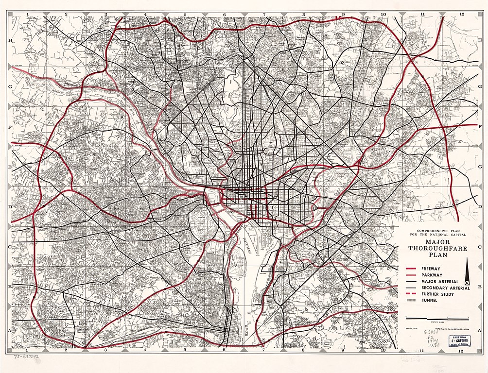
English: Scale ca. 1:50,000. "June 30, 1974." "NCPC map file no. 44.00/100.00-27706." Available also through the Library of Congress Web site as a raster image. DCP AACR2 |
||
| Title | Comprehensive plan for the National Capital, major thoroughfare plan. | ||
| Shelf ID | G3851.P2 1974 .U51 | ||
| Date | |||
| Source | https://www.loc.gov/item/75697292/ | ||
| Author | United States. National Capital Planning Commission | ||
| Permission (Reusing this file) |
|
||
| Other versions |
|
||
| Location | United States · Washington D.C. · Washington Metropolitan Area · Washington · District Of Columbia | ||
| Part of | American Memory · Cities And Towns · Catalog · Geography And Map Division | ||
| Subject | Washington (D.C.) · Washington Metropolitan Area · Highway Planning · Washington · Express Highways · United States · Maps · District Of Columbia |


Licensing
edit
| This work is from the Library of Congress. According to the library, there are no known copyright restrictions on the use of this work. |  |
File history
Click on a date/time to view the file as it appeared at that time.
| Date/Time | Thumbnail | Dimensions | User | Comment | |
|---|---|---|---|---|---|
| current | 21:18, 4 June 2018 | | 8,854 × 6,774 (11.97 MB) | Fæ (talk | contribs) | LOC Maps https://www.loc.gov/item/75697292/ #20102 |
You cannot overwrite this file.
File usage on Commons
The following page uses this file: