File:Diagram of the United States of America, Mexico, the West India Islands and Isthmus of Darien; by W. T. Steiger, General Land Office. LOC 98688319.jpg

Size of this preview: 743 × 600 pixels. Other resolutions: 298 × 240 pixels | 595 × 480 pixels | 952 × 768 pixels | 1,269 × 1,024 pixels | 2,538 × 2,048 pixels | 11,870 × 9,579 pixels.
Original file (11,870 × 9,579 pixels, file size: 12.6 MB, MIME type: image/jpeg)
Captions
Captions
Add a one-line explanation of what this file represents
Summary
edit| Warning | The original file is very high-resolution. It might not load properly or could cause your browser to freeze when opened at full size. |
|---|
| Description |
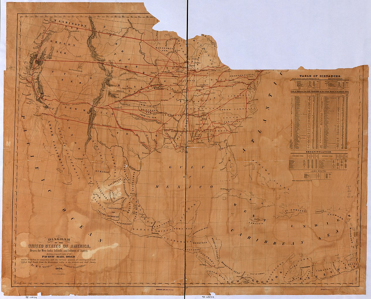
English: Outline map of the United States and Middle America showing proposed routes of the Pacific Rail Road and its branches in connection with the various systems of existing and unfinished rail roads from the Mississippi Valley to the Atlantic and Gulf coasts. |
||
| Title | Diagram of the United States of America, Mexico, the West India Islands and Isthmus of Darien; by W. T. Steiger, General Land Office. | ||
| Shelf ID | G3301.P3 1854 .S7 | ||
| Date | |||
| Source | https://www.loc.gov/item/98688319/ | ||
| Author | Steiger, W. T.; United States. General Land Office | ||
| Permission (Reusing this file) |
|
||
| Other versions |
|
||
| Location | North America · United States | ||
| Part of | American Memory · Catalog · Railroad Maps, 1828-1900 · Geography And Map Division · Transportation And Communication | ||
| Subject | North America · Pacific Railroad · Railroads · United States · Maps |


Licensing
edit
|
This is a faithful photographic reproduction of a two-dimensional, public domain work of art. The work of art itself is in the public domain for the following reason:
The official position taken by the Wikimedia Foundation is that "faithful reproductions of two-dimensional public domain works of art are public domain".
This photographic reproduction is therefore also considered to be in the public domain in the United States. In other jurisdictions, re-use of this content may be restricted; see Reuse of PD-Art photographs for details. | ||||
File history
Click on a date/time to view the file as it appeared at that time.
| Date/Time | Thumbnail | Dimensions | User | Comment | |
|---|---|---|---|---|---|
| current | 09:58, 15 May 2018 | | 11,870 × 9,579 (12.6 MB) | Fæ (talk | contribs) | LOC Maps https://www.loc.gov/item/98688319/ #467 |
You cannot overwrite this file.
File usage on Commons
The following page uses this file: