File:Empire Ottoman - division administrative LOC 2007633930.jpg

Size of this preview: 800 × 585 pixels. Other resolutions: 320 × 234 pixels | 640 × 468 pixels | 1,024 × 748 pixels | 1,280 × 936 pixels | 2,560 × 1,871 pixels | 10,638 × 7,775 pixels.
Original file (10,638 × 7,775 pixels, file size: 12.38 MB, MIME type: image/jpeg)
Captions
Captions
Add a one-line explanation of what this file represents
Summary edit
| Warning | The original file is very high-resolution. It might not load properly or could cause your browser to freeze when opened at full size. |
|---|
| Description |
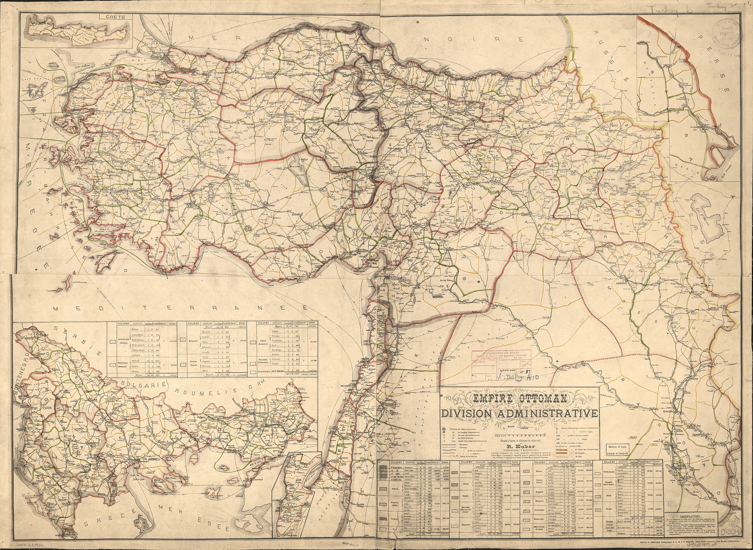
English: Includes four insets and tables of cities, with size and population. Available also through the Library of Congress Web site as a raster image. |
||
| Title | Empire Ottoman : division administrative | ||
| Shelf ID | G7431.F7 1899 .H8 G7431.F7 1899 .H8 | ||
| Date | |||
| Source | https://www.loc.gov/item/2007633930/ | ||
| Author | Huber, R. | ||
| Permission (Reusing this file) |
|
||
| Other versions |
|
||
| Location | Turkey | ||
| Part of | American Memory · General Maps · Catalog · Geography And Map Division | ||
| Subject | Turkey · Maps · Ottoman Empire · Administrative And Political Divisions · History |


Licensing edit
|
This is a faithful photographic reproduction of a two-dimensional, public domain work of art. The work of art itself is in the public domain for the following reason:
The official position taken by the Wikimedia Foundation is that "faithful reproductions of two-dimensional public domain works of art are public domain".
This photographic reproduction is therefore also considered to be in the public domain in the United States. In other jurisdictions, re-use of this content may be restricted; see Reuse of PD-Art photographs for details. | ||||
File history
Click on a date/time to view the file as it appeared at that time.
| Date/Time | Thumbnail | Dimensions | User | Comment | |
|---|---|---|---|---|---|
| current | 10:42, 28 August 2018 | | 10,638 × 7,775 (12.38 MB) | Fæ (talk | contribs) | LOC Maps https://www.loc.gov/item/2007633930/ #11408 |
You cannot overwrite this file.
File usage on Commons
The following page uses this file: