File:Franzius Unterweser.jpg
Size of this preview: 800 × 521 pixels. Other resolutions: 320 × 208 pixels | 640 × 417 pixels | 1,024 × 667 pixels | 1,280 × 834 pixels | 2,160 × 1,407 pixels.
Original file (2,160 × 1,407 pixels, file size: 2.36 MB, MIME type: image/jpeg)
Captions
Captions
Add a one-line explanation of what this file represents
Summary
edit
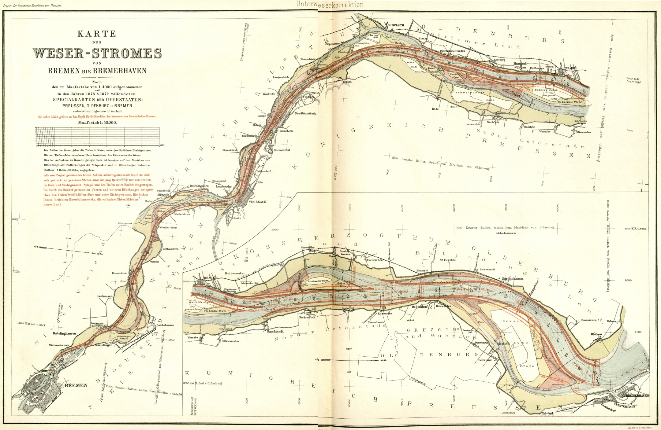
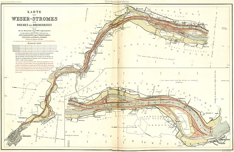
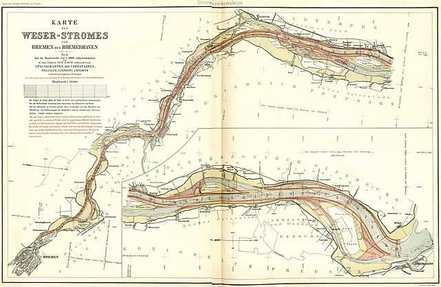
| Description | Survey map of the straightening of Lower Weser or Weser inner estuary (DE: "Korrektion der Unterweser") drawn in 1888 by Ludwig Franzius, the engineer who proposed and realized this project |
| Date | |
| Source | Die Unterweserkorrektion", copy provided in Staatsarchiv Bremen |
| Author | Ludwig Franzius, scan & upload by Ulamm (talk) 21:29, 19 February 2014 (UTC) |
| Other versions |
 English: The same map broadside Deutsch: Dieselbe Karte im Querformat Franzius Unterweser r90.jpg |
Licensing
edit
|
This work is in the public domain in its country of origin and other countries and areas where the copyright term is the author's life plus 100 years or fewer. | |
| This file has been identified as being free of known restrictions under copyright law, including all related and neighboring rights. | |
File history
Click on a date/time to view the file as it appeared at that time.
| Date/Time | Thumbnail | Dimensions | User | Comment | |
|---|---|---|---|---|---|
| current | 14:00, 16 April 2018 | | 2,160 × 1,407 (2.36 MB) | SteinsplitterBot (talk | contribs) | Bot: Image rotated by 90° |
| 17:39, 27 February 2014 |  | 1,407 × 2,166 (2.37 MB) | Ulamm (talk | contribs) | nonsens overhead position removed by my original upload | |
| 08:47, 27 February 2014 |  | 2,166 × 1,392 (2.34 MB) | Rotatebot (talk | contribs) | Bot: Image rotated by 270° | |
| 21:29, 19 February 2014 |  | 1,407 × 2,166 (2.37 MB) | Ulamm (talk | contribs) | {{Information |Description=Survey map of the straightening of Lower Weser or Weser inner estuary (DE: "Korrektion der Unterweser") drawn in 1888 by Ludwig Franzius, the engineer who proposed and realized this project |Source= ''Die [[:de:Unterweserkorr... |
You cannot overwrite this file.
File usage on Commons
The following 6 pages use this file:
File usage on other wikis
The following other wikis use this file:
- Usage on de.wikipedia.org
- Usage on fr.wikipedia.org
- Usage on www.wikidata.org