File:General soil map, East Feliciania Parish, Louisiana. LOC gm69002185.jpg

Size of this preview: 431 × 599 pixels. Other resolutions: 172 × 240 pixels | 345 × 480 pixels | 552 × 768 pixels | 736 × 1,024 pixels | 1,473 × 2,048 pixels | 6,169 × 8,576 pixels.
Original file (6,169 × 8,576 pixels, file size: 4.73 MB, MIME type: image/jpeg)
Captions
Captions
Add a one-line explanation of what this file represents
Summary
edit| Description |
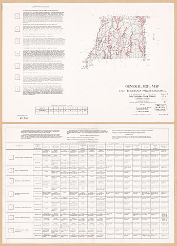
English: Scale 1:253,440; 1ʺ = 4 miles. "4-R-17,441-A. Compiled from base 4-R-27,132." Includes text and "Proportion of associations in the parish" table. "Soil interpretations for selected uses" table on verso. Available also through the Library of Congress Web site as a raster image. AACR2: 110 |
||
| Title | General soil map, East Feliciania Parish, Louisiana. | ||
| Shelf ID | G4013.E4 1969 .U5 | ||
| Date | |||
| Source | https://www.loc.gov/item/gm69002185/ | ||
| Author | United States. Soil Conservation Service | ||
| Permission (Reusing this file) |
|
||
| Other versions |
|
||
| Location | East Feliciania Parish. · United States · Louisiana · East Feliciania Parish | ||
| Part of | American Memory · Catalog · Geography And Map Division · Additional Conservation And Environment Cartographic Items | ||
| Subject | United States · Soils · Louisiana · East Feliciania Parish · Maps |


Licensing
edit
| This work is from the Library of Congress. According to the library, there are no known copyright restrictions on the use of this work. |  |
File history
Click on a date/time to view the file as it appeared at that time.
| Date/Time | Thumbnail | Dimensions | User | Comment | |
|---|---|---|---|---|---|
| current | 03:58, 19 April 2019 | | 6,169 × 8,576 (4.73 MB) | Fæ (talk | contribs) | LOC Maps https://www.loc.gov/item/gm69002185/ #187 |
You cannot overwrite this file.
File usage on Commons
The following page uses this file: