File:General soil map, Great Plains Resource Conservation and Development Area, Beckham, Custer, Greer, Harmon, Jackson, Kiowa, Roger Mills, and Washita Counties, Oklahoma LOC 85692450.tif
Size of this JPG preview of this TIF file: 329 × 600 pixels. Other resolutions: 131 × 240 pixels | 263 × 480 pixels | 421 × 768 pixels | 561 × 1,024 pixels | 1,123 × 2,048 pixels | 3,250 × 5,927 pixels.
Original file (3,250 × 5,927 pixels, file size: 55.11 MB, MIME type: image/tiff)
Captions
Captions
Add a one-line explanation of what this file represents
Summary edit
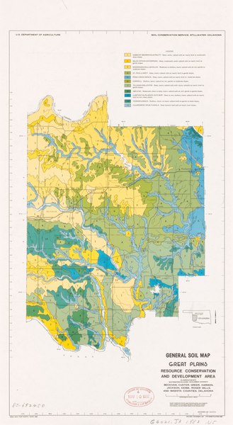
| Description |
English: "December 1981 4-R-37715. Revised December 1981 4-R-34293 Plates ABC." "Base compiled from AMS topographic map sheets and latest available general highway maps." Includes location map. Available also through the Library of Congress Web site as a raster image. |
||
| Title | General soil map, Great Plains Resource Conservation and Development Area, Beckham, Custer, Greer, Harmon, Jackson, Kiowa, Roger Mills, and Washita Counties, Oklahoma | ||
| Shelf ID | G4021.J3 1981 .U5 | ||
| Date | |||
| Source | https://www.loc.gov/item/85692450/ | ||
| Author | United States. Soil Conservation Service; South Western Oklahoma Development Authority | ||
| Permission (Reusing this file) |
|
||
| Other versions |
|
||
| Location | United States · Oklahoma. · Oklahoma | ||
| Part of | American Memory · Catalog · Geography And Map Division · Additional Conservation And Environment Cartographic Items | ||
| Subject | United States · Soils · Oklahoma · Maps |


Licensing edit
| This work is from the Library of Congress. According to the library, there are no known copyright restrictions on the use of this work. |  |
File history
Click on a date/time to view the file as it appeared at that time.
| Date/Time | Thumbnail | Dimensions | User | Comment | |
|---|---|---|---|---|---|
| current | 05:11, 1 May 2019 |  | 3,250 × 5,927 (55.11 MB) | Fæ (talk | contribs) | LOC Maps https://www.loc.gov/item/85692450/ #309 |
You cannot overwrite this file.
File usage on Commons
The following page uses this file: